Atlas Essay — 2026-08-10
Myths That Remember Sahul
Flood traditions of Australia, lutruwita (Tasmania) and New Guinea

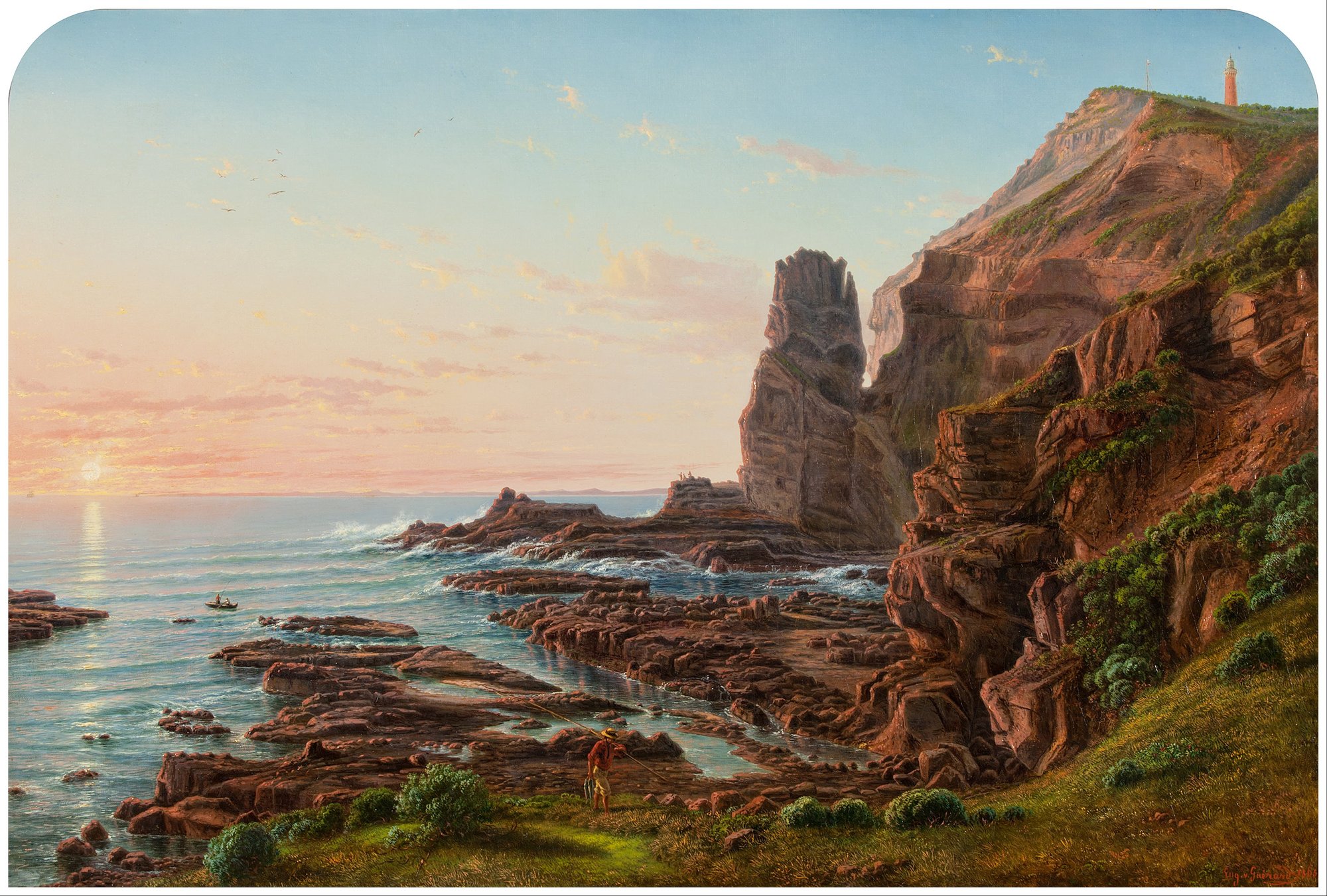
The water does not arrive once. It cuts Spencer Gulf through a marsh. It races over a Noongar plain. It fills Yotefa Bay where gardens once stood. In Gippsland the creator’s son makes the first pair of bullroarers, children carry one home to the women, and the country goes down under the sea. In Arnhem Land a python wakes, rises into the sky and calls up the first monsoon, and the roaring board swung at his ceremony is not a picture of him but his body, his fangs and his voice. Across the old continent of Sahul, ninety-five traditions give the flood a face, a path and a place — and not one of them stops at the drowning. Water takes a world apart and hands back another, and the world it hands back is the one people are living in: the coastline, the island, the crossing that can no longer be walked, the wet season, the clan, and the law about who may hear a sacred sound.
Country became sea
At the glacial minimum, Sahul was not Australia with a temporary northern bridge attached. It was a continent in its own right. New Guinea formed its mountain wall. Cape York reached north across the Torres plain. Lake Carpentaria occupied an interior basin. The Arafura shelf was open country. Lutruwita/Tasmania joined the mainland through the Bassian plain. The modern coastline cuts through that older geography like a watermark.
The retreat came in a human lifetime and over many lifetimes. Alan Williams and colleagues estimate that Sahul lost about 2.12 million square kilometres of continental shelf after the glacial maximum, roughly ninety percent of it between 14,600 and 8,000 years ago. The average coast moved 139 kilometres inland; in some regions it travelled more than 300. Lake Carpentaria admitted marine water, the Bassian corridor broke, the western shelves narrowed and the low country between New Guinea and Australia became Torres Strait.
The companion essay Old Sahul reconstructs that continental world through archaeology, ancestry, language and exchange. The map here turns to the human record of its ending and to later water catastrophes remembered in the same continental field. These are not versions of one flood. They remember rising seas, storms, rivers, broken coastal barriers, tsunamis and volcanic collapse; the gold rings mark other ways water made and erased places. Together they show what flooding means from the ground: a path closes, an island appears, an old coast becomes reef, a community leaves.
The southern arc
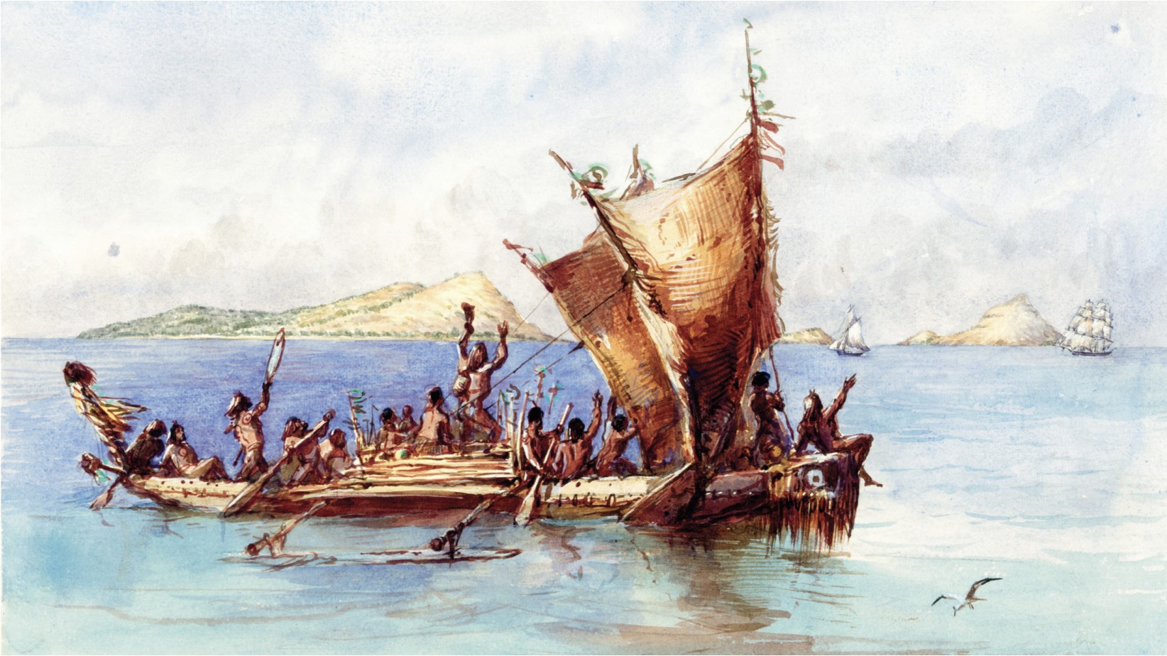
Along the southern coast, the stories remember the shape of what was lost. Narungga country holds Spencer Gulf as a former plain: level ground, a marsh in the middle, lagoons where the gulf now opens. A giant kangaroo cuts the channel and marine water pours north. A long gulf occupies that old lowland today. Nunn and Reid compare its depths with a coastline between about 9,330 and 12,460 years ago.
On Guuranda/Yorke Peninsula, Badhara and Ngarna narratives describe the coast splitting, the sea invading and Wardang/Waraldi becoming island country. Amy Roberts, Adrian Mollenmans, Lester-Irabinna Rigney and Geoffrey Bailey compare Wardang’s separation with a shoreline about 8,500 to 7,400 years old.
Farther south, Ngarrindjeri traditions send Ngurunderi’s fleeing wives toward Karta, Kangaroo Island. They cross the former land bridge when he calls up the water: wave follows wave, driving them toward The Pages, while Backstairs Passage becomes sea. At MacDonnell Bay a productive country is covered by a sea that never returns. Around Narrm/Port Phillip, the bay lies where people once hunted kangaroo on dry land. These are different moral worlds laid over the same physical reversal—familiar country becoming impassable water.
“Long ago there was land to the south of Gippsland where there is now sea.”
Fison & Howitt, Kamilaroi and Kurnai (1880), p. 269
Gippsland gives the southern arc its most startling ritual scene. Kurnai children find a turndun, the local bullroarer, and carry it home. The instrument belongs to restricted men’s ceremony; the children show it to women. Immediately the ground crumbles and all is water. Nunn and Reid place the comparison on the northern edge of the lost Bassian country, between about 9,240 and 12,460 years ago. The story binds shoreline, prohibition and catastrophe into one irreversible moment.
On the eastern edge of the same arc, Dharawal traditions remember ancestors crossing swamps where Botany Bay now lies. Storm waves alter the passage and leave a bay. The water in these accounts is never an abstract global curve. It enters a marsh, crosses a lip, cuts a route and stays.
Reef, gulf and islands
North of Botany Bay, the stories track an increasingly wide drowned shelf. Quandamooka accounts explain the opening of channels around Moreton and North Stradbroke through wind, shell and broken ground; these belong to a mobile coast where channels also changed recently. Hinchinbrook is Bandjin and Girramay Country; Palm Island is Manbarra Country. A broader Dyirbal-language account remembers Giɽugar walking to islands now reached across water.
Farther north, Butchulla oral histories speak of walking across the Great Sandy Strait to K’gari. A Butchulla-led research team is reconstructing those paths from oral history, seafloor depth and shallow marine survey.
Near Cairns, the old coast is named with exceptional clarity. Gungganyji and coastal Yidiny traditions place the shoreline at the outer Barrier Reef and say that water drove people from former homes into their present territories. Nunn and Reid compare it with shoreline positions roughly 9,960 to 13,310 years old—the oldest interval in their eastern Australian set.
Across the Gulf of Carpentaria, Garnguur’s ancestral raft cuts channels through country that had joined the Wellesley Islands to the mainland. At Elcho Island, Djanggawul crosses country before the sea rushes through and leaves a sandbar. Between the Goulburn Islands, Crow fells a great paperbark tree; its splash turns Mandurl-mandurl creek into the deep channel dividing Warruwi from Weyra. From Cape Don, Mangurug remembered Aragaládi: an island where a struck Dreaming rock brought long rain, and in another telling a coil of Snake sank beneath the sea. Mudangkala, an old blind woman, crawls from the mainland with children on her back; water fills the tracks behind her and the Tiwi Islands take form.
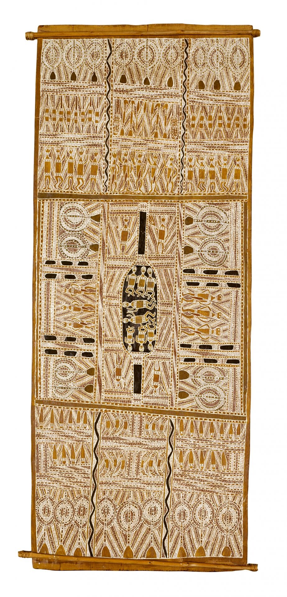
The sequence around northern Australia is unusually dense because the shelf was broad and low. Sea-level rise did not trim a fixed coast. It reorganised the map: islands emerged from hills, passages replaced foot routes, and stories carried the old adjacency after the land ceased to carry it.
The western shelf broke into islands
At Brue Reef in Bardi and Jawi country, Juljinabur is remembered as inhabited land before the sea covered it. At Wadjemup/Rottnest, Whadjuk Noongar tradition says that wooded country lay west of the modern mainland until the ground split with a great noise and the sea rushed in. New modelling by Ingrid Harben and colleagues places Wadjemup’s islanding around 7,000 to 6,500 years ago. Here narrative geography and shelf reconstruction point to the same transformation: an island that was once not an island.
At Gathaagudu/Shark Bay, Malgana ancestral routes run from the mainland toward Wirruwana/Dirk Hartog, Bernier and Dorre islands across sandy bottom and freshwater seeps. Farther south, Wudjari Elders describe cultural corridors whose storylines continue from the mainland through the Recherche islands and out into the ocean. Their joint management plan places those corridors beside the much lower Ice Age shoreline. Each record preserves a social geography that extends across drowned Country.
The south-western coast then offers a string of distinct water events. Cape Chatham remembers a broad plain reaching toward White-topped Rocks offshore; two women see the sea racing over it. Oyster Harbour forms when a dog scratches a vast hollow and water enters. At Bremer Bay, willy-wagtails pierce mud springs, hear the water roar and release an overflowing lake to the sea. The Cape Chatham plain fits land lost after the Ice Age. Oyster Harbour and Bremer Bay also preserve the behaviour of barrier coasts that can open, close and flood within recent memory.
Along the Great Australian Bight, water advances as a power that people meet and redirect. At Eucla, Wati Nyiinyii uproots water-bearing trees and a flood moves south until people drive bundled spears into the escarpment to stop it. Near Fowler’s Bay, a Bidjandjara tradition from the Great Victoria Desert tells how the brothers Malgaru and Jaul puncture a kangaroo-skin waterbag at the dry coast and release an onrushing sea. Both accounts turn a slow continental transformation into one break in a container. Country holds water until an action lets it loose.
The water was inside something
That is not a local habit of the Bight. Two thousand kilometres east, at Lake Tyers in Gippsland, a giant Frog held every drop of the world’s water inside himself until No-yang the Eel twisted and wriggled and made him laugh, and it all came out at once and drowned many; Booran the Pelican cut a great canoe and sailed among the islands left standing above the flood, keeping people alive. Three thousand kilometres north of that, on the Pennefather River at the top of Cape York, Thunder was still shaping the first human bones when his younger son spoiled them and ignored the order to leave. Lightning drove the boy into the ground, and salt water sprang from the place he went in and spread over the country until the new sea stopped his mother at Kokowarra.
On the Barka, Kuluwarra opens the container deliberately. Near Bourke he lets the Ngatji, the Rainbow Serpent, out of his waterbag with the water; Ngatji passes through the country and lives in the river still, while Thirri shapes the channel, bends and islands behind it. The creation establishes a relationship rather than a catastrophe. Barkandji means “people belonging to the Barka”; the river is mother, homeland and memory, and Ngatji’s care for the people is answered by their obligation to care for the serpent, the river, its floodplains and the waters beneath the ground.
Five peoples, on every side of the continent, one grammar. All the water in the world is held inside something — a kangaroo-skin waterbag, a stand of water-bearing trees, the body of a frog, the ground itself, a bag with a river’s serpent in it — and the sea is what happened when the container opened. The coastal traditions of this map tell the opposite story: there the water comes from outside and takes. Here it was always present, and the shoreline is the mark of the moment it got out. Two of the five already carry published comparisons with a coastline between about 7,990 and 12,460 years old, and the container carries part of the same weight as the drowned coasts, in a different idiom.
The Bassian crossing closed
Lutruwita was connected to the mainland by a broad plain before the final path across Bass Strait drowned. George Augustus Robinson recorded an east-coast palawa tradition in 1831: people had come from a distant country over land, and the sea formed afterward. Robinson himself routed the crossing from Wilsons Promontory toward Cape Portland. The ancestors came by land, before island and mainland were divided.
Duane Hamacher and colleagues used the shallowest continuous Bassian route to estimate when such a crossing ceased. Their bathymetric model places the final drowning around 11,960 years ago, with a wider twelve-to-fourteen-thousand-year window. The Kurnai tradition on the northern shore and the palawa tradition on the southern shore face the same vanished plain from opposite edges.
A later Cotton-family archive names a northern land, Moo-Ai, overwhelmed by a “Big Sea Water Flow” as Vetea’s people move toward the Tasmanian coast. Robinson’s 1831 note holds the same geographic reversal: arrival by land, separation by sea.
When the Bassian corridor closed, lutruwita became an island and every neighbour beyond the new water was gone. The tradition keeps the crossing in social memory after the crossing itself disappears from sight.
New Guinea’s waters rise from river, sea and volcano
Along New Guinea’s north coast, water leaves villages on different shores, old gardens beneath bays and sago country turned into tidal mangrove swamp. Other tellings follow a river cutting through its banks or a lake filling a valley. The people come out into a country whose food, routes and neighbours have changed.
At Tambunum on the Middle Sepik, Eastern Iatmul tradition tells how Wobowi and Mendangumeli open water-lily holes. Torrents surge from the ground and flood the region. Eric Silverman places the story inside the ecological rhythm of the Sepik, where annual water surrounds houses, alters travel and makes the village a temporary island. This is river flood as cosmogony: the landscape does every year, in lesser form, what the ancestors did once.
In Waropen, the ropes decide who stays and who leaves. Two mangrove rafts carry the people of Risei–Sayati; one tears loose and drifts to Ambumi in Wandamen Bay, while the other stays tethered above its own village. The anchored survivors rebuild where they lived, but their sago forest has become tidal mangrove swamp. Long afterward, Ambumi people working in Sorong meet Risei labourers and ask about their village of origin and the trees that carried their ancestors. The transformed coast has divided a community without erasing its kinship.
At Manyalibit Bay in Raja Ampat, two brothers arrive inside a hollow tree they had chosen as shelter from a storm on Supiori. Water spins it through a new gorge and grounds it on the bay’s northern shore. With no people in sight, they make sago and wait. Then a dog comes down to the beach. They feed it, tie a fishbone and a cord with three knots around its neck, and release it. Three days later its people arrive. The brothers teach them to make sago and build houses from palm trunks and leaves; they marry, stay, and name their landing after their home at Sowek. Their descendants keep the Rumbiak clan name. The flood makes a sea passage and a new community in the same journey.
Eastward, around Biak, a dry plain becomes Cenderawasih Bay, a wall of sea drives people toward high ground, and a pumpkin-floater repopulates Biak–Supiori. At Yapen a whale carries seawater upriver. In Wandamen Bay the flood moves a men’s house: after boys violate the authority of a sacred snake, the water carries the Anio Sara house and its institution toward Dusner. An offence against a serpent sends a ceremonial house to a new shore.
In the Southern Highlands the flood is women’s work from start to finish. At first the Kutubu valley held no lake, and the women who lived in it were perpetually thirsty, living on rain caught in leaves. Their dog Niyibe kept coming back out of the forest with a wet muzzle, so they tied a cord to his leg and followed it to a spring hidden beneath a giant fig. They could not get at the water, so they cut the tree down with stone axes, and it burst out of the opening. The women ran up the mountainsides and made magic that stopped the water rising any further. The felled tree is the shape of the country now: its trunk is the long body of Lake Kutubu, its branches the bays, its broken limbs the rivers and creeks, and ground the tree never touched stayed above the water as islands. Palms on the cliffs carry the women’s hair and clothing, and the survivors are the four principal lake villages. Women release the water and women halt it — the one flood on this map opened and closed by the same hands.
At Yotefa Bay near Jayapura, Aya returns to the plain of Iria and finds its houses smashed and its gardens ruined. A quarrel between brothers has drawn in the whole settlement; a magician has struck the chief’s houseposts, shaking the houses and sending people fleeing toward Lake Sentani and along the coast. Aya cannot bear the wreckage. He hurls down a bamboo tube of water, and it pours until the plain disappears beneath a bay. Only Injemoch, once a hill, stands above it. Through clear seawater the descendants can still see their ancestors’ garden plots.
Other Yotefa tellings change the cause. Two visiting sisters are warned to leave a guarded pond alone; the elder spears a fish through its bottom, and the water pours out over the plain. Elsewhere sorcery or an erupting island brings the sea. One account makes the Pirjeu passage a former river mouth; another says that even the lowest tides never uncover the plain again. Different causes leave the same aftermath: the gardens stay underwater.
On the Sepik plain, a Gaikarobi account begins with almost everything underwater: the water withdraws into the sea and a small patch of ground grows into New Guinea. Bragge separately places Gaikarobi near the shore of a former inland sea in his reconstruction of the Sepik plain. Other clan histories make water the cause of movement. A tide destroys Glaskom and Marakom and sends Mongwalion survivors through swamp country toward Kutbug; at Sauinabit, rising water destroys an ancestral settlement before the account continues at Aurimbit. A Sawos cosmology looks forward rather than back: when Manam turns, the sea returns west and covers Aibom, Chambri and Ambunti. Three gold-ringed stories widen the view from flood to water-made landscape. Dibkel opens the Walio River, and the Sepik erases the lake at Kalok, old Munkoswi and Mauwanjatop. Both histories run through Kubkain, beside the Leonard Schultze/Walio River. Gubat and Ginjit leave Parembei to make Lake Malingai and its Indabu channel.
South and east, the waters change again. Muyu and Mandobo sources make River Kao the first river and tell how a giant fish returns as a wall of water. At Arso, killing the sacred crocodile Watoewa releases hot ground water and rain. At Sissano, people remembered a great wave from the west; lagoon deposits offer an event between AD 1440 and 1600 as the leading comparison. Near Aitape, Adam Amod’s Ali Island account begins at a mortuary feast: villagers poison the water, kill the eel that warns them, and are destroyed by flood. One family survives by coconut tree and shelter pit, while the Yini Parey people ride a breadfruit tree to the reef that becomes Ali Island. Off the Madang coast, Bel-community narrators remember Yomba or Kinembla at Hankow Reef as inhabited country that disappeared. Their versions preserve several mechanisms—rough sea, earthquake, great wave or its own eruption—and some explicitly place the loss before Arop’s eruption.
Farther east, in Papua and the islands, the waters change again. At Wamira in Goodenough Bay, the sea climbs the hills until Raudalo, king of snakes, drives it down Tauaga and back to shore. Near Gavi, Lake Wapogi rises after fishers disturb Abaia, its great eel; an elder who abstains survives in a tree and the flood becomes the charter for a fish taboo. On West Fergusson Island, Ipapaya releases a blocked spring and the water sweeps her grandfather into the sea—a local spring story rather than a regional flood. In New Britain the sea has an owner, and the owner is an old woman. In the Baining telling she kept the only salt water there was in a small hole in the ground, covered with barkcloth, until her two sons tore the cover off; the water came up and kept coming until only rocks with a little earth on them stood above it. Seeing it would swallow everything, she went down to the water’s edge and planted twigs along it, and the sea came no further. The twigs are the shoreline — from that day the sea has a bound it does not cross — and the fuller telling runs straight on into gardening, canoe-building and the beginnings of the coastal people. A woman owned the water, her sons let it out, and a woman fixed the world’s coastline. At Lehinga, an Ilahita Arapesh flood carries sleeping musicians downstream in a casuarina and ends with the settlement of Malahun.
Between those regions, other waters remake the land. In the Kabadi district beside Yule Island, Lohero’s bone makes a stream become a sea over the lowland, driving people step by step onto the highest peaks; when it recedes, some return and others build on the ridges. At old Berlin Harbour, now Aitape, a Valman story makes the eating of a forbidden fish release water from the ground. The family that obeyed the warning survives in a coconut tree with a pair of every animal, then descends to plant new gardens. On the Mimika coast, two Tuga women dam a river after their osprey-son is killed; the flood covers mountains and scatters canoe survivors toward Paniai and western shores. Farther north, a Mamberamo account makes the river itself the weapon: cutting the vine that holds a fallen tree releases water over the land and Mount Vanessa.
The southern Fly and offshore island arc carries another concentration. Landtman’s Kiwai and Mawata texts preserve a classic deluge at Ipisia beside a companion tale in which a woman drinks the sea dry and releases it again, an island-loss story for Gimini, and a vanished-island whirlpool at Merewoiwo near Aibinio. Gimini falls to sorcery worked in the Mawata men’s house: Sasa warms a stingray spine, pig parts and a human bone there, buries the spine and the bone in the island and carries the pig parts round its shore, commanding them to root it away. At Boigu, men cut a channel and make a swamp and well; near Madiri, a sawfish opens a coastal route to the sea. Slone’s Wantok pages carry the geography east: on the Kandrian coast, Koran Rainge cuts one long island into Kangro, Pugi and Aviglo; behind Baluan in Manus, Lep Island sinks beneath rain, thunder, earthquake and flood, leaving only reef.
The northern stories belong to different kinds of water history: bay and island origins, river floods, ritual deluges, tsunamis, volcanic waves, migrations and a future return of the sea. Some tell how a spring, channel, lake or river came into being without describing a flood. Seeing those differences makes the drowned-land traditions clearer.
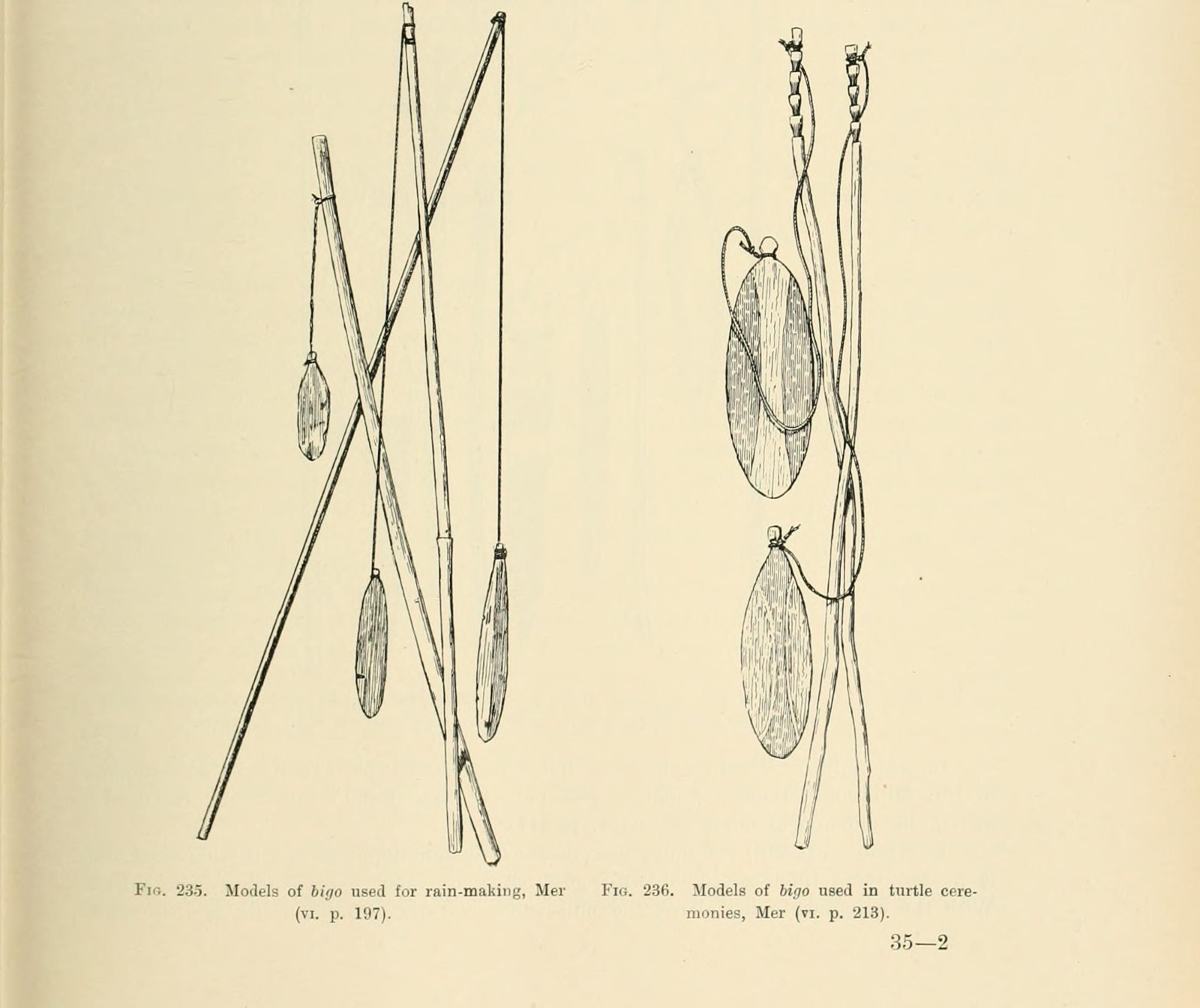
Sacred sound runs through these northern floods. In Kamma’s Arso narrative the rebuilt world includes three sacred bamboo flutes, and in Tor country Gottfried Oosterwal records that the flute rites themselves hold back the rain and the rivers that would otherwise cover the land and end the world.
The python, the monsoon and the voice
The Wagilag Sisters walked through Arnhem Land naming what they came to — the animals, the plants, the stars, the places — and at the waterhole of Mirarrmina they stopped. Their presence woke Yurlunggur, the great python who lived in the water. He rose out of it into the sky, and the clouds and the thunder of the first monsoon came up behind him, and the rain he called flooded the earth. He swallowed the sisters and their children. Then he cast the sisters out again, because they belonged to his own moiety and he had eaten his own kind.
What that flood installs is the year, and everything hung on it. The wet season begins here; so does the ceremonial ground at Mirarrmina; so do the rules of authority, kinship, territory and marriage that people live under afterwards. It is the fullest statement on this map of what water is for: it takes a world apart and hands back the one with the law in it.
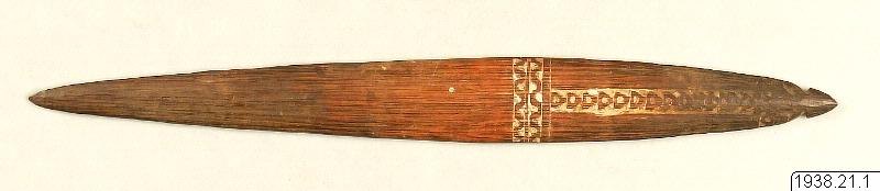
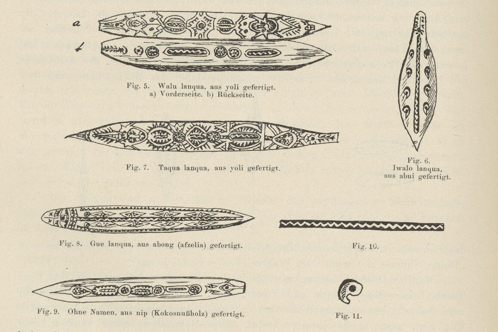
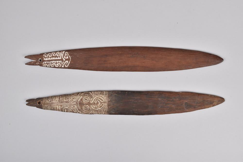
And the instrument is inside the story rather than beside it. The bullroarer swung at this ceremony is Yurlunggur. Not an emblem of him and not a noise made in his honour: swung hard on its cord, it is his voice. The National Gallery of Victoria’s account of the Yolngu instrument is exact about the anatomy — the blade is the snake’s body, the human-hair cord its fangs, and the sound it makes is the snake speaking. One complete example, blade and cord and handle together, which is more than most museum roarers keep, was collected at Milingimbi itself, in the country the cycle runs through.
Set the two halves together and there is no distance left to bridge. The being who makes the first flood, the serpent, and the object in the hand are one thing. Everywhere else on this map the instrument stands near the flood — same people, same coast, same ritual office, one remove away. Here the flood, the snake and the bullroarer are a single body.
Three Yolngu water traditions run through this same coastline and none of them is a version of the others. The python’s monsoon is one. The Djanggawul crossing at Elcho Island, where the sea rushes through a route ancestors had walked, is a second, and the only one with a published comparison to island separation. A Gumatj mourning story in which two sisters’ deaths bring weeks of rain and bark rafts carry the survivors out to the islands is a third. One people, one shore, three different pieces of work.
The forbidden roar at the edge of the flood
Gippsland has the other one, and it runs the other way.
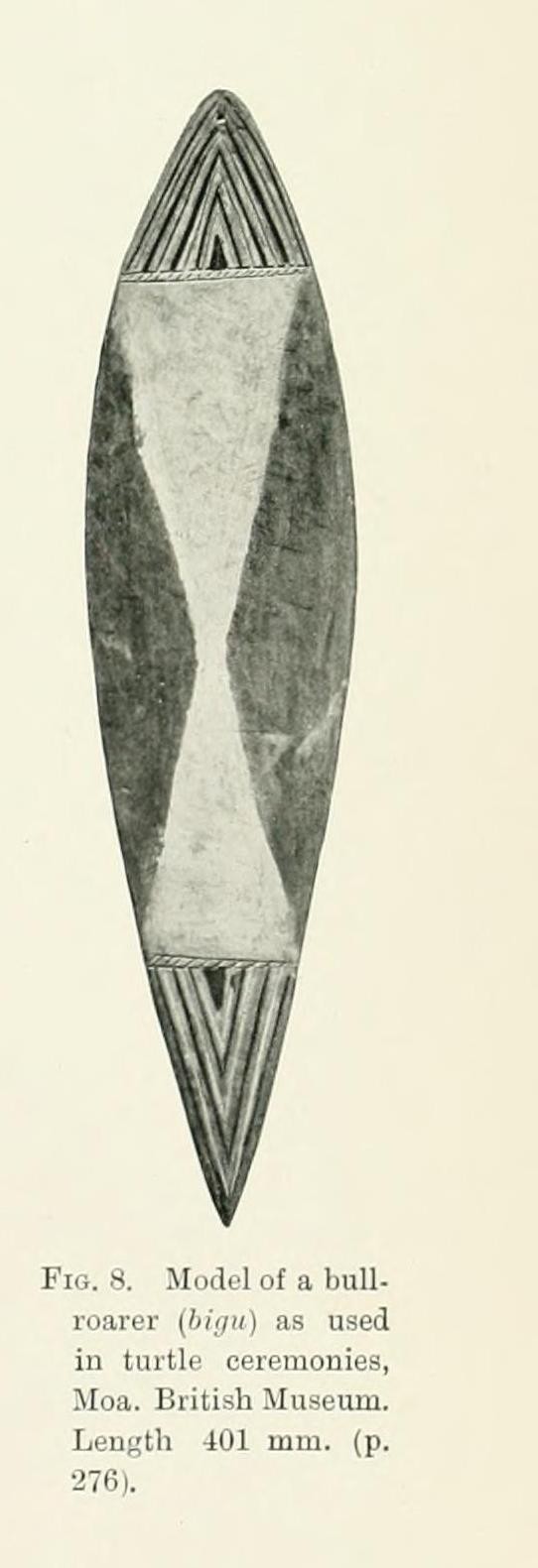
Mungan-ngaua, the creator, taught the ancestral Kurnai what they use — their implements, their canoes, their weapons, the names they inherit. His son Tundun made the first pair of bullroarers and conducted the Jeraeil, the initiation at which they are sounded. The two are a married pair: Tundun the man and Rukut Tundun the woman. Then the instruments were shown to the women. Fire came out of the sky, and a sea came in and drowned nearly the whole of humanity; the few who came through became the Muk-kurnai, the Dreamtime ancestors of the Kurnai, and Tundun and his wife went into the water and became porpoises.
Fison and Howitt’s short telling keeps the middle of that and nothing else: children find a turndun, they show it to women, and immediately the ground crumbles and all is water. Nunn and Reid place the comparison on the northern edge of the lost Bassian country, between about 9,240 and 12,460 years ago — the same drowned plain the palawa remember from the far shore.
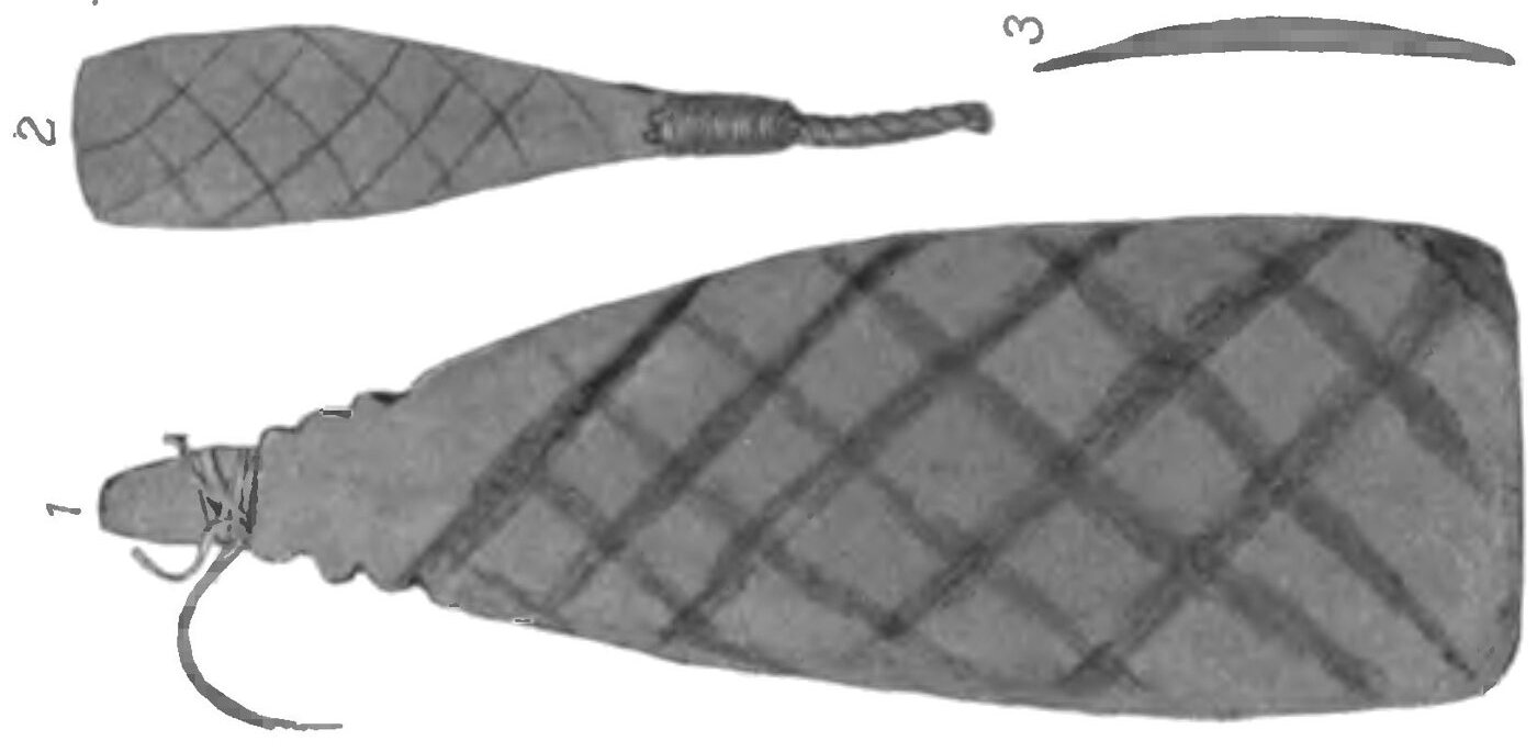
So in Gippsland the roaring board is not a witness to the flood and not a warning of it. It is the cause. In Arnhem Land the instrument is the flood’s voice; in Gippsland it is the flood’s occasion. Two ends of a continent, and in both the sacred sound and the drowning of the country are one event.
Elsewhere the instrument keeps its distance from the plot, and the distance is worth marking. In Bardi and Jawi Country, Juljinabur’s drowned island and Djamar rising from the sea whirling a bullroarer belong to separate ancestral complexes. Butchulla histories remember walking to K’gari before it became an island; a Butchulla dictionary records Bon’da’ban as a ceremonial noise-maker for men only, without placing it in the crossing story. Tiwi creation makes the contrast sharpest: Mudangkala carves the island channels in ancestral time, while a 1914 account reports no bullroarers on Melville or Bathurst islands at all.
A second, independent story complex concerns who first held ritual authority. Across northern Australia and New Guinea, traditions place women at the beginning of institutions later controlled by men. In the Yolngu Djanggawul cycle, ancestral sisters carry sacred objects and men take over a rite. In the Manggawila cycle, the transfer of ritual authority is again narrated through gender. The companion essay Nggwal and Djanggawul follows this women-first architecture across the Arafura world; When Women Owned the Bullroarer follows it more widely; and Always From the North follows the concentration of named forms in New Guinea.
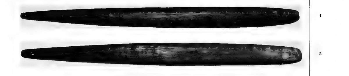
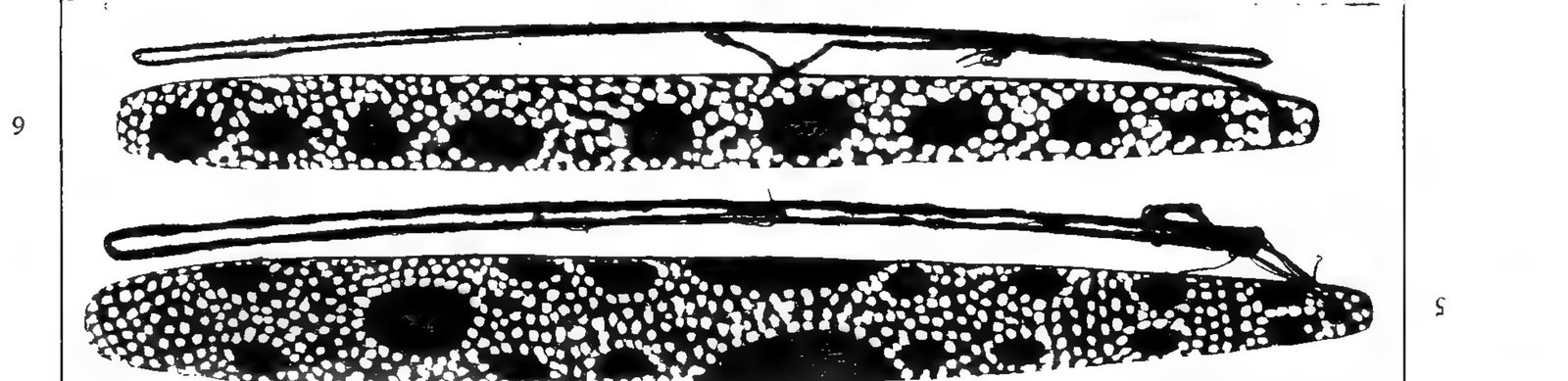
In the south, water punishes an exposure of ritual knowledge. In the north, myth authorises a transfer of it. Both are making social order out of who may hold or hear a sacred power, and in both the flood is the instrument by which the order is fixed.
Floodwater moves institutions
The sea displaced people before it divided modern nations. The Cairns tradition says so plainly: former coastal homes lay toward the Barrier Reef, and advancing water drove communities toward their present territories. Archaeological models reach the same human consequence at continental scale. When shelves hundreds of kilometres wide disappeared, routes contracted, neighbours converged and populations reorganised around new coasts.
This matters to a central proposal of the Bullroarer Atlas. The great post-Ice-Age migrations were not only movements through empty space. They carried marriages, ritual rights, songs, technologies and institutions. Forced relocation created new meetings between communities. In that environment, a bullroarer cult could travel by adoption and alliance even when the migrating population was too small to leave a simple genetic trail.
The Atlas proposal: post-Ice-Age displacement helped carry bullroarer institutions across Sahul and onward through wider migration networks.
The flood traditions supply the human mechanism—lost homes, compressed territories, altered routes and newly adjacent peoples. The mapped stories attest those displacements, and the institution moved with the people the water moved, out of Sahul and on around the world.
Lay the flood map beside the ritual map and a larger pattern comes into view: the most dramatic redistribution of human geography at the end of the Ice Age coincides with one of the great eras of population movement. The bullroarer is light, memorable, easy to make and socially powerful. Institutions like it can move farther than objects.
All mapped traditions
Every mapped tradition appears below. One number may hold a closely related group: the seven tellings of Yotefa Bay’s creation share a number because neighbouring communities describe the same drowned plain. Different stories from the same place keep separate numbers when their actions, survivors or consequences differ.
How to read the last column. Some traditions have been compared directly with shoreline change after the Ice Age. Others closely match a drowned plain, a new island or a changed coastal wetland without providing a date.
River floods, tsunamis, volcanic waves and barrier breaches belong to later or recurring hazards. Ritual deluges, migrations and undated floods remain because they record how water reordered law, settlement and ceremonial life. The distinction is visible here and in each story card.
Water made or erased a place marks eight stories about a spring, channel, lake, shifting river, lost settlement or coastal route rather than a clear flood. Ipisia keeps one ordinary point because its flood and its separate story of the sea withdrawing share the same place.
Complete tradition table
| # | Place and community | What the story remembers | Event comparison |
|---|---|---|---|
| Australia and lutruwita | |||
| 1 | Spencer Gulf — Narungga | A level plain and marsh became the gulf when a giant kangaroo cut a trench for the sea. | Compared with shoreline change 9,330–12,460 years ago. |
| 2 | Karta / Kangaroo Island — Ngarrindjeri | Ngurunderi’s fleeing wives crossed the former land bridge; wave after wave drove them toward The Pages as Backstairs Passage became sea. | Compared with island separation 10,080–10,950 years ago. |
| 3 | MacDonnell Bay — Buandig source | A once-bountiful coastal country was covered by a sea that never withdrew. | Compared with shoreline change 8,590–12,460 years ago. |
| 4 | Narrm / Port Phillip — Boonwurrung and Woiwurrung sources | The bay was dry kangaroo country before water broke through and stayed. | The story describes a real bay filling with water, although that landscape changed more than once. |
| 5 | Gippsland — Kurnai / Gunaikurnai | Mungan-ngaua gave the ancestral Kurnai their implements, canoes, weapons and inherited names, and his son Tundun made the paired bullroarers and conducted the Jeraeil. When the instruments were shown to women, sky-fire fell and a rushing sea drowned nearly all humanity; the few survivors became the Muk-kurnai, the Dreamtime ancestors of the Kurnai, and Tundun and his wife became porpoises. | Compared with the drowning of the Bassian plain 9,240–12,460 years ago. The instrument is the cause of the flood, not a warning of it: Howitt, Native Tribes of South-East Australia (1904), p. 493, and “The Jeraeil” (1885), pp. 301–325. |
| 6 | Botany Bay — Dharawal | Ancestors crossed swamps where the bay now lies; storm waves helped remake the place. | Compared with shoreline change 7,930–9,560 years ago. |
| 7 | Moreton and North Stradbroke — Quandamooka sources | Shell, wind, and broken ground explain channels that cut islands from the mainland. | The channels have changed repeatedly, including in recent times. |
| 8 | Hinchinbrook and Palm islands — Bandjin, Girramay, Manbarra and Dyirbal-language sources | Several island-country traditions meet on this coast. In the Dyirbal-language account, Giɽugar walked to islands that now lie across open water. | Compared with island separation 7,450–9,680 years ago. |
| 9 | Cairns–Great Barrier Reef — Gungganyji and coastal Yidiny | The Barrier Reef was the old coast; rising water drove people from former homes. | Compared with the sea covering former coastal land 9,960–13,310 years ago. |
| 10 | Wellesley Islands — Lardil, Kaiadilt, Yangkaal and Gangalidda | Garnguur’s raft cut channels through country that had joined islands to the mainland. | Compared with island separation 7,450–9,140 years ago. |
| 11 | Elcho Island — Yolngu | Djanggawul crossed land or shallows before the sea rushed through and left a sandbar. | Compared with island separation 7,450–9,140 years ago. |
| 12 | Goulburn Islands — Maung — told by Peter Namiyadjad | In the Dreaming, only Mandurl-mandurl creek divided Warruwi from Weyra. Angry that the other fishers gave him only poor fish, Crow felled a great paperbark tree across the creek. Its splash made the water widen into deep sea, drowning the people on the banks as Crow became a bird; Blanket Lizard drowned trying to reach Warruwi and became a reef. | Compared with the drowning of the land bridge between the two Goulburn Islands when sea level was 17–20 metres lower, 8,890–9,680 years ago. |
| 13 | Aragaládi / Cape Don — Mangurug — northern Gunwinggu | On Aragaládi, an island in the sea, people accidentally knocked a maar — a dangerous Dreaming rock. Rain fell for a long time and water pursued them as the island went under; some escaped by canoe to Djamalingi. In another telling, Aragaládi was a coil raised by Snake; she drew it beneath the sea, swallowed the people and left their bones as rocks. | Compared with possible offshore drowning 7,930–9,520 years ago. Aragaládi’s location is unknown; this dot marks Djamalingi / Cape Don, Mangurug’s mainland anchor, not the drowned island. |
| 14 | Tiwi Islands — Tiwi | Mudangkala crawled from the mainland, carving the islands as water flowed behind her. | Compared with channel formation 8,210–9,680 years ago. |
| 15 | Brue Reef — Bardi and Jawi | Juljinabur was inhabited country before the sea covered it and left a reef. | Compared with drowning 7,250–9,140 years ago. |
| 16 | Wadjemup and nearby islands — Whadjuk Noongar | Wooded mainland country split apart and the sea rushed through, making islands. | Wadjemup became an island about 7,000–6,500 years ago. |
| 17 | Cape Chatham — Noongar source | A broad plain reached offshore rocks until two women saw the sea rushing over it. | Compared with the sea covering former coastal land 11,730–13,070 years ago. |
| 18 | Oyster Harbour — Menang Noongar source | A dog scratched a great hollow around a dead woman and the sea entered to form the harbour. | The harbour may have opened after the Ice Age or in a later event. |
| 19 | Bremer Bay — Wirlomin Noongar source | Willy-wagtails pierced mud springs; roaring water joined the sea and the lake overflowed. | A recent or recurring barrier-breach tradition. |
| 20 | Eucla — Mirning source | Uprooted water trees released a south-moving flood, halted at the escarpment with spears. | Compared with shoreline change 7,990–12,460 years ago. |
| 21 | Fowler’s Bay — Bidjandjara / Great Victoria Desert source | Malgaru and Jaul punctured a kangaroo-skin waterbag, releasing a rushing sea that drowned them. | Compared with the sea forming Fowler’s Bay 7,990–12,460 years ago. |
| 22 | Bassian land bridge — palawa | East-coast people said their ancestors came over land before the sea formed. | The last continuous Bassian route drowned about 11,960 years ago. |
| 23 | Wardang / Waraldi, Yorke Peninsula — Narungga | In Badhara and Ngarna narratives, the coast splits and the invading sea makes the bay and offshore island country. | Compared with Wardang’s separation about 8,500–7,400 years ago. |
| 24 | Gathaagudu / Shark Bay islands — Malgana | Ancestral walking tracks run from the mainland toward Wirruwana, Bernier and Dorre across country now covered by sea. | Malgana knowledge is compared with Country drowned by rising seas after the Ice Age. |
| 25 | K’gari / Great Sandy Strait — Butchulla | Oral histories remember walking across the Great Sandy Strait to K’gari before it was an island. | Community research compares the old walking route with the strait’s drowned country; the date remains under study. |
| 26 | Recherche islands — Wudjari | Old cultural corridors and their storylines continue from the mainland through islands and out beneath the ocean. | Community research follows cultural routes across drowned Country; no single date is assigned. |
| 80 | Milingimbi / north-east Arnhem Land — Liyagalawumirr and other Dhuwa-moiety Yolngu custodians of the Wagilag cycle | The Wagilag Sisters travelled through Country naming animals, plants, stars and places until their presence woke Yurlunggur the great python. He rose into the sky and called up the first monsoon, flooded the earth, swallowed the sisters and their children, then cast the sisters out again because they shared his moiety. | The flood installs the first wet season, the ceremonial ground and the law of authority, kinship, territory and marriage. The bullroarer of this ceremony is not a picture of Yurlunggur but his voice, and one complete blade, cord and handle was collected at Milingimbi itself. No published comparison with postglacial coastal change. |
| 81 | Elcho Island and north-east Arnhem Land — Gumatj source, printed as “Gumaidj” | Two sisters gathering shellfish angered Namarangini, who had sung up a storm. After the younger sister was wronged and killed, the Fly and Sandfly women wept over her until their grief became weeks of rain, and a rush of inland water carried them on bark rafts out to Elcho and the neighbouring islands. | Mourning turns a mainland community into an island people. A separate tradition from the Djanggawul account at 11; no published comparison with Elcho’s separation. |
| 82 | Lake Tyers — Lake Tyers source | A giant Frog held every drop of the world’s water inside himself until No-yang the Eel twisted and wriggled and made him laugh. The water poured out at once and drowned many, and Booran the Pelican cut a great canoe and sailed among the islands left above the flood, keeping people alive. | A dry world becomes the watered world, and Pelican is finally fixed in the country as stone. No named scholar connects this telling with postglacial landscape change. |
| 83 | Port Albert district — Kurnai / Gunai source | A flood covered the country and left one man and two women on an island. Bunjil Borun the Pelican ferried the man and one woman across, keeping the woman he wanted until last; fearing him, she wrapped a log in her rug and swam ashore before he returned. | Pelican’s black-and-white plumage and his death at another pelican’s hands close the story. Kurnai country, but the narrative names neither serpent nor instrument; no published comparison with Bass Strait or local Holocene inundation. |
| 84 | Bibhiringda / Mount Elliot–Cape Cleveland country — Bindal-associated Morrill source | A great flood rose over the country and drowned nearly everyone. Only those who reached Bibhiringda, a mountain high enough to stand above the water, were saved. | A mountain-refuge deluge with no canoe, no receding-water test and no journey afterward. Morrill likened it to the biblical flood, which is his comparison and not a date inside the story; Bibhiringda’s modern identification is unresolved, so the point marks the public Mount Elliot–Cape Cleveland country. |
| 85 | Pennefather River — Pennefather River source | Thunder made the first man and woman and their two sons. While he was still shaping the bones from which more people would come, the younger son damaged them. Thunder ordered the boy away, but he refused to go. Lightning struck and drove him into the ground. Salt water sprang from the place where he entered and spread across the country, making the sea. His mother followed in search of him until the new water stopped her at Kokowarra. The first family’s rupture is written into the landscape: one son remains beneath the salt water, while his mother’s journey ends at its shore. | |
| 87 | Lower Murchison / Port Gregory country — Watchandie / Watjanti source, in a Nhanda context | Two peoples lived on opposite banks of a fordable river, marrying and visiting and fighting across it, until months of rain spread the water and drove the southern people far back from their country. When the flood fell and they came home, the ford was gone: an impassable sea rolled north of them and the northern people had disappeared. | A crossing replaced by ocean. The point sits at the people level on the lower Murchison, the country Oldfield names. |
| 88 | Mutawintji and Koonenberry country — Wanyuparlku, Paruntji, Paakantji, Malyangapa and Kungatitji, in Walter Newton’s 1957 telling | Kulawirru went through the country punishing people: buried at Broken Hill where their veins turned to silver, their water taken at Mayala Lake so that they perished, thrown up as rock at Kuntuwanti. Then he made a great rain and a thunderstorm and destroyed the camps at Tibooburra and Mount Brown with lightning. Then he brought a greater rain and the whole of the land was under water, and everyone he could not reach was drowned. The good people were able to stop up on Nhanthurrantji and Koonenberry Hill, and he made sure there was enough food for them. | He then flew up into a big cloud and went to heaven, telling them he would not be down amongst the people any more; Hannah Quayle said he cut the Mutawintji engravings while the rock was still soft from this flood. Walter Newton, recorded 1957, in Beckett, Hercus and Martin, Mutawintji: Aboriginal Cultural Association with Mutawintji National Park (2008), §3.4.1, p. 28. Newton and Quayle themselves equated Kulawirru with the Christian God, so the retelling carries mission-era framing. The point is a regional anchor between the two named refuge hills, and no scholar has published a landscape comparison for this inland deluge. |
| 89 | Wirangu country, far west coast of South Australia — Wirangu source | Djunban was hunting kangaroo rat with his magic boomerang when the weapon struck his “sister” Mandjia instead and wounded her leg. Afterwards he taught his people how to make rain. Mandjia died from the wound the next day. Djunban tried the rain-making again, but grief broke his concentration and the ceremony called down far too much water. He shouted a warning, yet the flood swept away the people and everything they owned. This is not a struggle between men and women: the catastrophe begins with an accidental injury between kin and ends when a rain-maker’s mourning overwhelms his ritual control. | |
| 90 | Bourke, upper Barka — Barkandji; William “Badger” Bates’s telling | The Barka is mother, homeland and memory to Barkandji people, whose name means “people belonging to the Barka.” Near Bourke, Kuluwarra opened his waterbag and released the Ngatji, the Rainbow Serpent, with the water. Ngatji travelled through the country and lives in the river still; Thirri shaped its channel, bends and islands. That creation carries an obligation: Ngatji looks after the people, and the people must look after Ngatji, the river, its floodplains and the waters beneath the ground. Along the banks, families fish, swim, camp, cook, speak their language and pass stories to their children. Marks left by ancestors still teach them how to read the river: a shell midden reveals the mussel bed below and the deep bend where cod will feed. “The river is our memory,” Badger Bates says. | |
| 92 | Munda / Lake Frome, Flinders Ranges — Adnyamathanha | Akurra the serpent came down out of the ranges to Munda and drank until the lake was empty. The weight of all that water swelled his belly, and as he laboured homeward his body cut the creeks and the gorges out behind him. Where he stopped, waterholes appeared. He reached Yaki Awi and stayed there, and his rumbling is still carried through the ranges. | The dry salt lake, the gorge and its permanent waters all belong to one ancestral journey. Dorothy Tunbridge, Flinders Ranges Dreaming (1988), pp. 6–10; the texts are reproduced as exact extracts in the Australian Children’s Television Foundation source packet, pp. 29–31, and the same tradition is documented by Museums Victoria. On the deep-time side, Lake Mega-Frome joined Frome, Blanche, Callabonna and Gregory and last connected with Mega-Eyre around 50–47 ka, with later high-water phases including one around the end of the Last Glacial Maximum (Cohen and colleagues). |
| 93 | Torulba / Mount Giles — Arrernte | In the beginning water covered the earth and only the high places stood above it. Kangaroo men lived on Torulba; duck men sheltered inside a rock near Finke Gorge and climbed into the sky to hunt. An urbura ancestor struck the water with a stick and ordered it away. The sea drew off to the north and the land came up out of it. | The beings left behind on the drying ground were shaped into people, and with them came fire, weapons, tjurunga and the laws by which country and kin are ordered — the withdrawal of the water is not a disaster remembered but the moment the world takes its present form. Carl Strehlow, Die Aranda- und Loritja-Stämme in Zentral-Australien, Teil I (1907), pp. 2–6, University of Adelaide edition; Strehlow identifies Torulba as Mount Giles, and the coordinate is confirmed by the Northern Territory Place Names Register. No Holocene or late-Pleistocene sea stood over central Australia. This is world establishment, not a drowned coast. |
| 94 | Tnenjara and Ellery Creek Gorge — Arrernte | A great flood bursts out of Tnenjara carrying every kind of fish down Ellery Creek. A crayfish drives the shoal on from behind while a cormorant races ahead of it, throwing grass and branches into the water to build one weir after another. At the lower Finke the last barrier breaks. | Fish, crayfish and cormorant sink beneath the flood and become tjurunga, and a great body of water stays behind where their journey ended. Carl Strehlow, Teil I (1907), pp. 46–48, University of Adelaide edition; the route includes Nkualbila beside Ellery Creek Gorge, and the modern reserve anchor is in the Northern Territory Place Names Register. It reads as a local ephemeral-river flood and a charter for the fish-totem places along the watercourse; no deep-time interpretation is available for it. |
| 95 | Ulumbarru — Luritja | From a mountain above Ulumbauru, Nguritjukurba loosens his hair, rises into the sky as a cloud and pours streams of water down on the bird-men below. They drown and are turned into rocks; his daughters he seizes by the arm and throws onto dry ground. Farther on he drives his long anatantji, the ceremonial pole, into the rock at Pekilji until water bursts out, fills the stone basin and runs away down the slope. | The spring and the waterhole below it hold the journey’s last transformation: Nguritjukurba sank into the rock with his pole and his daughters went into another waterhole, and no one drinks there for fear of the water-snake that pulls people down. Carl Strehlow, Teil II (1908), pp. 35–36, University of Adelaide edition. The modern Ulumbarru locality supplies the coordinate; the mythic rocks and the spring are not publicly mapped. A local rain flood and a spring charter. |
| New Guinea and West New Guinea | |||
| 27 | Tambunum, Middle Sepik — Eastern Iatmul | Wobowi and Mendangumeli opened water-lily holes; torrents rose from the ground and flooded the region. | A river-flood tradition grounded in recurrent Sepik inundation. |
| 28 | Sissano / Aitape coast — Sissano | A great wave remembered in legend came from the west without a felt earthquake. | A marine layer dated AD 1440–1600 is the leading comparison. |
| 29 | Yomba / Kinembla at Hankow Reef — Bel-community narrators, Madang coast | Yomba was inhabited land or an island before rough sea, earthquake or a great wave carried it away. Different tellings disagree about whether an eruption was involved. | A drowned-island tradition between Bagabag and Arop with several possible causes, not one fixed volcanic event. |
| 30 | Southern New Guinea — Jair and Kombai descendant tradition | Tefafu repeatedly destroyed imperfect humanity by fire and flood; each time two children survived inside a bamboo tube. | An undated story of repeated destruction and renewed humanity. |
| 31 | Southern New Guinea — Tefafu tradition, second version | Tefafu’s people were handsome and perfect, untouched by sickness, defect or evil. Their perfection made their creator envious. He drowned the earth but sealed one brother and sister inside bamboo; the tube lodged in a casuarina, and their knocking brought Tefafu to open it. When the brother refused to marry his sister, Tefafu overruled him. Their descendants inherited sickness, imperfection and evil — and only then was the creator satisfied. | |
| 32 | River Kao / upper Muyu–Mandobo — Muyu and Mandobo sources | A giant fish returned with a wall of water after people disturbed the river’s source during a pig feast; seven survived. | A flood released from the River Kao; no date is assigned. |
| 33 | Arso / Tami River country — Arso source | After people killed the sacred crocodile Watoewa, hot ground water and rain flooded the country; survivors escaped in an uprooted coconut tree. | No event has been identified; three sacred bamboo flutes enter the ritual order rebuilt afterward. |
| 34 | Senggi and Lake Por — Senggi–Molof source | Kungu’s sister’s sons killed his two wives for trying to poison him. He judged their revenge excessive — but his answer was more terrible still. He sent his children, Kelébi and Noad, to build a shelter in the highest tree on a mountain, hollowed the fallen Manda ironwood into a vessel, and asked Bata, the great sago palm standing in Lake Por, to raise the water. The flood covered every tree and mountain. After forty days Kungu landed at Wombe. His children also survived: Kelébi became an ancestor of a Senggi tribe, and Noad went to the Molof people. | |
| 35 | Kruabah and Singgi — Kasuitemu and Bawa tradition | Kasuitemu and Bawa were the only people in a world of animals, but they were forbidden to have sex: both knew that doing so would destroy every living thing. Bawa refused, then yielded after a bitter quarrel. The next day ash darkened the sky and water bubbled from the ground. They loaded food and valuables into the roof of their house, tore its timbers free as the flood reached them, and floated to Mount Kruabah. When the water fell, fiery Warikerang sent them to Singgi and commanded them to have children. Scattered sago flour became palms, tobacco stubs became cassowaries and their waste became pigs; four sons and four daughters began humanity again. | |
| 36 | Burumsman / Nimboran — Lambert Bemei of Dekening — Nimboran | For a month at Burumsman, everyone gathered in the chief Eram’s house for sanctification before the Unknown Father. Husbands and wives could not approach one another; even conversation between a man and a woman could be punished by death. A newly married couple secretly consummated their marriage during the abstinence. Storm, darkness and torrents from the sky and rock holes followed at once. Only a brother and sister survived, floating in a vast windowless house stocked with food. When the waters fell, they wept at having to marry one another — and their great house hardened into a cloud-wrapped mountain. Flutes, gongs and singing still sound inside; climbing its coconut-crowned summit calls back thunder and storm. | |
| 37 | Risei–Sayati, Waropen — Waropen source | Before the flood, the people of Risei–Sayati cut great mangrove trees and made two rafts. Both were tied in place, but the waves tore one raft free and swept its passengers to Wandamen Bay, where they founded Ambumi. The other raft held fast. When the water fell, its passengers rebuilt Risei–Sayati on the same ground. Their old sago forest was gone: tidal mangroves grew where it had stood. The trees used for the rafts remained there, feared and untouched. Years later, Ambumi workers meeting Risei people far away in Sorong still asked about their village of origin and those trees. | The old sago forest becomes tidal mangrove swamp, while one village becomes two communities on distant shores. The teller also identifies the catastrophe with Noah’s flood. |
| 38 | Serui / Sangé River, Yapen — Yapen source recorded by D. C. A. Bout | At Serui, a two-branched tree bore a stone axe on one bough and a blue glass bead on the other. An unnamed couple lived beneath it; their children, Andori and Imbajomi, were brother and sister, yet married and had a daughter, Korewui. The Sangé River people publicly shamed her — apparently by naming that incestuous birth, a true insult that could not be answered. Enraged, Korewui sent her crab friend to Arbui, Renai and Sendori, the powers governing the sea. They ordered a sperm whale to drink the ocean, swim up the Sangé and disgorge the seawater. Its spout flooded the whole country. Four people escaped in the canoe Yasi and drifted until the earth dried; the inherited blue bead remained a vessel of power. | |
| 39 | Cenderawasih Bay / Biak — Manyova tradition | Manyova, the first great king of Biak, judged his people wicked and sent a torrent that drowned the dry plain around the island, making Cenderawasih Bay. Biak itself sank, and only Mount Sombunem seemed to float. One man and one woman separately decided to “worship a moment,” reached Sombunem and were fostered by Manyova. The hill grew; Manyova made an island anew; the pair settled at Bomandowen and became ancestors of its people. Generations later Mandowen and Burdam split, murdered peace envoys and went to war. When the fighting ended, migrants called the island Biak, “the emerging,” because even from distant mountains they could still see it rising above the horizon. | |
| 40 | Napdori–Sombunem, Biak — Mamoribo chief’s tradition, recorded by F. J. S. Rumainum | After months of feasting on fish from Napdori and neglecting their gardens, the people of Biak faced a disaster only a widower and his orphan son had prepared for. The father saw the sea rise like a wall. They ran toward Sombunem carrying cassava, cane, tuber tops, pineapple crowns and pumpkin seed. A flooded gap stopped them; the tree they felled as a bridge proved too short, naming the place Armbroi, “the bridge could not reach.” When even Sombunem went under, they climbed to Doubori and clung to the last tree until only their feet remained above water. They descended and replanted. Other families survived on a raft or beneath sheltering rocks, and their marriages peopled Biak again. | |
| 41 | Biak–Supiori — P. Rumsowek’s pumpkin-floater tradition | A great flood struck Biak and the sun went out. Nearly everyone drowned. One man stayed alive by clutching a great pumpkin and drifting for many days. When the water fell, he washed onto a mountain summit and found a young woman who had also survived. Hungry, they tried to eat the pumpkin raw but could not. Nearby, the crossing branches of an Oru tree rubbed together in the wind until their dust caught fire and dropped sparks to the ground. The two roasted the pumpkin, saved its seeds and planted them down the mountainside, where pumpkins grew in abundance. Then they married, and from them the people began again. | |
| 42 | Bonepai / Amberbaken — Sasui tradition | Sky and earth collided for seven days, plunging Amberbaken into darkness, earthquake and flood. Sasui, his wife and their two children fled to Bonepai and sheltered beneath Batu Penju, the turtle-shaped boulder called Keru Wau; Sasui’s wife died there. When bumblebees sounded on the seventh day, sunlight returned, but Sasui found no other survivors. Later his dog chased a white pumpkin through an underground passage to Marsau. The pumpkin spoke, floated west on an ancient plate toward the land of Amber and left its “body” behind — an origin for the name Amberbaken. Sasui’s grown son and daughter married because no one else remained, and their children became the original people of the region. | |
| 43 | Mount Pipaki / Amberbaken — Rumbiak tradition recorded by S. Rumbrawer | Dwani heard earthquake rumblings day after day and understood that a deluge would follow. She took her son and daughter up Mount Pipaki, where a huge ironwood stood, and built a house on the summit. They brought animals inside, including a crow and pigs, and warned their relatives to join them. The others refused, trusting their own mountains. Then water rose until most peaks were covered and even the sun disappeared. Across the drowned country, mountaintop survivors beat drums to show that they still lived. One refuge after another fell silent as the water climbed. Dwani’s household endured on Pipaki, and she is remembered as the ancestral mother after the flood. | |
| 44 | Sawar / Sarmi coast — Manipora tradition told by Obed Sawen | Manipora led his people from Suguram to the Sawar coast carrying a bamboo bow and the moon that had lit their houses. The moon needed a place, so Manipora climbed a bamboo ladder, lifted the low sky and fixed the moon above it. Fearing that humans had crossed a forbidden limit, the people hurried to finish a vast outrigger canoe. The sea surged over every island, but the Manipora clan survived aboard. As the water fell they released a crow, white cockatoo, lory and pigeon to test the earth. The crow eventually returned with an oranti leaf, then vanished like the others; all four birds became taboo. The sequence resembles Noah’s bird test, but here it establishes local bird law, renewed settlement and the stone canoe still said to lie beneath Sawar’s cape. | |
| 45 | Bagaiserwar / Sarmi coast — Bagaiserwar source | A huge canoe carried a deck of soil and a garden while a tidal flood covered mountains; rafts carried other survivors. | A great-wave and repopulation story with no dated physical match. |
| 46 | Verkami–Sawar coast — Wejasu, yarme and the madi tradition | A spirit living in a well deceived Wejasu’s wife, who bore a human boy and a crocodile child called yarme. When a monstrous sawfish began devouring children in Sarmi Bay, yarme fought it from a raft and died of exhaustion. The sacred flute sounded in mourning; his mother made a bound imitation crocodile and hurled it into the well of yarme’s spirit-father. The answer was darkness, thunder and flood. People crowded into the great madi men’s house, but the water overtopped it too. They tore its gaba-gaba stalks free and made a giant raft from the sacred building itself. Swept down the Verkami and east along the coast, the survivors founded later communities and carried Wejasu’s inherited powers and goods with them. | |
| 47 | Sawar — second Sawar deluge | A mother lowered her murdered son into a well; rain and rising water overwhelmed a festival, while rafts carried survivors away. | An undated rain flood and survivor story. |
| 48 | Sawar — Merne and Wejasu tradition | Merne reached Sawar and found Wejasu splendid in Sepambri, a bird-of-paradise feather headdress. Refused when he asked for it, Merne proposed a diving contest. Wejasu could become a bonito beneath the sea; Merne could not. While Wejasu remained underwater, Merne surfaced, ran to his house, stole the headdress and fled. Wejasu shut his own house so it would float, then released a new flood. Water covered the trees and climbed halfway up the mountains; Merne survived only by clinging to a tree. Trapped, he begged forgiveness. Wejasu allowed him to keep Sepambri, the flood receded and the two made peace. Together they became the arrangers of dances and feasts. | |
| 49 | Mararene / Sarmi region — Mamawiso tradition | The opening is unmistakably Noah-like: the Lord Almighty punishes a violent humanity with forty days and nights of water, and only Burunam and Sotijo survive on a raft. But the aftermath becomes a Mararene charter. Their children Mamawiso and Uamanfò marry and begin a new population. Mamawiso later follows a child’s footprints to Kim, a little girl living in a pig’s hole and drying herself on a canarium log. He insists that she, not he, owns the land, fosters her and marries her to his son. A peacemaker and boundary-maker, Mamawiso joins scattered groups into a people and warns against renewed killing. When his work ends, he climbs an ironwood ladder to the sky-village Mahaseremi, leaving his descendants a powerful ancestral image. | |
| 50 | Lake Sentani — Sentani source | A damaged water vessel released a roaring river that filled the valley and made Lake Sentani. | A story of the lake’s origin, not a dated flood. |
| 51 | Yotefa Bay / Jayapura — Tabati, Enggros and neighbouring sources | The plain called Iria lay where Yotefa Bay lies now. In one telling, two brothers fought over the privileges of a chief; their quarrel spread to their followers until the younger brother’s magician struck the chief’s houseposts with enchanted palmwood. Houses shook and people fled toward Lake Sentani and along the coast. Returning to the wrecked gardens, Aya hurled down a bamboo tube of water. It poured without end until the plain became a bay. Only the hill Injemoch stood above it, and the old garden plots could still be seen through the clear water. Another telling begins with two visiting sisters: the elder spears a fish through the bottom of a guarded pond, releasing its water and its sea fish across the plain. The other versions change the cause—insult, sorcery or an erupting island—but leave the same country permanently under the sea. | The tellings leave a permanent bay and the hill Injemoch as an island. One makes the Pirjeu sea passage a former river mouth; in another, even the lowest later tides never expose the old plain again. They give different causes to the same lasting loss. |
| 52 | Wandamen Bay / Dusner — Mandomaka and the Anio Sara tradition | Near the source of a Wandamen river stood the Anio Sara, the first sacred house of the men’s society, with the great snake Nawusoi tied beneath it and guarded by old Mandomaka. Two boys hid above the path and stole his smoked fish. Mandomaka discovered the theft and threatened ruin unless they brought their sister as wife to the sacred house. The boys told no one. Three days later darkness fell, rain hammered without end and the quiet river revealed itself as the freed snake, raging downstream and tearing the Anio Sara loose. The house drifted through the bay, shedding beams that became the main posts of later men’s houses. At Dusner it grounded, was raised again and made the community guardian of the cult’s well-being. | |
| 53 | Manyalibit Bay, Raja Ampat — Rumbiak source | Two Rumbiak brothers from Sowek on Supiori were marking a tree for a sea canoe when a storm caught them. They sheltered inside a hollow tree; the rising sea uprooted it and carried them west. At Raja Ampat the tree struck the entrance to a new gorge, then spun through its whirlpools into the broad bay beyond. It grounded on the northern shore. The brothers made sago and slept first in the tree, then under palm leaves. A wandering dog gave them a way to call the people inland: they tied a fishbone and a rattan cord with three knots to its neck and let it go. Three days later Siam men arrived. The brothers taught them to make sago and build palm houses, married women of the community and stayed. They named the landing after Sowek, and their descendants kept the Rumbiak clan name. | A new sea gorge leads into the bay, and a voyage from Supiori ends in food, houses, marriages and a new landing name on its northern shore. The Rumbiak descendants keep their distant home within the changed country. |
| 54 | Sororogwi / Tegoi / Kanganaman — Kanganaman clan histories | One Tegoi account is stark: water drowned the lakeside settlement Sororogwi while nearby Tegoi remained dry. A fuller Kanganaman history gives the flood a crime and a rescuer. A man of the Kosimbit haus tambaran raped a woman remembered as Maliaimanga or Nogusimei; afterward the lake rose hot and drowned Sororogwi. Naua — marked “Noah?” in the recorded text — built a ship and carried the village’s “good people” away, while his brother Masam helped resettle them. The survivors moved through Tegoi and Parembei; after another dispute, the people who became Kanganaman crossed the Sepik and established themselves near the ancient drowned ground. | |
| 55 | Ali Island, Aitape coast — Ali Island source | Villagers preparing a mortuary feast poisoned the water with Walamil. A talking eel warned them to remove it; instead they killed the eel, carved it up and distributed the meat. Its head, given to a boy, spoke again: do not eat me, and prepare for a flood. The boy’s father Kairap planted the head beside a tall coconut, dug a shelter pit for his wife and son, and climbed the tree himself. Water destroyed the village. Kairap lived on coconuts and tested the flood by dropping three: the first two vanished, but the third struck earth, while smoke rising from the pit showed that his family lived. Meanwhile the Yini Parey people, arriving for the feast, were swept away on a breadfruit tree and stranded on the reef that became Ali Island. | |
| 56 | Gaikarobi, Sepik Plain — Sawos / Gaikarobi source | Water once covered everything but a small piece of ground; it receded into the sea as that ground grew into New Guinea. | Gaikarobi lies beside the former Sepik inland sea, but the story itself is not dated. |
| 57 | Kutbug / Waskuk, upper Sepik — Mongwalion clan / Wogamush source | A crocodile spirit whipped up waves; the tide destroyed Glaskom and Marakom, and survivors moved through swamp country toward Kutbug.Water made or erased a place | A flood-and-migration story; the lost settlements are not securely located, so Kutbug marks the wider region. |
| 58 | Sauinabit / Aurimbit, Sepik Plain — Nogusimei clan source | Water rose over the ancestral settlement Sauinabit and killed its people; the account then places the clan at Aurisago and Aurimbit.Water made or erased a place | A brief clan history of flood and movement; Sauinabit’s exact location is unknown. |
| 59 | Ambunti and Middle Sepik — Sawos source | When Manam turns, tide and current return west; Aibom, Chambri and Ambunti are covered and the sea floods back into the low basin. | This is a future or repeating return of the sea, not a remembered past flood. |
| 60 | Wamira / Goodenough Bay — Wamira-area source | A great sea covered the earth and climbed the hills. Fairies, tree spirits and snakes fled to Tauaga, the highest mountain, but Raudalo, king of snakes, rested there unafraid. He sent the servants Titiko, Dubo and Anauri to report how close the water had come. Only when it touched him did he rise. Raudalo laid his forked tongue upon the flood and drove it down Tauaga, across the plain and back to the shore. He then made his home in a coral cave at Qarara to guard the sea. When great waves threaten the coast, the story says, he comes out and speaks a charm that stills them. | |
| 61 | Baining Mountains, Gazelle Peninsula, New Britain — Baining | An old woman kept the only salt water there was in a small hole in the ground, covered over with tapa cloth. Her two sons tore the cover off. The water came up out of the hole and kept coming, spreading until it had covered the country and only rocks with a little earth on them stood above it. Seeing that it would swallow everything, the woman went down to the edge of the water and planted twigs along it, and the sea came no further. | The twigs are the shoreline: from that day the sea has a bound it does not cross, and the rocks left standing above it are the land. In the fuller Baining telling the story runs on into the beginnings of gardening, of the coastal people, of canoe-building and of dealings with New Ireland — the sea rising is the moment the world takes the shape it has. Roland B. Dixon, Oceanic Mythology (1916), pp. 111–112. The Bismarcks are one of the few parts of Oceania occupied long enough to have watched the postglacial sea take their shelves; Remote Oceania, settled from about 3,200 years ago, cannot have. No published comparison ties this narrative to a particular drowned shelf. |
| 62 | Gavi / Lake Wapogi, Milne Bay — Gavi source | A hunter found Lake Wapogi crowded with fish and led the Gavi people there. While the women swept the shallows with hand nets, one seized Abaia, the lake’s great eel, but it slipped away. Abaia summoned the young eels and Water Spirits. As the people cooked and smoked their catch, a dark cloud broke, rain hammered down and the lake rose over them. Only an old woman recognized Abaia and refused the fish. She climbed a tree with two dogs and a firestick, testing the water with sparks. When one dog revealed that it had eaten a fishbone, she cast it into the flood and the rising stopped. Later her sparks struck corn, leaves and finally ground. She descended, recovered the village’s valuables and cared for the surviving children. The Gavi fish taboo remembers why. | |
| 63 | Lehinga / Ilahita Arapesh — Ilahita Arapesh source | A flood carried sleeping musicians downstream inside a casuarina; people at Lehinga resettled them in the new village of Malahun. | A river-flood settlement story; Lehinga is the nearest recoverable location. |
| 64 | Tor country, northern New Guinea — Tor sacred-flute tradition | The Tor peoples kept long bamboo flutes wrapped and hidden beside the faareh men’s house. Women were forbidden to see or hear them: a breach was said to bring immediate rain, rivers bursting their banks and a flood from which no person or plant would survive. In ceremony, after the women had gone, men fed the flutes pork and sago jelly, divided into two groups and blew against one another. Their breath was the work that kept the world alive—bringing rain at the proper time, helping sago and fruit grow, sustaining sun and moon, protecting people from illness and helping children to be born. Without the rites, Utantifié would descend as thunder and rain; clouds would extinguish the sun, endless water would cover the land and the ordered world would end. | |
| 65 | Mimika coast / Tuga River — Kamoro / Mimika source | Two old women at the mouth of the Tuga were refused fish by people upstream. Their osprey-son began stealing fish from the drying racks until a sore-legged young man saw and speared him. His feathers drifted down to his mothers. In revenge the women built a wooden weir and the river rose inland, covering trees, then mountain after mountain, until even the highest ground disappeared. People loaded canoes inside their houses and escaped in two directions: some fled inland toward Paniai; others drifted west across the open sea. The western survivors blamed the osprey’s killer, threw him overboard and were carried onward toward Arguni, Koparao, Kaapu, Sokara and Nakura. The deluge is also a map of dispersal from the Mimika coast. | |
| 66 | Kabadi district / Yule Island coast — Kabadi source | Lohero and his brother placed a human bone in a stream; water formed a sea over the lowland and forced people onto the highest peaks before it receded. | A lowland flood and resettlement story with no dated physical match. |
| 67 | Berlin Harbour / Aitape — Valman source | A woman saw a great fish beside the bank, though at first her husband could not see it. She hid him behind a banana tree so that he could look, and he warned everyone not to catch or eat it. They ignored him, shot the fish with arrows, hauled it in on cords and began the feast. The man sent his wife, son and two daughters into a coconut tree and placed a pair of every animal in other trees. As the fish was eaten, water burst violently from the ground, drowning everyone below and climbing to the crown of the highest tree. Then it fell as quickly as it had risen. The family and animals descended, and the survivors planted new gardens. | |
| 68 | Mamberamo River / Mount Vanessa — Mamberamo source | A man cut the vine holding a tree across a tributary; the Mamberamo surged over the land and Mount Vanessa, leaving human and animal survivors. | A river released across the land, followed by renewed human and animal life. |
| 69 | Ipisia / Kiwai Island — Kiwai source | One Ipisia tale sends a flood above the coconut crowns and saves a family with animals, food and planting stock. Another says a woman drank the sea dry and released it again. | Two different Ipisia stories share this place: one a deluge, the other a withdrawal and return of the sea. |
| 70 | Gimini Island / Mawata coast — Mawata source | Gimini was once a wooded island guarded by Gubo and Moiso, who received turtle offerings. When young fishers borrowed Sasa’s canoe and failed to secure it, the tide carried it to Wonaroma, where mangrove roots damaged it. Sasa blamed Gimini: without the island, he said, the fishers would have slept in the canoe. In the men’s house he performed necromancies over a stingray spine, pig parts and a human bone, making them “warm.” He buried the stingray spine and bone in the island and carried the pig parts around its shore, commanding them to root and dig it away. The next high tide swept across Gimini and felled its trees until only a sandbank remained. When people learned what Sasa had done, they killed him by sorcery. | |
| 71 | Merewoiwo / Aibinio — Mawata source | A monstrous crab dragged people under water and made the sea swirl until the island of Merewoiwo was washed away. | A vanished-island and whirlpool story; Aibinio is the surviving location. |
| 72 | Ais–Aruba / Kandrian coast — Moewehafen source | Koran Rainge cut one long island into Kangro, Pugi and Aviglo, then shoved the pieces out to sea and left ship channels between them. | A story of three islands and the channels between them; the point marks Kangro. |
| 73 | Lep Island / Baluan — Baluan-Pam source | A ten-headed masalai died in storm, thunder and earthquake; water flooded over Lep Island and the island sank beneath the sea, leaving only reef. | An island-sinking story; Baluan is the surviving regional location. |
| 74 | Ibonaniu / West Fergusson Island — Kukuya source | Ipapaya stopped a mountain spring with a stone; when Wanabokobombom bent to the remaining trickle, she released the water and the flood swept him into the sea.Water made or erased a place | A local spring released into flood, not a regional deluge. |
| 75 | Leonard Schultze / Walio River — Wusmion and Kwolion clan source | Dibkel lifted an axe-shaped stone from a hole; water followed his canoe while the crew cleared a path through Lake Bitoma and Mount Wuwun, making the Walio River to the Sepik.Water made or erased a place | A story of a river and lake coming into being, not a remembered flood. |
| 76 | Kalok / Munkoswi / Mauwanjatop — Kubkain and Chenapian clan histories | The Sepik cut into Kalok until its lake vanished; old Munkoswi and the former house ground Mauwanjatop were washed away as communities carried names and claims to new ground.Water made or erased a place | Several histories of a shifting river and lost settlements share this regional location. |
| 77 | Lake Malingai / Indabu — Parembei–Malingai source | Gubat and Ginjit led their families into Malingai swamp, where they cleared the wetland to make a lake and dug a channel to the Sepik at Indabu.Water made or erased a place | A story of making a lake and channel, not of a flood catastrophe. |
| 78 | Boigu Island — Boigu men / Kiwai–Boigu source | Three brothers cut a passage across Boigu with a spear, then made a swamp and freshwater well and established the observances used when drinking there.Water made or erased a place | A named channel, swamp and well are created; no flood occurs. |
| 79 | Madiri, Kiwai coast — Iasa / Kiwai source | A giant sawfish fled poisoned swamp water, cutting a broad treeless route from Madiri to the sea; when it returned, it killed most of another fishing party.Water made or erased a place | A place-specific coastal corridor is created; no inundation occurs. |
| 86 | Fayu country, western New Guinea — Fayu; Kloru’s telling | The first village spoke one language until fire fell from the sky. Afterwards each man and woman understood only one another, and the pairs scattered. Bisa and Beisa carried the Fayu language. When rain continued for weeks, they built a canoe, loaded animals and paddled back-to-back, calling for the rain and thunder to stop. Water covered the trees and killed everyone else. After days afloat, the canoe came to rest on a small hill beside a cave; the flood vanished, the animals dispersed and the couple remained. Their children became the Fayu. Bisa and Beisa themselves became two great stones sitting back-to-back beside the cave, where their descendants could sit with them and tell them their troubles. The opening joins a Babel-like scattering of languages to a Noah-like canoe, but its destination is Fayu ancestry and place. | |
| 91 | Lake Kutubu, Southern Highlands — Foi and Fasu | At first the valley held no lake, and the women who lived in it were perpetually thirsty, living on rain caught in leaves. Their dog Niyibe kept coming back out of the forest with a wet muzzle, so they tied a cord to his leg and followed it to a spring hidden beneath a giant fig. They could not get at the water, so they cut the tree down with stone axes, and it burst out of the opening. The women ran up the mountainsides and made magic that stopped the water rising any further. | The tree that was felled is the shape of the country now: its trunk is the long body of Lake Kutubu, its branches the bays, its broken limbs the rivers and creeks, and ground the tree never touched stayed above the water as islands. Palms on the cliffs carry the women’s hair and clothing, and the survivors are the four principal lake villages. David Eastburn, “…we thought it was Paradise,” Paradise 40 (April 1983), p. 9. Geological work reads the basin as a valley dammed by lava from Mount Afuma between the late Pliocene and the Pleistocene — far older than any telling, and a different mechanism. |
Each card says whether its story has been compared with shoreline change after the Ice Age, a later coastal event, a river or lake flood, a tsunami or an undated deluge.
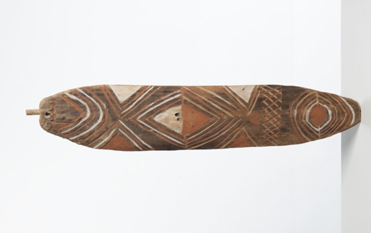
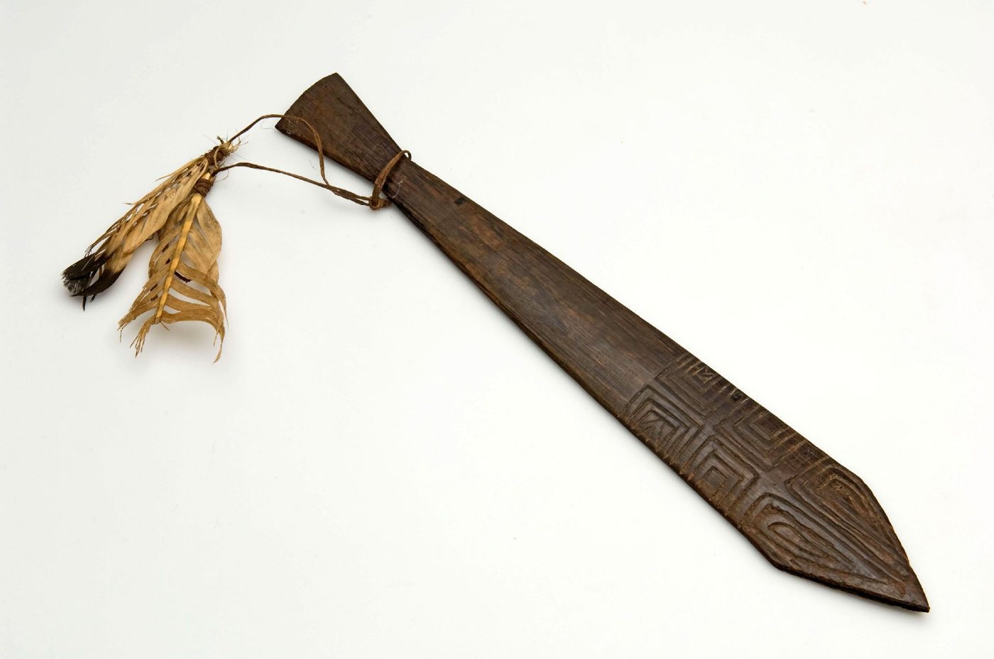
A human map of Sahul
A sea-level curve measures metres. These traditions measure consequences. The old coast becomes a reef people can still name. A walking route becomes a channel. Hills become islands. A forbidden sound and a collapsing shore become one remembered crisis. Ancestors arrive in lutruwita by land before the water makes them islanders. Around Biak, Sarmi, Yotefa, the Sepik, Aitape and Long Island, other floods teach the same grammar of life beside unstable water.
Myth keeps more than depth and date. It carries blame, kinship, law, flight, invention and survival—the social facts that a sediment core cannot hold. That is why the stories can remain meaningful after the visible landscape has vanished. The event survives as a rule for living in the world the event made.
The dead centre of the continent says it most completely, in a country no Holocene sea ever touched. In the Arrernte account Carl Strehlow took down, water covered the earth in the beginning and only the high places stood above it: kangaroo men lived on Torulba — Mount Giles — and duck men sheltered in a rock near Finke Gorge and climbed into the sky to hunt. Then an urbura ancestor struck the water with a stick and ordered it away; the sea drew off to the north, and the land came up out of it. What follows the withdrawal is everything: the beings left behind on the drying ground were shaped into people, and with them came fire, weapons, tjurunga and the laws by which country and kin are ordered. The retreat of the water is not a disaster remembered. It is the moment the world takes its present form, sacred boards included — and the desert keeps that account a thousand kilometres from any coast the water could have meant.
That is what the ninety-five traditions on this map hold in common, and it is the only thing they need to hold in common. They do not remember one flood. They each hand back one world. Narungga country comes back with a gulf cut through the middle of it. Butchulla country comes back with a strait where a walk used to be. The Kurnai get a rule about who may hear the roaring board, and the sea that enforced it. The Yolngu get a wet season, a ceremonial ground and a marriage law, carried up out of the water on the back of a python whose voice they still swing on a cord. Sahul lost more inhabited country to the sea than any other continent. What the people who lost it kept was never a measurement. It was the world that came back, and the terms it came back on.
Key sources
Patrick D. Nunn & Nicholas J. Reid, “Aboriginal Memories of Inundation of the Australian Coast Dating from More than 7000 Years Ago” (2016), pp. 11–47, especially figure 1, tables 1–2 and the twenty-one regional discussions.
Patrick D. Nunn et al., including Ngarrindjeri Aboriginal Corporation, “Calibrating Holocene human–environment interactions using ancient narratives: The example of Ngurunderi in South Australia” (2025), especially pp. 566–575, for the narrative sources and Backstairs Passage crossing.
Lorimer Fison & A. W. Howitt, Kamilaroi and Kurnai (1880), p. 269, for the Gippsland turndun inundation; A. W. Howitt, The Native Tribes of South-East Australia (1904), p. 493, and “The Jeraeil” (1885), pp. 301–325, for Mungan-ngaua, Tundun’s making of the paired bullroarers, their disclosure to women, the sea and the Muk-kurnai.
W. Lloyd Warner, A Black Civilization: A Social Study of an Australian Tribe (Harper, 1937), pp. 24–49, for the Wagilag Sisters, Mirarrmina, Yurlunggur and the first monsoon, from fieldwork of 1926–29; and the National Gallery of Victoria’s essay on Mathaman Marika for the Yolngu bullroarer as the snake’s body, its hair cord as his fangs and its sound as his voice. As far as we know, the flood, the serpent and the instrument have not previously been set out as one being on a single page.
R. Brough Smyth, The Aborigines of Victoria I (1878), pp. 429–430, for the Lake Tyers Frog who held all the world’s water; Walter E. Roth, North Queensland Ethnography Bulletin 5 (1903), §24, p. 11, for the salt water that sprang from the ground at the Pennefather River.
Ernest A. Worms, “Djamar, the Creator: A Myth of the Bād” (1950), pp. 641–658, for the Bardi/Jawi ancestral bullroarer complex; the Korrawinga Aboriginal Corporation’s Butchulla Mini Dictionary (2021), p. 7, for Bon’da’ban.
J. van Baal, “The Cult of the Bull-Roarer in Australia and Southern New Guinea” (1963), p. 209, for the distinction between Djanggawul and Kunapipi; Baldwin Spencer, Native Tribes of the Northern Territory of Australia (1914), p. 211, for the Tiwi absence report, read beside the Tiwi Land Council’s Mudangkala creation account.
Duane Hamacher et al., “The archaeology of orality: Dating Tasmanian Aboriginal oral traditions to the Late Pleistocene” (2023), pp. 3–6, 14, for Robinson’s record, the Bassian route and the 11,960 BP estimate.
Ingrid Harben et al., “Evaluating the Deep Time Archaeological Potential of the Submerged Rottnest (Wadjemup) Shelf, Southwestern Australia” (2025), for the Whadjuk Noongar tradition and the islanding chronology.
Amy Roberts, Adrian Mollenmans, Lester-Irabinna Rigney & Geoffrey Bailey, “Marine Transgression, Aboriginal Narratives and the Creation of Yorke Peninsula/Guuranda” (2019), for the Narungga Wardang/Waraldi tradition and palaeogeographic comparison.
Elizabeth A. Sinclair et al., “Healing country together” (2024), p. 1, for Malgana ancestral tracks toward the Gathaagudu islands, and the Wudjari Marine Park Joint Management Plan (2024), p. 24, for cultural corridors and storylines extending through the Recherche islands and into the ocean.
Allen Gontz, Glen Miller, Lisa Stewart & Adrian McCallum, “Walking to K’gari” (2022), for Butchulla oral histories of crossing the Great Sandy Strait and the submerged-pathway research programme.
Eric K. Silverman, “The Waters of Mendangumeli” (2016), pp. 179–185 and 193–195, for the Tambunum flood and Sepik ecology.
Hugh L. Davies et al., “Past major tsunamis and the level of tsunami risk on the Aitape coast of Papua New Guinea” (2019), for the Sissano tradition and older lagoon tsunami deposits.
Mary R. Mennis, Voices of the Villagers, for the Bel-community Yomba/Kinembla drowned-island variants; see also the publisher record.
Freerk C. Kamma, Religious Texts of the Oral Tradition from Western New-Guinea, part B (1978), sections I–II, for map numbers 30–53; I.8, pp. 26–27, for the two Risei–Sayati rafts; II.2, pp. 89–103, for the distinct Yotefa tellings; and II.4, pp. 106–109, for the Rumbiak brothers, the dog’s message and the settlement of Manyalibit.
Thomas H. Slone, One Thousand One Papua New Guinean Nights (2001), public table of contents and village/language indexes. The Ilahita synopsis and Slone locator give vol. 2, pp. 954–955, for the Lehinga–Malahun settlement flood; and the complete Wantok 464 translation, “Ipapaya Helped Two Boys” (16 Apr. 1983, p. 18), supplies the Ibonaniu spring-release story.
Gunnar Landtman, The Folk-Tales of the Kiwai Papuans (1917), no. 112, p. 201, for Gimini Island; no. 114, pp. 202–203, for Merewoiwo near Aibinio; no. 117, pp. 203–204, for the sawfish route at Madiri; nos. 493–494, pp. 535–537, for the Ipisia deluge and sea-withdrawal pair; and no. 495, pp. 537–538, for the Boigu channel, swamp and well.
Thomas H. Slone’s archived “A Masalai Made Three Islands” (issue 418, 22 May 1982, p. 19), his archived “The Masalai of Lep Island” (issue 429, 7 Aug. 1982, p. 44), and the Slone village/language indexes, for the Kandrian three-island and Baluan/Lep island-sinking traditions.
Laurie Bragge, A History of the Sepik Region of New Guinea, Part 1, printed pp. 87–88, 153–154, 171–172, 223, 230–233, for the Sawos sea-return, Gaikarobi water-recession, Sauinabit, Sororogwi and Lake Malingai accounts; and Part 2, pp. 361, 372–374 and 395, for the Mongwalion migration toward Kutbug, Walio River, Kalok–Munkoswi and Mauwanjatop.
Annie Ker, Papuan Fairy Tales (1910), especially “The King of the Snakes”, pp. 30–31, and “Why the Men of Gavi Will Not Eat Fish”, pp. 52–56, for the Goodenough Bay marine deluge and Lake Wapogi flood.
Karl Hesse and Theo Aerts, Baining Life and Lore (1982), in a public transcript of Manam of Tamanaokin’s Baining origin account, for the saltwater pool becoming the sea and islands.
Gottfried Oosterwal, Die Papua: Von der Kultur eines Naturvolkes (1963), pp. 119–123, for the Tor sacred flutes that maintain rain, rivers and natural order against a world-ending flood.
Petrus Drabbe, “Folk Tales from Netherlands New Guinea (Continued)”, Oceania 20.1 (1949), pp. 71–73, for the Tuga flood and Kamoro/Mimika diaspora.
James Chalmers and William Wyatt Gill, Work and Adventure in New Guinea (1885), p. 164, for Lohero’s Kabadi lowland flood and mountain refuge.
Paul Schleiermacher’s 1900 Valman account, summarised in James George Frazer’s Folk-Lore in the Old Testament, for the forbidden-fish deluge at Berlin Harbour; and Max Moszkowski, “Die Völkerstämme am Mamberamo” (1911), pp. 340–341, for the Mount Vanessa flood.
Valdis Gauss, “Compiling the Austronesian Deluge Myths” (2023), for an overview of the large Kamma–Slone–Bragge collections. The map draws on the individual narratives, not the collection totals alone.
Steven Gimbo, “Folktales are our national treasures” (2009), summarising Adam Amod’s school-text version of “The Great Flood,” for the Ali Island tradition.
GEBCO Compilation Group, GEBCO 2020 Grid, for terrain; Kurt Lambeck et al., “Sea level and global ice volumes from the Last Glacial Maximum to the Holocene” (2014), for the animated sea-level curve.
Alan N. Williams et al., “Sea-level change and demography during the last glacial termination” (2018), pp. 144–154, for the scale, speed and demographic consequences of shelf loss.
Ronald M. Berndt, Djanggawul: An Aboriginal Religious Cult of North-Eastern Arnhem Land (1952), pp. 40–41, and W. E. H. Stanner, On Aboriginal Religion (1959–1963), pp. 142–147, 159–160, for women-first northern ritual charters discussed separately from the Kurnai flood.
Continue the series: Sundaland, East Asia, South Asia, the Mediterranean Near East, Doggerland, North America, South America, and the coasts where it is not remembered. The series hub, Twelve Drowned Worlds, maps the drowned landscapes the nine essays are standing on.