Atlas Essay — 2026-08-11
Flood Myths of the Mediterranean Near East
From the Aegean and Black Sea to the Caspian and Persian Gulf

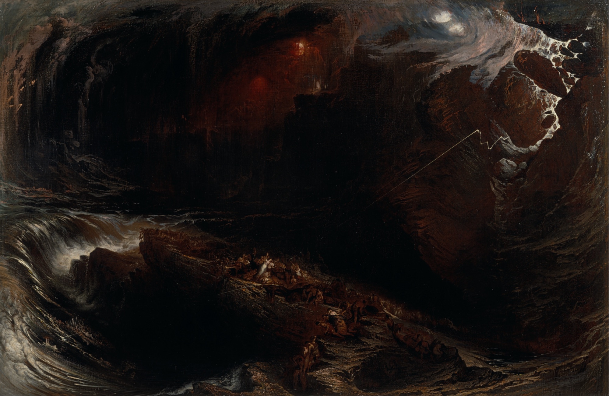
The oldest flood in writing begins as a noise. People multiply, the land bellows like a bull, and the god Enlil cannot sleep for the rigmu—the din of human beings—so the gods resolve to wipe them out. One man is saved because another god cheats: forbidden to warn him, Ea speaks instead to the wall of his house and lets him overhear. Around the inland seas that is what a flood is for. It ends a world and issues the next one: the altars on Samothrace stand at the water’s highest reach, the Athenians feed the crack the water drained into, Argos builds its sanctuary at the ebb line, and a Syriac book says the men and women of a church stand on opposite sides of the aisle because that is how they stood on the ark. Fifty-one traditions are gathered here, from Egypt and the Aegean to the Caspian and the Persian Gulf. Between them they take one world apart and hand back the one people are still living in.
A flood made of noise
In the Babylonian poem Atrahasis the human race is created to do the gods’ work, and it succeeds too well. The people multiply, the land grows wide, and the land bellows like a bull. What reaches heaven is not sin and not violence: it is rigmu, uproar, racket, the sound of a species at full volume. Enlil cannot sleep. He sends plague, and the noise returns. He sends drought and famine, and the noise returns. At last he takes the flood, and binds the other gods by oath not to tell anyone.
Ea keeps the oath and breaks it in the same breath. He does not speak to the man. He goes to the reed hut where Atrahasis sleeps and addresses the building—Reed hut, reed hut! Wall, wall!—and delivers his instructions to the fabric of the house while the man inside listens. In the Sumerian version the same trick is preserved almost intact, and the wall is left standing in the poem where the warning belongs:
A voice with no visible speaker, arriving through a barrier, telling one man what nobody is supposed to know: a voice from behind a screen is this atlas’s own subject, and in the oldest flood text there is, it is doing the largest job it will ever be given. The whole human line comes through a wall. When Berossus retold the story in Greek for a Hellenistic readership, he kept the disembodied voice and moved it to the end. After Xisuthrus and his family vanish from the mountain, the people left in the vessel call for him and get an answer out of nowhere: they see him no more, Berossus says, but they could distinguish his voice in the air
, instructing them to honour the gods and to walk back to Babylon and dig up the writings he had buried at Sippar before the water came.
And when the water dries, the poem writes its settlement. Enki has the birth goddess establish death for all peoples. He puts a third kind of woman among the people, the one who does not bear; he sets the pašittu loose to snatch the baby from the lap that bore it; and he institutes the high priestesses who are forbidden children, to cut childbirth down. Barrenness, infant death and celibacy all date from the morning after the flood, and they are there to keep the noise within limits. The oldest flood in writing already ends the way the youngest ones on this map do — by instituting something. What it institutes is a category of women.
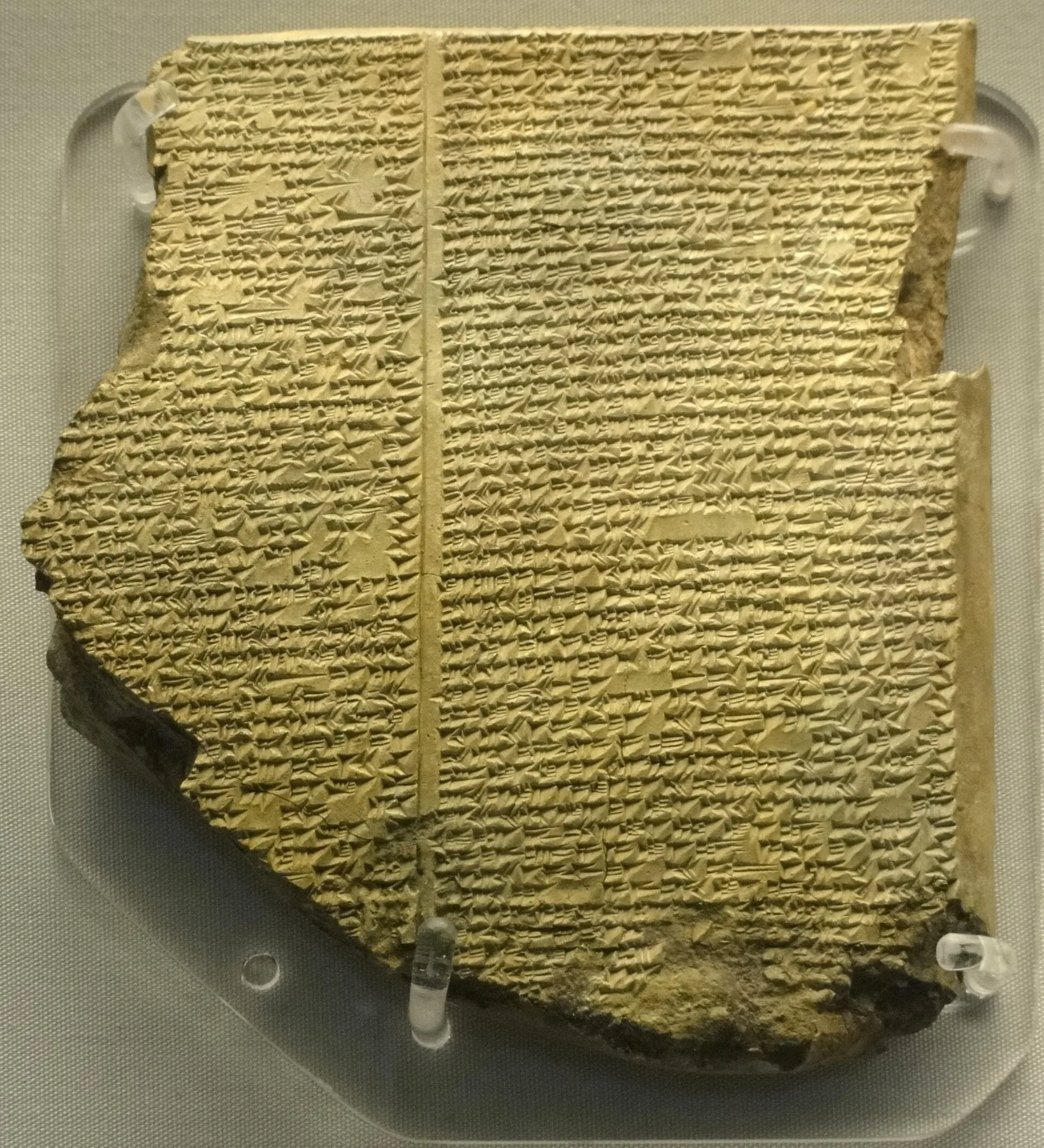
The Mesopotamian flood is a family, not an event: Ziusudra in Sumerian, Atrahasis and Utnapishtim in Akkadian, Xisuthrus in Berossus’ Greek, Noah in Genesis and Nūḥ in the Qur’an. They share a shoreline as well as a plot. At the glacial minimum the Persian Gulf was not a sea but a long low basin with rivers running down it, and the water that eventually filled it came in fast enough, at times, to move a coastline kilometres within a lifetime. Jeffrey Rose’s Gulf Oasis model reconstructs that habitable country and its loss. One drowned country stands behind them all, and the aftermaths run separately: kingship restarted at Kish, learning dug back up at Sippar, covenant and food law at Ararat, the vessel on al-Jūdī.
When the Black Sea entered the Aegean
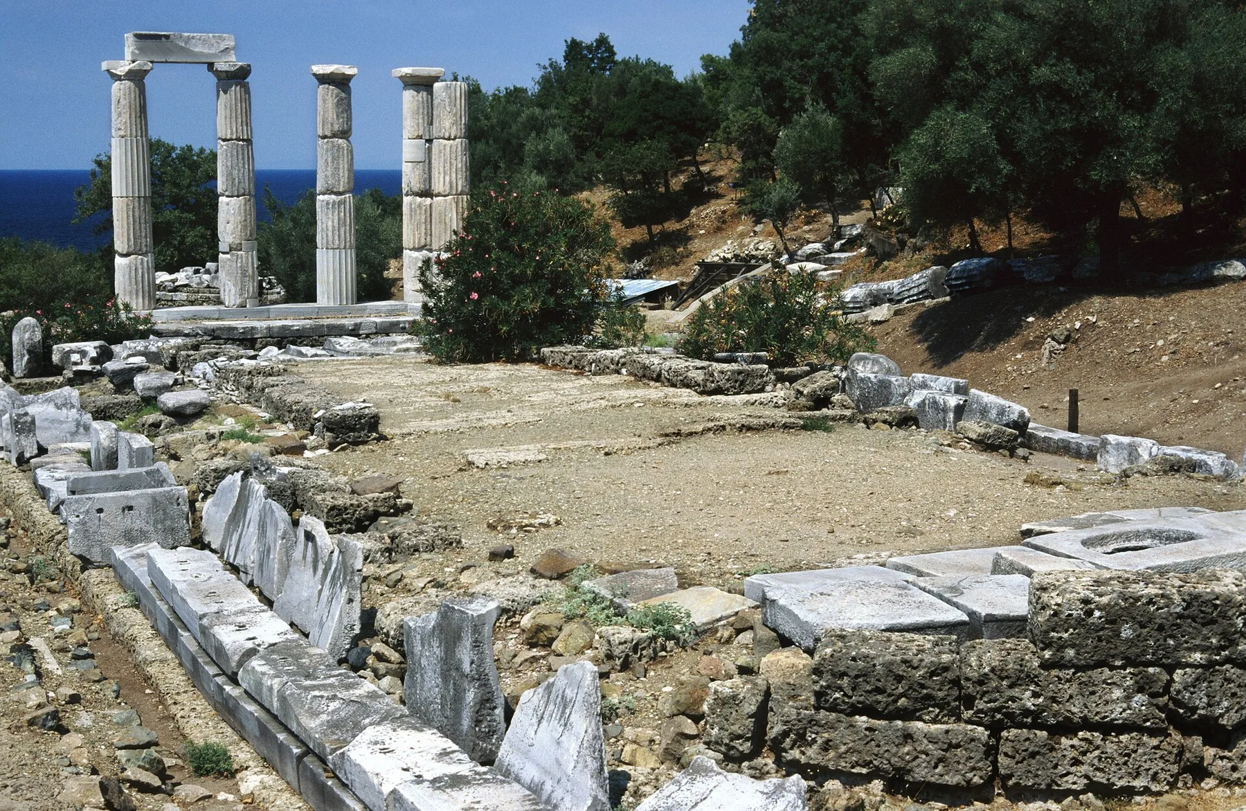
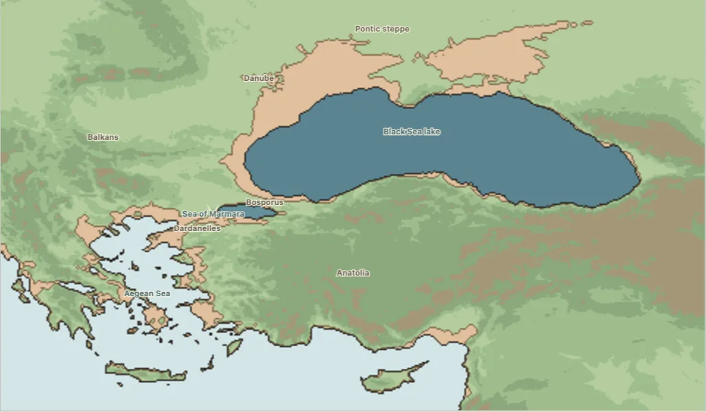
Diodorus of Sicily preserves a story the Samothracians told about their own island, and it is unusually physical. The Black Sea was once a closed lake. Its rivers went on pouring in until the water forced the Bosphorus, crossed the Sea of Marmara, forced the Dardanelles too, and came down on the Aegean coast. The low ground of Samothrace went under. The people ran uphill, and when the water finally stopped they built altars along the line it had reached and sacrificed there ever after—altars that were still in use, Diodorus says, in his own day. Fishermen working the drowned country afterwards brought up the stone capitals of buildings in their nets.
Two published studies place that tradition beside the real remaking of the Black Sea, Marmara and northern Aegean at the end of the Ice Age: Compatangelo-Soussignan on Samothrace itself, Lancini on the wider Greek cluster. Samothrace did become an island; the plains around it did go under; the passages between the two seas did open. The tempo is still argued over. The correspondence is not.
The far shore of the same sea keeps a mirror-image story. On the Turkish Black Sea coast, people around Çarşamba and Terme said the plains they farm had once been under water, and that the fort at Eğri Kale had stood beside a ship’s pier; then the ground broke open, the Bosphorus formed, the water ran out, and the Samsun plain was left behind. They pointed to the shells and sea sand turned up beneath the soil. The plain is real and young and its soil does contain the coast’s history—but it was built outward by river sediment over the last several thousand years rather than exposed by a drain, so the tradition has the right country and the wrong plumbing.
Refuge mountains
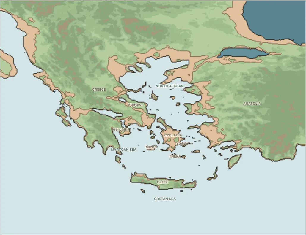
Around the same seas the Greeks kept a belt of survivors, each on his own summit. Deucalion is warned by Prometheus, rides out nine days in a chest with Pyrrha and grounds on Parnassus. Megaros, near Megara, hears cranes calling above the rising water and follows them up Mount Geraneia. Cerambus is given wings by nymphs and lifts off Othrys as Thessaly goes under. On Rhodes the Telchines, the island’s first inhabitants, see the flood coming and simply leave, abandoning the lowlands to the sea.
Sakellariou and Lykousis make the strongest published case for Deucalion, setting the tradition beside the rapid drowning of former glacial lakes and low basins around the Gulf of Corinth; Lancini gathers the rest into the same Aegean cluster. What all four share is a shape: high ground is not scenery but the mechanism of survival, and the story ends by explaining who lives there now.
Deucalion’s does it most bluntly. He and Pyrrha come down from Parnassus into an empty country and are told to throw the bones of their mother behind them. They understand the riddle—the earth is the mother, the stones are her bones—and the stones they throw over their shoulders stand up as people. Their son Hellen gives his name to the Hellenes. The flood is the reason there are Greeks at all.
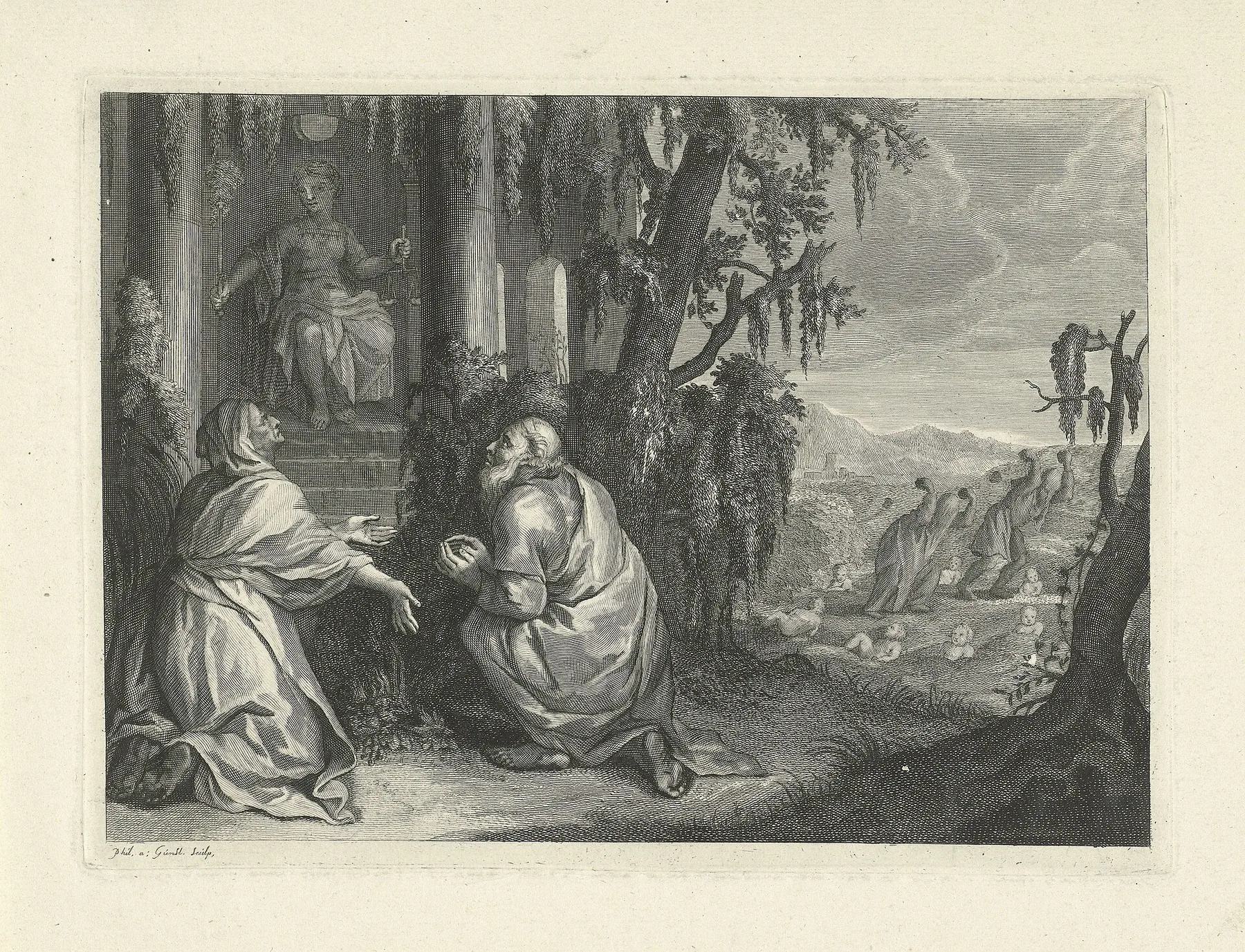
Lesbos gives the whole sequence in civic form. In Diodorus, Deucalion’s water leaves the island empty; Macareus arrives later with a mixed company drawn from several peoples and settles the good ground. The land is divided among them, Mytilene and Methymna are named for members of his family, colonies go out to the neighbouring islands, and he lays down a law that later Greeks still remembered for its usefulness. Depopulation, resettlement, land tenure, place-names, colonies, constitution—the flood is the first chapter of a founding charter, and the rest of the chapters follow immediately.
Western Greece keeps a smaller and better-anchored version of the same transformation. Five river nymphs slight the river god Achelous during a sacrifice, and he answers by tearing their farmland off the bank, carrying it out to sea and breaking the former mainland into the Echinades islands. Palaeogeographic reconstructions of that coast show rising water isolating hills there between roughly 18,000 and 6,000 years ago. Mainland genuinely became an island group here, and the river’s own sediment has since welded some of the islands back onto the delta, so the coast has run the story forwards and then partly backwards.
Behind all of them stands an older and vaguer one. Greek writers remembered a flood earlier than Deucalion’s, in the time of Ogyges around Boeotia and Athens, and the surviving notices are so brief and so inconsistent that even the country affected is uncertain. What the fragments preserve securely is the word: Ogygian came to mean primeval, the far edge of anything anyone could remember. The Greeks kept a name for the flood beyond the flood.
At Argos the aftermath is a boundary marker. Poseidon and Hera go to arbitration over who owns the country; the judges give it to Hera; Poseidon floods almost all of it in return. When Hera talks him into withdrawing, the Argives build a sanctuary at the precise point where the sea stopped and call the god Prosklystios, the Flooder. The water is gone. Its edge is a permanent civic monument.
Four places that marked the water’s edge
That instinct at Argos is not local. Four places around the eastern Mediterranean, in four different traditions, do the same thing: they find the mark the water left and make it a place of offering.
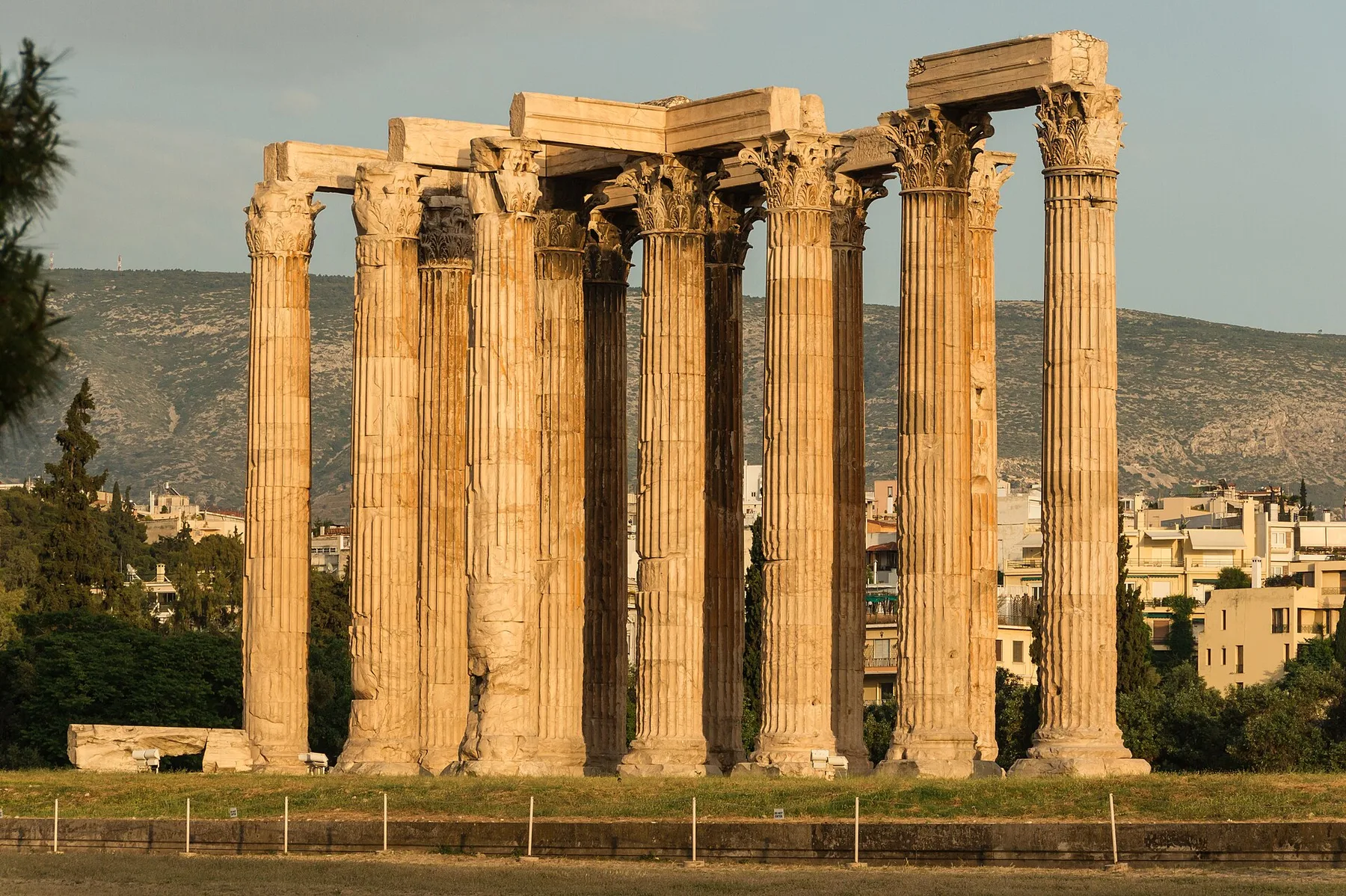
Inside the precinct of Olympian Zeus at Athens the bedrock splits open, a gap about a cubit across. Athenians said this was where the flood in Deucalion’s time had drained away. They showed visitors his grave beside it and said he had built the old sanctuary. Once a year they threw wheat meal kneaded with honey down the crack. Pausanias saw the hole and saw the offering go in.
At Hierapolis—Manbij, in northern Syria, a day’s march west of the Euphrates—Lucian found the same idea running on a larger budget. The first human generation had been destroyed by water; the pious Deucalion, whom the locals also called Sisythes, came through it in a great ark with his household and paired animals; the water drained into an opening in the ground, and the temple was built on top of it. Twice a year priests and pilgrims from Syria, Arabia and beyond the Euphrates carried seawater inland and poured it through the sanctuary into the little chasm. Lucian looked at the hole, thought it too small for the job, and reported the rite anyway.
Argos sets its sanctuary at the ebb line; Samothrace sets its altars at the highest reach. Athens feeds the drain; Hierapolis feeds it seawater fetched from the coast twice a year. Four traditions with no common text, agreeing on what to do with the last line the water touched.
Athens does all of them one better, because Athens kept a piece of the water itself. When the gods were taking possession of the cities where each would be worshipped, Poseidon reached Attica first: he struck the middle of the acropolis with his trident and produced a sea there, the one they call the Erechtheis. Athena came after him, called Cecrops to witness her act of possession, and planted an olive. Twelve gods arbitrated the quarrel and gave her the country, because Cecrops testified that the olive had come first — and Poseidon, in a hot rage at the verdict, flooded the Thriasian plain and laid Attica under the sea. The salt water never left the rock. Inside the temple on the acropolis there is a well of sea water sunk in the ground that sounds of waves when the wind is in the south, and the olive stands beside it. The two things Athens keeps as evidence of the quarrel are a tree and a captive piece of sea — the flood not marked but impounded, and still audible.
Two ways to make a strait
Where the sea narrows, the stories turn technical. Ovid runs through a catalogue of remembered transformations of the Mediterranean—islands becoming mainland, mainland becoming island, streets visible under clear water—and at the Strait of Messina he is exact: Zancle was part of Italy until the sea cut it off. Justin tells it with more violence: Sicily hung from Calabria by a narrow neck until the upper sea tore it away. Antonioli and colleagues reconstruct the sill that carried a walkable land bridge between Sicily and Calabria during the last glacial lowstand, dry for at least five centuries around 21,500 to 20,000 years ago. No text dates the Roman story; what the geology supplies is the before-and-after that the story describes.
At the other end of the sea the Greeks could not agree whether their strait had been made or unmade, and Diodorus prints both versions in the same paragraph. On one account Heracles built the headlands of Europe and Libya out towards each other to narrow the gap, so that the monsters of the Ocean could not get into the inner sea. On the other the two continents were a single piece of ground and he cut them apart, after which the Ocean came in and never left. Diodorus declines to choose. The disagreement is the valuable part: two schools, one arguing that the strait is an obstruction someone installed and the other that it is a wound someone opened.
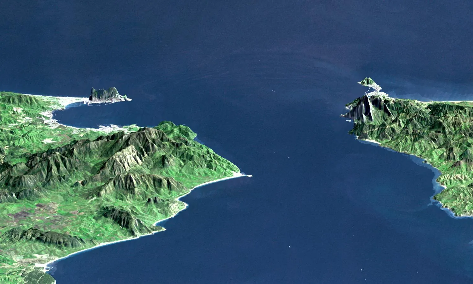
One Greek got the mechanism right, and he was not telling a myth. Strato of Lampsacus, who ran Aristotle’s school in the early third century BC, argued that the Black Sea originally had no outlet at all: its rivers kept raising it until the water forced its own passage at Byzantium, and the Mediterranean, filling the same way, then broke out at the Pillars of Heracles. Ground that had been under water was left dry, both breaches stayed open, and Strato expected the process to repeat—given enough silt, he said, the Black Sea will fill up completely in the end. Strabo preserves the argument. Twenty-three centuries before anyone put a corer into the Marmara, a natural philosopher had a lake overflowing into the Mediterranean and opening its own strait; his water runs the opposite way to the catastrophic-inflow model that made the modern quarrel, which is precisely what makes him worth reading rather than recruiting.
The Argonauts supply the mythic version of the same passage. At the mouth of the Black Sea the Symplegades, the Clashing Rocks, crush anything that tries to get through. Jason sends a dove ahead, follows it in the Argo, and once the ship is through the rocks are rooted where they stand and the strait stays open forever after. Whatever else that story is, it is an account of a permanently opened gate between two seas.
The northern shore keeps the strangest version of the opened passage, and gives it a motive. In the Ossetian Nart tradition, when Bora, forefather of a Nart line, died, his companions buried him on the shore of the Endless Sea. The water beings wanted the grave for themselves, under the sea, but their own sea had too little water in it — so at midnight their elder opened the shut passage to the Eastern Sea. The two seas joined, Bora’s tomb went under with the shore it stood on, the water was remade and stayed that way, and people named the darkened water the Black Sea. A shut passage deliberately opened, two seas joined, a coastline drowned for good: the event the Samothracians dated from their altars, told from the far shore — where what the joining of the seas took was the grave of a great ancestor, and the sea’s own name is the stain of it.
Shells on the hills
Herodotus went to Egypt and was told that the country was young. Under the first king, Min, everything except the Thebaid was swamp, and nothing north of Lake Moeris stood above the water at all. He tested it the way a Greek of the fifth century tested things: he had the lead dropped a day’s sail off the coast and it came up muddy. Then he made his case from what was lying about—shells out on the hills, salt sweating through the stone of the pyramids, the whole Delta plainly built out of river mud—and concluded that the sea had been there before the country was, and that every field an Egyptian works is land the river handed him.
The reasoning is good and the clock is wrong. The Faiyum did hold a far bigger lake in the early Holocene, and the Delta really is river sediment; but his informants put it in dynastic time and he argued it from silting rates rather than from anything remembered. It is ancient observational science, roughly right about the process, badly wrong about the age.
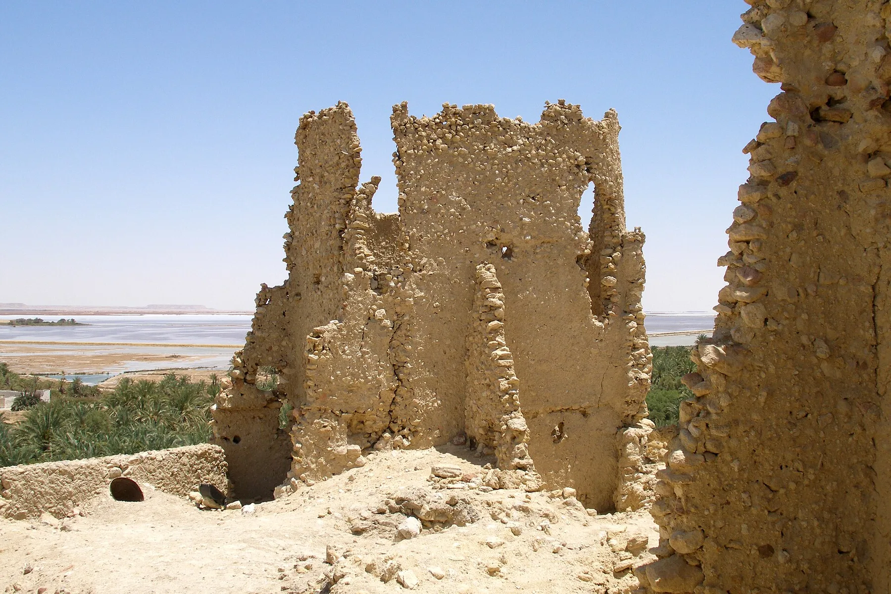
The oasis of Siwa shows the same instrument failing harder. Eratosthenes, quoted by Strabo, reports that travellers on the desert road to the oracle of Ammon, three thousand stades inland, walked over mussel, oyster and scallop shells, salt beds and springs of brine, and came across the timbers of seagoing ships; the local people said the wreckage had been thrown up out of a chasm. The shells are real and marine and tens of millions of years old. Read as a recent shore, they made Siwa a beach, and the sacred envoys of Cyrene went out into the middle of the Sahara and dedicated dolphins there on little columns, inscribed with their office.
Egypt also keeps the region’s two great cosmic versions. The oldest surviving Egyptian story of any length begins with a wave: 120 picked sailors go down in a storm and one man is thrown up on an island of inexhaustible fruit and fish, ruled by a golden serpent who is himself the last of a destroyed family. The serpent tells him a ship will come, and that once he leaves he will never find the place again, because it will become waves. He goes home with incense, ivory and marvels, is presented at court, receives rank and attendants and reaches his children; the island drops out of the sea. And in the Book of the Heavenly Cow, painted in the tomb of Seti I, the sun god grows old, hears what people are saying behind his back, and sends his Eye out as a goddess to kill them. She kills until she likes it. To stop her he has seven thousand jars of barley beer brewed and dyed red as blood and poured over the fields in the night to a depth of three palms; at dawn she sees her own reflection in what she takes for blood, drinks until she is drunk, and forgets her errand. The people alive that morning are the people alive now. Sick of them, the god climbs onto the back of the sky-cow and withdraws upward, and in going he sets heaven above, earth below and the land of the dead beneath—the world in the shape it has kept ever since. The flood here is beer on farmland, but the move is the one the whole region makes: near-extinction followed by a permanent rearrangement of the universe, with the survivors installed in it.
And Egypt keeps the one text in this essay that runs the flood the other way. In spell 175 of the Book of the Dead, Osiris arrives in the necropolis and finds it insupportable—no water, no air, very deep, very dark, nothing to do but lie quiet—and complains to Atum, who answers that he has given blessedness instead of water and air, and quietness of heart instead of bread and beer. Osiris asks how long a lifetime of life is. Millions of millions, Atum tells him, and then: I will destroy all that I have made, and this land will go back into the Deep, into the flood, as it was before. Only I shall survive, together with Osiris, after I have taken my other shapes—snakes that men do not know and gods do not see. Every other flood on this map founds something: a people, a shrine, a law, a shoreline. This one repeals. Nothing is founded and nothing is repopulated; the two who are left are not a couple in a boat but the creator and the dead god, coiled and invisible in the water that was there at the beginning. The deluge that everywhere else opens the world is here how the world will close—and the survivors are serpents.
The Greeks are always children
At Sais in the Delta, an old priest told the Athenian lawgiver Solon that his people had no memory. The world, he said, is wrecked over and over, most often by fire and by water, and each kind of ruin sorts the survivors differently. When the fire comes, the people down by the rivers and the sea live. When the flood comes, the herdsmen high in the hills live and everyone in the cities drowns.
Follow the mechanism through and it is devastating. The people who drown are the ones who keep records; the people who live are the ones who cannot write. So the towns, the archives and the names go under together, and the country restarts from illiterate shepherds who know nothing of what came before—which is why, on this account, the Greeks were forever telling one flood story as though it were the only one. Egypt is the exception because the Nile rises from below instead of falling from the sky, and the temples kept writing straight through.
Plato is constructing an argument, not filing a report, and the speech exists to set up Atlantis in the next breath. But the argument he constructs is this series’ own thesis, stated by an ancient author in the fourth century BC: catastrophe is repeated, memory is the first casualty, and what survives a flood is not the record but the people furthest from it. Every point on this map is a story that came down that filter.
Atlantis and its many shores
Plato’s Atlantis is the flood story that never settled on a shore. In the Timaeus, its first appearance belongs to an Athenian conversation and an Egyptian priest’s rebuke; its narrated island lies beyond the Pillars of Heracles, normally read as Gibraltar. On this map its point sits beside the Greek traditions because that is where the story enters the world—through Solon, Athens and Plato.
Readers have put Atlantis in and around the Aegean, especially at Thera after the Minoan eruption; beyond Gibraltar in the Atlantic and near the Azores; on the Spanish Atlantic coast; and, much farther north, beneath the North Sea. The French mining engineer Jean Deruelle made the last case in his Dogger Bank project: a drowned plain, he argued, became Plato’s great island, and the encircling ditch was a prehistoric dyke system. The Doggerland reconstruction shows the North Sea plain before it drowned.
Four mountains, one ark
Once the vessel exists, four mountains put in a claim to where it landed.
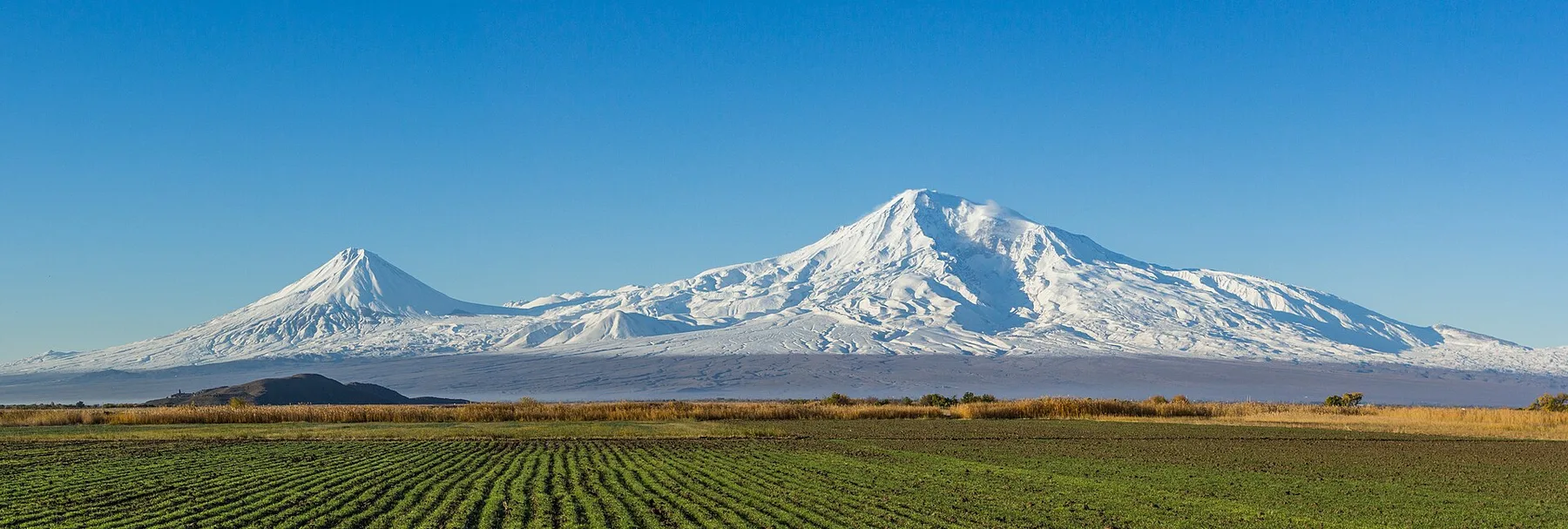
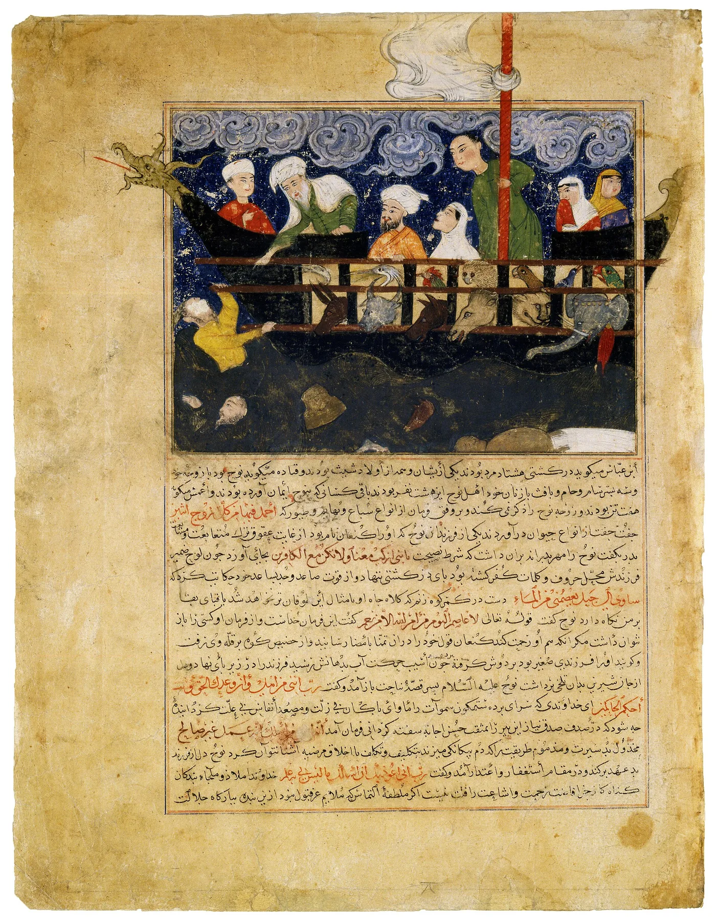
Genesis says the mountains of Ararat, a region rather than a peak, and later readers fixed it on the great double cone above the Araratian plain. The Qur’an names al-Jūdī, which Islamic geographers identified with Cudi Dağı in southeastern Turkey; in that telling one of Noah’s sons refuses the ark because he trusts a mountain to save him, and drowns within sight of it. Berossus grounds his vessel in the Armenian highlands, where people were still scraping bitumen off its timbers for amulets.
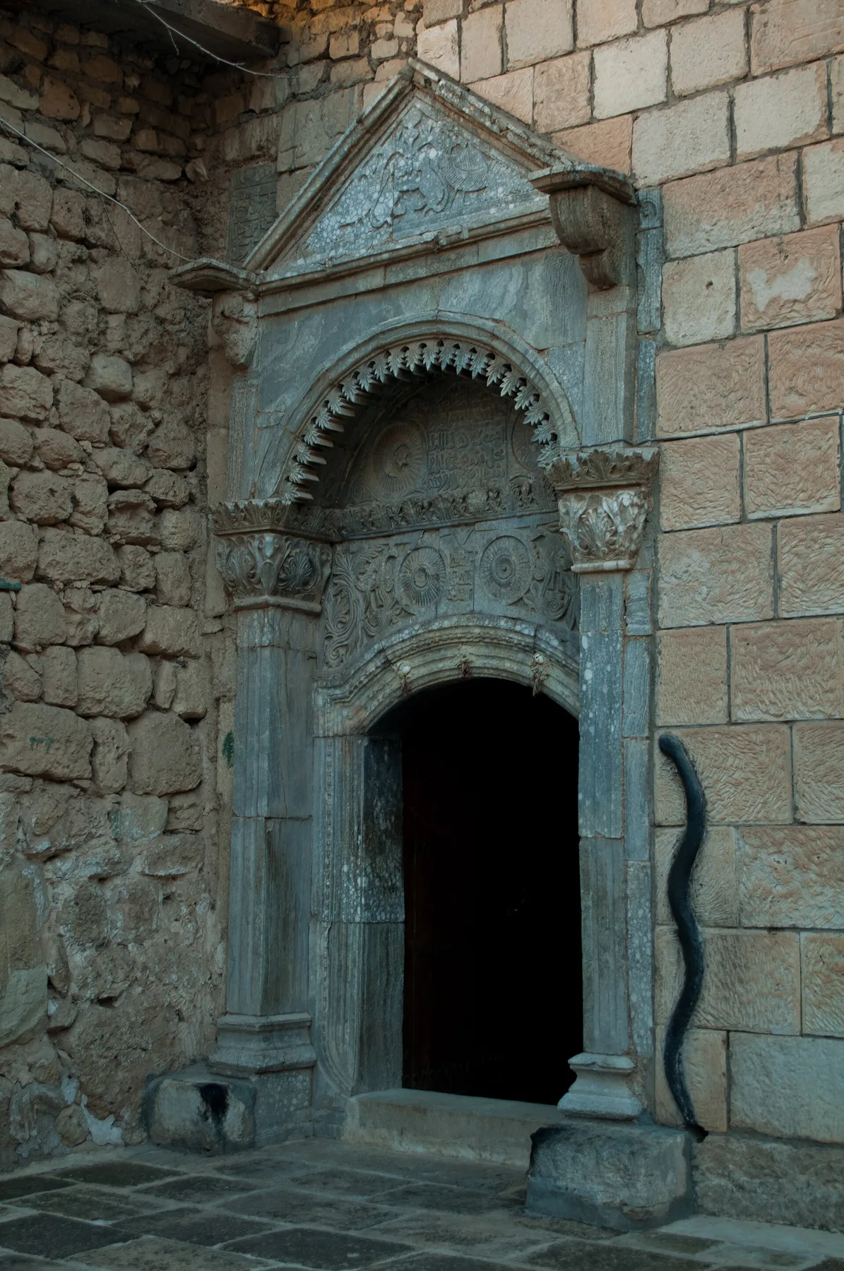
The Yazidis of Mount Sinjar, in northwestern Iraq, put the landfall in their own country and add the detail nobody else has. The ship came over Sinjar and struck; a rock went through the hull and the water started in; a serpent wound itself into a flat coil and jammed itself into the hole. The vessel floated off the mountain and carried on to Judi. The serpent was thanked and released, and bred until its offspring were biting people and livestock everywhere, so in the end it was caught and burned—and the fleas came out of the ash. The printed Meṣḥefa Reş that carries the story was transmitted through outsiders and its authenticity has been argued over; what is not in doubt is the black serpent carved beside the door of the sanctuary at Lalish, kept black, touched by those going in.
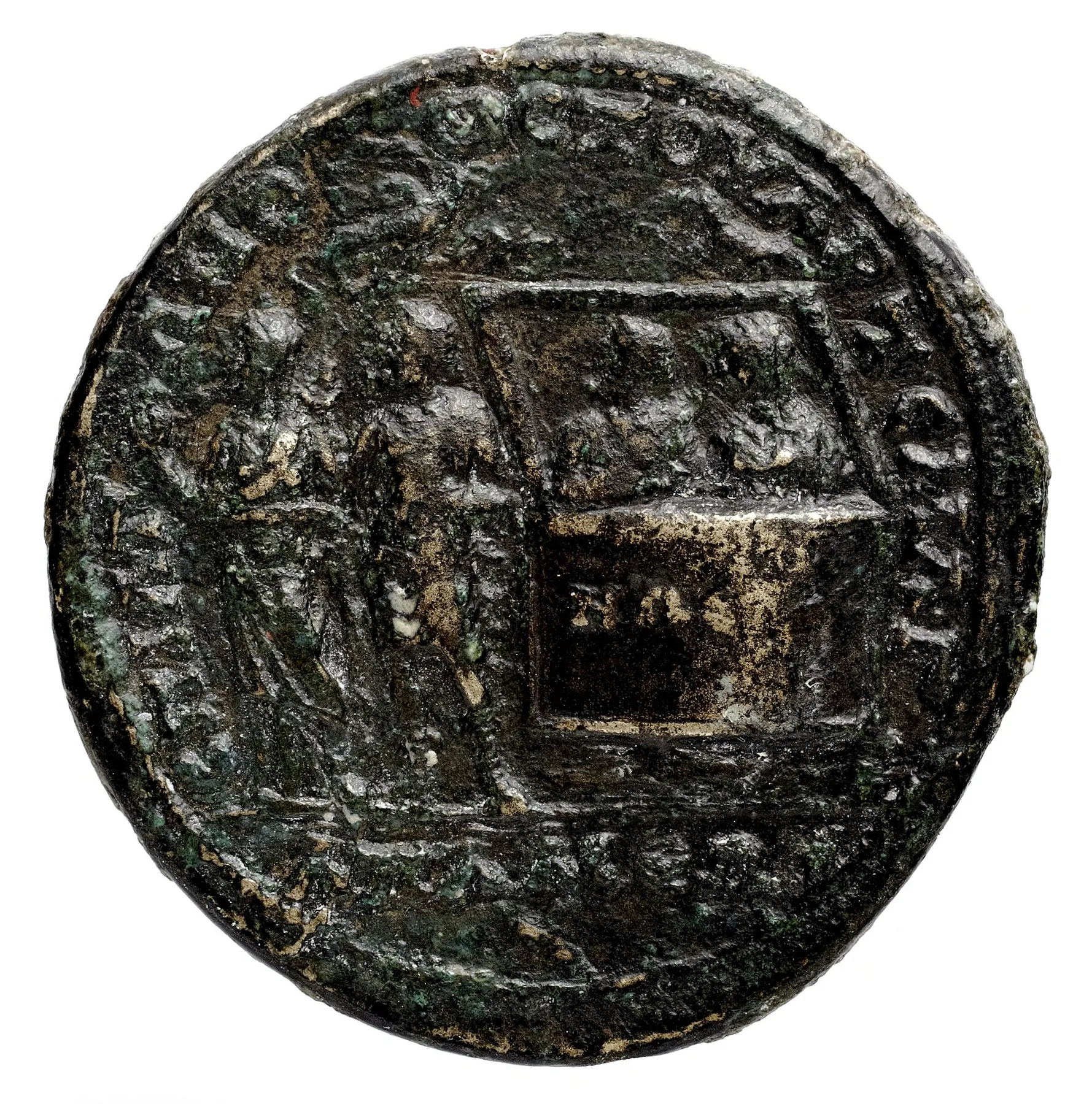
The fourth claimant is a landlocked city in Phrygia that had the by-name Kibotos—the Chest. Apamea Kibotos said the ark had come down on a steep dark mountain in its own territory, which it also called Ararat, with the river Marsyas running out from under it. Then it did something no other flood tradition in this region did: it put the claim on its money. From the reign of Septimius Severus onward the city struck bronze showing a box afloat with two figures inside, the name ΝΩΕ—Noah—lettered across the side of it, the same pair standing again on dry ground at the left, and a bird overhead. It is the oldest surviving picture of the ark, and it was small change.
North of them all, the Caucasus keeps its own landing, and it lands on ice. In the Ingush telling, God sends rain against a cruel world; an old man and his family shut themselves in a chest, and the water carries it to the ice summit of Bashloam-kort — Kazbek — where they live on the ice until the flood withdraws. His children go out afterwards and spread through the earth, all but seven sons, who stay behind in cells high on the mountain until they pass into the sky as a constellation — leaving mountain, people and stars in the order they hold now. Ararat’s ark leaves a covenant, Apamea’s leaves a coin; the chest on Kazbek leaves seven stars standing over the mountain that saved them.
Men to the east, women to the west
The sharpest thing on this map is not a drowned coast. It is a sixth-century Syriac book explaining why a congregation stands the way it stands.
In the Cave of Treasures, Noah does not board first. He goes into the cave where the patriarchs are buried and brings out the embalmed body of Adam, with gold, myrrh and frankincense, and lays the body in the middle of the ark like a raised stand. Then the passengers are arranged around it. Noah and his sons keep to the east side of the deck; the women keep to the west; and for the whole voyage neither side crosses to the other, so that no one sees the other’s face. Meanwhile the ark itself is steered: driven east to west and then north to south over the water, again and again, until its wake has drawn a cross on the face of the flood.
Then the text says what it is for. Men stand on the east of the church and women on the west because that is how they stood on the ark. Adam’s body, carried on afterwards to the middle of the earth, is laid in the ground at the place where the cross would later stand above it. A flood story is being used, explicitly and in so many words, as the charter for a rule about who may look at whom during worship. Most world-establishing myths have to be inferred from what they leave standing. This one hands over its derivation.
Anatolia makes the same move at village scale. Zeus and Hermes walk through Phrygia disguised as strangers and are turned away at every door but one: an old couple, Philemon and Baucis, feed them out of nothing. The gods walk the pair up the hill, and when they look back the whole community is under water and their own cottage has become a temple. They serve it as its priests for the rest of their lives and are turned at the end into two trees growing from one spot. A drowned district, an isolated righteous household, and a functioning cult with its founding staff—the sequence in miniature. At Iconium, modern Konya, the immensely old king Nannacus foresaw the deluge and gathered his people into a temple to weep and pray; after his death the water destroyed humanity, and Prometheus and Athena made new human figures. Ancient writers connected those images with the city’s old name, and “to weep for Nannacus” became a proverb for grief that changes nothing.
The same move runs through the eastern traditions. Under the Temple Mount, David digs the drainage shafts too deep, cuts into the Deep, and the water under the world comes up to drown it; the Name is written on a shard and thrown down; the water falls so far that the ground dries out, and David has to sing the fifteen Songs of Ascents to bring it back up and fix it a thousand cubits down—which is where the water table under Jerusalem has stood ever since. In the Zoroastrian Bundahishn the star Tishtar takes three shapes, man, horse and bull, and rains for ten days and nights in each; the drops come down the size of bowls, water stands a man’s height over the whole earth, the noxious creatures are killed and driven into holes. Then the wind sweeps the water off the land to the edges of the world and the wide-shored ocean is made out of it. That flood is not a punishment at all. It is where the sea came from.
And in the Vendidad, Ahura Mazda warns Yima of winters that will bring deep snow to mountain and plain and floodwater when the snow melts. Yima builds the Vara, a sealed refuge, and carries into it the seeds of the finest men and women, of cattle and birds, of plants and fruits, and red-burning fires. Inside there is no deformity, no disease, no falsehood and no shortage. It is the most exact cold-catastrophe story in the region and it is also a specification for a world: not a remnant that survives, but a curated inventory of everything the next world is permitted to contain.
The women who stopped the sea
Lycia keeps the one flood on this map that women end. Bellerophon had rid the Xanthian plain of the pirate Chimarrhus, whose ship carried a lion at the prow and a serpent at the stern, and driven out the Amazons besides, and Iobates gave him nothing for any of it. So he waded out into the water and prayed to Poseidon that the land be made barren and unprofitable, and turned back inland — and a wave got up and came after him, the sea standing high in the air and covering the plain as he walked. The men came out and begged him to stop it, and could not move him. Then the women came out to meet him with their skirts lifted, and he turned back toward the sea for shame, and the wave went back with him.
Plutarch, who preserves the story, keeps its consequence attached: the plain came out from under the water, and from then on the Xanthians took their names from their mothers and not their fathers. That is the reason given for the custom. Everywhere else on this map the flood’s charter is delivered by a survivor — kingship at Kish, a covenant at Ararat, a standing arrangement in church. At Xanthos the charter is won from the flood itself, by the women, with the one gesture the hero cannot face down; and the law that commemorates it writes the mothers into every Lycian’s name.
Lakes on the wrong clock
Some of these traditions describe real hydrology in the right order and the wrong epoch.
The plain of Pheneos in Arcadia is a closed basin: no river runs out of it, and the water leaves underground through chasms beneath two mountains, which the Pheneatians said Heracles had cut. When the chasms blocked, the plain filled and the old city went under. Pausanias was shown the marks high on the mountainsides where the water had stood, and walked the fifty-stade channel Heracles was said to have dug for the river Olbius—thirty feet deep in places and completely dry, because the river had gone back to its old bed. All of that is how the basin behaves. It has ponded and emptied repeatedly within historic time, and it will do it again; the marks are the sort of thing a filled basin actually leaves. It is simply Holocene karst on a repeating cycle rather than anything terminal-Pleistocene.
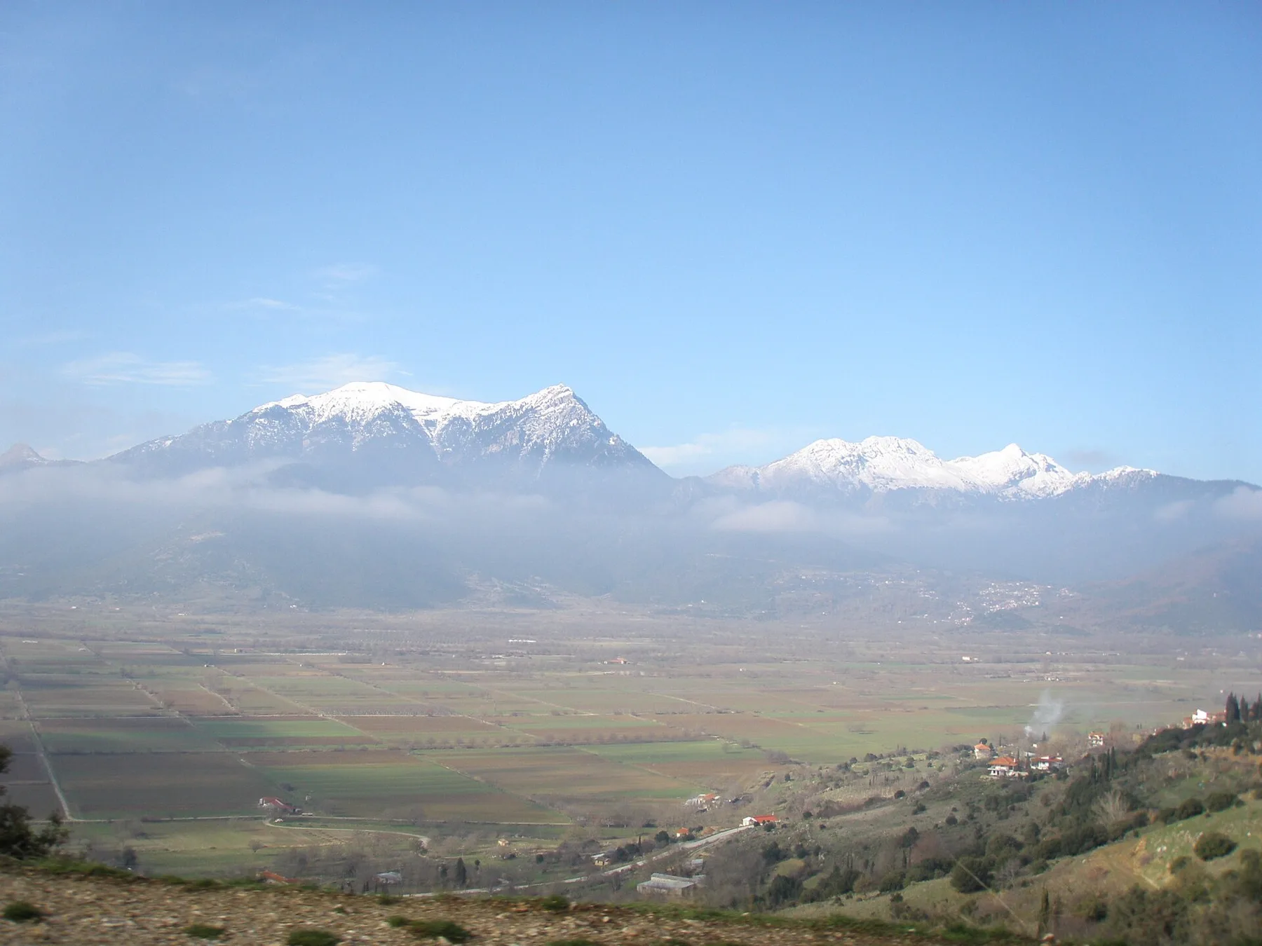
Boeotia runs the same machine with the polarity reversed. Where Lake Copais lay, Strabo says, there had been dry ground, tilled in all kinds of ways
while the Orchomenians ran it; Diodorus supplies the culprit, Heracles again, blocking the outflow past Orchomenos to punish the Minyans. A worked plain becomes a lake and the district is ruined. Copais did alternate between lake and plain as its sinkholes clogged and cleared, and the Mycenaean drainage works at Orchomenos are archaeologically real, which makes the likeliest referent the collapse of a Bronze Age engineering scheme—far too late for this map. Thessaly belongs to the same family: Herodotus was told that the whole plain had been a lake shut in by mountains until Poseidon split the Tempe gorge and let it out to the sea.
The Caucasus tells the drained basin with a serpent in the plumbing. Kakheti, the Georgians say, was once a sea, brought there from another sea, and a serpent lived in it. Saint George’s calf came back from that water with bloodied horns, so the people armed its horns with diamonds and sent it in again, and this time the calf beat the serpent — which fled in panic and smashed through the Shiraki barrier between the Alazani and the Iori. The water ran out behind it, Kakheti was freed, and the people came down from the heights to settle the land. Heracles opens the Greek basins with tools; at Shiraki the barrier is broken by the beaten serpent’s own flight, and the drained floor is the settlement charter of the province.
The most tempting lake of all is in Tunisia. Greek writers describe a great Libyan lake called Tritonis, with an island in it and peoples living all round the shore—the Machlyes on one side, the Auseans on the other. Jason’s ship was blown off Cape Malea to Libya and grounded in its shallows, and the god Triton showed the crew the way out in exchange for a bronze tripod. Diodorus says the lake later dropped out of sight in an earthquake, when the side of it facing the ocean was torn open. What outlived the water was the rite: once a year the Ausean girls divided into two parties and fought each other with stones and staves in honour of Athena, whom they called the daughter of Poseidon and the Tritonian lake, and any girl who died of her wounds was declared to have been no virgin.
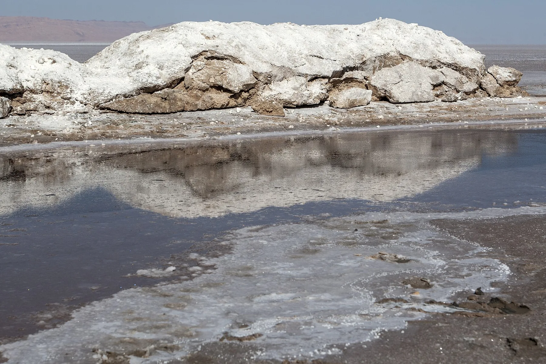
The chotts did hold big lakes in the African Humid Period and the Gulf of Gabès coastline has moved a long way, so a great lake in southern Tunisia is not a fantasy. But Diodorus’s earthquake is an explanatory device, the ancients themselves could not agree where Tritonis was, and the nineteenth-century schemes to flood the Sahara left a century of bad literature attached to this exact basin. The tradition is carried. No identification is.
The island that had to be stopped
The Aegean’s real postglacial history is islands appearing where hills used to be. One tradition in the middle of it imagines the opposite problem.
Before Apollo was born the island was called Asteria and it would not stay put. It ran the straits of the Euripos, turned its back on the Chalcidian water and swam to Sounion in a day; sailors saw it on the way out and could not find it on the way home. When Leto, hunted by Hera, could find nowhere on earth that would dare take her in, this unfixed island took her. After the birth the wandering stopped. Callimachus says the island no longer floated unseen upon the water but planted the roots of its feet in the Aegean, and its name changed from Asteria to Delos—from the hidden to the visible.
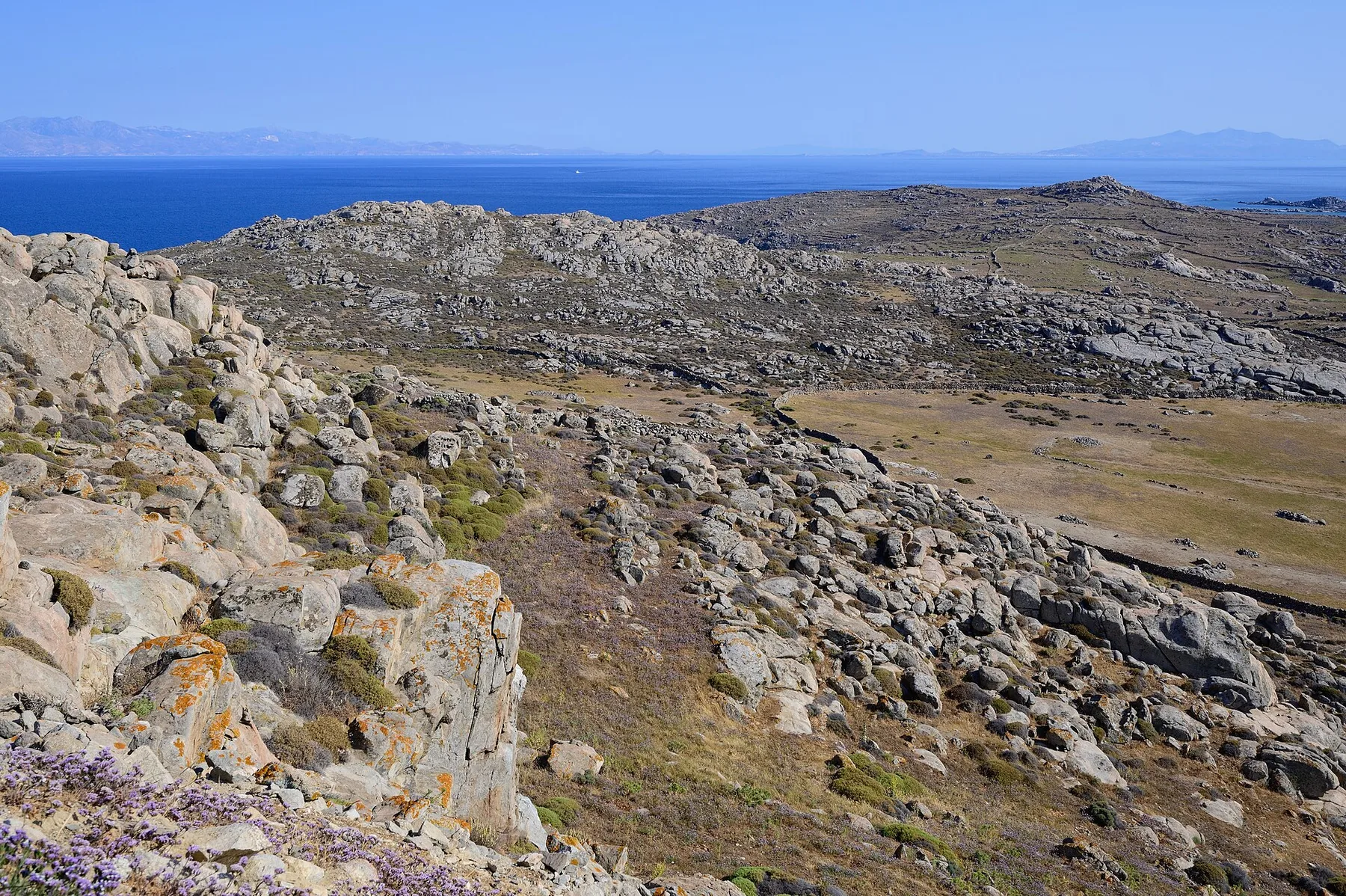
Nothing in the Aegean ever drifted. But the region full of new islands produced a story about an island that had to be fastened down, and gave the moment of fastening the name of the god born there.
The Gulf and the restless Caspian
The Sumerian flood text ends with a relocation that is easy to read past. Ziusudra comes out of the vessel, prostrates himself, kills an ox and a sheep; An and Enlil give him life like a god’s because he kept the animals and the seed of humankind alive. Then they move him. They settle him overseas, in Dilmun, where the sun rises—so the one man who came through the flood ends his days on an island out in the Gulf, and southern Mesopotamia is repeopled without him.
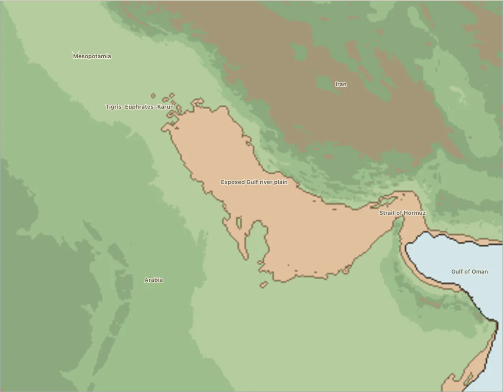
Rose’s Gulf Oasis model describes that basin being drowned from Hormuz inward, and the poem sends its one survivor out to live in the middle of it. Of every ending in the Mesopotamian family, that is the one that puts a man where the country went.
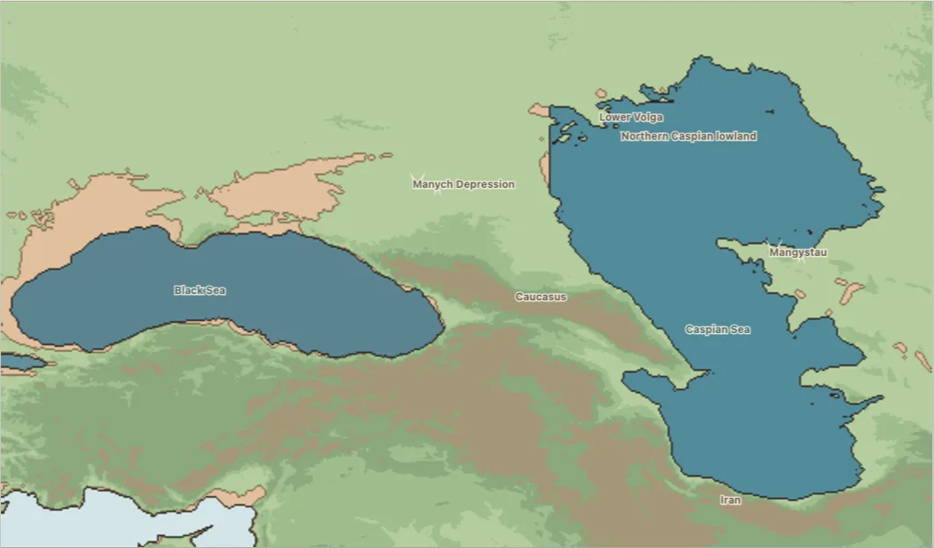
The Caspian keeps a shorter memory and a sharper one. In the 1830s the physicist Emil Lenz recorded what people in Baku told him: the sea had once lain much further from the city, and four of the islands offshore had been part of the mainland until the water came up suddenly and gave the coast the shape it has now. The Caspian’s level does exactly that—it has swung many metres, repeatedly, well inside historic time—so the story may be remembering a medieval high stand rather than the end of the Ice Age. It is a genuine drowned-land tradition on a sea that drowns land often.
Mapped traditions
All mapped traditions
| No. | Place and tradition | What the story remembers | World after the water | Why it may be postglacial | Source trail |
|---|---|---|---|---|---|
| Aegean refuges and island transformations | |||||
| 1 | Samothrace — Black Sea opening tradition | The tradition says Black Sea water broke south toward the Mediterranean, rushing through the Bosphorus, Sea of Marmara and Dardanelles into the Aegean. Low ground on Samothrace was submerged, and survivors climbed the island’s slopes. | People marked the highest reach of the water with altars. Fishermen later recovered stone capitals from buildings remembered beneath the sea. | Researchers compare the story with the opening between the Black Sea and the Aegean, and with the post-Ice-Age separation of Samothrace from the mainland. | Diodorus Siculus, Library of History 5.475.47: the Black Sea breaks through, low Samothrace is drowned, altars mark the water’s limit and worked stone is later drawn from the sea. Comparison: Compatangelo-Soussignan 2020 |
| 2 | Gulf of Corinth / Mount Parnassus — Deucalion and Pyrrha | The god Prometheus warns Deucalion of the flood. Deucalion and Pyrrha survive nine days of water inside a great chest and come ashore on Mount Parnassus in central Greece. | They repopulate the emptied country by throwing the “bones of Mother Earth”—stones—behind them, and the stones become people. | Researchers compare this flood cycle with rapid post-Ice-Age flooding of lakes and low basins around the Gulf of Corinth. | Sakellariou and Lykousis on Deucalion’s floodGulf of Corinth basins compared with the Deucalion tradition. Ancient account: Apollodorus, Library 1.7.2 |
| 3 | Samothrace to Mount Ida near Troy — Dardanus migration | Rising water drives Dardanus from Samothrace across the northeastern Aegean to Mount Ida near Troy, in what is now western Turkey. | The flood refugee carries sacred objects, names and rites into a new homeland, where they become foundations of a new community. | Researchers place this flight within a cluster of stories shaped by early shoreline change around the Aegean and Sea of Marmara. | Lancini on ancient Greek flood traditionsAegean and Marmara flood cluster, including Dardanus’ flight from Samothrace. Ancient account: Nonnus, Dionysiaca 3 |
| 4 | Mount Geraneia near Megara — Megaros | Near Megara, west of Athens, Deucalion’s flood covers the low coastal country. Megaros follows the cries of cranes up Mount Geraneia and survives above the water. | The mountain remains the story’s named refuge above a drowned coast. | The refuge overlooks a gulf transformed by post-Ice-Age sea rise, but no evidence dates the story to that change. | Lancini on ancient Greek flood traditionsCoastal localizations of Deucalion’s flood. Ancient account: Pausanias 1.40.1, Megaros guided up Geraneia by the cranes |
| 5 | Mount Othrys in central Greece — Cerambus | In central Greece, nymphs give Cerambus wings. He alone escapes when the flood of Deucalion covers the country around Mount Othrys. | He alone remains alive above the drowned Thessalian country, carried clear of the water on wings. | Lancini sets this flight uphill in the same Aegean flood cluster as the Dardanus story, a group of narratives she reads as shaped by early shoreline change around the Aegean and the Sea of Marmara. | Lancini on ancient Greek flood traditionsThessalian localizations of Deucalion’s flood. Ancient account: Antoninus Liberalis, Metamorphoses 22 |
| 6 | Rhodes — Telchines | The Telchines, the island’s mythic first inhabitants, foresee a flood and leave Rhodes. Rain and rising water cover the lowlands while other survivors climb to high ground. | The island’s heights preserve life while its former low country remains beneath the water. | The story remembers the loss of low ground on an island reshaped by rising seas, but no secure date or event has been identified. | Diodorus Siculus, Library of History 5.55–565.55–56: the Telchines foresee the flood and abandon Rhodes as its lowlands go under. Cluster: Lancini |
| Ancient deluges and worlds remade | |||||
| 7 | Shuruppak–Kish — Sumerian King List flood break | The Sumerian King List says kingship passed through five ancient cities of southern Mesopotamia. Then, after the reign of Ubara-Tutu at Shuruppak, “the flood swept over.” | Kingship begins again at Kish, making the flood the dividing line between an old political world and a new one. | This is an ancient chronology, not a physical account of one disaster. Southern Mesopotamian cities contain flood deposits of many different dates, so the text cannot be tied securely to a single event. | Electronic Text Corpus of Sumerian Literature, “The Sumerian King List” (2.1.1).lines 1–39 (antediluvian kings and flood); 40–94 (post-flood Kish) |
| 8 | Sippar near Babylon to the Armenian highlands — Xisouthros in Berossus | The god Kronos warns Xisouthros that humanity will be destroyed. He tells him to bury written records at Sippar near Babylon, build a great vessel, and take aboard family, friends, birds and other animals. When the vessel grounds in the Armenian highlands, Xisouthros releases birds to test whether the water has fallen. | Xisouthros, his wife, daughter and pilot are taken into the divine world. The remaining survivors return to Babylon, recover the buried writings and rebuild civilization. | This Greek-language retelling preserves Babylonian learned tradition but gives no date for a physical flood. Saving written knowledge is as important to the story as saving life. | Berossus fragment preserved by Alexander Polyhistor/Eusebius, in I. P. Cory, Ancient Fragments (1828).Berossus, pp. 26–29 in the printed text (PDF pp. 63–67; Xisouthros passage begins printed p. 27) |
| 9 | Mountains of Ararat — Noah in Hebrew Genesis | God judges a corrupt and violent world and tells Noah to build a three-decked ark. Noah brings aboard his household and animals of every kind. Rain falls and underground waters burst out until even the mountains are covered; the ark comes to rest in the mountains of Ararat, and a raven and dove test whether the land is dry. | Noah offers sacrifice, and the rainbow seals God’s covenant that a flood will never again destroy all living creatures. | Genesis combines more than one literary strand and engages with older Mesopotamian flood traditions. Its “mountains of Ararat” describes a region, not a confirmed ark site on the modern peak called Mount Ararat. | Hebrew Bible, Genesis 6:9–9:17; Masoretic text and English translation at Mechon Mamre.Genesis 6:9–9:17; resting place at 8:4 |
| 10 | Mount al-Jūdī / Cudi — Noah in the Qur’an | Noah—Nūḥ in the Qur’an—warns his people and builds a vessel under divine instruction. Water pours from the sky and bursts from the earth. One son refuses the ark because he trusts a mountain to save him, and he is drowned. | Earth is commanded to swallow the water, the sky clears, and the vessel comes to rest on a mountain called al-Jūdī. | This is a late antique theological retelling, not a geological report. Later Islamic geographers often identified al-Jūdī with Cudi Dağı in southeastern Turkey, but the verse itself gives no coordinates. | Qur’an, Sūrat Hūd 11:25–49, especially 11:40–44.11:25–49; vessel on al-Jūdī at 11:44 |
| 11 | Boeotia and Athens — Flood of Ogyges | Ancient Greek writers remembered an extremely early flood associated with King Ogyges in the lands around Boeotia and Athens. Only brief and conflicting versions survive, so even the kingdom and landscape affected are uncertain. | Later Greeks used “Ogygian” to mean something primeval: the flood had become a boundary at the far edge of remembered time. | The surviving fragments are too brief and geographically inconsistent to support a geological comparison. What they securely preserve is a separately named Greek flood of the remote past. | Eusebius, Chronicle, Armenian version, chronological notices for Ogyges; preserved in nineteenth-century editions.Chronicle, first book, Ogyges/Ogygian flood notices; edition pagination varies |
| 12 | Phrygia in central Turkey — Philemon and Baucis | Zeus and Hermes travel through Phrygia, in what is now central Turkey, disguised as strangers. Everyone refuses them hospitality except the poor couple Philemon and Baucis. The gods lead the pair uphill; when they look back, the surrounding country is underwater and their cottage has become a temple. | The couple serve as priests at the new temple and finally become two intertwined trees. The flood destroys the inhospitable community but preserves its generous hosts. | Ovid tells a local punishment flood, not a story of gradual sea-level rise. His poem identifies no lake or flood deposit that could be tested against the landscape. | Ovid, Metamorphoses 8.611–724.8.611–724 |
| 13 | Iconium, now Konya — Nannacus | Nannacus, the immensely old king of Iconium—modern Konya in central Turkey—foresees a deluge and gathers his people in a temple to mourn and pray. After his death the flood destroys humanity, and Prometheus and Athena make new human figures. | Ancient writers connected those human “images” with the city’s old name, Ikonion. “To weep for Nannacus” became a proverb for hopeless mourning. | No geological event is known. The story survives mainly in ancient proverb collections and dictionaries, not as a detailed local account tied to a particular landscape. | Zenobius, Proverbs 6.10; Suda, s.v. “Nannacus” and “I shall weep for Nannacus”; Stephanus of Byzantium, s.v. Ikonion.Zenobius 6.10; Suda nu 20 and related entry |
| 14 | Vale of Tempe in northern Greece — Thessaly’s former lake | Herodotus records a claim that the wide Thessalian plain in northern Greece was once a lake enclosed by mountains. The water escaped only when a narrow outlet opened through the Tempe gorge toward the Aegean Sea. He credits the split to Poseidon, god of both the sea and earthquakes. | The remembered result is the dry Thessalian plain and its river outlet through the deep Tempe gorge. | Geology confirms that the basin held ancient lakes and that its drainage changed repeatedly, but Herodotus gives no date. The landscape observation is striking. | Herodotus, Histories 7.129.7.129.1–4 |
| 15 | Atlantic Ocean beyond Gibraltar — Atlantis | In Plato’s story, Egyptian priests tell the Athenian lawgiver Solon about Atlantis, a powerful island kingdom in the Atlantic beyond the Strait of Gibraltar. Atlantis attacks the Mediterranean world, but in a single terrible day and night earthquakes and floods swallow the island and leave a muddy shoal.Greek literary tradition | Atlantis vanishes beneath the sea. Plato turns its destruction into a warning about imperial power by contrasting it with an idealized ancient Athens. | This marker sits with the Greek traditions because that is where the story enters the world, through Solon, Athens and Plato; its narrated geography is beyond Gibraltar. No proposed archaeological or geological location commands scholarly acceptance. Most scholars read the dialogues as a literary and philosophical construction rather than a verifiable memory of one modern place. | Plato, Timaeus 24e–25d; Critias 108e–121c.Timaeus 24e–25d; Critias 108e–121c |
| Straits, coasts, sanctuaries and snowmelt | |||||
| 16 | Achelous River mouth and the Echinades islands — Western Greek river tradition | Five river nymphs neglect the river god Achelous during a sacrifice. In anger, he tears their farmland from the riverbank, carries it out to sea and breaks the former mainland into the Echinades islands off western Greece. | Farmed mainland becomes an island group. Later, sediment carried by the Achelous River joins some of those islands back to its delta. | Reconstructions show that rising seas isolated hills here between roughly 18,000 and 6,000 years ago. The geology explains how islands formed, but it cannot prove the age of the story. | Ovid, Metamorphoses 8.573–591Lines 573–591; comparison: Mariolakos et al., proceedings pp. 170–181 |
| 17 | Bosphorus / Black Sea entrance — Greek story of the Clashing Rocks | At the entrance to the Black Sea, the Symplegades—the Clashing Rocks—slam together and destroy anything that tries to pass. Jason’s Argonauts first release a dove, then follow it through in their ship, the Argo. | Once the Argo succeeds, the rocks become fixed and the passage remains open forever as a route between the Black Sea and the Mediterranean. | Researchers compare the permanently open passage with the opening of the Bosphorus. The direction, speed and date of water flow between the Black Sea and Mediterranean remain disputed. | Apollonius Rhodius, Argonautica II2.317–340 and 2.549–610; comparison: CIESM Monograph 24, pp. 85–88 |
| 18 | Eğri Kale on Turkey’s Black Sea coast — Local tradition of the Samsun plain | On Turkey’s Black Sea coast, people said the plains around Çarşamba and Terme were once underwater and the fort at Eğri Kale stood beside a ship’s pier. Then the land broke open, the Bosphorus formed, and the water withdrew to reveal the Samsun plain. | A broad agricultural plain replaces the former water. Shells and sand found beneath its soil are cited as traces of the old shore. | The plain really grew during the last several thousand years as rivers deposited sediment and built new land. That gradual outward growth fits the geology better than drainage caused by the opening of the Bosphorus. | Doğu Karadeniz Kültür Envanteri, Eğri Kale EfsanesiOfficial inventory; full school compilation in Efsaneler Diyarı, printed p. 94 |
| 19 | Baku Bay and Absheron islands — Baku local testimony recorded by Emil Lenz | Residents of Baku said the Caspian Sea once lay much farther from the city and that four present-day islands had belonged to the mainland. Then the sea advanced suddenly and gave the coast its modern shape. | Former mainland becomes the Baku archipelago and the modern bay. | The level of the Caspian Sea has changed rapidly many times. This story may remember a medieval high-water period rather than the end of the Ice Age. | Sara Ashurbeyli, History of the City of BakuPrinted pp. 15–16, quoting Lenz 1833, p. 81 |
| 20 | Strait of Messina — Sicily–Italy separation tradition | Roman writers said Messina—then called Zancle—once formed part of mainland Italy. Sicily was joined to Calabria by a narrow strip of land until the sea broke through and tore the island away. | A walkable neck of land becomes the Strait of Messina, leaving Sicily as an island across a dangerous sea passage. | When Ice Age sea level was lower, a land bridge connected Sicily and Calabria for at least 500 years around 21,500–20,000 years ago. No published study links that reconstruction to these Roman texts, and ancient writers could have inferred a former connection simply by looking at the narrow strait. | Ovid, Metamorphoses 15.287–292; Justin, Epitome 4.1Ovid, Metamorphoses 15.287–292; Justin 4.1. Geological comparison: Antonioli et al. 2016, doi:10.1144/SP411.1, pp. 111–144 |
| 21 | Hierapolis near modern Manbij — Syrian ark and temple tradition | At Hierapolis, near modern Manbij in northern Syria, people said a flood destroyed the first human generation. The pious Deucalion survived in a great ark with his family and paired animals. A deep opening in the ground swallowed the floodwater, and Deucalion founded altars and a temple above it. | A second human generation descends from the survivor. Twice each year, pilgrims carry seawater to the temple and pour it into the opening, turning the remembered flood into an enduring public rite. | The place and its Roman-era ritual are specific, but the story combines the Greek Deucalion flood with the Mesopotamian tradition of Xisouthros. No independent geological event or post-Ice-Age date has been established. | Lucian, On the Syrian Goddess 12–13Sections 12–13: destruction, ark, Hierapolis chasm, temple foundation and twice-yearly seawater rite |
| 22 | Argos / sanctuary of Poseidon the Flooder — Southern Greek sea-flood tradition | At Argos in southern Greece, a divine contest decides who will rule the country. The judges choose the goddess Hera over Poseidon, god of the sea; Poseidon answers by flooding most of the land. Hera finally persuades him to withdraw the water. | The people of Argos build a sanctuary where the tide stops. They call it the sanctuary of Poseidon Prosklystios—Poseidon the Flooder—making the former waterline a sacred boundary. | The ancient account identifies both the flood’s reach and the sanctuary at its ebb line. The shore of the Argive plain changed after the Ice Age, but no published study links that change with this story. | Pausanias, Description of Greece 2.22.42.22.4: inundation of the Argive country, withdrawal of the sea and sanctuary at the ebb line |
| 23 | Lesbos — Macareus and the post-flood settlers | In the story, Deucalion’s flood leaves the Greek island of Lesbos empty and kills much of humanity. Macareus later arrives with refugees drawn from several peoples and settles the fertile but deserted island. | Land is divided among the settlers; the cities of Mytilene and Methymna receive ancestral names; new settlements spread to neighboring islands; and Macareus establishes a law remembered for the common good. | Rising seas reshaped Lesbos after the Ice Age, and the story gives an unusually complete sequence from depopulation to resettlement. It supplies no date or physical cause, however, and no published study connects the two. | Diodorus Siculus, Library of History 5.81–825.81.1–8 (flood, resettlement, cities and law); 5.82.1–4 (mainland aftermath and colonies) |
| 24 | Airyanəm Vaējah, an uncertain Iranian homeland — Yima’s sealed refuge | In Zoroastrian scripture, the creator Ahura Mazda warns Yima that deadly winters will bring deep snow followed by catastrophic meltwater. Yima builds a vara—a sealed refuge—and fills it with the seeds of the best people, cattle, birds, plants, fruits and sustaining fires. | A chosen remnant of humanity survives with animals, food plants and fire in an ordered refuge free from disease, deformity, falsehood and shortage. | The ancient Iranian text explicitly describes floodwater from melting snow, an unusually direct fit with a cold-climate catastrophe. The homeland called Airyanəm Vaējah cannot be located securely, so its physical setting remains uncertain. | Vendidad, Fargard 2, Yima and the VaraFargard 2 §§22–24 (winter, snow and meltwater); §§25–38 (Vara and preserved seeds of life) |
| Charters: the world set in order after the water | |||||
| 25 | Cave of Treasures, Nisibis milieu — Syriac Christian ark tradition | Before the water came, Noah went into the cave where the patriarchs were buried and carried out the embalmed body of Adam, with gold, myrrh and frankincense. He laid the body in the middle of the ark like a raised stand. Noah and his sons kept to the east side of the deck and the women to the west, and neither side crossed to the other for the whole voyage. The ark ran east to west and north to south over the water until its track had drawn a cross on the flood. | The rule of the ark became the rule of the building. Men stand on the east, women on the west, so that neither sees the other’s face — and Adam’s body, carried on to the middle of the earth, was laid in the ground where the cross was later set up above it. | Purely theological: a sixth-century Syriac reworking of Genesis in which the ark’s course is steered to make a cross. No landscape reading is available. | Cave of Treasures, Budge translation“The Third Thousand Years,” printed pp. 69–71 (Syriac fols. 17a–18a); the ark rests on the mountains of Kardô |
| 26 | Temple Mount, Jerusalem — Rabbinic tradition of the Deep | When David dug the drainage shafts under the Temple, he cut down as far as the Deep, and the water beneath the world came up and made to drown it. David asked whether the Divine Name might lawfully be written on a piece of broken pot and thrown down to stop it. Nobody would answer until Ahithophel reasoned that if the Name may be dissolved in water to settle a quarrel between one husband and one wife, it may certainly be used to save the world. | The Deep dropped sixteen thousand cubits — so far that the ground went dry — so David sang the fifteen Songs of Ascents to draw it back up, and fixed it a thousand cubits down. That is where the water under the earth has stood ever since. | Groundwater lore rather than sea-level lore: the tradition explains the depth of the water table under Jerusalem. Karst hydrology, not marine transgression. | Babylonian Talmud, Sukkah53a–53b |
| 27 | Mount Sinjar — Yazidi ark tradition | The ship carrying the survivors came over Mount Sinjar and struck; a rock went through the hull and the water started in. A serpent wound itself round like a flat loaf and jammed itself into the hole. The ship floated off the mountain and went on to come to rest on Mount Judi. | The serpent was thanked and let go, and it bred until its offspring were biting people and livestock everywhere. In the end it was caught and burned, and the fleas came out of the ash. Yazidis still keep a black serpent carved beside the door of the sanctuary at Lalish, kept black and touched by those going in. | An ark-landing tradition attached to a named mountain five hundred kilometres from any sea, best read as a Yazidi claim on the flood story rather than a memory of water. The Black Book as printed is of contested authenticity and was transmitted through outsiders. The serpent’s place in living practice at Lalish is independently attested and is what secures the tradition. | Meṣḥefa Reş, in Isya Joseph, Devil Worship1919, pp. 41–42; living cult residue at Lalish (36.772, 43.308) |
| 28 | Dilmun (Bahrain) — Sumerian Flood Story | When the flood had passed over, Ziusudra came out, prostrated himself, and slaughtered an ox and a sheep. An and Enlil dealt kindly with him and gave him life like a god’s, because he had kept alive the animals and the seed of humankind. | They did not leave him at home. They settled him overseas, in the land of Dilmun, where the sun rises — so the one man who came through the flood ends up on an island out in the Gulf, and southern Mesopotamia is repeopled without him. | Rose’s Gulf Oasis model describes a habitable Gulf basin progressively drowned from Hormuz. The poem sends its one flood survivor to live on an island in that drowned basin. | The Flood Story, ETCSL 1.7.4Segment E, lines 3–11 |
| Straits argued open and shut | |||||
| 29 | Lampsacus — Strato’s tradition of the two broken straits | Strato of Lampsacus argued that the Black Sea originally had no way out. Its rivers kept pouring in until the water forced and opened a passage at Byzantium. The Mediterranean, filling the same way, then broke through at the Pillars of Heracles. | The levels fell and ground that had been under water was left dry. Both breaks held open. Strato expected the process to run again: given enough silt, he said, the Black Sea will fill up completely in the end. | Not myth but early third-century BC natural philosophy. Strato states, in the right order and by the right mechanism, that the Black Sea overflowed and opened its own strait — a striking anticipation of the modern debate. His direction of flow is the opposite of the catastrophic-inflow model. | Strabo, Geography, reporting Strato1.3.4–1.3.6 |
| 30 | Rock of Gibraltar (Calpe) — Greek tradition of the opened strait | Diodorus records two things Greeks said Heracles did at the strait between Europe and Libya. On one account he built the two headlands out towards each other to narrow the gap, so that the great sea monsters of the Ocean could not get into the inner sea. On the other, the two continents were originally one piece of land, and he cut them apart. | On the second version the Ocean comes in and mixes with the Mediterranean, and the cut never closes. Diodorus refuses to say which he believes and leaves it to the reader. | Two contradictory versions in one paragraph, one the reverse of the other — which is the point: the Greeks were arguing about whether the strait was made or unmade. Ice Age sea level never closed Gibraltar, and the Zanclean flood that did fill the basin is five million years old and beyond any possibility of memory. | Diodorus Siculus, Library of History4.18.4–5 |
| Sanctuaries, drowned plains and eastern deluges | |||||
| 31 | Sanctuary of Olympian Zeus, Athens — Athenian cleft and yearly offering | Inside the precinct of Olympian Zeus at Athens the ground splits open about a cubit across. Athenians said this was where the water went after the flood in Deucalion’s time. They pointed out Deucalion’s grave close by, and said he built the old sanctuary. | Once a year they throw wheat meal kneaded with honey down the crack. The place where the flood drained away is kept open and fed. | Local aetiology of a karst fissure. The Attic bedrock does swallow water, and the shrine fixes a drainage point rather than a shoreline. The value is the yearly rite. | Pausanias, Description of Greece1.18.7–8 |
| 32 | Pheneos, Arcadia — Arcadian drowned-plain tradition | The plain of Pheneos in Arcadia has no river outlet; the water leaves through chasms under Mount Oryxis and Mount Sciathis, which the Pheneatians said Heracles cut. When the chasms closed, the plain filled and the old city of Pheneos went under. | They still showed the marks on the mountainsides where the water was said to have stood. Heracles’ fifty-stade channel for the river Olbius is still there and thirty feet deep in places, but empty — the river left it and went back to its old bed. | A genuinely real hydrological system: the Pheneos basin is closed, drains only by sinkholes, and has repeatedly ponded and emptied within historic time. The water-marks Pausanias was shown are the sort of thing a filled basin actually leaves. This is Holocene karst behaviour on a repeating cycle, not a terminal-Pleistocene event. | Pausanias, Description of Greece8.14.1–3 |
| 33 | Orchomenos and Lake Copais — Boeotian lake-formation tradition | Where Lake Copais lies, people said, there had been dry ground, farmed every way while the Orchomenians ran it. Diodorus gives the reason it went under: Heracles blocked the stream that drained past Orchomenos, to punish the Minyans for what they had done to Thebes. | A worked plain became a lake and the district was ruined. The same hero is credited with the reverse operation in Thessaly, where he cut a channel through the ground bordering the marsh, drained it, and made plains appear. | The same karst family as Pheneos with the opposite polarity. Copais really did alternate between lake and plain as its sinkholes blocked and cleared, and the Mycenaean drainage works at Orchomenos are archaeologically real. The likeliest referent is the collapse of a Bronze Age drainage system, far too late for this map. | Strabo 9.2.40; Diodorus Siculus 4.18.7Strabo 9.2.40 (“tilled in all kinds of ways when it was subject to the Orchomenians”); Diodorus 4.18.7 |
| 34 | Delos — The island that stopped wandering | Before Apollo was born the island was called Asteria and it did not stay put. It ran the straits of the Euripos, turned its back on the Chalcidian water and swam to Sounion in a day. Sailors saw it once and could not find it on the way home. When Leto, hunted by Hera, could find nowhere on earth that would take her, this unfixed island took her in. | After the birth the wandering stopped. The island no longer floated unseen upon the water but planted the roots of its feet in the Aegean, and its name changed from Asteria to Delos — from the hidden to the visible. | No island in the Aegean drifted. The interest is structural and inverse: the Aegean’s postglacial history is precisely one of islands appearing where hills had been, and this tradition instead imagines an island that had to be stopped. | Callimachus, Hymn 4 (to Delos)§§40 and 51, Mair translation |
| 35 | Apamea Kibotos, Phrygia — Phrygian ark-landing tradition | A tradition current in Phrygia put the ark’s landfall in its own country, not in Armenia: a steep dark mountain, visible far off, which it also called Ararat, with the river Marsyas running from it. The ark rested on its crest. | The city carried the claim in its name — Apamea Kibotos, Apamea the Chest — and in the third century put it on its coinage: a box on the water with two figures inside and the name ΝΩΕ across it, then the same pair standing on dry land with a bird overhead. It is the oldest surviving picture of the ark. | A landlocked Phrygian city claiming the ark on the strength of its own by-name; the mountain is a local hill and the Ararat is a transfer. What makes it worth carrying is that the claim was minted, from the reign of Septimius Severus onward, on public coinage under several emperors — a flood tradition with a datable material witness. | Sibylline Oracles 1.261–267; the Apamea coinsSibylline Oracles 1.261–267 (Terry translation); on the coins see “The Coins from Apamea Kibotos,” Vox Patrum |
| 36 | Southern Caspian shore — Zoroastrian tradition of Tishtar’s rain | The star Tishtar takes three shapes — man, horse and bull — and rains for ten days and nights in each. The drops come down the size of bowls. Water stands a man’s height over the whole earth, and the noxious creatures are killed and driven into holes in the ground. | Then the wind gets up and sweeps the water off the land to the edges of the earth, and out of it the wide-shored ocean is made. This flood is not a punishment; it is where the sea came from and how the world got clean. | Cosmological, but with the most physically explicit language in the region after Yima: rain in bulk, water standing over the whole earth, the ocean formed from the runoff. The Vourukasha sea has been identified with the Caspian, the Aral and Lake Hamun, and this coordinate is a broad anchor on the water body rather than an event site. | Bundahishn VII, West translationChapter VII, Sacred Books of the East V |
| The Caucasus: basins drained and seas joined | |||||
| 37 | Kakheti / Alazani Valley — Georgian tradition of the drained basin | Kakheti was water from end to end, and its people lived up in the mountains while the sea climbed over pasture and ploughland toward their houses. A charcoal-burner set a basket full of coal afloat to show where the trapped water wanted to go; it drifted against the closed mountains, and there the people cut the barrier through. | The water ran out by the Alazani and left the basin dry. The people came down, and out of the emptied floor came the Kakheti of fields, villages and settled life. | A drainage-and-settlement charter, undated in its own telling, with no published landscape identification behind it. The coordinate is a broad regional anchor rather than an event point. | Elene Virsaladze, Gruzinskie narodnye predaniia i legendy (1973)No. 81, pp. 136–137; the collection’s notes trace the text to M. Janashvili, Drevniaia Gruziia II.IV, pp. 208–209. |
| 38 | Black Sea, Ossetian Nart tradition — Ossetian Narts, from Boris Andiev | When Bora, forefather of a Nart line, died, his companions buried him on the shore of the Endless Sea. The water beings wanted the grave for themselves, under the sea, but their own sea had too little water in it; so at midnight their elder opened the shut passage to the Eastern Sea. | The two seas joined and Bora’s tomb went under with the shore it stood on. The water was remade and stayed that way, and people named the darkened sea the Black Sea. | Konstantin Rakhno sets this narrative among traditions of the Black Sea and Mediterranean opening to one another. That is a comparison with other traditions rather than with a dated postglacial landscape; the physical opening of the sea belongs to Samothrace, the Bosphorus and Strato of Lampsacus. The coordinate is a deliberately broad water-body anchor. | Konstantin Yu. Rakhno, “Motiv potopa v osetinskom nartovskom epose,” Izvestiia SOIGSI 22 (2019)Pp. 59–63, especially 60–63. The text is Boris Andiev’s, from his father Teba of Antiatykau, printed in Narty kaddzhytae, vol. 6 (2010), pp. 91–92; |
| 39 | Gveleti / Mount Kazbek — Ingush tradition of Bashloam-kort | God sent rain against a cruel world. An old man and his family shut themselves in a chest, and the water carried it to the ice summit of Bashloam-kort — Kazbek — where they lived on the ice until the flood withdrew. | His children went out afterwards and spread through the earth. Seven sons stayed behind in cells high on the mountain until they passed into the sky as a constellation, leaving mountain, people and stars in the order they hold now. | A sacred mountain refuge rather than a coast: the setting is cosmological and topographic, and the narrative is undated. Christian flood material may have shaped the telling. | A. Viskovatov, “S Kazbeka,” Russkii vestnik 60.2 (1865)Pp. 413–414, reprinted and discussed in U. B. Dalgat, Geroicheskii epos chechentsev i ingushei (1972), p. 50. Read here through Dalgat. |
| 40 | Shiraki plain, Kakheti — Georgian tradition of Saint George’s calf | Kakheti was once a sea, brought there from another sea, with a serpent living in it. Saint George’s calf came back from the water with bloodied horns; the people armed its horns with diamonds and sent it in again, and this time the calf beat the serpent. | The serpent fled in panic and smashed through the Shiraki barrier between the Alazani and the Iori. The water ran out behind it, Kakheti was freed, and the people came down from above to settle the land. | A mythic draining of the Kakheti basin and a settlement charter, undated in its own telling. The bull here is a calf fighting a serpent, a Caucasian bull-and-lake motif. | Nargiz Akhvlediani and Marina Puturidze, “Cult of Bull and the Aspects of Its Manifestation in Interdisciplinary Research”Article pp. 409–425, tale at pp. 410–411. The authors attribute the earlier printed text to Iveria (1894); that original issue has not been recovered. |
| Mesopotamian deluges: noise, judgment and the ark's landfall | |||||
| 41 | Nippur — Atra-ḫasīs, the flood that begins as noise | People multiplied and made a din, and the din came up to Enlil in his house at Nippur and would not let him sleep. Plague was sent, then drought, then famine, and none of them quieted the land, so the assembly swore to wipe out humankind with a flood and swore Enki to say nothing. Enki kept the oath and broke it at the same time: he spoke not to the man but to the side of the man’s house — wall, listen to me; reed wall, attend to every word I say; leave the house, build a boat, let the goods go and save the life. Atra-ḫasīs, on the other side of the reed, took the words down. Then the deluge came on bellowing like a bull. | The gods went hungry, because nobody was left alive to feed them, and when they smelled the survivor’s offering they crowded over it like flies. Humanity was allowed to continue, on new terms drawn up on the spot. Enki told the birth goddess to establish death for all peoples, and to put a third kind of woman among the people, the one who does not bear; he set the pašittu loose to snatch the baby from the lap that bore it; and he had high priestesses made who are forbidden children, to cut childbirth down. Barrenness, infant death and celibacy all date from the morning after the flood, and they are there to keep the noise within limits. | Political and cosmological rather than geographical: no coast, lake or dated inundation appears, and the flood is a decision taken in a divine assembly. What earns it its place is the mechanism — a flood that begins as noise, and a warning delivered as a voice through a wall. | Epic of Atra-ḫasīs, Foster’s translation as presented at LiviusSegments [i.c20]–[i.c25] (Enki speaks to the wall and the reed wall); [iii.15]–[iii.20] (the deluge bellows like a bull); [iii.45] and [iii.d1]–[iii.d5] (death, the woman who does not bear, the pašittu, celibate priestesses). The lines naming noise as the cause fall inside a lacuna in this presentation; the standard edition is Lambert and Millard 1969. |
| 42 | Mount Nimuš — Ut-napištim in Gilgameš XI | Ut-napištim tells Gilgameš what it was like. Six days and seven nights the storm flattened everything; on the seventh it went quiet, and when he opened a vent and the light came in on his cheek he sat down and wept, because the water was level as a roof and every human being had turned to clay. Twelve leagues off, a strip of land came up. The boat struck Mount Nimuš and the mountain held it and would not let it sway, one day and a second, a third and a fourth, a fifth and a sixth. On the seventh he let out a dove and it came back, having found nowhere to perch; a swallow, and it came back; then a raven, which found the water going down, and ate, and scratched, and did not come back. | He set seven and seven vessels out on the mountain top and burned reed, cedar and myrtle, and the gods came down to the smell like flies over a sacrifice. The Lady of the Gods lifted the fly-shaped lapis beads at her throat and swore that as surely as she would not forget them she would remember these days, and that Enlil should not come to the offering. Ea told Enlil to his face that he should have charged the offence to the offender rather than drown everyone, and sent a lion or a wolf to thin the people instead of a flood. Then Enlil came up into the boat, took the survivor by the hand, blessed him and his wife, made them gods, and settled them far off at the Mouth of the Rivers — which is why nobody since has been able to get their hands on a life like that. | The mountain is the one hard geographical fact in the account, and its identification with Pira Magrun above Sulaymaniyah is a modern convention rather than a demonstrated one; this coordinate follows the convention. No published study connects the episode with a postglacial landscape; the Gulf reading belongs with Dilmun. | Epic of Gilgameš, Standard Babylonian Tablet XI, Kovacs translation as presented at LiviusXI 133–146 (the water flat as a roof, the people turned to clay, the boat held fast on Mount Nimuš); 147–155 (dove, swallow, raven); 156–171 (the offering and the Lady of the Gods’ lapis flies); 180–198 (Ea rebukes Enlil); 199–205 (Ut-napištim made a god and settled at the Mouth of the Rivers) |
| 43 | Ahvaz on the Karun — Mandaean tradition of the three destructions | Mandaean tradition counts the flood as the third ending rather than the first. The first world was carried off by sword and plague, and Rām the man and Rūd the woman were left as the head of the age; the second was carried off by fire, and Šurbai and Šarhabēl were left; the third went under water. For that one Noah felled cedars on the Amanus and female cedars on the Lebanon and spent three hundred years building, and then for forty-two days and forty-two nights the springs above and the springs below came together over the mountains and the highlands. The ark drifted eleven months and settled on Mount Qardūn. The raven sent out to look found a corpse, ate, and forgot the errand; the dove found the raven still at it, saw the olive tree standing on Qardūn with its leaves out of the water, and brought back a piece of it. | He cursed the raven and blessed the dove. The age passed to Sum, Noah’s son, and his wife Nhūraitā, and the world was raised again from them — the third time it has been raised from a single pair. Six thousand years on, the tradition has Jerusalem built as the next thing to go wrong. | A scheme of world-ages counted in generations and planet-years, with no landscape claim in it. Its Mount Qardūn is the landing the Syriac Cave of Treasures claims and the Qur’an calls al-Jūdī. The coordinate is the Mandaean heartland on the Karun, a community anchor and not an event site. | Mark Lidzbarski, Ginzā: Der Schatz oder das grosse Buch der Mandäer (1925)Right Ginza I §§181–187, printed pp. 26–28 (sword and plague, fire, water, and the surviving pair after each); paralleled at Right Ginza II §§118–123, pp. 45–47; the ark narrative at Right Ginza XVIII, printed pp. 409–410 (Mandaic text 380,8–382,11). |
| Plains laid under the sea, works washed away | |||||
| 44 | The Achaean camp on the Troad shore — Homeric tradition of the wall washed away | The Achaeans threw up a wall and a trench to protect the ships and the plunder, and they did it in a hurry and gave the gods no hecatombs for it. It was built without the consent of the immortals, and so it did not last. It stood while Hector was alive and Achilles was sulking and Priam’s city was untaken. Then Troy fell in the tenth year and the Argives sailed home, and Poseidon and Apollo took counsel to destroy the wall and turned against it every river that runs out of Ida into the sea — Rhesus, Heptaporus, Caresus, Rhodius, Grenicus, Aesopus, Scamander and Simois, where so many shields and helmets had gone down. Apollo brought all their mouths together and made them run against it nine days, and Zeus rained the whole time. | Poseidon went along the front with the trident and threw into the sea every beam and stone the Achaeans had laid, levelled the ground with the stream of the Hellespont, and when the wall was gone spread a great beach of sand over the place where it had stood. Then he put the rivers back in their old channels. There is nothing on that shore, and this is the account of why. | Not sea-level change: this is a fortification deliberately erased by gods using rivers and rain. The claim itself is the earliest statement in Greek that water can take a human work off a coast and leave clean sand where it stood, told at a named place to explain an absence. The coordinate is the camp on the Troad shore between the Sigeion and Rhoiteion headlands. | Homer, Iliad, Book 12 (Butler’s prose translation, Project Gutenberg)Iliad 12.1–35: the wall built without hecatombs, the eight rivers of Ida turned against it for nine days, the beams and stones thrown into the sea, the beach of sand spread over the site. |
| 45 | The Xanthian plain, Lycia — Lycian tradition of Bellerophon’s sea | Bellerophon rid Lycia of the pirate Chimarrhus, whose ship had a lion at the prow and a serpent at the stern and who had made it impossible to sail or to live in the towns near the sea, and he drove out the Amazons as well, and Iobates gave him nothing for any of it. So he waded out into the water and prayed to Poseidon that the land be made barren and unprofitable, and turned back inland. A wave got up and came after him, and the sea rose high in the air and covered the plain as he walked. The men came out and begged him to stop it and could not move him. Then the women came out to meet him with their skirts lifted, and he turned back towards the sea for shame, and the wave went back with him. | The plain came out from under the water. From then on the Xanthians took their names from their mothers and not their fathers, and that is the reason given for the custom. | An ancient landscape argument, though not a modern one. Plutarch reports rationalisers who held that the most fertile part of the plain lies below sea level and that Bellerophon simply broke through the ridge along the shore that had been keeping the sea out; Nymphis of Heraclea said instead that the whole plain came up glittering with salt and was ruined by it. Those are classical explanations of a real low coastal plain. | Plutarch, Bravery of Women IX, The Lycian Women (Babbitt, Loeb Classical Library III, at LacusCurtius)Moralia 248a–d; Loeb III pp. 503–505. The wave and the women at 248a–b; the below-sea-level rationalisation at 248b–c; Nymphis’ salt-ruined plain and the matronymic custom at 248d. |
| 46 | The Thriasian plain and the Erechtheion salt sea — Athenian tradition of Poseidon’s anger | The gods agreed to take possession of the cities where each would be worshipped, and Poseidon got to Attica first: he struck the middle of the acropolis with his trident and produced a sea there, the one they call the Erechtheis. Athena came after him, called Cecrops to witness her act of possession, and planted an olive. When the two of them fought over the country Zeus put twelve gods in as arbiters, and they gave it to Athena, because Cecrops testified that the olive had come first. Poseidon, in a hot rage at the verdict, flooded the Thriasian plain and laid Attica under the sea. | The salt water never left the rock. Inside the temple on the acropolis there is a well of sea water sunk in the ground that sounds of waves when the wind is in the south, and the olive stands beside it. The two things Athens keeps as evidence of the quarrel are a tree and a captive piece of sea. | A charter for the city’s cults rather than a memory of a shoreline. The Thriasian plain by Eleusis is genuinely low and coastal and its shore has moved a long way since the Ice Age, but the text supplies neither date nor mechanism and no published study connects the two. It belongs with the Argive sanctuary as a second Poseidon-flooded country. | Apollodorus, Library 3.14.1 (Frazer translation)3.14.1: the trident-made sea called Erechtheis, Athena’s olive, the verdict of the twelve gods, and Poseidon flooding the Thriasian plain and laying Attica under the sea. The sea-water well and its wave-sound: Pausanias 1.26.5; the olive and the salt sea shown together: Herodotus 8.55. |
| Egypt: the river’s floods and the desert’s seashore | |||||
| 47 | Faiyum and Lake Moeris — Egyptian priestly tradition in Herodotus | The priests told Herodotus that under the first king, Min, all Egypt except the Thebaid was swamp, and no land north of Lake Moeris stood above the water at all. Herodotus went out and checked: sound the sea a day’s sail off the coast and the lead comes up muddy. | Every field the Egyptians work is land the river handed them out of the water. He points at the shells lying out on the hills and the salt sweating out of the pyramids and says the sea was there before the country was. | Partly right as geography and wrongly dated by its own source. The Faiyum did hold a far larger lake in the early and mid-Holocene, and the Delta is genuinely built of river sediment — but Herodotus’s informants place it in dynastic time, and he argues it from silting rates rather than inherited memory. Ancient observational reasoning, roughly right about the process and badly wrong about the timescale. | Herodotus, Histories Book 22.4–2.5 and 2.10–2.12 |
| 48 | Heliopolis — Egyptian spell for not dying again | Osiris arrives in the necropolis and finds it insupportable — no water, no air, very deep, very dark, everything lacking, nothing to do but lie quiet with no pleasures to be had — and says so to Atum, who answers that he has given blessedness instead of water and air, and quietness of heart instead of bread and beer. Osiris asks how long a lifetime of life is. Millions of millions, Atum tells him, and then: I will destroy all that I have made, and this land will go back into the Deep, into the flood, as it was before. Only I shall survive, together with Osiris, after I have taken my other shapes — snakes that men do not know and gods do not see. | Nothing is founded and nothing is repopulated. Egypt’s other floods make a world; this one takes it back. The two who are left are not a couple in a boat but the creator and the dead god, coiled and invisible in the water that was there at the beginning. | Wholly cosmological: the water is the Nun, the uncreated deep, and it has no shore that could be tested against anything. Its value is the shape of the ending. It is the region’s one flood that closes the world instead of founding it, and the survivors are serpents. The coordinate is Heliopolis, Atum’s city; the spell’s own named places are Heracleopolis and Naref. | T. G. Allen, The Book of the Dead or Going Forth by Day, Studies in Ancient Oriental Civilization 37 (Chicago, 1974)Spell 175, printed p. 184: “This land shall return into the Deep, into the flood, as it was aforetime. (Only) I shall survive together with Osiris, after I have assumed my forms of other (snakes) which men know not and gods see not.” |
| 49 | Tomb of Seti I, Valley of the Kings — Egyptian Book of the Heavenly Cow | The sun god had grown old, and people said so behind his back and plotted against him. He sent out his Eye as a goddess to kill them, and she killed until she liked it. To stop her, he had barley beer brewed and dyed red as blood, seven thousand jars of it, and poured out over the fields in the night to a depth of three palms. She came at dawn, saw her own reflection in what she took for blood, drank until she was drunk, and forgot what she had come for. | The people left alive that morning are the people alive now. The god, sick of them, climbed onto the back of the sky-cow and withdrew upward, and in going he set heaven above, earth below and the land of the dead beneath — the world in the shape it has kept since. | The inundation is beer on farmland, and reads as an image drawn from the annual Nile flood over fields rather than from any marine change. What it hands back is the charter, not a coastline. | Book of the Heavenly Cow, Nederhof editionEarliest complete copy in KV17, tomb of Sety I; fields “filled to a height of three palms”; compare Lichtheim, Ancient Egyptian Literature II, pp. 197–199 |
| 50 | Siwa Oasis — Eratosthenes’ report of the desert seashore | On the desert road to the oracle of Ammon, three thousand stades inland, travellers walked over mussel, oyster and scallop shells, salt beds and springs of brine, and found the timbers of seagoing ships. The people there said the wreckage had been thrown up out of a chasm. | The oasis was read as an old shore. Sacred envoys from Cyrene set up dolphins on small columns there, inscribed with their office — sea creatures dedicated in the middle of the Sahara. | Ancient observation of real marine fossils, but they are geological and tens of millions of years old, nothing to do with postglacial change; the ships’ timbers are an informant’s gloss. It records the classical world doing palaeontology badly. | Strabo, Geography, reporting Eratosthenes1.3.4 |
| Bahrain: springs below the sea | |||||
| 51 | Manama, Bahrain — Bahrain islanders, recorded by Pedro Teixeira | Three fathoms down off the town of Manama, great springs of fresh, clear water rise through the salt sea, and men make their living bringing it to the surface in waterskins. The oldest men of the island told Pedro Teixeira that those springs had once lain far inland, until the sea broke in and overflowed them. | The divers take the water up “very cleverly and easily, where it bubbles up, and sell it cheap”; after the deep wells of Nanyáh in the centre of the isle it is the best water on Bahrain. The spring still gives — it is the dry ground around it that is gone. | Teixeira’s early-seventeenth-century account records a local memory of Bahrain’s changed shoreline: springs remembered as inland now rise beneath the salt sea. Bahrain’s submarine springs and their association with Dilmun’s abundance are independently documented, and the Gulf Oasis model supplies a plausible drowned-shelf context. The story keeps a former inland water source inside the island’s present marine geography. | Pedro Teixeira, The Travels of Pedro Teixeira, translated by W. F. Sinclair (1902)p. 175, in the account of Bahrain in the ‘Kings of Harmuz’ |
The world begins again
Line them up and the pattern is not really about water. In every one of them the flood is a hinge, and the far side of the hinge is the present arrangement of things.
Kingship comes down from heaven a second time and begins again at Kish. Xisuthrus’ people walk back to Babylon and dig the writings out of Sippar, so that learning survives its own civilisation. Noah offers sacrifice and gets covenant, rainbow and food law. Deucalion and Pyrrha throw stones and get the Greeks; their son gets them their name. Macareus divides Lesbos, names its cities, sends out colonies and lays down a law. Dardanus leaves flooded Samothrace with the sacred objects, the divine names and the rites in his baggage and carries them to Mount Ida, where they become the property of another people. The sun god withdraws on the back of the cow and leaves heaven, earth and the underworld separated for good. Tishtar’s rain runs off the land and becomes the ocean. David fixes the water table at a thousand cubits and it has not moved. And the congregation of a Syriac church stands men to the east and women to the west because the ark was loaded that way.
That is the same finding this series has been getting everywhere. In the Chinese southwest Wang Xianzhao counted 232 flood texts among the minority peoples and found that 79% of them end by instituting something—the clans, the surnames, the marriage rule, the division of the peoples and their languages. Around the inland seas the institutions are different but the grammar is identical: the water is what makes the story true, and the charter is what the story is for. A flood myth is a legal instrument with weather in it.
Which is why the noise at the beginning matters. The oldest version in the world does not open with rain. It opens with a god who cannot sleep for the racket people make, and it saves the human line by having another god talk to a wall so that a man can overhear what he has been forbidden to be told. The world ends because of a sound and continues because of a voice that comes through a barrier—and everything that follows, the altar on the high ground, the sanctuary at the ebb line, the honey thrown into the crack, the men on one side of the aisle and the women on the other, is people arranging themselves permanently around the memory of it.
Key sources
Map. Terrain: NOAA ETOPO 2022; sea levels: Lambeck et al. 2014.
The Mesopotamian material is quoted from the Electronic Text Corpus of Sumerian Literature, “The Flood Story” (1.7.4) for the wall-speech and the settlement of Ziusudra in Dilmun, and “The Sumerian King List” (2.1.1) for the flood break; the Akkadian sources are collected in Nathan Wasserman, The Flood: The Akkadian Sources (2020), where the rigmu of humankind and Ea’s speech to the reed wall are set out in full. Berossus is quoted from I. P. Cory, Ancient Fragments (1828), pp. 26–31, for the buried writings at Sippar and the voice in the air.
The postglacial comparisons are Compatangelo-Soussignan on Samothrace, Lancini on the Greek flood traditions, Sakellariou and Lykousis on Deucalion, Rose on the Gulf Oasis, and Antonioli et al., “Timing of the emergence of the Europe–Sicily bridge” (2016). Ancient anchors: Diodorus 5.47 (Samothrace), 5.55–56 (Rhodes), 5.81–82 (Lesbos), 4.18.4–5 (the two Gibraltar versions), 3.53–3.55 (Tritonis); Herodotus 2.4–12 (Egypt), 4.178–180 (Tritonis and the Ausean festival), 7.129 (Tempe); Strabo 1.3.4–6 (Strato of Lampsacus, and Eratosthenes on Siwa) and 9.2.40 (Copais); Pausanias 1.18.7–8 (the Athenian cleft), 2.22.4 (Poseidon the Flooder) and 8.14.1–3 (Pheneos); Ovid, Metamorphoses 15.287–292 and Justin, Epitome 4.1 (Messina); Callimachus, Hymn 4 (Delos); Lucian, On the Syrian Goddess 12–13 (Hierapolis); Plutarch, Bravery of Women 9, Moralia 248a–d (the Lycian women and the Xanthian matronymy); Apollodorus, Library 3.14.1 (the Erechtheis sea and the olive).
For Egypt, see P. Hermitage 1115 with Ronaldo Pereira and Thais Rocha da Silva, “The Tale of the Shipwrecked Sailor” (2023); the Book of the Heavenly Cow in the earliest complete copy, from the tomb of Seti I, with Lichtheim, Ancient Egyptian Literature II, pp. 197–199; spell 175 in T. G. Allen, The Book of the Dead or Going Forth by Day (Chicago, 1974), p. 184; and Plato, Timaeus 22a–25d, for the priest’s flood argument and Atlantis. For the charters, see the Cave of Treasures in Budge’s translation, “The Third Thousand Years,” pp. 69–71; Babylonian Talmud, Sukkah 53a–b; Bundahishn VII; and the Vendidad, Fargard 2, §§22–38. The Yazidi tradition is in Isya Joseph, Devil Worship (1919), pp. 41–42, with the living serpent cult at Lalish; the Apamea coinage is discussed with the Sibylline Oracles 1.261–267.
The gazetteer gives the source trail and the interpretive limit for every point on the map.
The ritual afterlife of Deucalion’s flood in Athenian festival time is followed in detail at Dionysus and the Deluge.
Continue the series: Sahul, Sundaland, East Asia, South Asia, Doggerland, North America, South America, and the coasts where it is not remembered. The series hub, Twelve Drowned Worlds, maps the drowned landscapes the nine essays are standing on.