Flood Traditions — Atlas Essay — 2026-08-14
Doggerland
The drowned country and the stories around it

Doggerland is the most spectacular drowned country in Europe and the strangest blank on its mythic map. The ground is real: rivers, peatlands, animal bones, hunting tools and human remains survive beneath the North Sea. The story is missing. No secure tradition from Britain, Scandinavia, the Low Countries or Germany names that country, describes its drowning or remembers the Storegga wave that crossed it. The possible deep memories begin around its western and southern margins instead. Much later, communities on the North Sea made stories from medieval storm floods and eroding villages. Europe forgot the country in the middle but kept learning how to tell the sea at its door.
The country with no surviving story
Doggerland is not a name carried out of prehistory. Archaeologist Bryony Coles coined it in the 1990s from Dogger Bank, and the bank took its name from Dutch fishing boats. The country was reconstructed from trawled bones and peat, seismic surveys, sediment cores and archaeology. A recent scholarly review could describe it precisely as a lost world “not known from myths and legends.”
The communities that lived on the plain moved, mixed and changed languages many times before anyone wrote their words down, and whatever they told went with them. No British flood tale may simply be labelled a memory of Doggerland because it mentions land under water, and no general European deluge may be moved onto the North Sea without a place-specific link.
The filled points therefore sit where the possible postglacial traditions put them: west of Doggerland in Ireland, Wales and the Hebrides, and south along Cornwall, the Channel Islands and Brittany. The four hollow points on the North Sea coast belong to a different clock. They are securely recorded local legends of later loss, useful because they show what memory looks like when the drowned place remains inside written history. The empty space over Mesolithic Doggerland is not an omission. It is the finding.
A stone’s throw to Scotland
At the northern end of the Isle of Man they said the Mull of Galloway, over in Scotland, had once been near enough to throw a stone to. A visitor collected the saying in 1834 and printed it two years later. The Point of Ayre is a long shingle spit, and standing on it you can see Galloway on a clear day, which is presumably why the saying attached itself there and stayed. It is a strange thing to have said. Nobody claims to have thrown the stone. There is no story about the sea coming in and no explanation of why the distance changed. A stone’s throw is all there is. Nobody drowns in it and nothing happens in it.
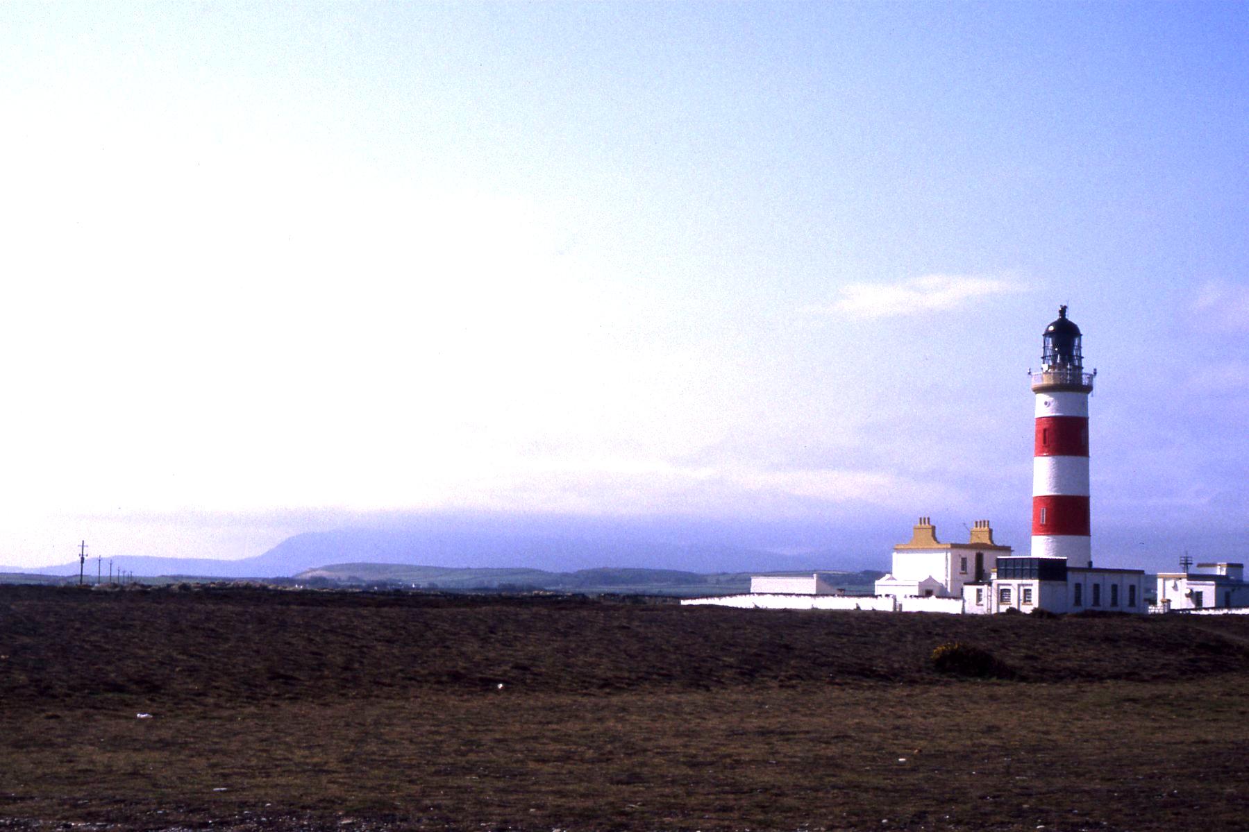
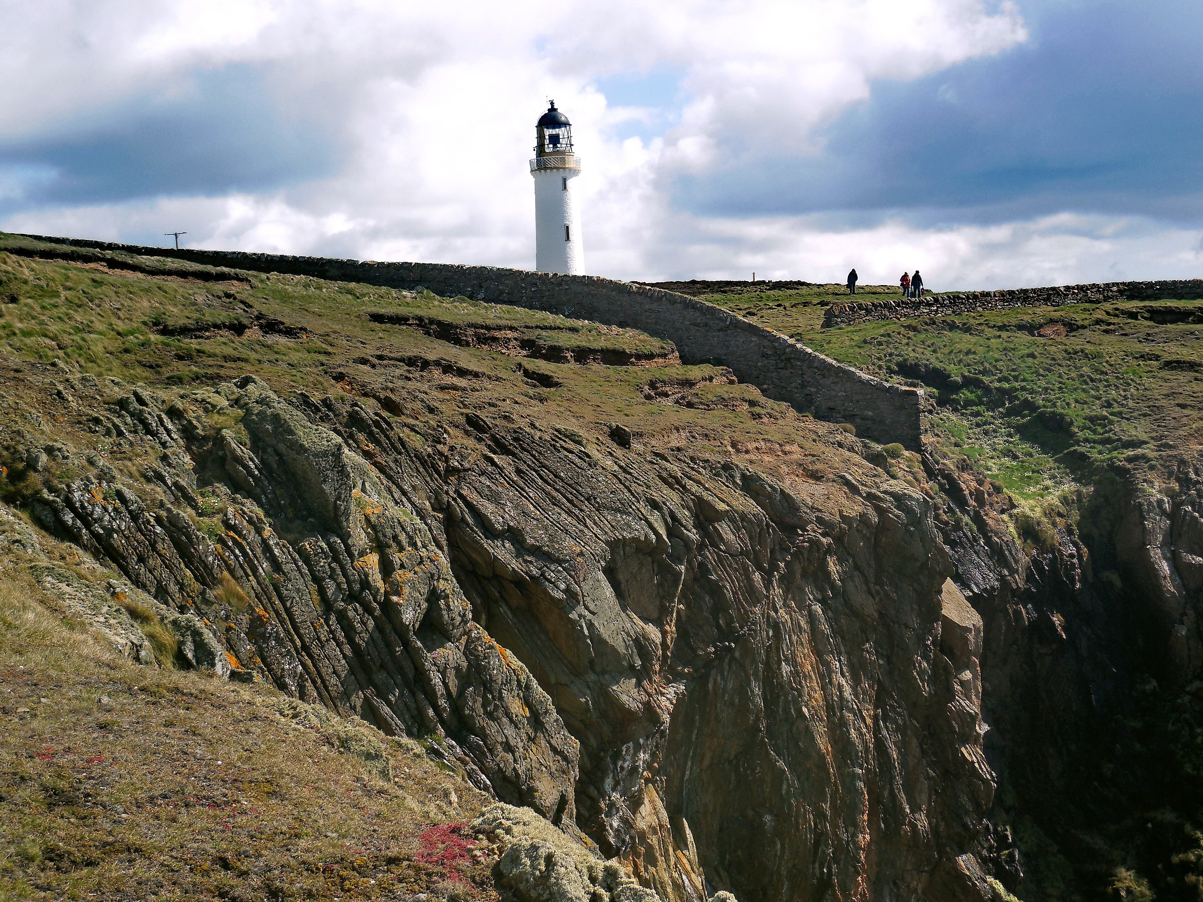
The ground under that sea makes the comparison a reasonable one. Patrick Nunn, who has spent years collecting traditions of this kind and setting them against reconstructions of the sea floor, models the drowning of the connection between Man and Scotland at roughly 10,680 to 8,550 years ago. Before that there is no forty kilometres of water to cross. There is land, and then a narrowing neck of land, and then finally a channel that a strong swimmer might have managed before it widened past all argument.
What the saying preserves, then, is the last moment when the two places were neighbours. Not the flood — the neighbourhood.
The woman who hunted where the sea is
St Kilda lies sixty-four kilometres out into the Atlantic beyond the Outer Hebrides, off the west coast of Scotland, and it was about as isolated as inhabited land in Europe ever got — the last islanders left in 1930. The people who lived there told a story about a woman who hunted deer between St Kilda and Harris. She would loose her greyhounds on St Kilda and send them at the deer running toward the islands opposite. On Harris the same vanished country is called the hunting ground of a princess.
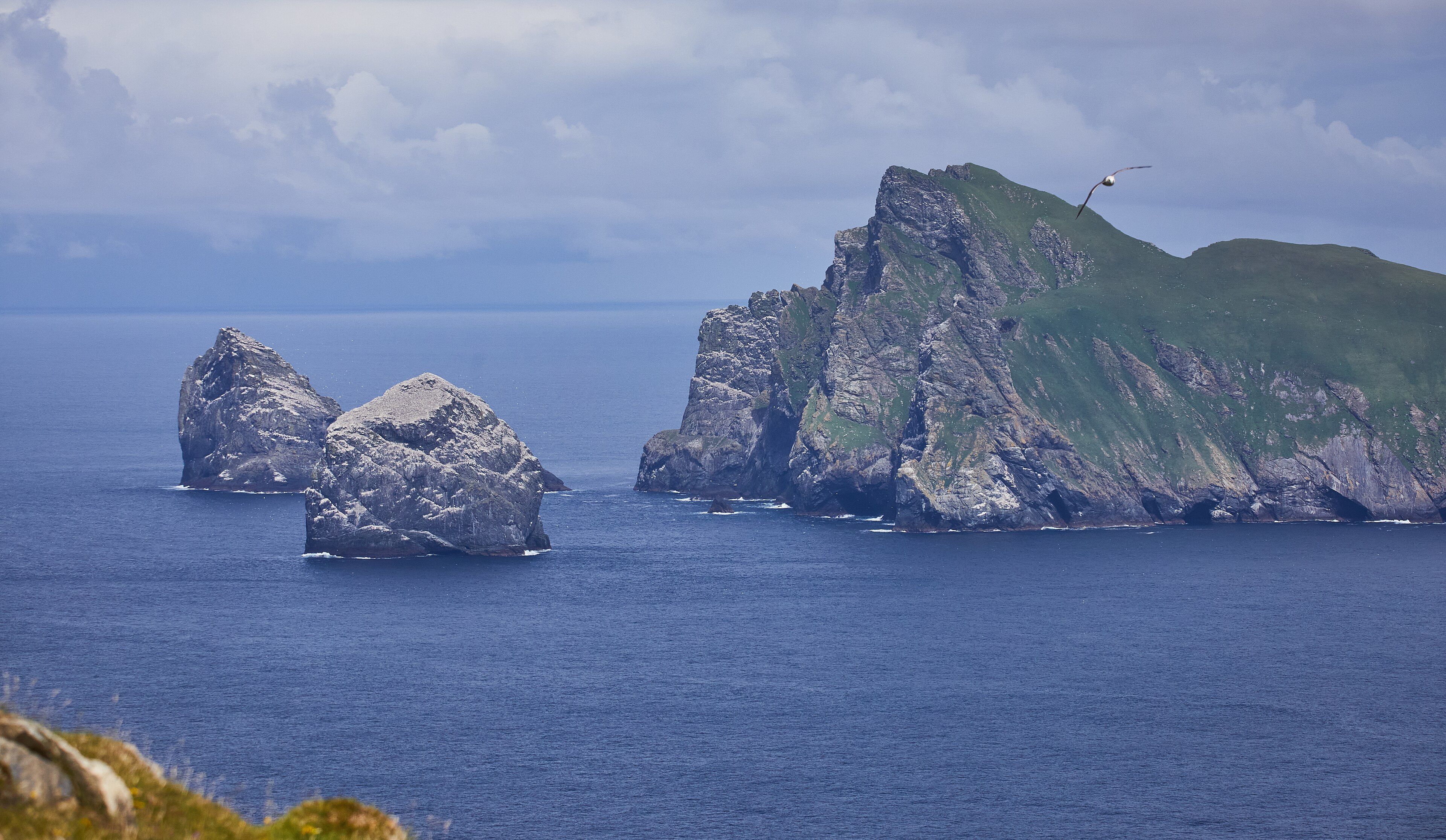
Take that literally for a moment, because the tradition means it literally. It describes a woman standing on what is now a scrap of rock in the open ocean, watching dogs chase deer over eighty-odd kilometres of ground that is now under a hundred metres of water. Deer need a great deal of country. The story is not describing a beach or a sandbar; it is describing a hunting range.
Nunn, Axel Creach, Pierre Stéphan and their colleagues read this as a recollection of a lower sea, and calculate that the saddle between the two would have had to be very deep indeed — deep enough that they note in the same breath that later slope collapse or scouring may have taken it down further since. So the date here is looser than the Manx one. What is not loose is the shape of the memory. Again there is no flood. There is a hunt, and the hunt has nowhere left to happen.
Why the crosser had to be a giant
On Arran, in the Firth of Clyde on the west coast of Scotland, Fionn mac Cumhaill keeps house at Drumadoon and lays stepping-stones over to Kintyre. The old people of the island, according to a survey of Arran published in 1807, said he went from the one land to the other in a few steps.
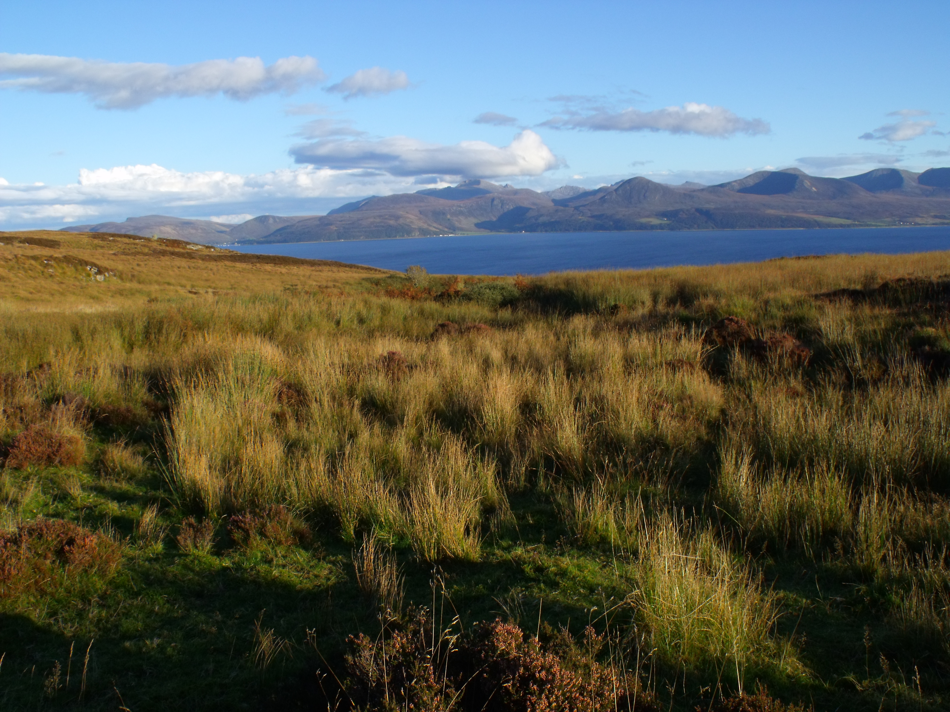
Arran and Kintyre are about eight kilometres apart across Kilbrannan Sound. At the lowstand they were joined. Nunn and his colleagues set the tradition against that connection, and Nunn has argued more generally that giants are one of the ways a crossing survives in memory after it stops being possible. A community that goes on saying “you could walk to Kintyre” long after nobody can walk to Kintyre is saying something that is manifestly false. The correction that keeps the tradition alive is not to drop it. It is to enlarge the walker. Fionn does in a few steps what people used to do in an afternoon, and the statement becomes sayable again.
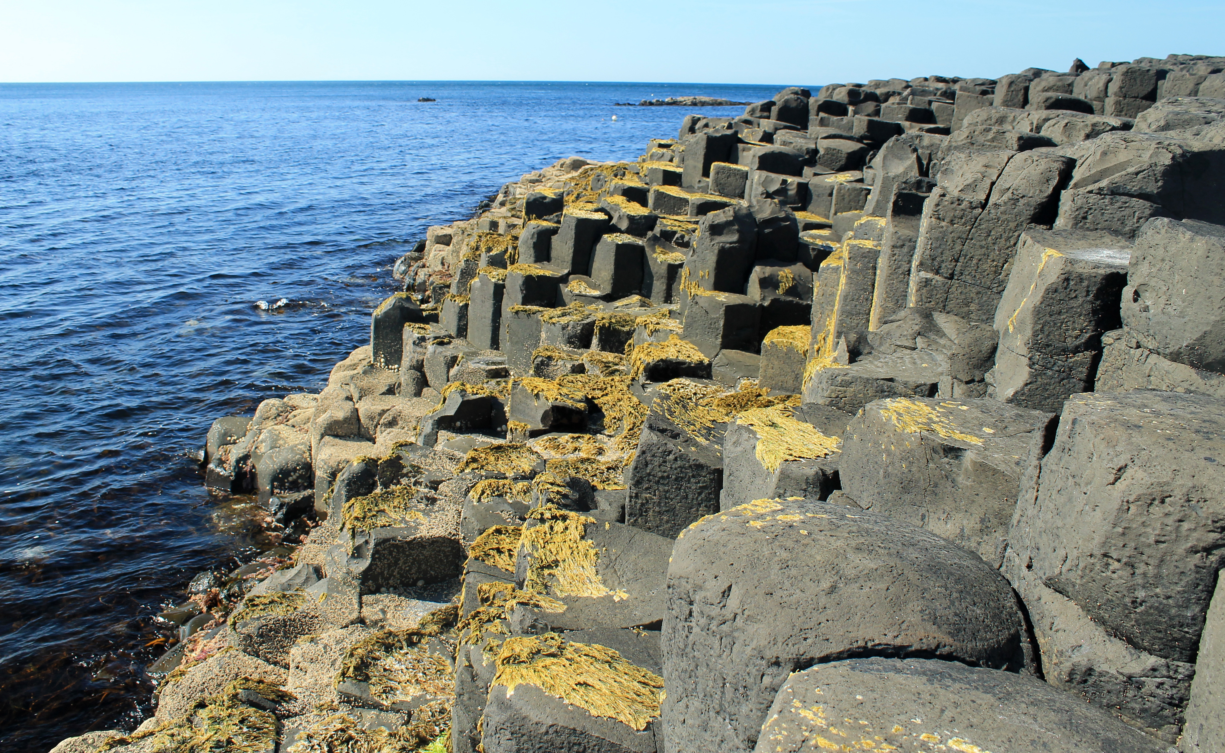
The same figure does the same work on the other side of the North Channel. Fionn sets out to confront Benandonner in Scotland and builds a causeway over the sea to reach him — running, the tradition says, to Staffa in the Inner Hebrides, where the same basalt columns rise out of the water again; seeing the size of the man, he abandons the job, or in the other telling Benandonner goes home pulling the stones up behind him. The basalt columns at the water’s edge in County Antrim are the visible stump of the road. The Giant’s Causeway and Fingal’s Cave are spectacular pieces of geology, and a good deal of the story has been fitted to them after the fact by people explaining the rock in front of them. But the thing being explained is still a road that used to go somewhere and now stops in the sea.
The crossings people tried to save
In the Outer Hebrides the old country went under a little at a time. The Monach Islands, west of North Uist, were said to have been joined to North Uist and Benbecula by green isthmuses, with plains and lakes behind them. The Atlantic entered through small channels. The channels became fords, the fords became straits, and people who had crossed on horseback at low water could no longer get through. Alexander Carmichael recorded the tradition in the nineteenth century: the last people to make the crossing, and people who drowned trying, were still remembered by name.
There was work to do before they gave the land up. People built embankments to stop the water. The Atlantic broke them, rushed into the lakes and joined the Minch beyond. A large and stormy sea lay over the green crossings, the plains and the lakes together. The drowned ground kept its place-names. There was a barrier rock, said to mark a floodgate, and a red smithy. Crofters told Carmichael of iron bolts in rocks exposed at low tide and buildings visible beneath clear water. The islanders knew what they were looking at: the remains of a country they had tried to hold.
The neighbouring islands of Pabbay and Berneray kept a smaller measure. Three men told the ecologist Charles Elton that the gap had once been narrow enough for a shouted voice to carry, or an object to be thrown across. The voice now faces kilometres of water. Patrick Nunn compares both traditions with the postglacial coastline: the reconstructed Monach crossings need seas at least seven to fourteen metres lower, while the Pabbay–Berneray saying fits a narrower channel at five metres lower. His models place the Monach connections at least about 7,300 and 8,700 years ago, and the narrower Pabbay–Berneray gap at least about 6,800 years ago. The telling supplies the human scale of the loss: a horse crossing, a neighbour's voice, an embankment that finally failed.
The toll-house at Coutances
The best detail on this entire map is Norman. People on the Cotentin peninsula in Normandy, and on Jersey in the Channel Islands, said that you could once walk out from Normandy to Jersey, crossing one small stream on the way by a bridge, and that you paid your toll at Coutances.
That is not a myth. That is an itinerary. It has the three things a person who has actually made a journey remembers: the obstacle on the road, how the obstacle was got over, and where the money changed hands. Nobody inventing a legend of a drowned country puts a toll-booth in it. The other Norman version remembers a forest running from Mont-Saint-Michel to Cherbourg that the sea afterwards swallowed, and submerged forests are in fact exposed along that coast at low tide.
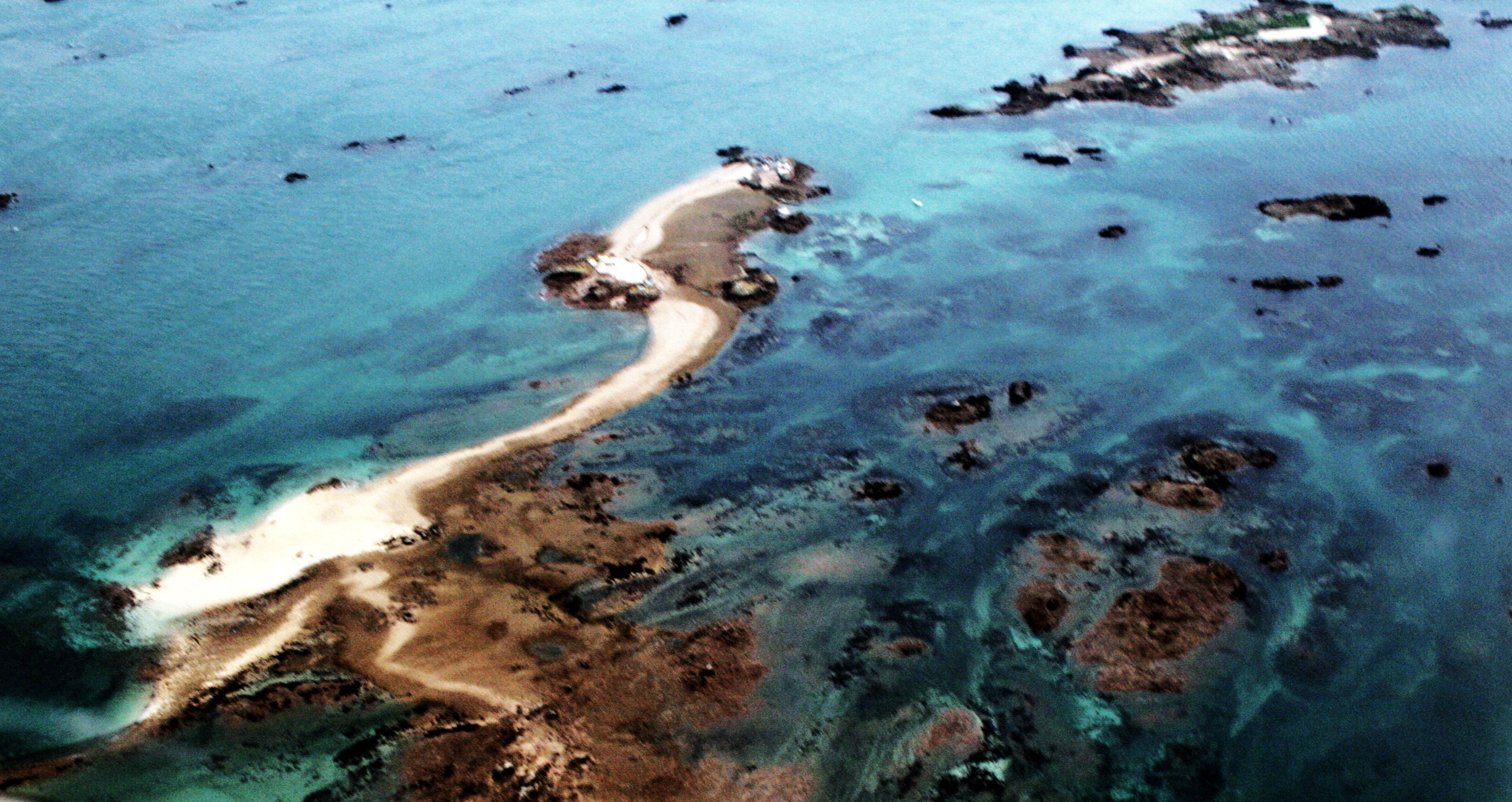
Nunn and his colleagues set these traditions against post-glacial islandisation of the Channel Islands. The dates usually attached to the severance in the older literature — AD 565, AD 709 — are historical rationalisations, later writers reaching for a year because a story seemed to want one. They cannot be right; the Channel between Jersey and France was dry, then marsh, then shallows, then sea, over thousands of years. That mismatch is normally treated as a strike against a tradition. Here it is the reverse. The dates are the part somebody added. The road, the bridge and the toll are the part that was handed down.
The cities that were put on top
Not every tradition on this coast is as bare as the Manx saying. Several of them have a full story, with a named king, a sin and a punishment. Cantre’r Gwaelod, the Lowland Hundred, lies below sea level behind gates in Cardigan Bay; Seithenyn has the keeping of them, is drunk at the feast, leaves them open on a high tide, and the sea takes the country. Off the Breton coast Ker-Is stands behind its dyke, and the king Gradlon wears the key to the gate on a chain around his neck until his daughter Dahut takes it, for a lover who asks her for it, and opens the gate at night.
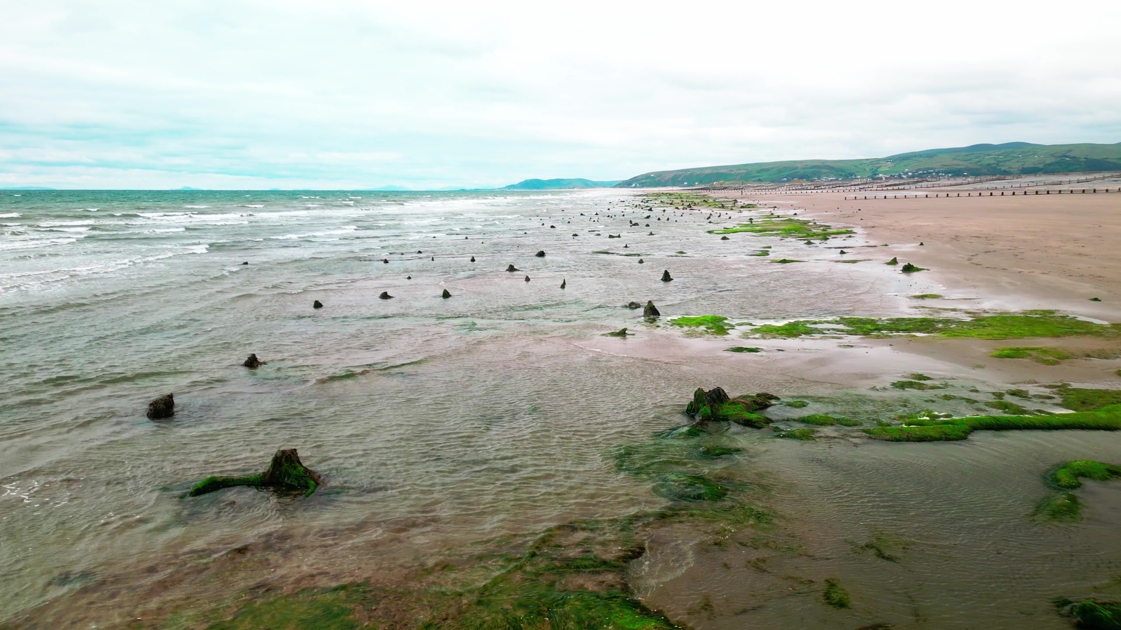
These are the famous ones, and they look like a different kind of story: a moral tale about drink, or lust, or pride, of the sort that could be attached to any coast anywhere. Look at what is underneath them, though. In both cases the thing the audience is actually being told is that the sea is sitting on inhabited ground, and in both cases the tradition names features you can go and see. The sarnau of Cardigan Bay — long stone reefs running kilometres out from the shore — are pointed out as the causeways of the drowned hundred. Off Borth the stumps of a submerged forest come out of the peat at low tide, black and waterlogged, standing where they grew.
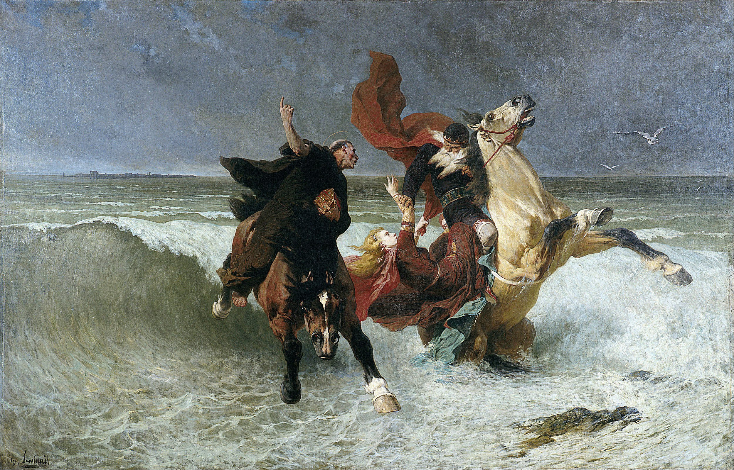
The moral apparatus is bolted on, and the texts show it happening. The Black Book of Carmarthen has Seithennin and the drowning of Maes Gwyddno and no sluice gates at all; the drunkenness and the forgotten floodgates arrive centuries later, and Nunn notes that the Welsh and Breton versions may have converged only after Hersart de la Villemarqué’s Welsh journey of 1838. It is easy to see why: a country that goes under for no reason is unbearable, and a country that goes under because a drunk man forgot the gates is a story you can tell children. What is not bolted on is the claim about the ground. Nunn and his colleagues model the submergence in Cardigan Bay and in the bay of Douarnenez and put both within the Holocene. No city has been found under either, and the medieval kings in both stories are far too late to have seen anything. The kings are the drunk steward’s problem, not the coastline’s.
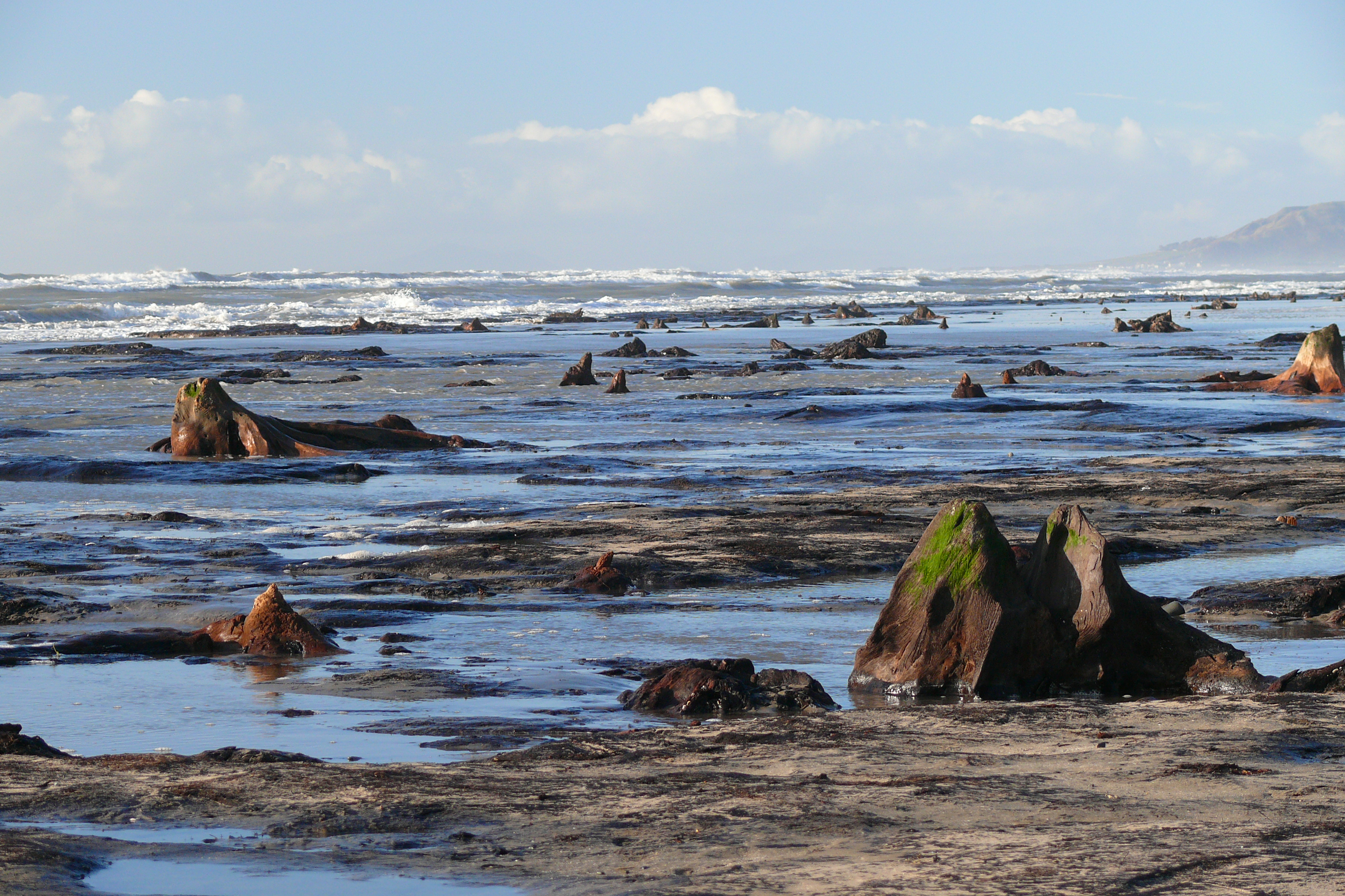
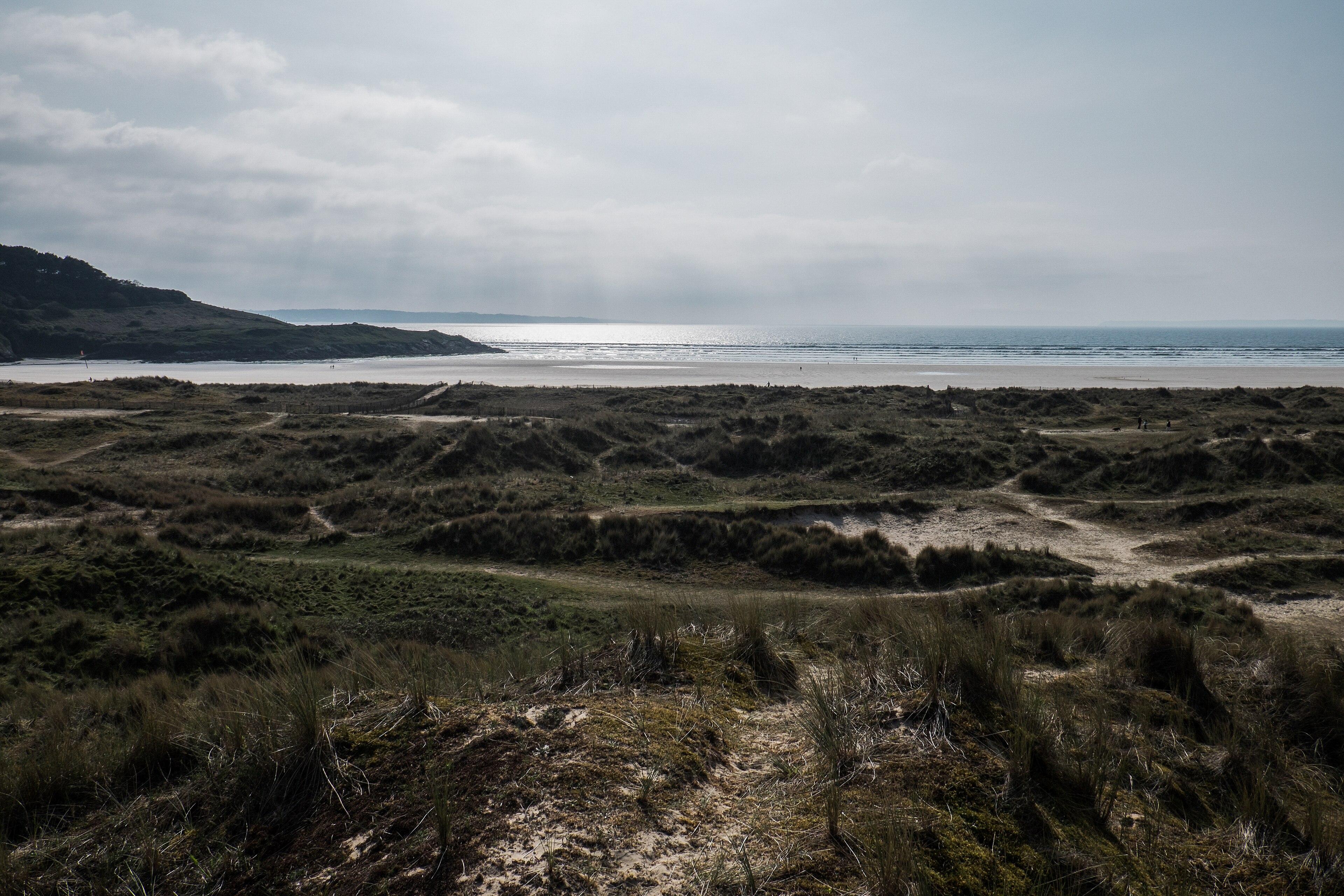
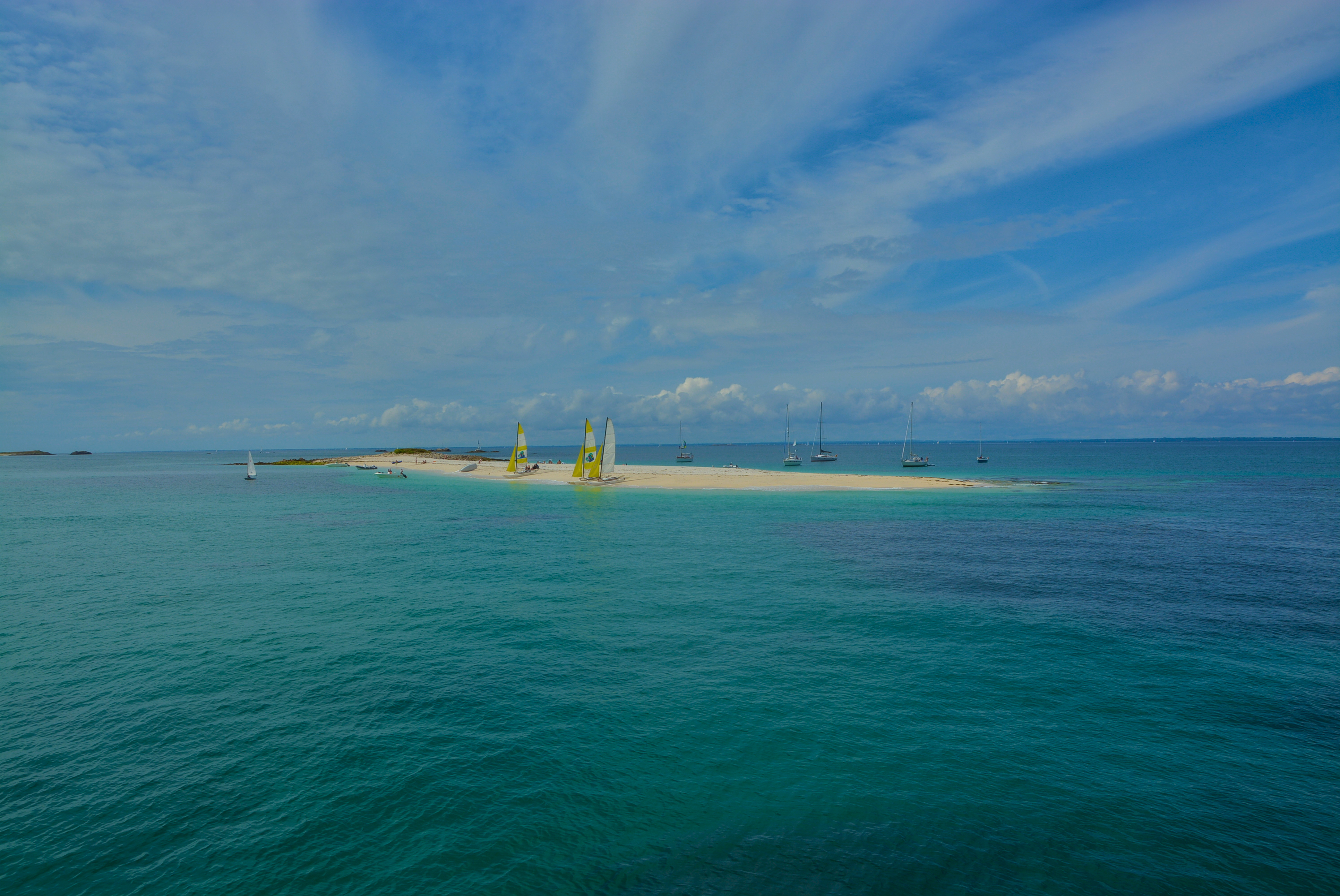
Off the Cornouaille coast in southwest Brittany — Finistère, not Cornwall — the same tradition runs without the king. The Glénan islands, they say, were one land, and the ways across it are named — which island you could walk to, where the ground ran that is now channel between them. The Glénan sit on a shallow platform that was continuous dry surface into the Holocene. It is the cleanest case on the map: a real drowned floor, a tradition that specifies footpaths across it, and no morality tale in the way.
What the North Sea did remember
Rungholt is the control case. The North Frisian settlement, on the German Wadden Sea coast, was lost in the storm flood of 1362, close enough to written history that its drowned fields and buildings could not be mistaken for Ice Age ground. By 1587 it had a punishment story. Revellers made a mockery of the sacrament with an intoxicated sow; a priest fled after a warning; the storm took the town. Later versions let the towers appear and the bells ring under quiet water. The archaeology belongs to a medieval cultural landscape. The myth explains why it deserved to drown.
Across the Dollard in Groningen, in the northern Netherlands, two tales make the same landscape into opposite lessons. One farmer pulls a herring from a freshwater well, understands that the sea is moving underneath him and sells before the autumn storm. Tidde Winnenga refuses to help his neighbours strengthen the dike; it breaks and the sea washes away Reiderland. One man reads the warning. The other breaks the rule of communal defence. Neither tale needs eight thousand years to become useful.
At Staithes in North Yorkshire, an escaped mermaid says the sea will reach Jackdaw’s Well. The tradition was first printed in 1924, after the well itself had disappeared from an eroding fishing village. On Fanø, a Danish Wadden island made of shifting sand, the creation story is also a prophecy: water and sand made the island, and “from the sea it arose, and into the sea it shall sink again.” N. M. Kromann recorded independent witnesses and nineteenth-century continuity. These are excellent North Sea traditions. They are also emphatically not Doggerland memories, which is why their map points are hollow.
The smell of the thyme
Ireland is different again, because it was cut off early — early enough that a land bridge is at the outer edge of anything tradition could hold. What Ireland has instead is islands that went down and kept their names.
In Liscannor Bay in County Clare, Stuithin’s fort stood on its island until the fighting of the three sons of Turrolbh, and then it went under. It is seen once in seven years, standing in the water. And boatmen passing over the place where it was, according to the antiquary T. J. Westropp who wrote the tradition down in 1908, said they could smell the thyme off its fields.
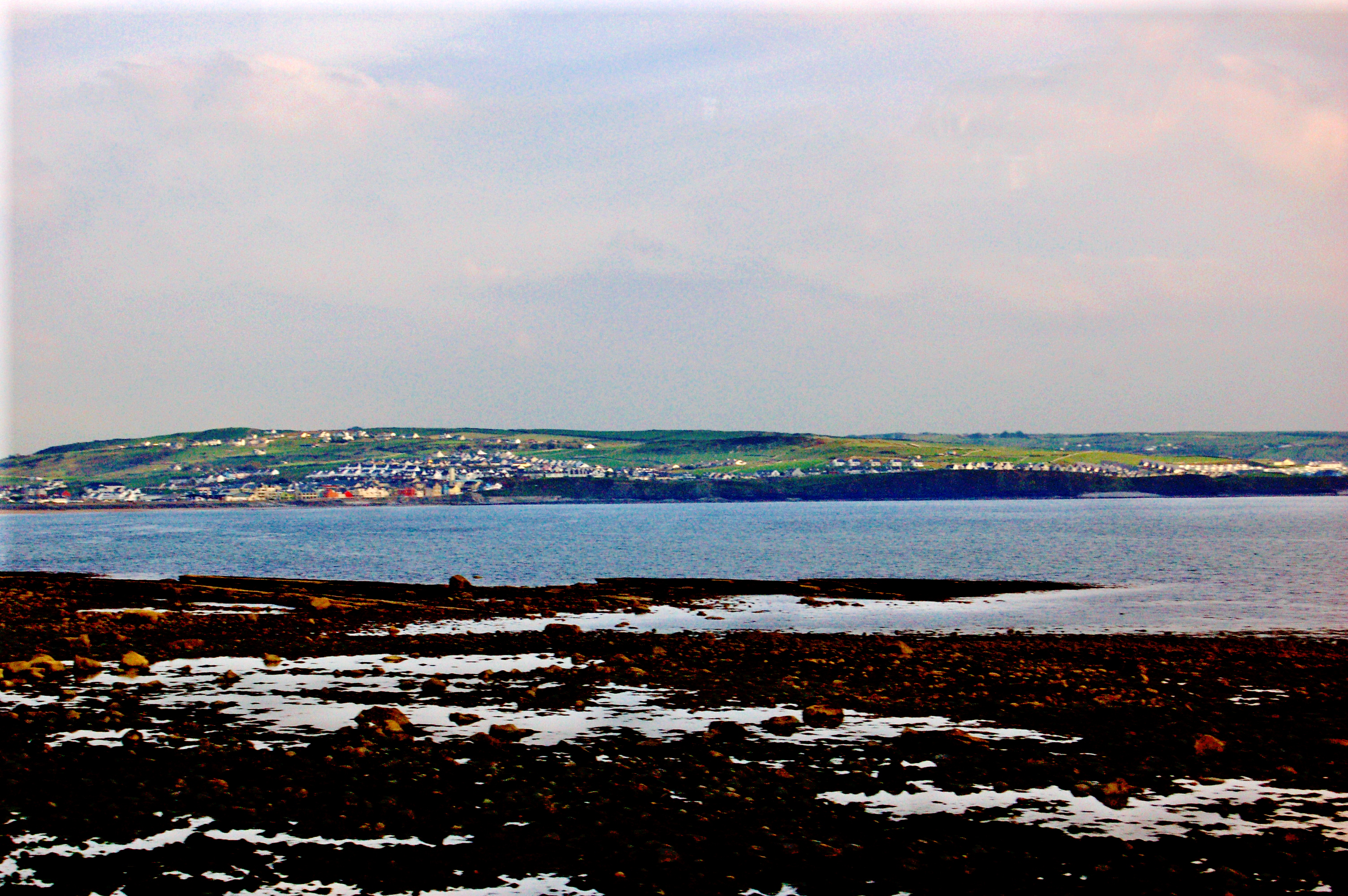
Nunn and his colleagues model the relevant shoreline at fifteen to thirty metres below the present sea and get a minimum age of somewhere between about 7,830 and 10,000 years ago. Nothing has been found on that floor. But consider what the tradition chose to preserve. Not the battle, which is the sort of thing that gets invented. The smell of a herb growing on cultivated ground. That is a detail from the surface of somebody’s farm.
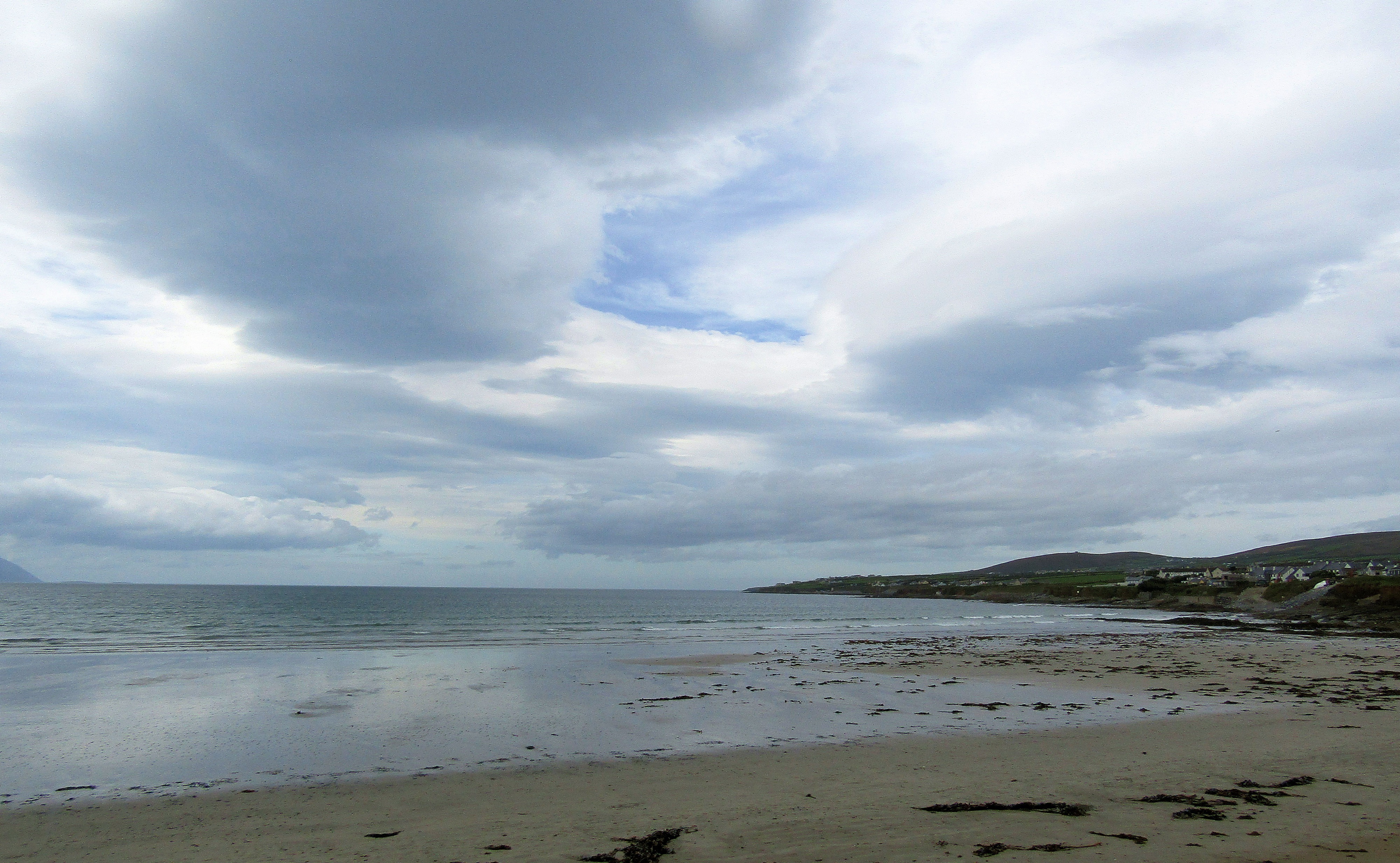
Further south, in Ballyheigue Bay in Kerry, the Cantillons buried their dead on an island offshore, carried out at night by their own ancestors, until a man broke the rule against watching it done and the island was sunk. Cantillon’s Rocks are where it was, and fishermen say the chapel walls are down there. Nunn and his colleagues give seven to fifteen metres of submergence here, and a minimum age between 5,000 and 7,450 years ago. The Cantillons are a late Norman family whose name has been fitted to an older loss. It is the island that is doing the work, and the island went down.
The wave with no surviving story
About 8,150 years ago a piece of the Norwegian continental slope the size of a small country let go and slid into the deep Atlantic. The Storegga slide sent a tsunami into Shetland, Orkney, the east coast of Scotland and the last low islands of the North Sea plain. It ran more than twenty metres above the tide line on Shetland, and three to six along the northeast Scottish coast. It is one of the best-dated catastrophes in European prehistory, and there were people on those shores when it arrived.
No well-attested tradition has been tied to it in Shetland, Orkney, Scotland or the North Sea basin. The accounts occasionally offered are modern, and work backward from the geology to a piece of later folklore that happens to mention the sea. The same evidentiary blank sits over Doggerland, the great drowned plain in the middle of the North Sea: people walked, hunted and lived there for thousands of years, but no surviving story can be securely placed on that ground.
This is the most interesting fact in the region, and it points directly at what the surviving traditions are made of. A tsunami is a pure event: enormous, brief, and over. It is exactly what we assume oral tradition is for — the great catastrophe, remembered and retold. And it is precisely what did not survive. What survived instead, all along the Atlantic coast, is the dullest possible content: where you could walk, what the crossing cost, where the deer were.
Mapped traditions
All mapped traditions
| No. | Place and tradition | What the story remembers | World after the water | Story and landscape | Source |
|---|---|---|---|---|---|
| The Irish Sea and the North Channel: a neighbourhood that had to be sailed | |||||
| 1 | The Point of Ayre and the Mull of Galloway — Manx | At the Point of Ayre they say the Mull of Galloway was once only a stone's throw off. It is not told as a disaster and there is no flood in it. It is told as a measurement: the distance a man could throw, where there are now forty kilometres of sea. | What the water leaves is an island. A neighbourhood that had been walked becomes a crossing that has to be sailed, and the saying is the only thing that carries the older arrangement. | Patrick Nunn's reconstruction puts the drowning of the Man-to-Scotland connection at roughly 10,680 to 8,550 BP, and he names the Point of Ayre saying as a possible memory of it. The inference runs from bathymetry to tradition; the recorded words reach us first in 1836, carried by a saying rather than a story. | “A Stranger” [John Welch], A Six Weeks' Tour through the Isle of Man (1836); Patrick D. Nunn, “Hidden by Mist and Waves”, Geoheritage 17 (2025)Welch p. 164; Nunn 2025 §§4.2 and 5, and Table 1 |
| 2 | St Kilda and the deer country to Harris — Scottish Gaels of St Kilda and Harris | A woman hunts deer over the country between St Kilda and Harris. She looses her greyhounds on St Kilda and sends them running at the deer toward the islands opposite. Harris tellings call the same vanished ground the hunting country of a princess. | The chase is left with nowhere to happen. The hunter's country is divided into some of the remotest islands in Britain, and the route survives only as the impossible part of the story. | Nunn, Ward, Stéphan and colleagues read this as a place-specific recollection of a lower sea and calculate a very deep former saddle between the islands — while warning in the same breath that slope collapse or scour may have deepened it since. The comparison is published; the chronology is looser than the Manx case. | Martin Martin, A Voyage to St Kilda, 4th ed. (1753); Charles Maclean, Island on the Edge of the World: The Story of St Kilda (1972); Nunn, Creach, Gehrels, Bradley, Armit, Stéphan, Sturt and Baltzer, “Observations of postglacial sea-level rise in northwest European traditions”, Geoarchaeology 37 (2022), pp. 577–593Martin p. 15; Maclean p. 28; Nunn et al. Table 1 and Table 2, story 1 |
| 3 | Fionn's stepping stones to Kintyre — Scottish Gaels of Arran | Fionn keeps house at Drumadoon with the féinne and lays stepping-stones over to Kintyre. The old people of Arran say he goes from the one land to the other in a few steps. | The crossing becomes sea. A passage that had been walked is left in the tradition at giant's scale, because a giant is the only kind of person who could still make it. | Nunn and colleagues set the tradition against a time when Arran and Kintyre stood connected above sea level, and Nunn argues elsewhere that giants are precisely how a crossing survives once it has become impossible for people. The story carries no date of its own; what it carries is the crossing. | James Headrick, View of the Mineralogy, Agriculture, Manufactures and Fisheries of the Island of Arran (1807); Nunn, Creach, Gehrels, Bradley, Armit, Stéphan, Sturt and Baltzer, “Observations of postglacial sea-level rise in northwest European traditions”, Geoarchaeology 37 (2022), pp. 577–593Headrick p. 160; Nunn et al. Table 1 and Table 2, story 2 |
| 4 | The causeway to Scotland — Gaelic Ireland and western Scotland | Fionn mac Cumhaill sets out to face Benandonner in Scotland and builds a causeway over the sea to get at him. Seeing the size of the man he leaves the work unfinished; in another telling Benandonner goes home pulling the stones up behind him. The road is said to have run to Staffa, where the same columns come out of the sea again. | The basalt columns are left standing at the water's edge as the visible stump of the road, and the Irish Sea keeps the two of them apart for good. | Nunn and colleagues take the Antrim-to-Staffa causeway as one story with the Arran crossing and compare both with the low-sea-level connections of the North Channel, while stressing that the Giant's Causeway and Fingal's Cave are later rationalisations worked into the story by people explaining the rock they could see. The rock came first and the road was fitted to it, but the road is what was being explained. | Elizabeth Andrews, Ulster Folklore (1913); Nunn, Creach, Gehrels, Bradley, Armit, Stéphan, Sturt and Baltzer, “Observations of postglacial sea-level rise in northwest European traditions”, Geoarchaeology 37 (2022), pp. 577–593Andrews pp. 90–91; Nunn et al. Table 1 and Table 2, story 2 |
| Wales and the Channel: gates, roads and a toll-house | |||||
| 5 | Cantre'r Gwaelod — Welsh | Gwyddno's lowland hundred lies below the sea's level and is kept dry by gates. Seithenyn, who has the keeping of them, is drunk at the feast and leaves them open on a high tide, and the sea takes the country. | The hundred stays under Cardigan Bay. The sarnau — long reefs running out from the shore — are pointed out as its causeways, so the drowned kingdom keeps an address. | Nunn and colleagues treat the tale as a plausible recollection of post-glacial submergence in the bay, while noting that the supposed sea walls are glacial outwash and that no city has been found. The medieval names in the story cannot date the inundation; they may have been fastened later onto an older tradition about the ground. | Boddi Maes Gwyddno, Black Book of Carmarthen; Nunn, Creach, Gehrels, Bradley, Armit, Stéphan, Sturt and Baltzer, “Observations of postglacial sea-level rise in northwest European traditions”, Geoarchaeology 37 (2022), pp. 577–593, citing Thomas (1888) and North (1957)Nunn et al. Table 1 and Table 2, Cardigan Bay story |
| 6 | The road to Jersey — Norman and Jèrriais | They say you could once walk from Normandy out to Jersey, crossing one small stream by a bridge on the way, and pay your toll at Coutances. Other tellings remember a forest running from Mont-Saint-Michel to Cherbourg that the sea afterwards swallowed. | The island is left an island, and the road, the bridge and the wood are left on the sea floor. The toll-house is the detail that gives it away as a route somebody used. | Nunn and colleagues set these traditions against post-glacial islandisation and the submerged forests recorded along the same coast. The AD 565 and 709 dates so often repeated for the severance are historical rationalisations and cannot be the real date — that is precisely the chronological objection, and it cuts in the tradition's favour rather than against it. | Poingdestre’s tradition in W. Plees, An Account of the Island of Jersey (1817); Paul Sébillot, Légendes locales de la Haute-Bretagne (1899); Nunn, Creach, Gehrels, Bradley, Armit, Stéphan, Sturt and Baltzer, “Observations of postglacial sea-level rise in northwest European traditions”, Geoarchaeology 37 (2022), pp. 577–593Plees pp. 9, 12; Sébillot p. 23; Nunn et al. Table 1 and Table 2, Jersey story |
| Brittany: the cities and the ground under them | |||||
| 7 | Ker-Is in the bay of Douarnenez — Breton | Ker-Is stands below the sea behind a dyke, and the king Gradlon keeps the key to its gate on a chain about his neck. His daughter Dahut takes the key — in the tellings, for a lover who asks for it — and opens the gate at night, and the sea comes in. | The city stays under the bay. Gradlon rides clear and Dahut goes into the water, and fishermen are told they will hear the bells. | Nunn and colleagues include the bay of Douarnenez in their modelled series and give it a published submergence range. No settlement has been found on that floor, and the saint who appears in the medieval versions is a later arrival in the story, so what is being dated is the drowned ground and not the narrative around it. | Albert Le Grand, La Vie des saincts de la Bretaigne Armorique (1636); Paul Sébillot, Le Folk-Lore de France: la mer et les eaux douces (1905); Nunn, Creach, Gehrels, Bradley, Armit, Stéphan, Sturt and Baltzer, “Observations of postglacial sea-level rise in northwest European traditions”, Geoarchaeology 37 (2022), pp. 577–593Nunn et al. Table 1 and Table 2, north–west Brittany rows |
| 8 | The Glénan archipelago — Breton | Off the Cornouaille coast they say the Glénan islands were one land, and name the ways across it: which island you could walk to, and where the ground ran that is now between them. | The single land is left as a scatter of low islands and a shallow platform, with the crossings between them remembered as ground rather than water. | Nunn and colleagues model the platform under the archipelago at twenty to twenty-five metres of submergence and put its drowning between about 10,865 and 10,000 years ago, the strongest late-glacial fit anywhere on this map. Reclus and Sébillot both record it from the Concarneau shore. Of everything on this map it is the clearest case of a tradition that specifies pedestrian routes across a real drowned surface. | Paul Sébillot, Le Folk-Lore de France: la mer et les eaux douces (1905); Nunn, Creach, Gehrels, Bradley, Armit, Stéphan, Sturt and Baltzer, “Observations of postglacial sea-level rise in northwest European traditions”, Geoarchaeology 37 (2022), pp. 577–593Nunn et al. Table 1 and Table 2, story 15 (Concarneau and the Glénan) |
| Cornwall and the Atlantic edge | |||||
| 9 | Lyonesse and the Scilly platform — Cornish | Between Land's End and the Scillies there was a country called Lyonesse, with its churches and its towns, and the sea took it. One man rides ahead of the water on a white horse and comes out at Perranuthnoe. | The Seven Stones reef is pointed out as the drowned city, and the Scillies are left as the high ground of a country that used to be walked to. | The drowned landscape is real and is explicitly compared in print: the Scilly platform was a single island and the ground between the present islands was dry within the Holocene. The ground is well dated and the tradition is not: the best recent work puts the final separation of the Scilly islands later than six thousand years ago, so what Lyonesse holds is the long drowning of the platform rather than the last of it. | Nunn, Creach, Gehrels, Bradley, Armit, Stéphan, Sturt and Baltzer, “Observations of postglacial sea-level rise in northwest European traditions”, Geoarchaeology 37 (2022), pp. 577–593; Charles Thomas, Exploration of a Drowned Landscape (1985)Nunn et al. Scilly row; Thomas, chapters on the platform |
| Ireland: islands that went down and kept their names | |||||
| 10 | Kilstuithin in Liscannor Bay — Irish of Clare | Stuithin's fort stands on its island in Liscannor Bay until the fighting of the three sons of Turrolbh, and then it goes under. It is seen once in seven years, standing in the water; boatmen passing over it say they can smell the thyme off its fields. | The island is left as a place on the sea floor that keeps its name, its seven-year appearance and the scent of ground that was once cultivated. | Nunn and colleagues model the relevant shoreline at fifteen to thirty metres below present sea level, which gives a minimum age of roughly 7,830 to 10,000 BP. Nothing has been identified under the bay, and the tradition cannot be shown to be contemporaneous with the drowning — but the smell of the thyme is a strange thing for a story to keep. | T. J. Westropp, “Ring-Forts in the Barony of Moyarta, Co. Clare, and Their Legends”, Journal of the Royal Society of Antiquaries of Ireland (1908); Nunn, Creach, Gehrels, Bradley, Armit, Stéphan, Sturt and Baltzer, “Observations of postglacial sea-level rise in northwest European traditions”, Geoarchaeology 37 (2022), pp. 577–593Westropp pp. 198–200; Nunn et al. Table 1 row 4 and Table 2 row 4 |
| 11 | Cantillon's Rocks in Ballyheigue Bay — Irish of Kerry | The Cantillons bury their dead on an island offshore, carried out at night by their own ancestors. A man stays to watch it done, which is forbidden, and the island is sunk. In the other telling a sea-princess's father orders the waves to cut its roots away. | Cantillon's Rocks are left where the burial ground was, and fishermen say the chapel walls are down there. | Nunn and colleagues model seven to fifteen metres of submergence here and a minimum age of 5,000 to 7,450 BP. The Cantillons are a late Norman family whose name has been fitted to an older loss, and it is the older half of Nunn’s range that carries the burial island. | T. Crofton Croker, Fairy Legends and Traditions of the South of Ireland, 2nd series (1844); T. J. Westropp, “Brasil and the Legendary Islands of the North Atlantic”, Proceedings of the Royal Irish Academy 30 (1912–13); Nunn, Creach, Gehrels, Bradley, Armit, Stéphan, Sturt and Baltzer, “Observations of postglacial sea-level rise in northwest European traditions”, Geoarchaeology 37 (2022), pp. 577–593Croker pp. 139–143; Westropp pp. 249–50; Nunn et al. Table 1 row 5 and Table 2 row 5 |
| North Brittany: a coast sitting on a country | |||||
| 12 | Lexobie and the Sept-Îles — Breton | North Breton tradition holds that a town called Lexobie — also the Ville des Sept-Îles, also Triagoz — stood off this coast and has been wiped from the face of the earth altogether. Local tellings put its remains near Saint-Michel-en-Grève, or off the Sept-Îles, or by Tréguier. | Islands and reefs are left where a town or a tract of country is said to have been, and the name survives without a fixed address. | Nunn and colleagues take these together as their north Brittany row and model the shoreline at ten to twenty metres down, giving 7,165 to 9,300 BP. Lexobie, the Sept-Îles and Triagoz may not be one place, so the comparison holds for the coast rather than for a point on it. | C.-P. de Fréminville, Antiquités de la Bretagne: monumens du Morbihan, 2nd ed. (1834); Paul Sébillot, Le Folk-Lore de France: la mer et les eaux douces (1905); Nunn, Creach, Gehrels, Bradley, Armit, Stéphan, Sturt and Baltzer, “Observations of postglacial sea-level rise in northwest European traditions”, Geoarchaeology 37 (2022), pp. 577–593Sébillot p. 52; Nunn et al. Table 1 row 12 and Table 2 row 12 |
| The later North Sea: securely recorded, not Ice Age memories | |||||
| 13 | Staithes and Jackdaw’s Well — North Yorkshire fishing community | Villagers imprison two mermaids. After they escape, one curses the place: the sea will one day reach Jackdaw’s Well, then standing inland from the North Yorkshire shore. | The well itself has disappeared as the coast retreated. The prophecy became a way for a fishing village to speak about the sea advancing into familiar ground. | This is a secure local erosion tradition, first recorded from Robert Brown in 1924 and probably older. It is not a Doggerland memory: the record belongs to the modern village and recurrent loss on its own coast, so no comparison with the postglacial shoreline is proposed. | Sarah Peverley and Chloe Middleton-Metcalfe, “Tracking the Mermaids of Staithes”, Folklore 136.2 (2025)pp. 232–249, especially p. 239; first printed in the Whitby Gazette, 28 March 1924 |
| 14 | The Dollard and drowned Reiderland — Groninger Dutch | In one tale a farmer draws a herring from his freshwater well, understands that the sea is moving under the land and sells before the storm. In the other, Tidde Winnenga refuses to help strengthen the dike; it breaks and the sea takes Reiderland. | The paired stories leave the Dollard as both warning and judgment: one person reads a small environmental sign, while another refuses the communal work that could hold the water back. | These legends explain a historically drowned Wadden landscape recorded in modern collections. The Dollard is a medieval and early-modern drowning, thousands of years after the postglacial shoreline settled, so no minimum Ice Age age is proposed for it. | Theo Meder, The Flying Dutchman and Other Folktales from the Netherlands (2008)pp. 136–137; SINSAG 1173–1174, collected by K. ter Laan in Groningen |
| 15 | Rungholt in the North Frisian Wadden Sea — North Frisian | Revellers intoxicate a sow, summon a priest to give it the sacrament and desecrate it. The priest is warned to leave; storm water destroys Rungholt. Later tellings let its towers appear and its bells sound beneath the sea. | A real medieval cultural landscape lost in the 1362 storm surge becomes a moral drowned city: the Frisian Sodom, still audible when the water is quiet. | Rungholt is the North Sea’s strongest drowned-town tradition precisely because its loss is recent and historically documented. Its earliest specific text is sixteenth-century, not Mesolithic; it stands here as a comparison in memory, not chronology. | Samuel Meigerius (1587); Henricus Heimreich (1655); Holzhausen and Grecksch, “Historic narratives, myths and human behavior in times of climate change” (2021)“Die erste bekannte Rungholtsage” and the Henricus Heimreich version; WIREs Climate Change 12, pp. 5–7 |
| 16 | Fanø and the Danish Wadden islands — Danish of Fanø | When the land between England and France is cut, water and sand run toward Jutland and make Fanø, Mandø and Rømø. The same saying gives Fanø an ending: from the sea it arose, and into the sea it shall sink again. | A mobile sand island understands itself as borrowed ground. The sea created it, the tide keeps remaking it, and a future storm may take it back. | N. M. Kromann heard the tradition independently from older residents and traced nineteenth-century oral continuity. It is unusually secure Danish folklore, but the cutting of the Channel it invokes describes the shaping of the barrier islands themselves, not the postglacial flooding of the North Sea basin, so it is not read as an Ice Age memory here. | N. M. Kromann, Fanøs Historie, vol. I (1933)pp. 11–12; independent Nordby and Sønderho witnesses and an 1842 parallel near Holsted |
| The Outer Hebrides: crossings the sea widened | |||||
| 17 | The Monach Islands, North Uist and Benbecula — Gaelic-speaking people of the Outer Hebrides | The Monach Islands were joined to North Uist and Benbecula by green isthmuses, with green plains and lakes behind them. The Atlantic entered first through little channels, then through fords. People still rode across at low tide, until the crossings became too broad and deep. They built embankments to keep the sea out. The Atlantic broke them, filled the lakes and met the Minch on the other side. | A stormy sea covers the crossings, plains and lakes. Tradition keeps the names of the last people to cross and of people drowned trying. The drowned ground still has land names: the barrier rock, said to mark a floodgate, and the red smithy. Carmichael reports islanders seeing iron bolts and buildings at low water. | Patrick Nunn compares the lost crossings with postglacial submergence. His shoreline models place the North Uist connection at least about 7,300 years ago and the direct Benbecula connection at least about 8,700 years ago. | Alexander Carmichael, ‘Grazing and agrestic customs of the Outer Hebrides’ (1884), and ‘The place-names of Iona’ (1886); Patrick Nunn, ‘First a wudd, and syne a sea’ (2022)Carmichael 1884 p.464; 1886 pp.466–467; Nunn, Scottish Geographical Journal 138, pp.73–102, §4.2a and Table 3A (PDF pp.7 and 21), DOI 10.1080/14702541.2022.2110610 |
| 18 | Pabbay and Berneray in the Sound of Harris — Gaelic-speaking people of Pabbay and Berneray | The water between Pabbay and Berneray was once so narrow that people could call across and be heard, or throw things from one island to the other. | The neighbours now face one another across about three and a half kilometres of sea. The tradition keeps the former distance in the reach of a voice and a thrown object. | Nunn compares this named tradition with postglacial widening of the channel. His five-metre reconstruction gives a minimum landscape age of about 6,800 years. | Charles Elton, ‘Notes on the ecological and natural history of Pabbay, and other islands in the Sound of Harris’ (1938), as quoted and compared by Patrick Nunn (2022)Elton, Journal of Ecology 26(2), pp.275–297, p.287, DOI10.2307/2256248; Nunn §4.2c (PDF p.8) and Table3A (PDF p.21) |
What a road can carry
Read the fourteen filled points together and the pattern is unmistakable. From Man to Brittany the end of the Ice Age did not survive as a deluge. It survived as a lost route.
The reason is in the nature of the thing being remembered. A catastrophe is told; a road is used. A community that walks to the next island rehearses that route continuously, in the most ordinary way, for as long as it remains walkable — and the knowledge is not held as a narrative at all but as a piece of practical geography, of the same kind as knowing where the ford is. When the route goes, the knowledge does not have a plot to lose. It collapses into a sentence. The Mull of Galloway was a stone’s throw. You paid your toll at Coutances. She hunted deer to Harris.
That is why these particular scraps outlived the flood stories on the same coasts, which had plots and characters and were the first thing to be overwritten when a book with a better flood in it arrived. And it is why the traditions that do carry a full narrative — Cantre’r Gwaelod, Ker-Is — carry it as an obvious later layer over a plain statement about the ground: a drunk steward and a wicked daughter sitting on top of the older and stranger claim that the sea is on land that people used.
It also explains the giants, who are not decoration but repair. A statement about a walk becomes false the moment the walk becomes impossible, and a false statement gets dropped. Enlarge the walker and the statement is true again. Fionn steps to Kintyre; the memory of a crossing survives inside a body big enough to make it. The giant is what a route looks like after the sea has been over it for eight thousand years.
Cornwall keeps the one drowned country in this group with a named survivor in it. Between Land’s End and the Scillies there was a country called Lyonesse, with its churches and its towns, and the sea took it. One man rides ahead of the water on a white horse and comes out at Perranuthnoe. The Seven Stones reef is pointed out as the drowned city, and the Scillies are left as the high ground of a country that used to be walked to — the walk again, this time with a rider on it, outrunning the tide with a whole inhabited world going under behind him.
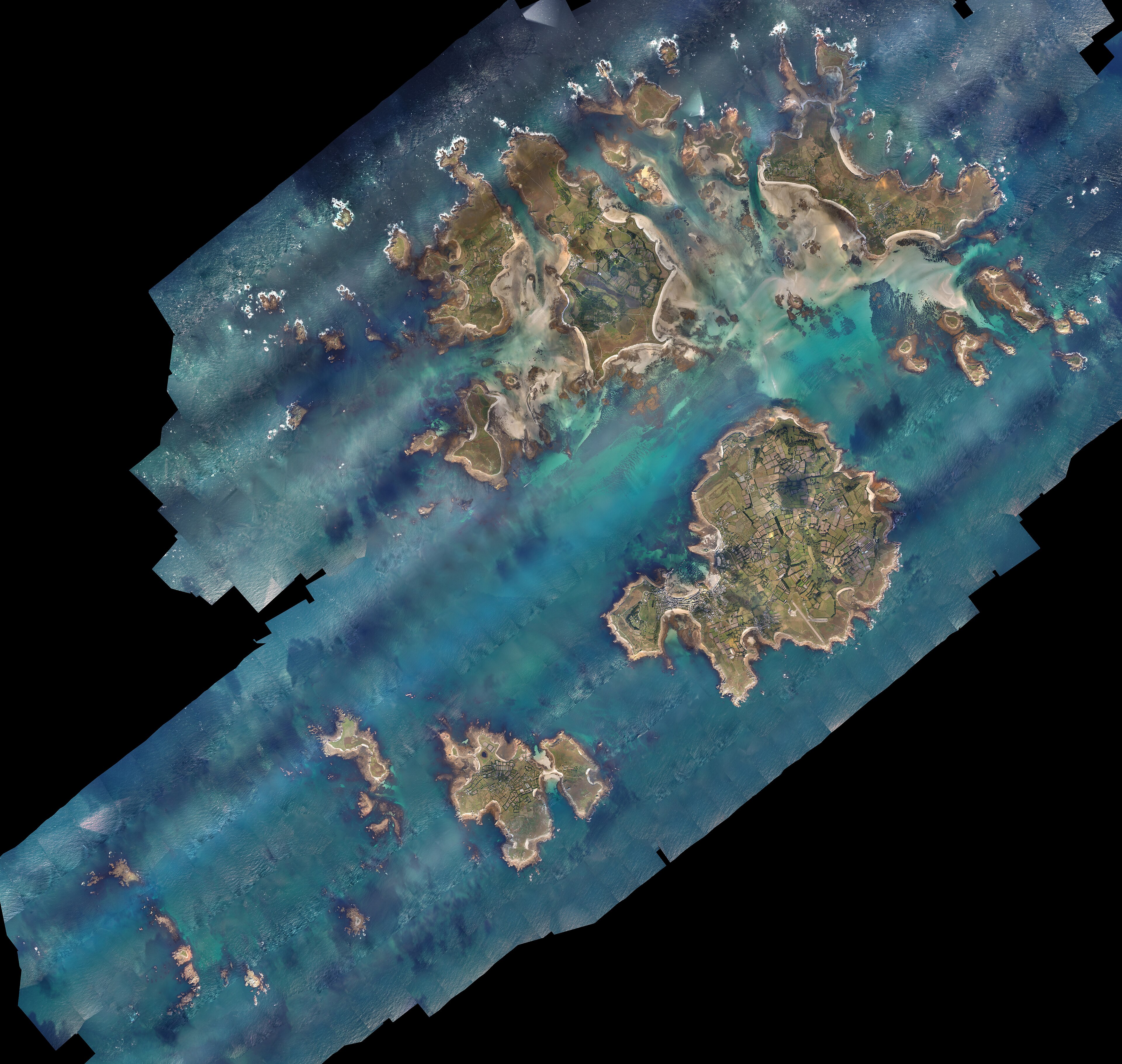
And this is why the region belongs on a map of Ice Age floods despite having so few floods in it. Ask of these fourteen whether the world as we know it was set up when the water rose, and they answer in a register no other region uses. They do not describe a world remade. They describe the moment a neighbourhood became a sea — and they are, in several cases, dated: the walk to Man closing between about 10,680 and 8,550 years ago, the platform under the Glénan going under between 10,865 and 10,000, the ground at Liscannor between 10,000 and 7,830. Somebody stood on the Point of Ayre and looked at Galloway and thought it was close. The sentence is still there. The isthmus is not.
Key sources
Map. Reconstruction: Drowned Worlds Doggerland; terrain: NOAA ETOPO 2022.
Eighteen traditions are mapped: fourteen possible postglacial memories as filled points and four later North Sea traditions as hollow points. The principal regional study is by Patrick D. Nunn, Axel Creach, W. Roland Gehrels, Sarah Bradley, Ian Armit, Pierre Stéphan, Fraser Sturt and Agnès Baltzer, “Observations of postglacial sea-level rise in northwest European traditions,” Geoarchaeology 37 (2022), pp. 577–593. Patrick D. Nunn, “Hidden by Mist and Waves,” Geoheritage 17 (2025), supplies the Manx comparison.
The primaries behind the traditions: J. Welch, A Six Weeks’ Tour through the Isle of Man (1836), p. 164. Martin Martin, A Voyage to St Kilda, 4th ed. (1753), p. 15, with Charles Maclean, Island on the Edge of the World: The Story of St Kilda (1972), p. 28. James Headrick, View of the Mineralogy, Agriculture, Manufactures and Fisheries of the Island of Arran (1807), p. 160. Elizabeth Andrews, Ulster Folklore (1913), pp. 90–91. Boddi Maes Gwyddno in the Black Book of Carmarthen, which names Seithennin and the drowning but has no sluice gates in it. W. Plees, An Account of the Island of Jersey (1817), pp. 9 and 12, with Paul Sébillot, Légendes locales de la Haute-Bretagne (1899), p. 23. Albert Le Grand, La Vie des saincts de la Bretaigne Armorique (1636), for Ker-Is. T. J. Westropp, “Ring-Forts in the Barony of Moyarta, Co. Clare, and Their Legends,” Journal of the Royal Society of Antiquaries of Ireland (1908), pp. 198–200, for Kilstuithin, and his “Brasil and the Legendary Islands of the North Atlantic,” Proceedings of the Royal Irish Academy 30 (1912–13), pp. 249–250, with T. Crofton Croker, Fairy Legends and Traditions of the South of Ireland, 2nd series (1844), pp. 139–143, for Ballyheigue. C.-P. de Fréminville, Antiquités de la Bretagne: monumens du Morbihan, 2nd ed. (1834), for Lexobie. Élisée Reclus, Nouvelle géographie universelle, vol. 2 (1877), p. 601, with Paul Sébillot, Le Folk-Lore de France: la mer et les eaux douces (1905), p. 70, for the Glénan. Charles Thomas, Exploration of a Drowned Landscape (1985), for the Scilly platform. On Storegga, Stein Bondevik, Jan Mangerud, Sue Dawson, Alastair Dawson and Øystein Lohne, “Record-breaking height for 8000-year-old tsunami in the North Atlantic,” Eos 84:31 (2003), pp. 289 and 293.
Alexander Carmichael, “Grazing and agrestic customs of the Outer Hebrides” (1884), p. 464, and “The place-names of Iona”, Scottish Geographical Magazine 2 (1886), pp. 466–467, for the Monach crossings, attempts to keep the sea out and submerged place-names. Charles Elton, “Notes on the ecological and natural history of Pabbay, and other islands in the Sound of Harris,” Journal of Ecology 26 (1938), p. 287, for the Pabbay–Berneray saying, quoted by Patrick Nunn in “First a wudd, and syne a sea”, Scottish Geographical Journal 138 (2022), pp. 73–102, sections 4.2a and 4.2c, Table 3A.
The later North Sea sources are Samuel Meigerius (1587) and Henricus Heimreich (1655) for Rungholt, with Jenny Holzhausen and Kevin Grecksch, “Historic narratives, myths and human behavior in times of climate change” (2021); Theo Meder, The Flying Dutchman and Other Folktales from the Netherlands (2008), pp. 136–137, for the Dollard pair; Sarah Peverley and Chloe Middleton-Metcalfe, “Tracking the Mermaids of Staithes” (2025), especially p. 239; and N. M. Kromann, Fanøs Historie, vol. I (1933), pp. 11–12. They are mapped because they answer what the later North Sea remembered, not because they extend the chronology of the filled points.
Four groups from Nunn and colleagues remain excluded from this map. Lough Gill is a freshwater fairy-city tradition whose marine reading is the researchers’ inference. Tyno Helig’s Conwy location is a seventeenth-century adaptation and its supposed palace is natural glacial material. The Mabinogi puts Arianrhod’s castle beside the sea but does not drown it; the explicit inundation account is much later. Tolente is a redundant, seventh-century historicising tradition with no North Sea connection. The map also leaves off the Lough Neagh episode within the Fionn cluster for a simpler reason: the Rennes Dindsenchas places its loch-burst a hundred years after Christ.
This is the eighth regional map in the series. The others are Sundaland, East Asia, South Asia, the Mediterranean Near East, North America, South America and Sahul; the landscapes themselves are collected at Drowned Worlds.
Continue the series: Sahul, Sundaland, East Asia, South Asia, the Mediterranean Near East, North America, South America, and the coasts where it is not remembered. The series hub, Twelve Drowned Worlds, maps the drowned landscapes the nine essays are standing on.