Drowned Worlds — Atlas Essay — 2026-08-08
Old Sahul
When New Guinea and Australia were one

Eight thousand years ago, the last land bridge between Australia and New Guinea was going under. Rising water broke that bridge into the islands of Torres Strait, leaving two shores of one older cultural world.
Australia and New Guinea are the two surviving shores of one old cultural world: Sahul.
In brief
- Australia and New Guinea are the two surviving shores of one old cultural world: Sahul.
- The final Torres land bridge was breached around 8,000 years ago. By roughly 7,200 years ago, people at Dabangay on Mabuyag were already living from the new Sea Country.
- Genomes record deep shared ancestry and prolonged early contact between northern Australia and New Guinea; maternal lineages preserve north-to-south movement into the close of the Pleistocene.
- Torres Strait languages retain both descent and exchange: Kala Lagaw Ya is Australian in lineage, while centuries of Papuan contact reshaped its sounds, verbs and vocabulary.
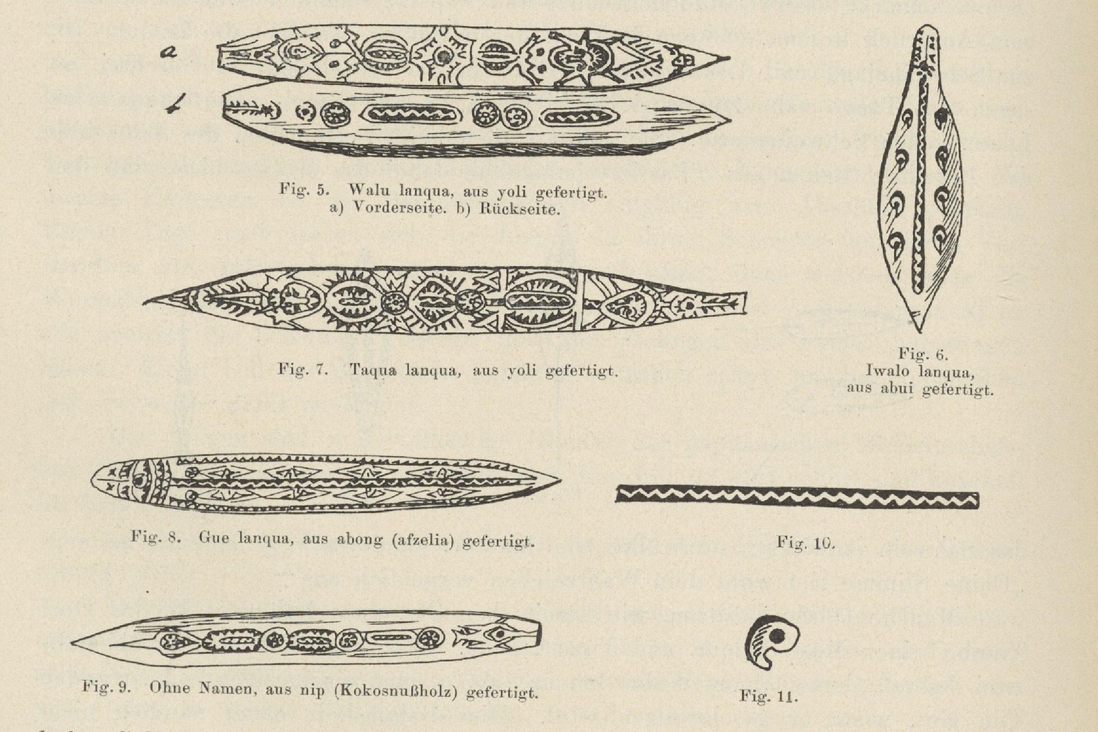
- The bullroarer crosses the same world as object, sacred voice and travelling cult. Even its names form island chains: Mabuiag and Yam bigu, Mer bigo, Kiwai madubu.
- Modern national and disciplinary boundaries divide this history into separate fields. The older relations run through the border.
The sea took the middle
Twenty-one thousand years ago, global sea level lay near its glacial minimum. New Guinea was the mountainous north of a single continent. Cape York was not a peninsula. The Gulf of Carpentaria was a low interior basin. Farther south, Lutruwita/Tasmania remained joined to the mainland across the Bassian plain. Then the water advanced across the shallow shelves.
Lake Carpentaria changed before it vanished. Stronger monsoon rains expanded it to nearly 190,000 square kilometres around 14,000 years ago. Marine water crossed the Arafura sill around 11,700 years ago; by 10,500 years ago, the western Gulf was fully marine. A freshwater interior became an arm of the sea.
Between 14,600 and 8,000 years ago, rising seas covered nearly ninety per cent of the 2.12 million square kilometres lost from the Australian portion of the continental shelf. The average coastline retreated about 139 kilometres; in places it moved more than 300. On the flattest country, the shoreline could advance hundreds of metres within a human generation. Country became sea. The companion essay Myths That Remember Sahul maps how that drowning is still told on both shores.
Aru makes that lost country human. Liang Lemdubu, now in the forested interior of the Aru Islands in eastern Indonesia, was first occupied around 27,000 years ago, when the Aru ridge stood as low hills within the exposed Arafura plain and remained joined to New Guinea. At Liang Nabulei Lisa, occupation began around 16,200 years ago. Its food remains follow the water inward: open-savannah animals dominate the earliest levels; freshwater foods become more regular between about 12,000 and 10,200 years ago, when estuarine and marine species first appear; by 7,700–6,100 years ago, shellfish and crabs mark the establishment of a tidal environment in the nearby channel. Geoffrey Hope and Ken Aplin conclude that the rapid inundation concentrated maritime peoples along the Aru ridge; while sea level stood 30–50 metres below present, a person could watch the coast retreat 20–50 kilometres in one lifetime. This was no empty shelf. It was inhabited country.
Global sea level lies near its glacial minimum and Sahul reaches close to its greatest extent.
The main deglacial sea-level rise begins; by about 16,200 years ago, people are living at Liang Nabulei Lisa on the Aru ridge.
The last mainland connections to Lutruwita/Tasmania disappear.
Meltwater Pulse 1A accelerates global sea-level rise as Lake Carpentaria approaches its maximum extent.
Marine water breaches the Arafura sill and Lake Carpentaria begins its turn from lake to sea.
The western Gulf becomes fully marine and Aru loses its mainland connections.
The last Torres Strait land bridge drowns. New Guinea and Australia become separate islands.
Sea level reaches its present height in the southern Gulf while shellfish and crabs mark locally established estuarine conditions at Liang Nabulei Lisa.
People occupy Dabangay on newly insular Mabuyag, working stone and taking turtle, fish and probably dugong.
The final division is close enough to count in family time: roughly three hundred generations. It is younger than cultivation at Kuk Swamp in the New Guinea highlands, where people were planting, digging and draining wetlands about 10,000 years ago. It is younger by tens of millennia than the peopling of the continent. Sahul’s people had already lived within one geography for most of their human history before the sea drew its narrowest cut.
Dabangay supplies the sequel. People were living on Mabuyag soon after the old plain became an archipelago. They made fires, worked quartz and igneous stone, and harvested marine animals. The land bridge ended. Connection did not. The drowned middle became inhabited Sea Country.
Objects moved the same way: selectively. In later millennia, double-outrigger canoes, bamboo pipes, pottery and cultivars moved between southern New Guinea, Torres Strait and northeastern Australia, while communities accepted some things and refused others. Yet northern Australia had already invented ground-edge axes tens of thousands of years before the flood, and its tool traditions differed from New Guinea’s even when both belonged to one continent. Old Sahul was connected without ever being culturally flat. Neighbouring peoples exchanged, transformed and kept their own ways.
One inheritance, many peoples
The shared genetic inheritance is tens of thousands of years older than the final flood. Aboriginal Australian and Papuan peoples share a branch of ancestry rooted in the first settlement of Sahul. The populations sampled today had begun to differentiate tens of thousands of years before Torres Strait flooded, yet the division was gradual. Northern Australian communities retain more shared genetic drift with New Guinea than central Australian groups, a pattern the largest survey of northern communities describes as “an extended period of genetic interaction between the ancestral populations of PNG and northern Australia.”
Mitochondrial lineages give the movement a direction near the end of the Ice Age. A 2020 study of 379 complete Papua New Guinean mitochondrial genomes found maternal interaction between northern and southern Sahul from about 30,000 to 10,000 years ago, moving “in a unidirectional manner (from Northern to Southern Sahul).” Several New Guinea-derived branches survive in northern Australia. That north-to-south movement continued until about 10,000 years ago, just before the Holocene sea completed the cut.
Whole-genome analysis found “continuous but modest gene flow, mostly unidirectional from Papuans to Aboriginal Australians, and geographically restricted to northeast Aboriginal Australians.” The main interaction was ancient and was followed by long isolation, while recent Papua New Guinea-related ancestry is local and small. Culture can travel by marriage, trade, ritual adoption and imitation without moving enough people to leave a large genomic signature.
Old Sahul carried a shared inheritance, regional divergence, prolonged northern contact and then an isolation far sharper in the genes than in language, objects or sea routes. Difference grew inside relationship.
The Strait is a seam
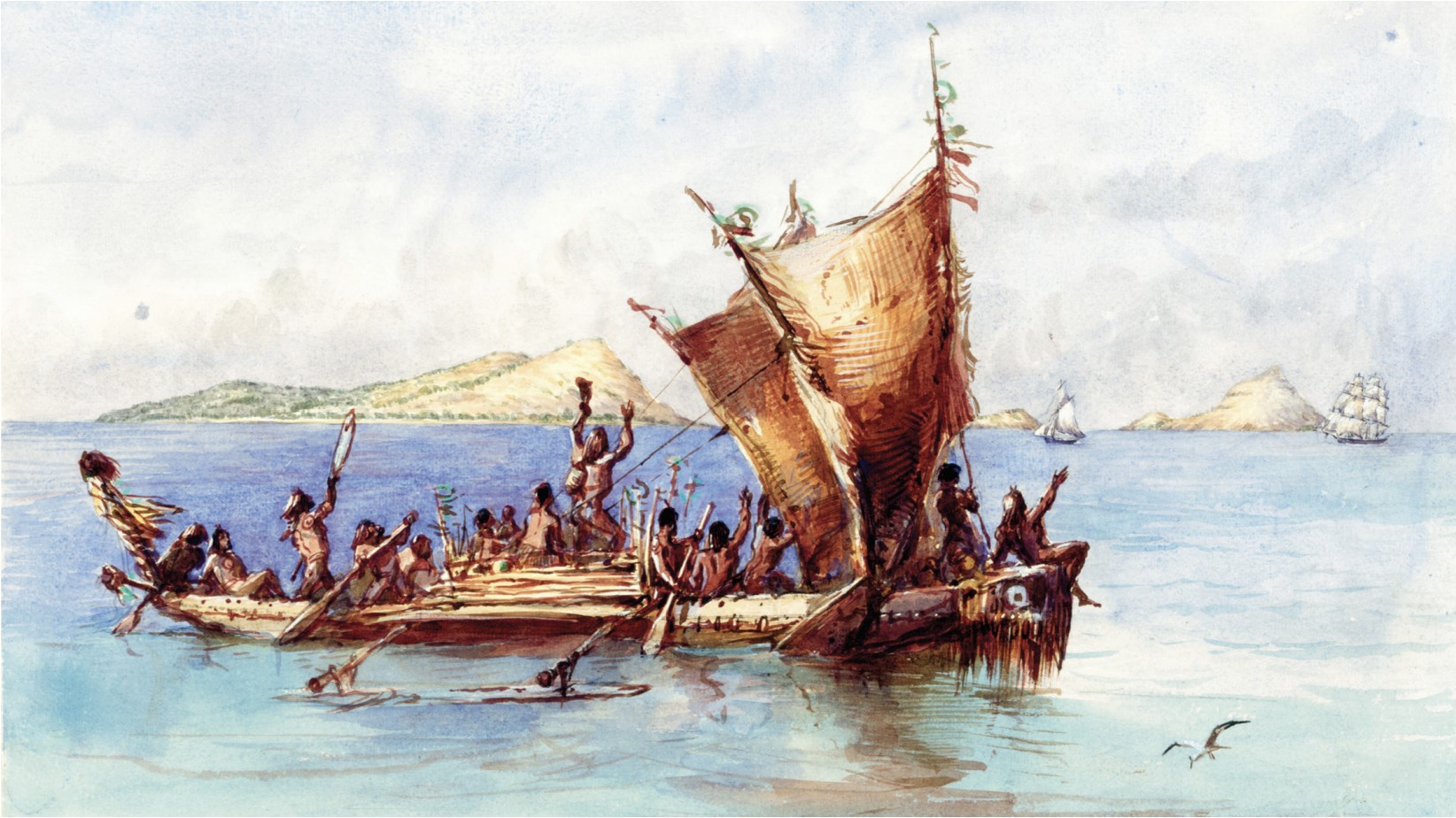
Languages preserve descent and neighbourhood at once. The western Torres Strait language Kala Lagaw Ya belongs to the Australian Pama–Nyungan family. Its first-person pronoun carries an inherited, irregular case system: nominative ngay, ergative ngath, accusative ngoena, dative ngayka—form for form, the Proto-Pama–Nyungan paradigm reconstructed across Australia. In the western Strait, an Islander still says “I” as ngay, the ancient form heard in languages across the continent.
| Reconstruction or language | “I” | “you” | Relation to Sahul |
|---|---|---|---|
| Proto-Australian | *ŋaj | — | A deep Australian first-person form |
| Proto-Pama–Nyungan | *ngayu | *ñun / *ñin | The lineage inherited by Kala Lagaw Ya |
| Kala Lagaw Ya | ngay | ni | Australian descent in a Torres Strait contact language |
| Proto-Trans-New-Guinea | *na | *ŋga | In New Guinea’s largest family, nga belongs to “you,” not “I” |
| Meriam Mir | ka | ma | A southern New Guinea lineage in eastern Torres Strait |
A lone nga echo proves little; whole paradigms carry the real history. Kala Lagaw Ya descends from Australian speech, yet contact with Papuan and Austronesian languages introduced new sounds, new vocabulary and even Trans-Fly patterns of verb suppletion. To the east, Meriam Mir belongs to the Oriomo branch of the southern New Guinea Trans-Fly languages, while its vocabulary of winds and directions records exchanges with Kala Lagaw Ya and Kiwai. The Strait is not a linguistic wall. It is a seam.
The seam may be older than the water. When Nicholas Evans reconstructed ancestral sound systems immediately north of Torres Strait, Proto-Yam and Proto-Pahoturi looked more Australian than many of their modern descendants: velar nasals, retroflex stops and unusually rich sets of liquid consonants. The histories remain distinct, but they emerged from a contact world in which their sound systems were once less sharply divided.
Across roughly 300 Australian and Papuan languages, the ways people group tree, firewood and fire form patterns rare elsewhere in the world. Sahul survives as a field of shared habits laid across many families.
The names cross the islands
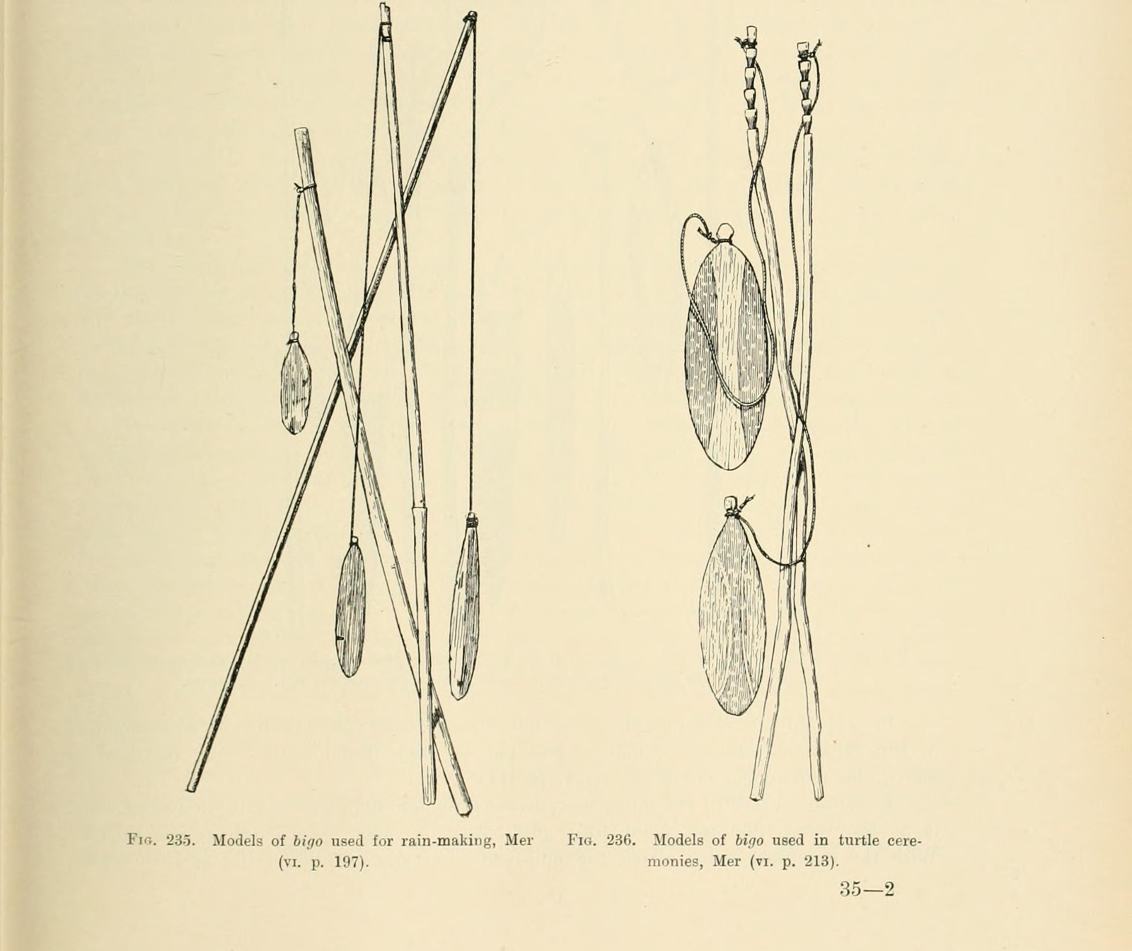
The bullroarer makes the linguistic seam audible. The deep-voiced bullroarer of Mabuiag is bigu; the small shrill one is wainis. Yam also has bigu. Far across the Strait on Mer, the small instrument is bigo, explicitly paired with Mabuiag bigu in Sidney Ray’s 1907 vocabulary.
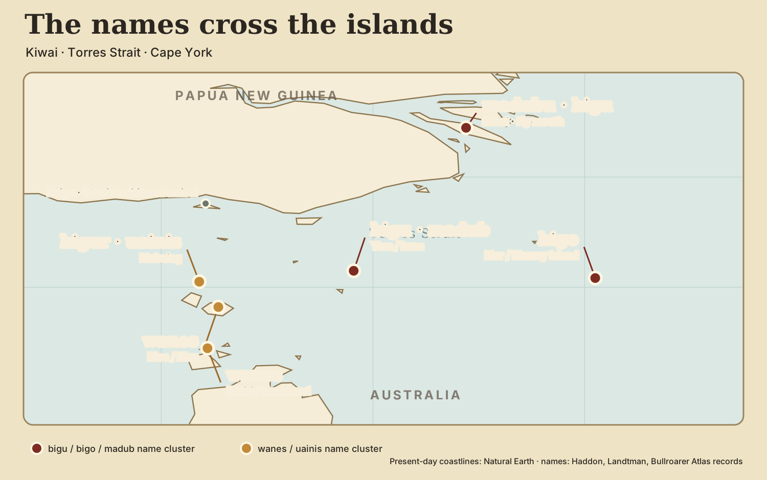
A Kiwai story makes the sound into a journey. An old Boigu woman named Mete sees a chip fly from her firewood. Whirled on a cord, it cries bigu-bigu-bigu and announces its own name. Men from Saibai and Budji pay for admission and carry away instruments and instructions. “The use of bull-roarers began in Bóigu and spread thence all over the country,” the story concludes. Its geography runs straight through the island chain.
The ordinary Kiwai instrument is madubu, not bigu. The story preserves two things at once: a local New Guinea name and a remembered crossing attached to the Strait word. On Mabuiag and Yam, bigu belonged to turtle, yams and sweet potatoes. On Mer, bigo worked in rain-making and turtle ceremony.
One wooden voice
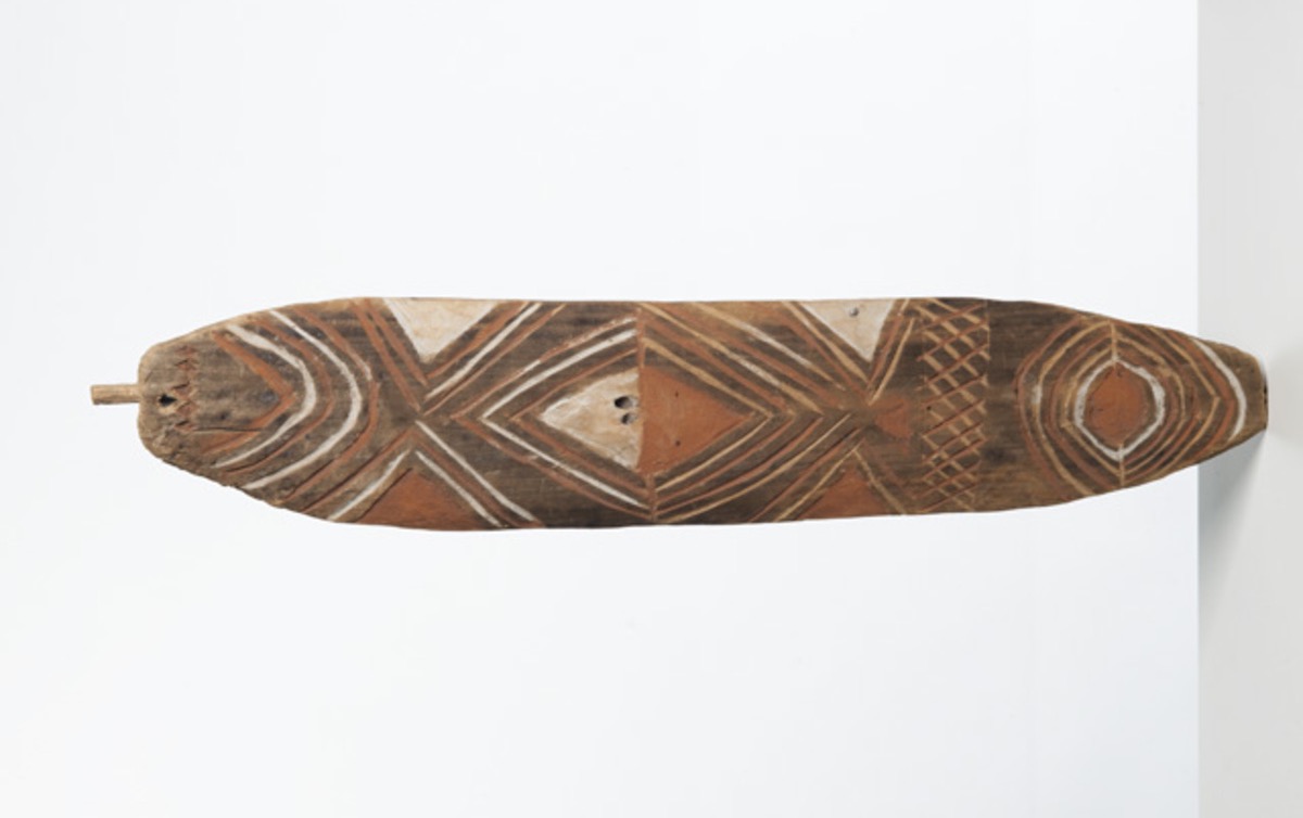
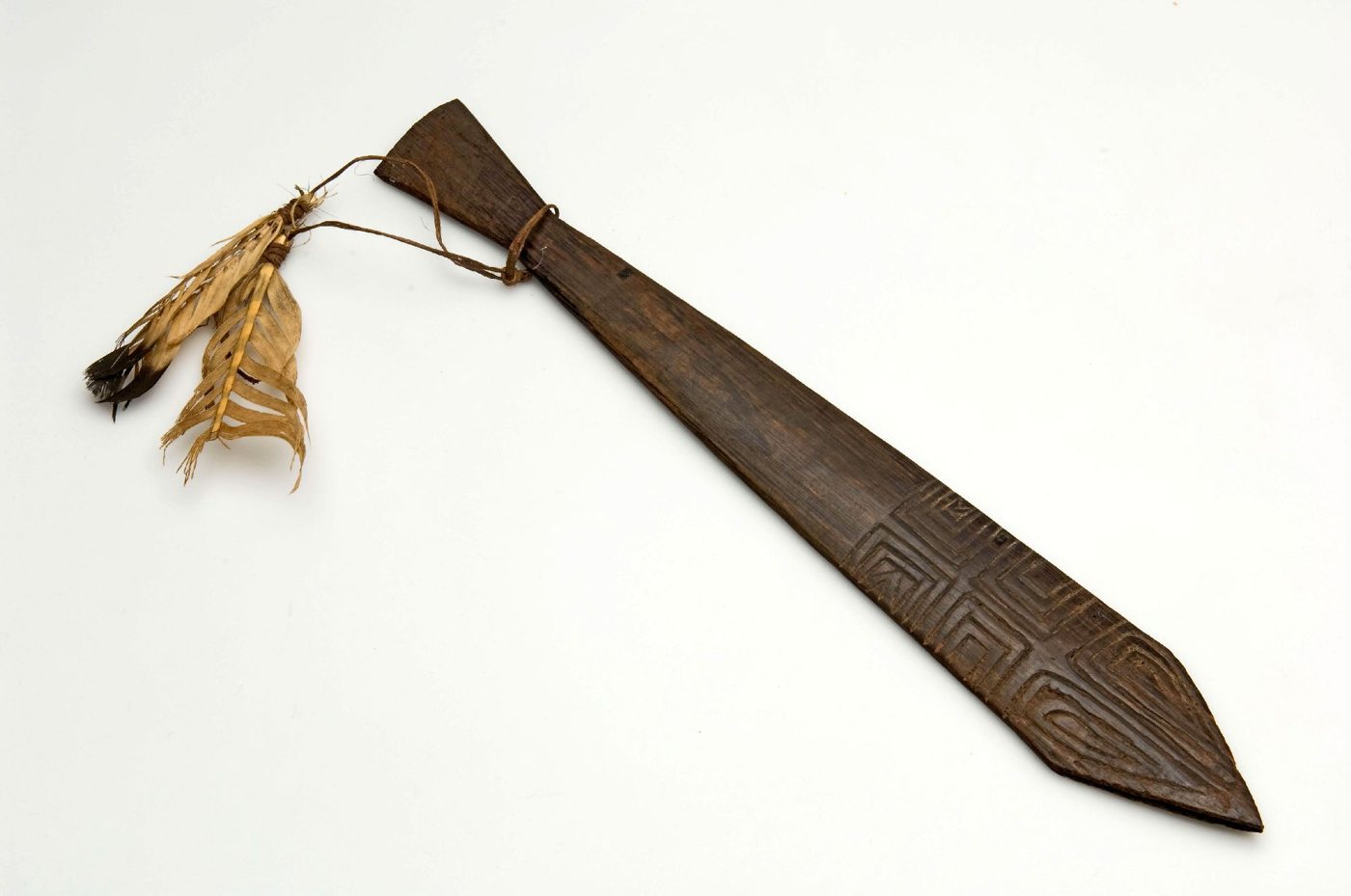
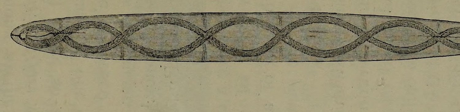
Across New Guinea and Australia, a flat blade whirled on a cord is the voice or body of an ancestral power. Its sound summons initiates, terrifies the uninitiated, governs access to sacred knowledge and marks the passage from boyhood. Women are often credited with discovering, birthing or first possessing it before men take control. Serpents, swallowing monsters, death and rebirth gather around its roar.
The bullroarer belonged to a travelling initiation complex. Across Australia, New Guinea and Melanesia, the secret blade spoke as a spirit, terrified women and children, accompanied bodily marking, and voiced a being who swallowed or killed the novice before returning him. The rites moved in both directions through northern Sahul, with each community choosing what to carry onward.
The continuity lies in the structure; the vitality lies in transformation. At the Huon Gulf, balum names both the blade and the being who swallows the boys. Among the Marind-anim of South Papua, sosom is both the roarer and the giant ancestor who receives initiates. In central Australia, the sacred board becomes an ancestor’s material body and a title to country. The same ritual grammar takes new names, myths, designs and political meanings as each community makes it its own.
Nggwal and Djanggawul
The closest mythic comparison joins the East Sepik of Papua New Guinea to Arnhem Land in northern Australia. At Ilahita, Nggwal was the highest power of a men’s cult built around the bullroarer. Its inner story remembered Mimi’unemb, the woman who made the first blade and produced a voice so enormous that a man killed her to possess it. In Arnhem Land, the Djanggawul sisters crossed the sea carrying sacred bags, ceremonies and the power to create life; men later stole the bags and performed the law with their contents.
The names lie along a longer road: Nggwal, nggwail, ngwal, piangwul, dunggul, Manggawila, djang, Djanggawul. So do the actions: women first own or generate sacred power; men appropriate it; the bullroarer makes ancestral authority audible; initiation turns seizure into law. Nggwal and Djanggawul belong to the related ritual worlds that formed, moved and separated across Old Sahul.
Continuity never means sameness. Ilahita, the Fly, Torres Strait, Cape York, Arnhem Land and central Australia made different social institutions from the wooden voice. A tradition stays recognizably related precisely because each people transforms it. Culture travels by becoming local.
How Sahul became two fields
Deep history and modern identity answer different questions. Before invasion, the peoples now gathered under the name Aboriginal Australia had their own nations, languages and countries. A continent-wide Aboriginal political identity became powerful inside a settler state that governed them as one racial category. Indigenous people turned that imposed category into solidarity while maintaining the older nations beneath it.
North of Torres Strait, a different colonial history produced different public identities. Britain and Germany partitioned eastern New Guinea; Australia governed Papua from 1906 and administered New Guinea after the First World War. Papua New Guinea became an independent Indigenous-majority nation in 1975. Aboriginal peoples remained within the Australian settler state. The modern umbrella identities formed around those different political histories.
Scholarship inherited the political division. Nineteenth-century ethnology cast Torres Strait as a racial frontier between a Papuan or Melanesian north and an Aboriginal Australian south. Ian McNiven writes that “Australia and New Guinea were conceptualised as two very different cultural realms with Torres Strait seen as an impervious boundary.” Universities, museums and national histories then built separate fields around the line. After Papua New Guinea’s independence, Australian history narrowed still further to the continent and Tasmania.
Torres Strait exposes the mismatch. Its peoples are not a bridge or mixture between two more important shores; they are makers of a distinct Islander world. Their canoes, marriages, exchange partners and ritual choices also joined a two-thousand-kilometre Coral Sea interaction sphere reaching southern New Guinea and northeastern Australia. Even the modern Australia–Papua New Guinea treaty draws an international border and then allows traditional inhabitants to cross it without passports for traditional activities. Sovereignty and social geography do not coincide.
The sea became a border because states and disciplines made it one. For Old Sahul, it was a road.
The two shores of Old Sahul
By 5,000 years ago, the modern outline was almost complete. Yet there was no moment when one cultural world became two. Genetics had begun differentiating populations long before the flood. Dabangay shows people inhabiting the new archipelago soon after it formed. Australian and Papuan language lineages met and reshaped one another in the Strait. The names bigu and bigo crossed the islands. Bullroarer rites carried the same wooden voice into radically different local worlds.
Old Sahul was never a single nation or a uniform culture. It was something both looser and deeper: a continent of many peoples whose histories unfolded in relation. The ocean altered every route without erasing the field of relationship. The nations are real. So are the older relations that exceed them.
Australia and New Guinea are the two surviving shores of one old cultural world: Sahul.
Discussed in Andrew Cutler, “Nggwal: The Cult That Crossed Sahul,” Vectors of Mind.
Key sources
Kurt Lambeck et al., “Sea level and global ice volumes from the Last Glacial Maximum to the Holocene” (2014), pp. 15296–15303 and fig. 4, for the ice-volume equivalent sea-level minimum around 21,000 years ago and the deglacial rise.
Alan N. Williams et al., “Sea-level change and demography during the last glacial termination” (2018), pp. 144–154, for the scale and speed of continental-shelf inundation.
Craig R. Sloss et al., “Holocene sea-level change and coastal landscape evolution in the southern Gulf of Carpentaria” (2018), pp. 1425–1426, for the Arafura sill and marine Gulf sequence.
Jessica M. Reeves et al., “The sedimentary record of palaeoenvironments and sea-level change in the Gulf of Carpentaria” (2008), pp. 3, 19–20 and fig. 1, for Lake Carpentaria’s maximum extent, western marine flooding and the later Pacific connection.
Geoffrey Hope & Ken Aplin, “Environmental Change in the Aru Islands” (2007), pp. 30–31, 36–38; Sue O’Connor et al., “Liang Nabulei Lisa” (2007), pp. 145–148; and “Liang Lemdubu” (2007), p. 195, for inhabited country on the Aru ridge and the archaeological record of the approaching sea.
Anthony Barham, Mike Rowland & Garrick Hitchcock, “Torres Strait Bepotaim” (2004), pp. 1, 41–42, for the land bridge to c.8,500 BP and the ensuing inundation.
Duncan Wright, Rod Mitchell & Bronnagh Norris, “Histories of Torres Strait Islander interaction and mythological geography” (2022), p. 2, for the estimated 9,000–7,500 cal BP breach interval.
Duncan Wright, Peter Hiscock & Ken Aplin, “Re-Excavation of Dabangay” (2013), pp. 15–16, 29, for mid-Holocene life on Mabuyag.
Tim Denham et al., “Origins of Agriculture at Kuk Swamp in the Highlands of New Guinea” (2003), pp. 189–192, for planting, drainage and early cultivation at Kuk.
Peter Hiscock et al., “World’s earliest ground-edge axe production coincides with human colonisation of Australia” (2016), pp. 2–3, 9–10, for early northern Australian invention and regional tool traditions within Sahul.
Anna-Sapfo Malaspinas et al., “A genomic history of Aboriginal Australia” (2016), pp. 207–214, for deep Sahul ancestry and directional Papuan-related gene flow.
Zoe Silcocks et al., “Indigenous Australian genomes show deep structure and rich novel variation” (2023), pp. 597–599, for prolonged early interaction and later isolation.
Nicole Pedro et al., “Papuan mitochondrial genomes and the settlement of Sahul” (2020), p. 884 and fig. 3, for late-Pleistocene north-to-south maternal-lineage movement.
Barry Alpher, Geoffrey O’Grady & Claire Bowern, “Western Torres Strait Language classification and development” (2008), pp. 16–18, 28, for the inherited Kala Lagaw Ya pronoun paradigm.
Nicholas Evans, “Australian languages reconsidered” (2005), pp. 254–256, for Papuan–Australian convergence in Torres Strait.
Antoinette Schapper, Lila San Roque & Rachel Hendery, “Tree, firewood and fire in Sahul” (2016), pp. 355–422, for a Sahul-wide semantic diffusion area.
Sidney H. Ray, Reports of the Cambridge Anthropological Expedition to Torres Straits, vol. III (1907), pp. 92, 128–129, 136, 172, for bigu, bigo, wainis and wanes.
Gunnar Landtman, The Folk-Tales of the Kiwai Papuans (1917), pp. 316–317, for Mete, Boigu and the first bigu.
Robert H. Lowie, Primitive Society (1920), p. 313; Edwin M. Loeb, Tribal Initiations and Secret Societies (1929), pp. 263, 285, for the early common-source account of bullroarer initiation complexes.
Ian J. McNiven, “Beyond bridge and barrier” (2022), pp. 25–29, 37–38, for Torres Strait as a co-constructed border zone and Coral Sea Cultural Interaction Sphere.
Don Tuzin, Unity in Duality: Social and Ritual Organization of the Ilahita Arapesh (1973), pp. 279–281, and The Voice of the Tambaran (1980), for Nggwal and the Ilahita bullroarer cult; Jim Metzner, Pulse of the Planet (1994), pp. 110–112, for Tuzin’s telling of Mimi’unemb.
Ronald M. Berndt, Djanggawul: An Aboriginal Religious Cult of North-Eastern Arnhem Land (1952), pp. 40–41, for the sisters, their sacred bags and men’s appropriation of the rite; W. E. H. Stanner, On Aboriginal Religion (1959–1963), pp. 142–147, 159–160, for the transferred Manggawila initiation.
Bain Attwood, The Making of the Aborigines (1989), pp. x–xii; Marcia Langton, Well, I Heard It on the Radio and I Saw It on the Television (1993), pp. 32–34, for Aboriginality as a political identity made relationally under colonisation.
Helen Gardner, Jonathan Ritchie & Brad Underhill, “The Moat of Oblivion: Australia and the Forgetting of Papua New Guinea” (2024), pp. 233–254, for the historiographical narrowing that followed independence.
Australian Parliamentary Education Office, “Administration of Papua”, for Australian colonial rule; Australian Department of Foreign Affairs and Trade, “The Torres Strait Treaty”, for passport-free traditional movement within the Protected Zone.