No. SPENCER1914-001
Ngalakan (Nullakun) Kunapippi bullroarer
Australia · Roper River · southern Arnhem Land (Ngalakan country)
Restricted
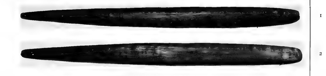
kunapippi
Source term: bull-roarer or kunapippi
kunapippi: Nullakun (Ngalakan) name for the sacred bullroarer, shared with the neighbouring Djauan and Mungarai — the regional Kunapipi/Gunabibi vocabulary; no literal meaning recorded for the Nullakun.
At the last stage of a Nullakun man's making, his guardian, the kinda, clapped both hands over the new bandari's eyes and ears at a special camp out in the bush. Men decorated with birds' down performed the totemic ceremonies of his own sub-class, and then — for the first time in his life — he was allowed to see the bull-roarer, the kunapippi. The women back in the main camp were told that its noise was the voice of Mumanna, the spirit who carries the boy away. Spencer photographed a Nullakun pair: two long blades of plain dark wood, left bare where the neighbouring Mungarai stippled theirs with spots. The Nullakun are today's Ngalakan of the Roper River country.
It is during the performance of these that, for the first time, he is allowed to see the bull-roarer or kunapippi, the noise made by which is supposed by the lubras to be the voice of a spirit called Mumanna, who takes the boy away during the initiation ceremony.
Spencer, Native Tribes of the Northern Territory of Australia (1914), p. 176
Particulars
- Object
- Pair photographed by Spencer: long, plain, dark tapering blades; no dimensions printed.
- Function
- Shown to the novice for the first time at the final stage of initiation, during the totemic ceremonies of his own sub-class; women are told its noise is the voice of the spirit Mumanna who takes the boy away.
Source
Baldwin Spencer, Native Tribes of the Northern Territory of Australia (London: Macmillan, 1914), p. 176 and pl. II figs. 1-2