Twelve Drowned Worlds
21,000–5,000 years ago
The coastlines on a modern map are young. At the close of the Ice Age the sea stood more than a hundred metres lower, and it came back up across country that people were living on — river plains, lake basins, walking routes, whole subcontinents with their own weather. Twelve of those landscapes are mapped on this page. Nine essays follow the people who were standing on them.
In almost none of those places is the flood remembered as a disaster. It is remembered as a hinge. The water takes one arrangement of the world apart and hands back another, and what the traditions care about — overwhelmingly, in every region — is the second one: the clans, the moieties, the surnames, the marriage law, the first ceremony, the division of the peoples and their languages.
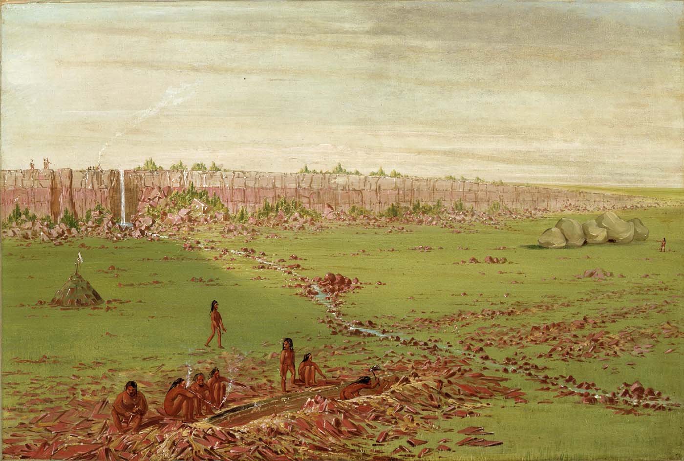
That is not an impression, and in one region it has been counted. Wang Xianzhao sorted two hundred and thirty-two flood texts from the minority peoples of southern China by how they finish, and seventy-nine per cent of them end by instituting something — the clans, the surnames, the division of the peoples, the marriage rule, the first ceremony. In the Xiangxi hills the sister bears a lump of flesh; it is cut up and scattered over the country, and where the pieces fell stood Wu and Long and Shi and Ma and Liao — still the five surnames of the Xiangxi Miao, and still the list against which every marriage in that country is arranged. In southern Brazil the Kayurukré and the Kamé drown, go into the mountain, dig their way back out by two separate roads and return as the two halves of Kaingang society, who marry each other’s daughters. On the Coteau des Prairies the nations climb one ridge together and their flesh becomes the red stone the peace pipe is cut from, which is why enemies quarry side by side there and no one owns the ground. And a sixth-century Syriac book keeps the men to the east of the ark and the women to the west, then says outright why it is telling you: that is how a congregation stands in church.
Those places are separated by oceans and by the whole span of recorded history, and they are all doing the same job. A flood myth is a charter with weather in it. The water is what has to be got out of the way before a world can be issued, and the world it issues is the one the teller is living in — which is exactly why these traditions were kept, retold and defended for as long as they stayed useful, long after the shoreline they open with had gone quiet.
The twelve landscapes
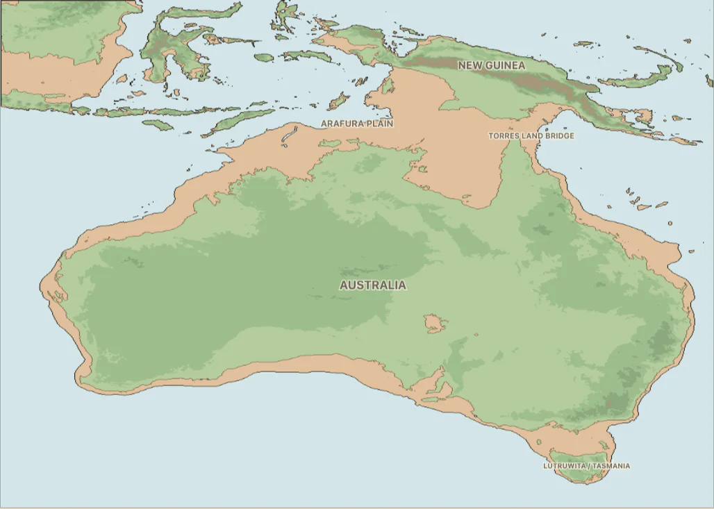
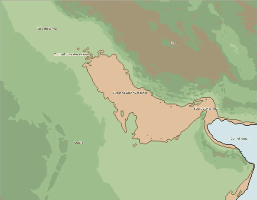
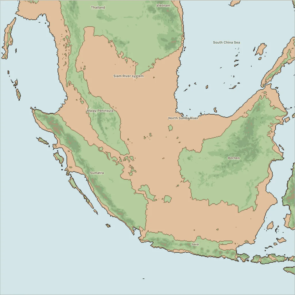
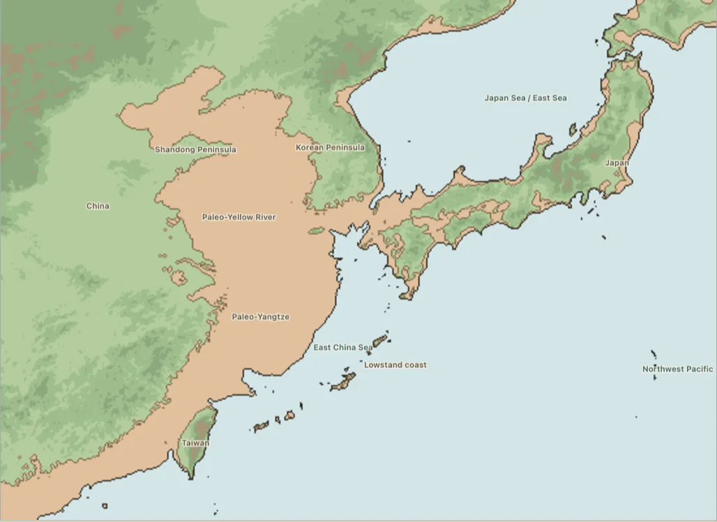
Each map shows an inhabited country the sea took.



The nine essays
Each essay maps every tradition it discusses, on the coast as it stood at the close of the Ice Age, with a slider that drowns the shelf while the places keep their numbers.
The world after the water
Twelve maps of what was lost, and nine essays about what was issued in its place. Read together they answer a question the maps cannot: why anybody bothered to remember. A drowned plain is not, on its own, the sort of thing an oral tradition holds for ten thousand years. Shorelines are hard to keep and easy to lose, and most of the world’s went. What survives that long is what people had reason to say out loud again every year — and in these traditions the shoreline comes attached to exactly that. The flood is why a Hopi Batki man lays out the cloud symbols at Mishongnovi. It is why the Ceramese are the Pata Siwa and the Pata Lima. It is why anyone at all may dig at Pipestone. The country went under, and the deed to the country that replaced it is still being read aloud.
Start where this atlas’s own subject walks into the flood: in Sahul, where the python who calls up the first monsoon is the bullroarer swung at his own ceremony, and where at the far end of the continent showing that instrument to the women is what brings the sea in. Then go to Sundaland, where a staff drawn across an isthmus becomes the Bali Strait and a permanent social boundary, and where the survivors come out of the water holding fire, crops, harvest law and ritual authority. East Asia tells the same flood at six sizes, from a patched sky down to a single pond, and nothing thins as the size drops. And South Asia states the rule outright, because there the survivor and the lawgiver are the same man: Manu comes down off the mountain, sits down, performs a sacrifice, and gets a lineage out of the offering. From the Himalaya to Bastar to Manipur the water leaves the descent groups, the marriage rule, the trade a family may practise, the animal a village may not eat, and in three places a whole country drained out of a lake and handed over.
Then cross to the Americas. North America has the closest published fits anywhere — Haida Gwaii reduced to an archipelago, salt-water diatoms high on the Tsinni Tsinni terrace, a marine arm far up the Fraser. South America runs from a dry Serpent’s Mouth at Trinidad to Selk’nam ancestors walking necks of land that later vanished, and asks after each one what people, food, fire and law came out the other side. And the Mediterranean Near East is where the writing starts: the survivor who buries his books at Sippar so knowledge can outlive its world, the altars set at the limit of the danger on Samothrace, and the sanctuary the Argives built at the line where the sea stopped.
Doggerland begins with a blank: no surviving tradition sits on the drowned country itself. That blank is the measure of what the other eleven landscapes kept. And Where the Flood Is Not Remembered turns that measure on the whole map. At the glacial maximum the Agulhas Bank south of the Cape was a grassland the size of Ireland, and the people who lost it left the richest un-missionised oral record taken down anywhere in Africa — thousands of pages from ǀXam speakers in Cape Town in the 1870s. Nothing in it remembers the plain. Sahul holds ninety-five of these traditions; Africa south of the Sahara holds one. A flood story is the one thing a better flood story overwrites, because the two want the same ground. Where the water rose and nothing came after it, the account is still being told — on the Sepik, in Arnhem Land, on the Sunda shelf, in the Kathmandu Valley, at the Point of Ayre on the Isle of Man. Where a book came, the book is there instead, and the mountain the ark landed on is the one you can see from the window.
Key sources
The nine essays carry the full apparatus for the traditions they map. These are the works behind the claims made on this page.
Wang Xianzhao, “The narrative art of flood myths among the southern minority peoples of China” (文北民族学院学报 2007, no. 1), for the classification of 232 texts and the seventy-nine per cent that end by instituting something; the five surnames of the Xiangxi Miao — Wu, Long, Shi, Ma and Liao — are at §4.
Telêmaco Borba, Actualidade Indígena (Curitiba, 1908), pp. 20–27, myth 1, for the Kayurukré and the Kamé digging their way out of the mountain by two separate roads and returning as the two halves of Kaingang society.
George Catlin, Letters and Notes on the Manners, Customs, and Condition of the North American Indians, vol. 2 (1841), for the pipestone tradition at p. 168 and the speech at the quarry at p. 174.
H. R. Voth, The Traditions of the Hopi (Field Columbian Museum Anthropological Series VIII, 1905), tale 11, p. 47, told by Sikanakpu, for the admission of the Batki and Sand clans at Mishongnovi.
P. van der Crab, De Moluksche Eilanden (1862), pp. 212–213, for the division of the Ceramese into Pata Siwa and Pata Lima and the naming of the Uliassers.
The Cave of Treasures in E. A. Wallis Budge’s translation, “The Third Thousand Years,” pp. 69–71, for the men to the east of the ark and the women to the west, and for the book’s own statement of why it says so.