Atlas Essay — 2026-08-14
Flood Myths of South Asia
The Himalaya, Kashmir and the Kathmandu Valley, the Tamil coast, the Andamans, Middle India and the northeastern hills

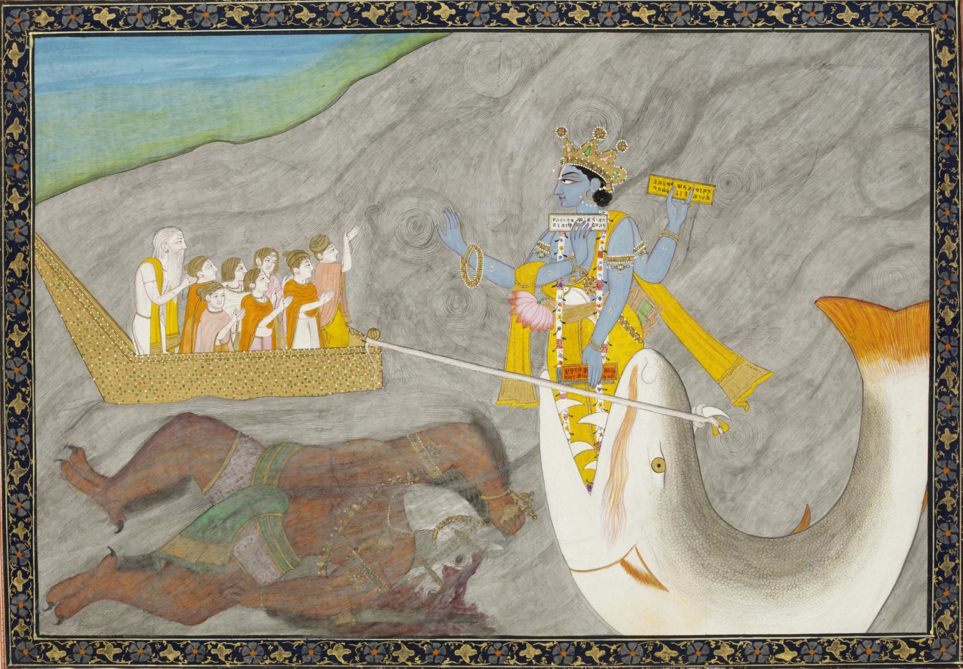
Manu is washing his hands when a fish swims into them and asks to be looked after. He keeps it in a jar, then a pit, then the sea; it warns him of the year; he builds a ship, ties the rope to the horn, and is towed north over a world with no land in it. When the water goes down he walks back down the mountain, and the Indian tradition remembers the name of the slope he came down by. What he does next is the point. He does not repopulate the earth. He sits down and performs a sacrifice, and out of the offering comes a daughter, and out of her comes the line — because Manu is the man whose name is on the lawbook. From the Himalaya to Bastar to Manipur, the water in South Asia is not there to destroy a world. It is there to leave one behind, furnished: the descent groups, the marriage rule, the trade a family may practise, the animal a village may not eat, and in three places a whole country, drained out of a lake and handed over.
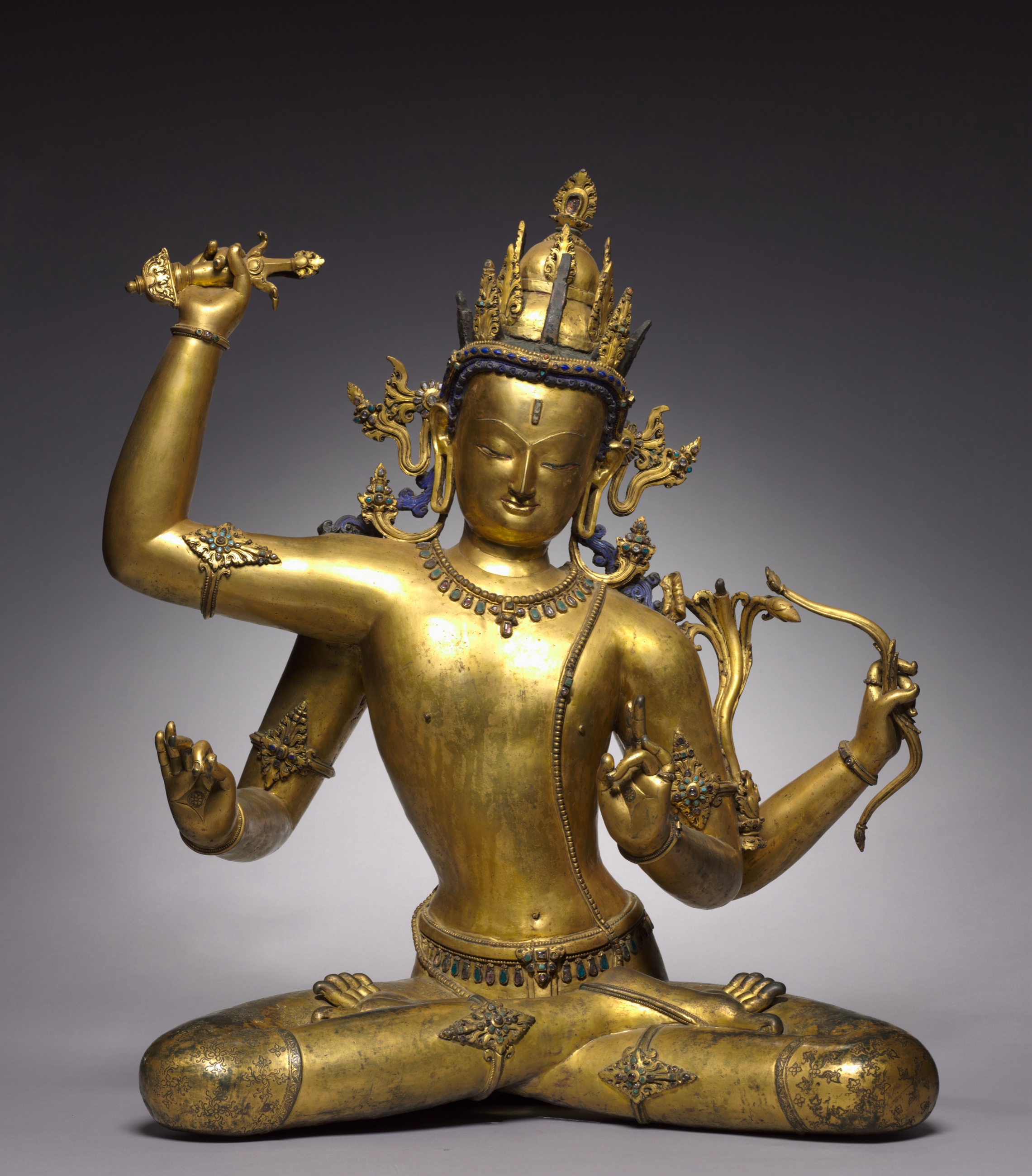
Manu ties his ship to a tree
The oldest flood in India is also the most domestic. It begins with a man washing before breakfast, and the whole cosmic apparatus — the destruction of every living creature, the survival of one — arrives inside a bargain struck between him and a fish that is small enough to hold. The Śatapatha Brāhmaṇa tells it without a wasted word. Julius Eggeling’s 1882 translation:
In the morning they brought to Manu water for washing, just as now also they (are wont to) bring (water) for washing the hands. When he was washing himself, a fish came into his hands.
It spake to him the word, ‘Rear me, I will save thee!’ ‘Wherefrom wilt thou save me?’ ‘A flood will carry away all these creatures: from that I will save thee!’ ‘How am I to rear thee?’
It said, ‘As long as we are small, there is great destruction for us: fish devours fish. Thou wilt first keep me in a jar. When I outgrow that, thou wilt dig a pit and keep me in it. When I outgrow that, thou wilt take me down to the sea, for then I shall be beyond destruction.’
… and when the flood had risen, he entered into the ship. The fish then swam up to him, and to its horn he tied the rope of the ship, and by that means he passed swiftly up to yonder northern mountain.
It then said, ‘I have saved thee. Fasten the ship to a tree; but let not the water cut thee off, whilst thou art on the mountain. As the water subsides, thou mayest gradually descend!’ Accordingly he gradually descended, and hence that (slope) of the northern mountain is called ‘Manu’s descent.’ The flood then swept away all these creatures, and Manu alone remained here.
Śatapatha Brāhmaṇa I.8.1.1–6, abridged, trans. Julius Eggeling, Sacred Books of the East XII (1882), pp. 216–218
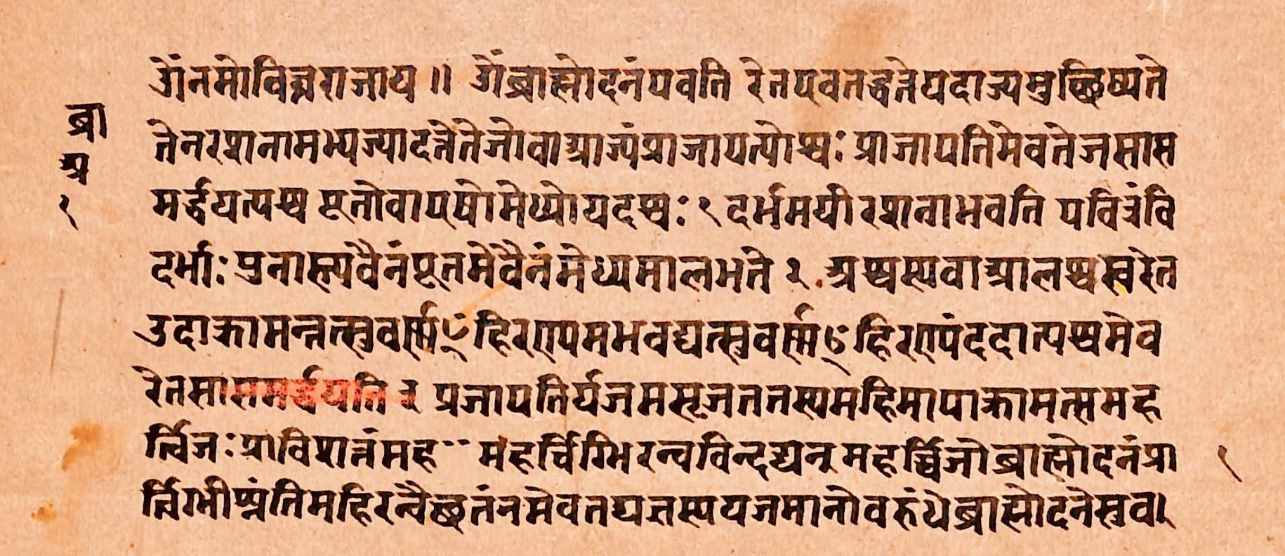
Two things in that passage do work the later versions cannot. The first is Manoravasarpaṇam, Manu’s Descent — a piece of ground with a name on it. Somebody, at some point, was walking on a slope in the northern mountains that was called after the man who came down it out of a flood. Nobody can now say which slope. What matters is that somebody could, and the impulse to fasten a universal deluge to a particular hillside is exactly what the rest of this map is made of.
The second is what Manu does when he gets down. He is alone, and he wants offspring, and the method he chooses is not the obvious one:
Being desirous of offspring, he engaged in worshipping and austerities. During this time he also performed a pāka-sacrifice: he offered up in the waters clarified butter, sour milk, whey, and curds. Thence a woman was produced in a year…
Śatapatha Brāhmaṇa I.8.1.7, same translation, p. 218
The woman is Iḍā, and through her Manu begets “this race, which is this race of Manu.” The first act of the new world is a ritual, correctly performed, and the human line comes out of the offering rather than out of a pair of survivors. That is a very unusual answer to the flood. Everywhere else on this map a man and a woman are left; here one man is left and he cooks.
By the time the story reaches the Mahābhārata it has acquired a crew. The seven sages are aboard, and the seeds of every living thing, and the fish is Brahmā; the ship is made fast to the highest peak of the Himalaya, and that peak is thereafter called Naubandhana, the Binding of the Ship. These are not two tellings of one text but two stages of an argument: the older has a solitary man and a named slope, the epic a rescued biosphere and a named summit. What survives both is the naming. The flood is over when a piece of the Himalaya is called after what happened on it.
“Fasten the ship to a tree; but let not the water cut thee off, whilst thou art on the mountain.” — Śatapatha Brāhmaṇa I.8.1.6, tr. Julius Eggeling
Three lakes let out to make three countries
Three times in South Asia the tradition says that a country people are standing in used to be under water, and that somebody opened the rim and let it out. In each place there was water behind the story; the hard question is when it left, and whether the tradition can be made to remember that event.
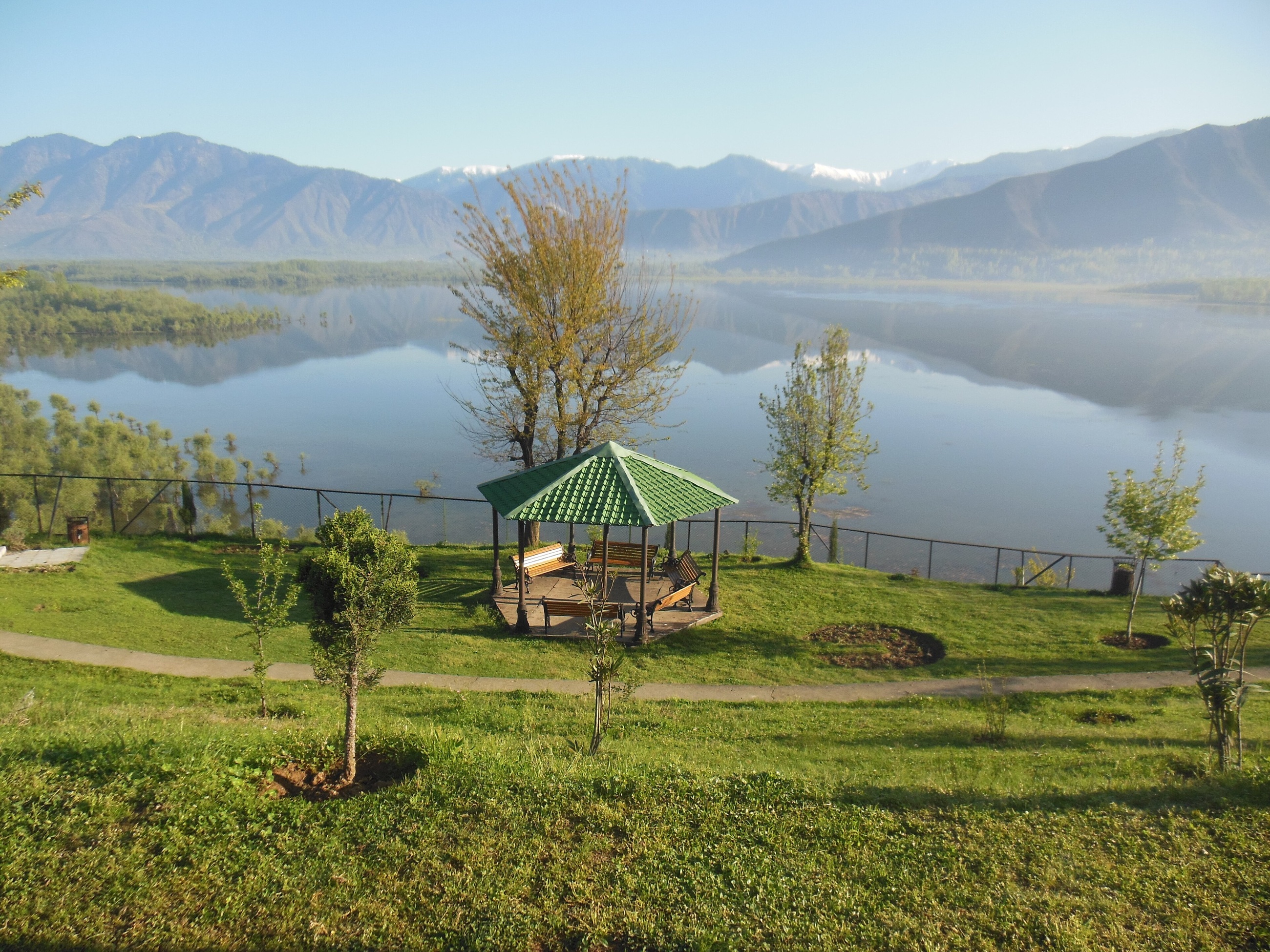
Kashmir was Satisar, and the water-born demon Jalodbhava held it. Ananta broke the enclosing mountain with his plough; the lake ran out through the gap; the demon was killed on the exposed floor, and the drained valley took its hermitages and its villages. Stand on the Kashmir valley floor and the wall of mountains goes all the way round. It is a lake bed and it is shaped like one, and the Nīlamata Purāṇa is describing what is in front of it. The Karewa deposits confirm a long-lived lake; Shah and colleagues say directly that the geological studies agree with the local tradition. The catch is the clock. Those lake sequences run from the Pliocene into the middle Pleistocene, which puts the draining of Satisar far outside the window this Atlas is testing.
The Kathmandu Valley is the same story with a better date. It was a lake full of nāgas, with a light standing over the water where Swayambhu now stands, and Mañjuśrī came to see the light and cut the southern rim of the valley with his sword so the water could get out. The cut is Chobhar Gorge, and you can walk to it. The lakebed became the valley floor, which is the most fertile ground in Nepal and holds more of its people than any other patch of ground its size.
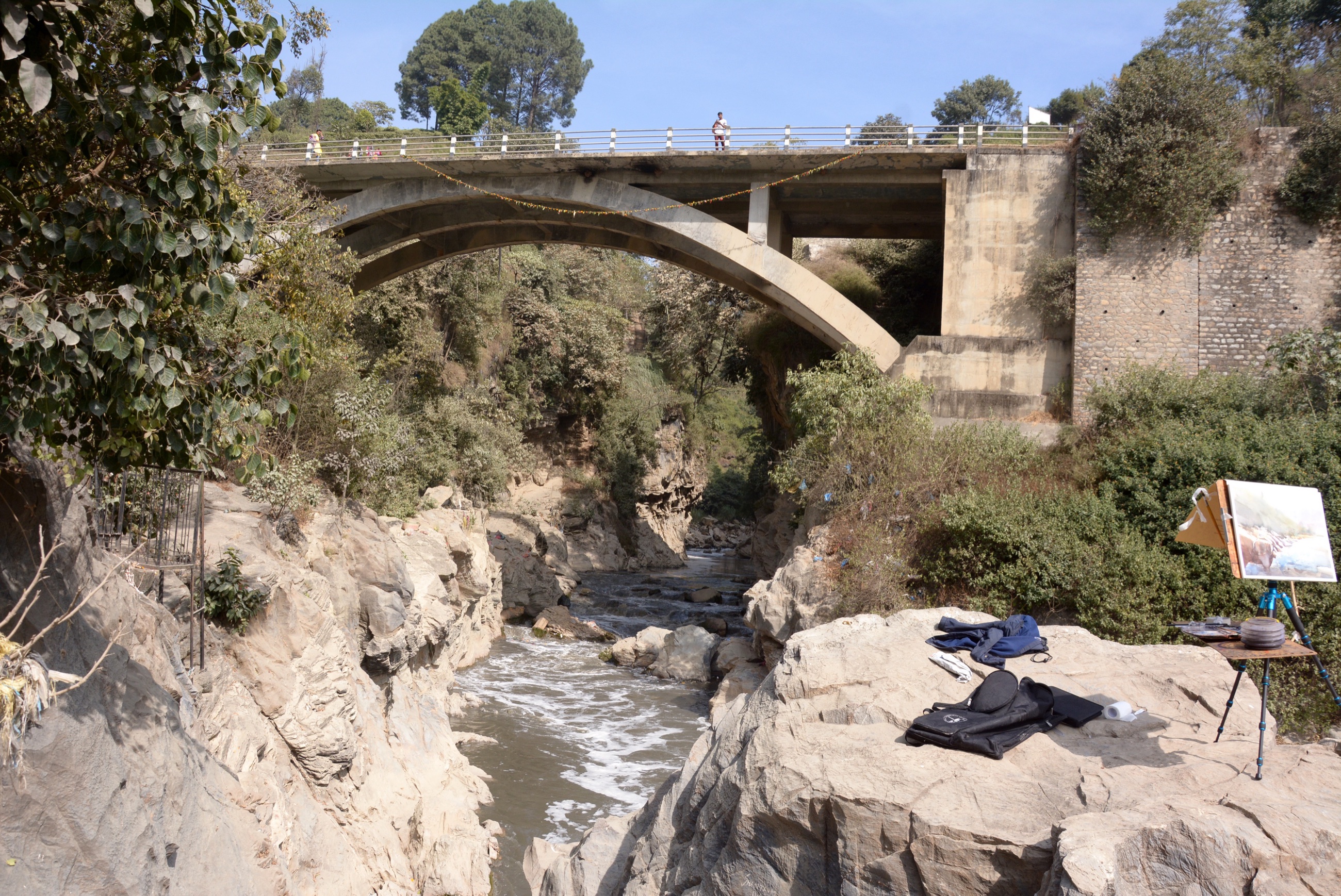
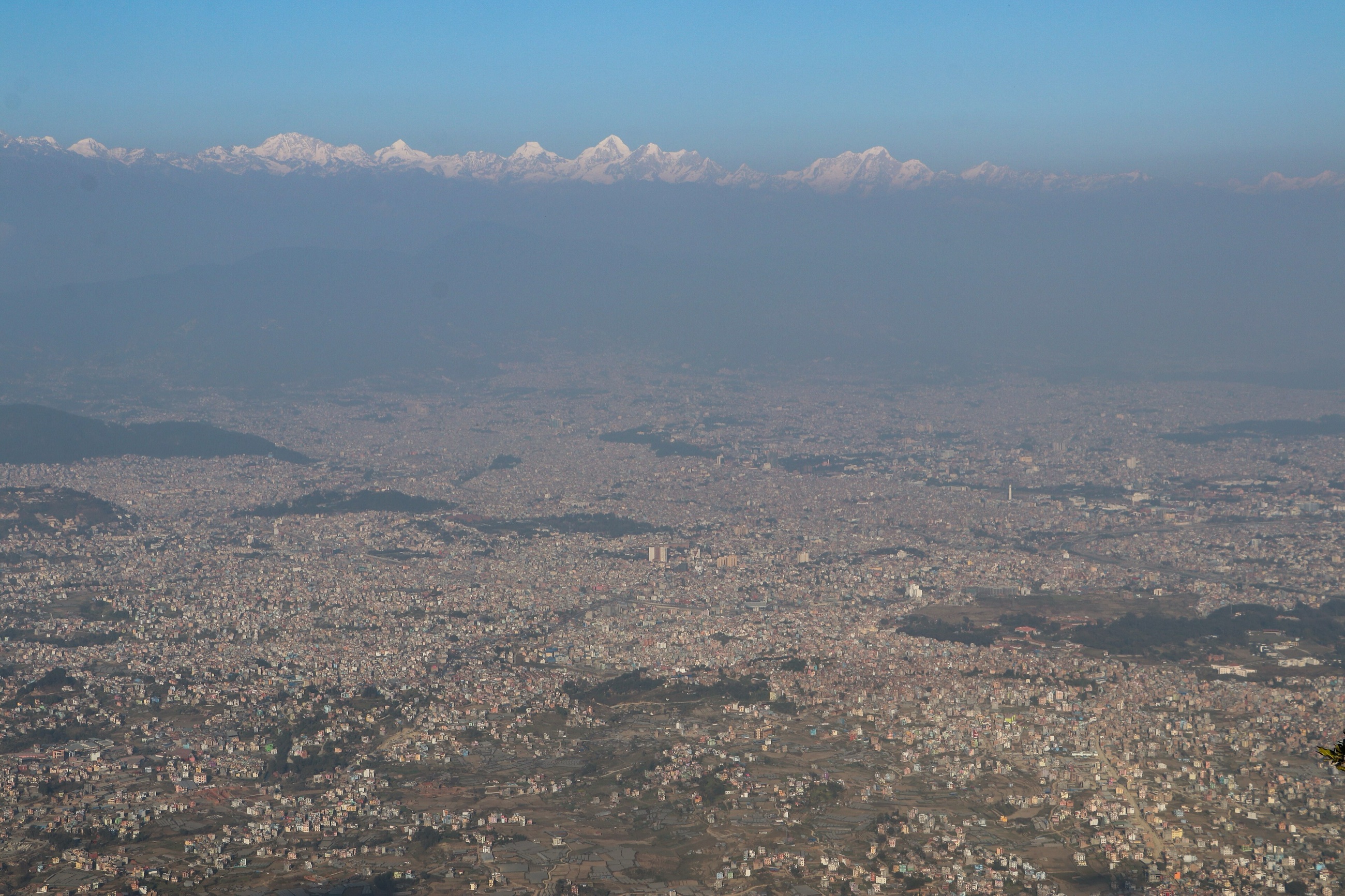
There really was a palaeo-Kathmandu lake, and unlike Satisar it did not disappear in deep geological time. Sakai and colleagues put the end of it at roughly twelve thousand years ago — inside the range of what a population can remember. Prabin Pranod Khatiwada makes the comparison between the Mañjuśrī account and the palaeolake record explicitly, and then adds the correction that matters: the Chobhar fault was real and mattered to the basin, but the final drainage went out farther south, near Danuwargaun. So the tradition has the event, and has it at close to the right time, and has put the door in the wrong place. That is about what ten millennia do to a memory of a landscape, and it is a great deal closer than it had to be.
East of both, the fourteenth-century Tibetan royal genealogy gives Kongpo the same beginning in one tight sequence. The mountains are forested, the valleys are full of water, the “arm of the Kong Chu” is opened, and the water runs away; the exposed plains become fields and towns. A later study sets that charter beside evidence for a glacially blocked lake in the Nyang Chu valley between about AD 200 and 800. Its authors also state the limit plainly: the imperial stories do not directly describe that palaeolake. Kongpo therefore belongs here as a named drainage tradition beside a published physical comparison, and remains an unfilled ring because the comparison is not a demonstrated memory.
Set the three side by side and the difference is instructive. Kashmir has the better story and no possible witness; Kathmandu has the drier story and a lake that drained while people were living around it; Kongpo has a concise medieval charter and a much later possible lake, but no direct identification between the two. None is a myth of destruction. All three are deeds of title: this valley is a country, and here is the moment it became habitable, and here is the being or opening that signed it over.
The gourd, and the earth brought back up
In Middle India the ark is a bottle gourd, and the flood’s real business begins after the water has gone.
Among the Bison-Horn Maria of southern Bastar, in Chhattisgarh in central India, Gajabhimul shuts Kawachi and Kuhrami inside a gourd when the first world drowns. It drifts until it grounds on a burning rock; a crow finds it, a crab searches it, and it is opened under a banyan. Then the world has to be made again from the bottom up — a boar finds a tortoise’s mound of mud, rolls in it and shakes it out over the rock until there is earth, and in some tellings the hills are the ridges a bear and a tiger leave behind them as they work the new ground over. Only then do the two survivors wander, meet without recognising one another, marry, and become the parents of the people. What arrives with them is the whole apparatus: the crops, the marriage rule, the descent groups, and what people owe each other.
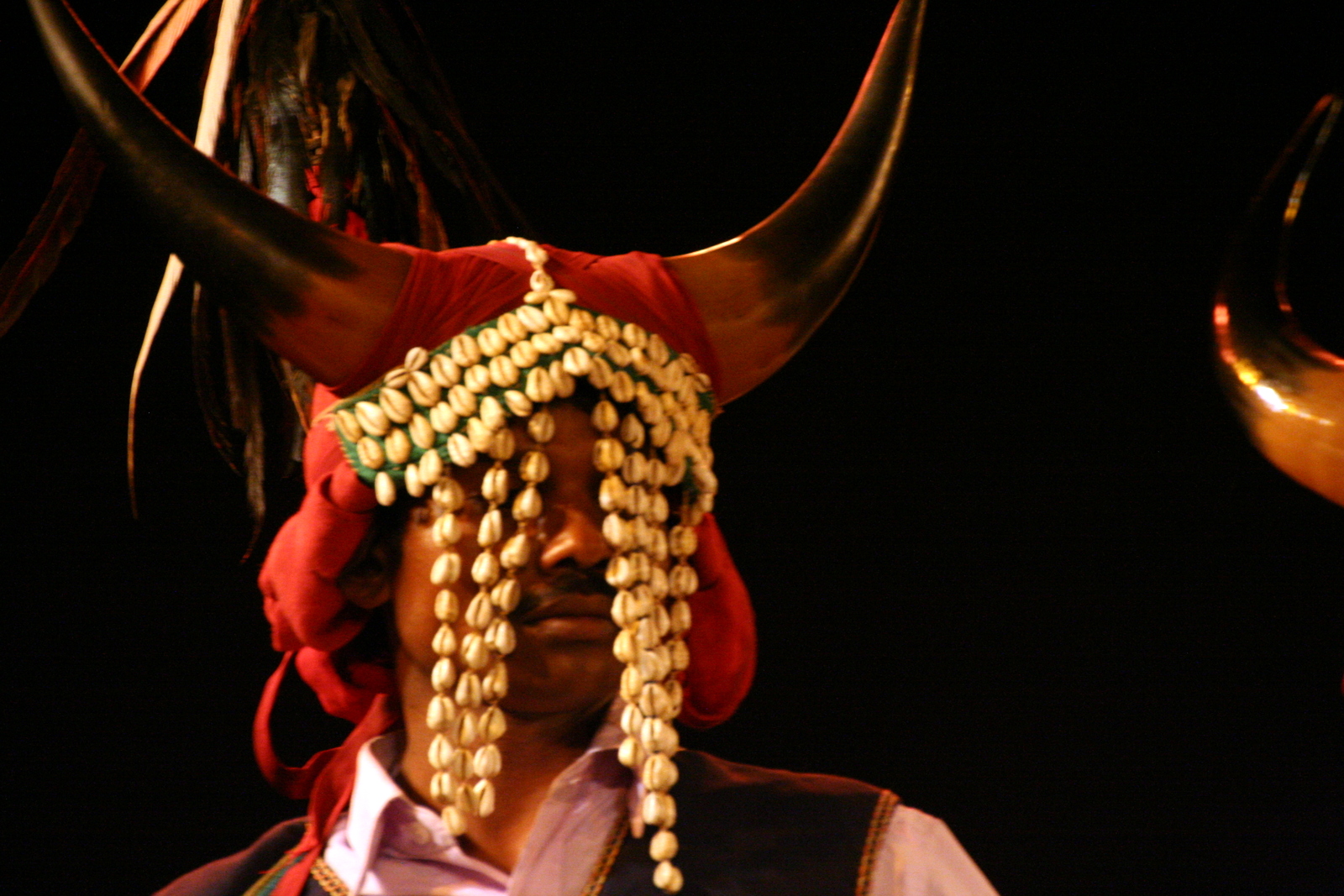
The Muria at Kanhargaon have the earth sink under the great waters until only the seven Koroho-Lingo brothers are left, and when the water drops they are cold and there is no fire; the story ends with Lingo sitting unburnt in the furnace, playing his instruments, and fire and cooking and music belong to the world that starts afterwards. The Lanjia Saora of the Odisha hills have the Dead pack a gourd with earth, seed, a brother and a sister; a crab brings up dirt for the new ground, and the Dead teach the survivors to clear forest and sow — and the story is explicit that the Saora were the first people, before castes and clans divided humankind. The Agaria of the central Indian iron-working belt, who smelt it, provision twelve gourds the size of houses before the water comes. On the new earth Bhagavan goes along tapping them, and nine are empty. One opens on twelve boys, a girl and every kind of iron tool; the next on bronze, the next on bell-metal, and those three become the Lohasur, the Tamesur and the Kansasur brothers. Most of the gourds hold nothing, which is the point: the metals are handed out, not inherited.

Four peoples, three gourds and an ark of brothers, and four different institutions carried through the water: kinship, fire and music, agriculture, and metal. The flood is a delivery mechanism. It is how the world’s furniture arrives.
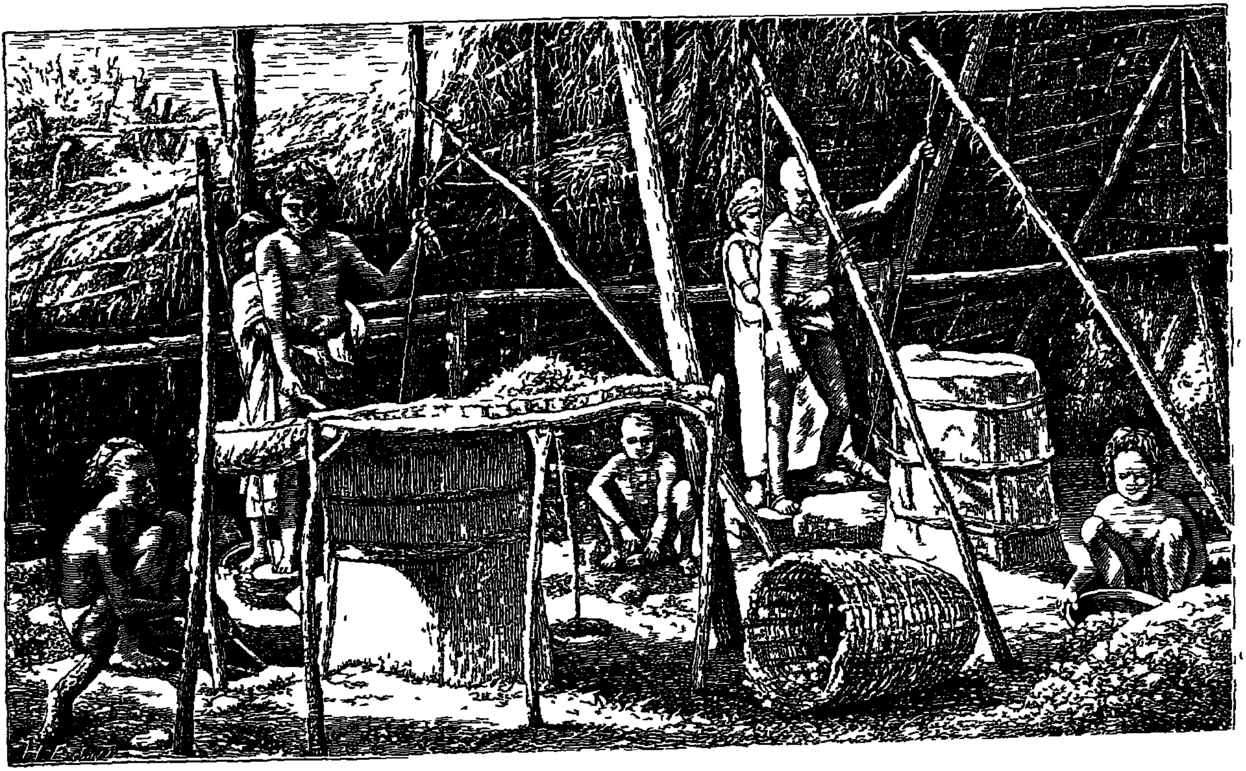
There is no drowned coast in any of them, no lake basin, no river that changed its course. Bastar is two hundred kilometres of hill country from the sea, and the water in these stories never once behaves like the sea. What they are is the clearest statement anywhere in South Asia of the thing the deluge is actually for.
The country south of Kumari
Tamil literature remembers a country the sea took. The Silappadikāram names the Pahruli River and mountainous Kumari — the southern tip of India, Kanyakumari on a modern map — as what the sea took; the commentators add the extent, and add that it took the first Sangam at Tenmaturai and the second at Kapatapuram, so that the academies of Tamil learning had to be reconvened at a third Madurai. The loss is written into the history of the poetry itself: the literature is a survivor of the water.
Offshore, in the Gulf of Mannar, the sea floor really does carry the drowned valleys of rivers that used to run there, mapped and staged by S. M. Ramasamy and colleagues at roughly fifteen, eleven, nine, eight and seven thousand years ago. That is a genuine drowned country, and it is the right kind of age. Ramasamy went on to name Kumari Kandam in connection with it; C. P. Rajendran answered that ordinary submerged valleys are not evidence of a lost continent. Both are right about their own half. There was a real coastal plain south of the Tamil country and the sea took it; there was never the continent-sized landmass that nineteenth-century Lemurian theory grafted onto the tradition and that modern popular writing still carries. Sumathi Ramaswamy has traced that graft in detail. The medieval Tamil texts contain no such continent. They describe a lost stretch of Pandyan coast, which is a modest claim, and which happens to be true.
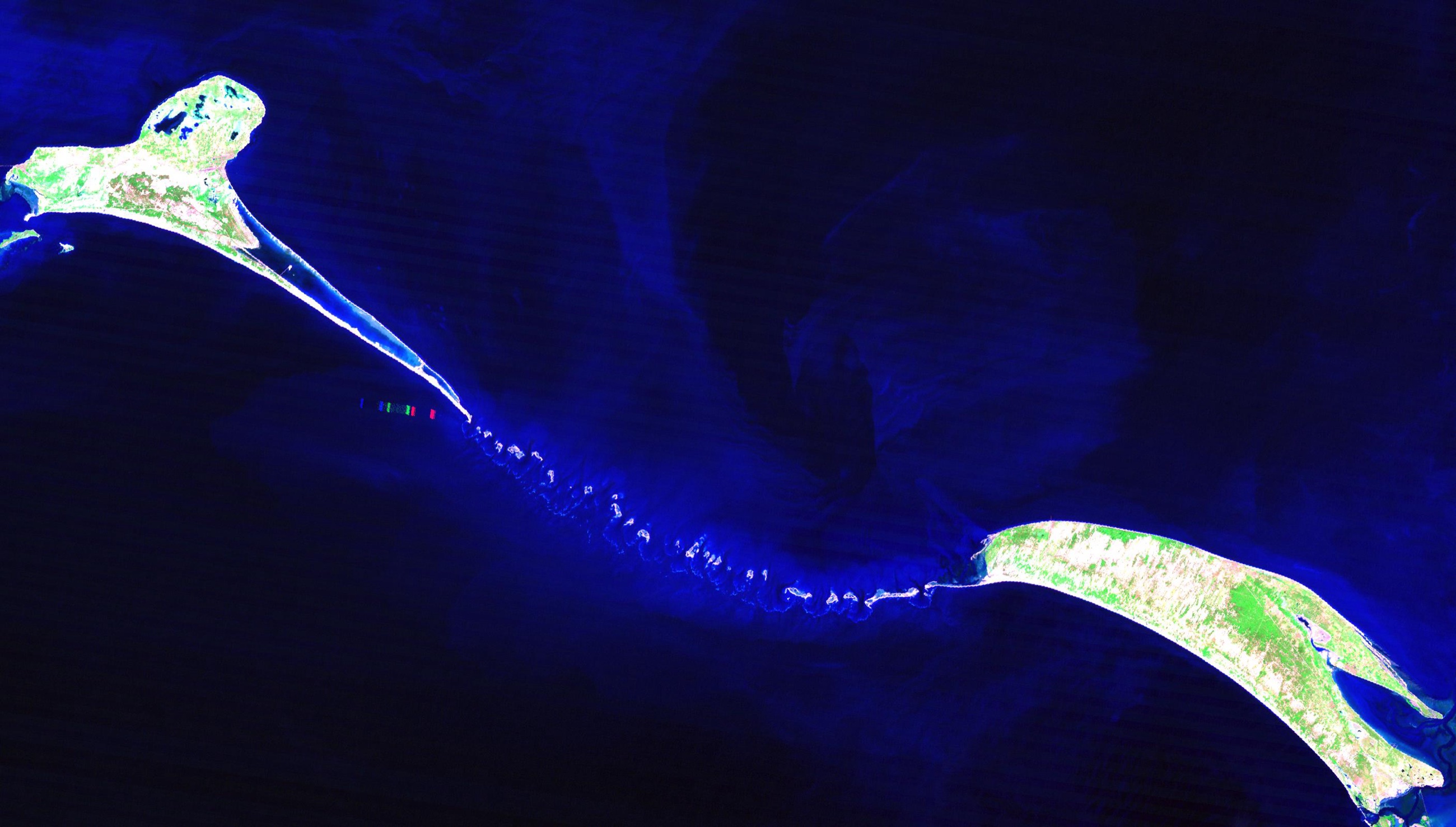
Two hundred and fifty kilometres up the same shore is the chain of shoals between India and Sri Lanka, Rama Setu. Here the geology is at its strongest and the epic is looking the other way. Quaternary work by Dubey and colleagues shows land and freshwater conditions across the connection through parts of the late Pleistocene, marine encroachment around 8,500 years ago, and the channels buried by roughly 7,500 to 7,000 — a walkable link, drowned inside the window. But the Rāmāyaṇa does not describe a land bridge sinking. It describes an army building one: Ocean grants a passage, Nala directs the work, trees and stones go into the water. The epic remembers a crossing being made where the geology remembers a crossing being lost. Two accounts of the same strip of seabed, pointing in opposite directions, and both of them right about what they saw.
Bain carries the fire uphill
The Akar-Bale of the Andaman Islands tell it of the first ancestors. A great storm rises over the ancestral land and the water comes over it. Sir Monitor Lizard, Duku, tries to carry a burning log up a tree and cannot manage it; his wife Lady Civet-cat, Bain, takes the fire from him and carries it to the top of a hill, and keeps it alight there until the rain stops and the water goes away.
What is saved is not people and not seed. It is a fire, and the hill it was saved on carries her name: Bain l’it-čapa, Bain’s fire, to the present day. In the related versions the flood is the hinge on which the world sorts itself out — human beings on one side, the animals and birds and fish on the other.
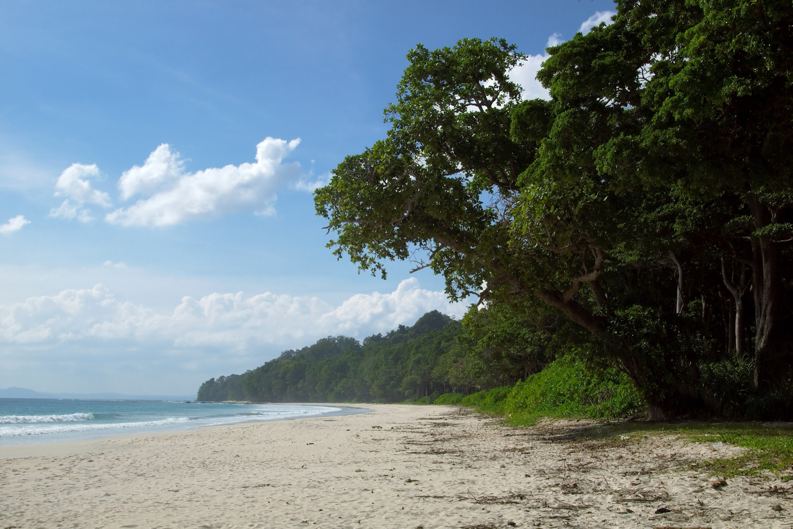
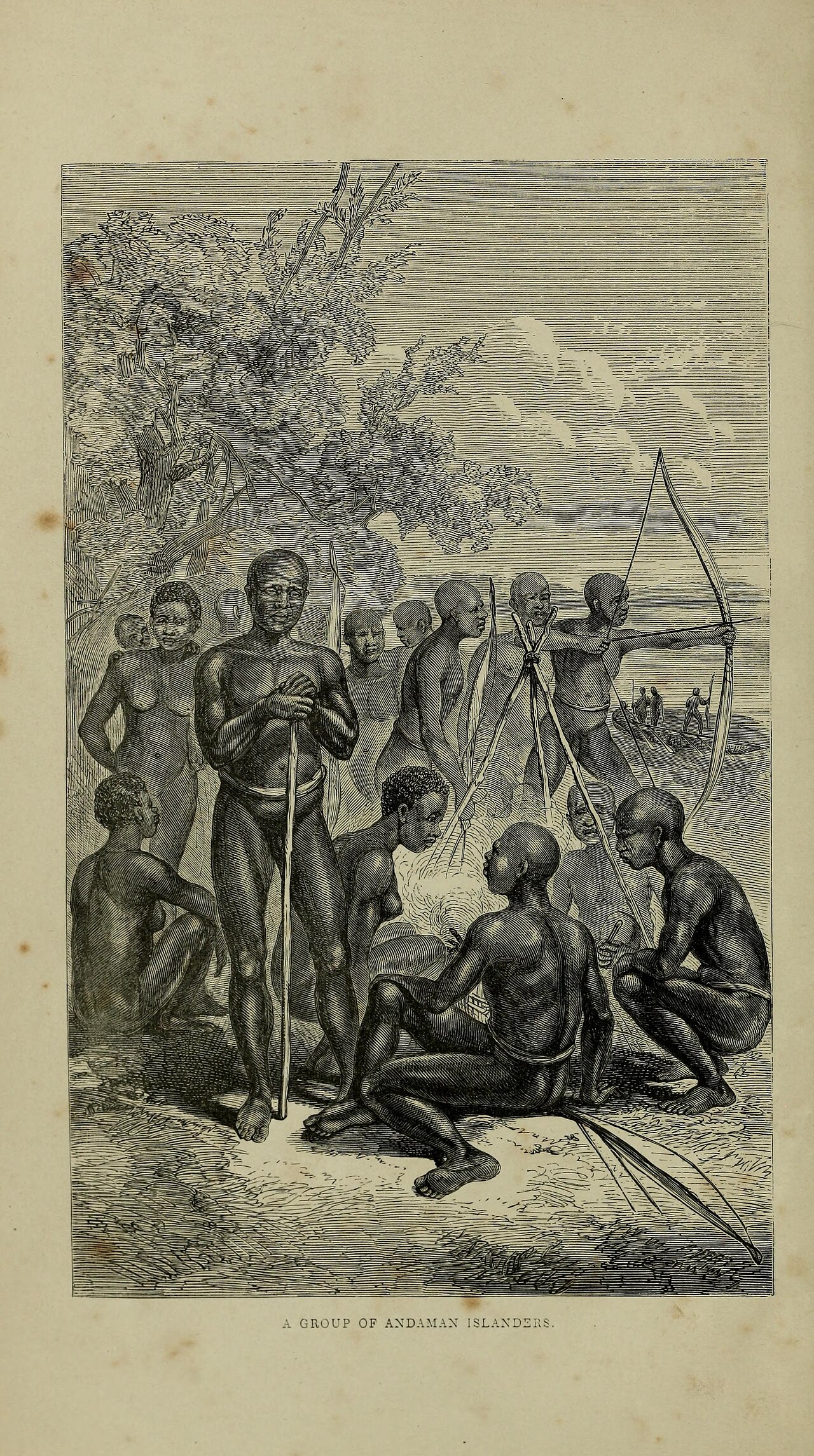
The islands were once bigger. Portman reported that a larger Andaman broke up and its peoples were sent off into separate territories; A. R. Radcliffe-Brown, who prints him in 1922, dismisses that as a tidied-up version of the islanders’ own accounts and reads the variants he collected as being about storms, fire and social order. The shelf, for its part, really was far larger at low sea level, and the islanders are among the longest-isolated populations on earth.
What the story plainly has is enough. A named landmark, a preserved fire, and a flood that separates the categories of the world — and a hill in the Andamans that is still called after the woman who carried the fire up it.
The hills the water cut
In the northeastern hills the flood does something it does almost nowhere else on this map: it does the landscaping.
The Lushei say the earth was smooth. The Water Huai pursued the girl Ngai-ti and drove all of humankind up onto the hill Phun-lu-buk, and to save themselves the people threw Ngai-ti into the water. The flood began to fall, and as it ran off it tore the smooth earth apart. The valleys and the high ridges of the country are the shape the retreating water left. Mizoram is a country of parallel knife-edge ridges. It looks drained rather than built.
On the Siang the landscaping is done by hand, and the builder has a name. There is a great flood and it covers the earth, and when it goes down the fish are left lying on dry ground. Shile Shido takes the hills and piles them along both sides of the river to shut it in for all time, and the fish fall back into the water and live. The Siang runs through one of the deepest cuts on earth on its way to becoming the Brahmaputra — and in the Minyong Adi account, that gorge is the hills Shile Shido raised along either bank to keep the water confined. The Siang is also the road the Himalaya’s greatest floods took. At the close of the Ice Age glaciers dammed the Yarlung Tsangpo above the gorge into a lake some 680 metres deep, and when the ice dams failed the water came down the Siang at one to five million cubic metres a second, cutting the gorge as it went. A flood that covers the earth and leaves the river shut between its hills for all time is what that country did.
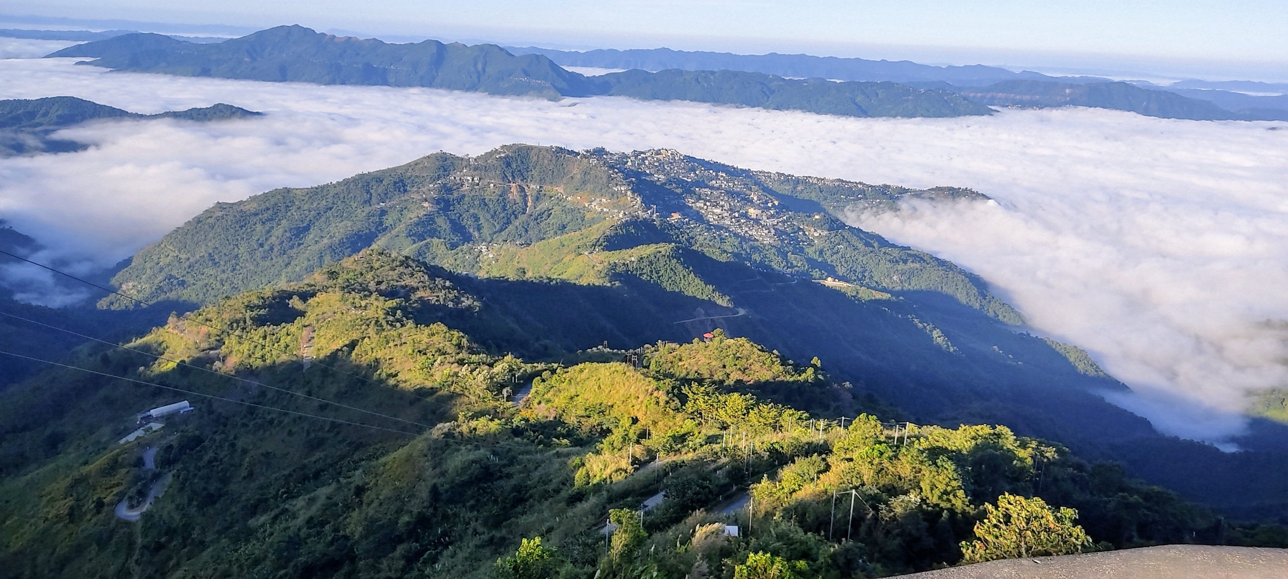
Around it the same water founds villages. At Leng Hill, in the Anal country on the Manipur–Mizo border, one man and one woman reach the summit and climb into a tree, and by morning they have turned into a tiger and a tigress; Pathian sends a second pair out of a cave, and it is they who ask for the strength to kill the tigers and start the world properly — so the first survivors are disqualified rather than rewarded. At Maram in Manipur, Medungasi and Simoting come through the flood and are permitted to marry on one condition — that their descendants never eat pig. Their sons become the ancestors of the village and its clans, and the rule is still kept. That is the whole machine in one sentence: a flood, a permission, a prohibition, and a village that exists because of all three.
Further west the Khasi tell it as a defeat. They had come down to Sylhet when a great flood drove them back up into the hills, and swimming the current the Khasi lost the book that carried writing, while the Bengali got his across. He came back to the hill country without it, and that is why one people has writing and the other does not. It is a flood that explains a homeland and a humiliation at once, and it is the only one on this map where what the water takes is a text.
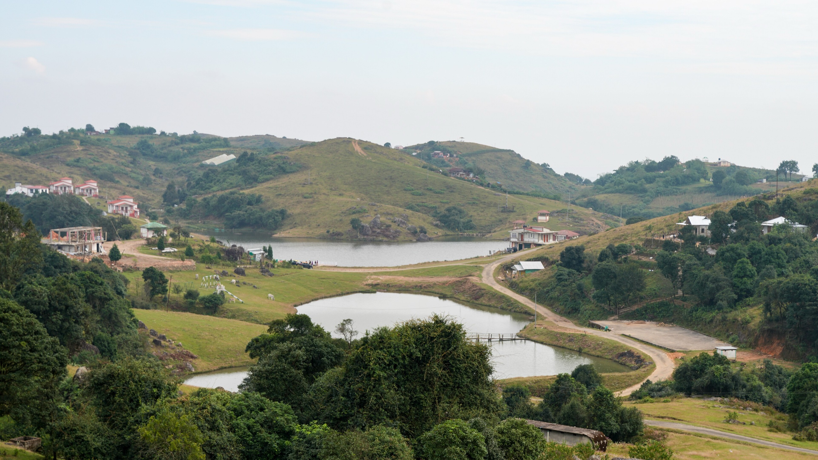
And on the Zungki, a river in Nagaland in India’s far northeast, the water speaks. The water had swallowed the fields and was at the villages, and no sacrifice would stop it, when a voice came out of the flood calling Thra, Thra. The old woman Thrasipi walked into the river and it drew back from every step she took. At the confluence she left her bamboo staff, which became a grove, and the grains from her meal, which became wild rice; both are still pointed out, and the junction carries her name. In scale this is a river flood and not a deluge, and the Sangtam tell it as one. But it is the only story in South Asia where the flood has a voice and someone answers it by walking in.
The water shut in among the hills
Along the eastern Himalaya, in the hill country between Assam and the Tibetan border, the flood arrives in a form that belongs to the mountains. There is no sea within a thousand kilometres and no coast to lose. What these traditions have instead is standing water held in by rock, and the moment it gets out.
The Apa Tanis say that when they first came into their country at Ziro they found it mud and water inside a ring of forest. They cut the forest, dug the water into channels and drained the swamp until there was ground to make fields on, and while they were draining it three buru came up out of the mud — great striped pig-like spirits, not animals — and were killed and buried. The valley they farm now, with the rice and the fish grown in the same water, is the swamp they emptied. Christoph von Fürer-Haimendorf, describing the place on its own account and not the story, wrote that Ziro had once been a lake standing far above the gorges on either side, silted up from the mountains around it and now drained by the Kele.
On Moklum Peak sits Lang, a great cock. On Rangokan, in the Patkai hills, sits Pu, a great snake. Below them water fills the country, and people have room to live only on the two summits. The cock and the snake dig through the enclosing hills by different routes. The trapped water pours down towards the plains, and the two cuts remain as rivers: the Tirap and the Namjin, the Dihing. A country confined to its mountaintops acquires two ways out.
The Bori put the beginning of the Siyom across the border in Tibet, at Tunker-Siddo. A sick spirit, Babing-Sunne, vomits and leaves a deep pond with no outlet. Years pass. Then Sedi-Botte falls into it by accident, and his splash breaks the bank. The water escapes between the hills and becomes the Siyom. The whole river begins with the failure of one enclosing wall.
Tallao, the Idu Mishmi name for the Brahmaputra, needs help to escape twice. First a worm digs a trickle out of her lake; a thirsty wild cat finds it too muddy, widens the channel and walks away with Tallao following. Then Drakub dams the new path with earth. Chainye tells him his wife is dead, but Drakub can get another wife. His son is dead: he can get another son. Only the death of his mother brings him away from the dam, because a mother cannot be replaced. Chainye tears down the obstruction, and Tallao winds through the mountains into Assam. Everywhere she passes, the people and animals dying of thirst revive.
The western Himalaya keeps the shut-in water too, and twice it is let out as a weapon. At Bari in Kinnaur the village god Nag — the serpent — rains until a lake stands in the valley, and Durga of Taranda dams the outlet with her own garment; when she takes the garment away, the departing floodwater flushes out the Thakurs who had been harassing the villagers. A goddess impounds the flood and releases it, and the release is the remedy. In the Katyur valley of Kumaon the lake has a demon in it who preys on the villagers, and Indra’s elephant Airavata bursts the embankment with its tusks; the water runs off, the demon can be beaten, and the valley is settled. And at Lamayuru in Ladakh the draining is itself the founding act: Naropa empties the lake, and the monastery stands on the floor the water gave up — in a basin geologists read as a genuine former lake.
Enclosed water becomes fields, or escapes through a channel that remains a river. It is the same event as a drowned coast turned inside out: instead of the sea arriving and taking the land, the water leaves and the land is handed over. And the Marring say the same thing about a valley rather than a river — that the Kabaw was almost all a lake when their seven men and seven women came up out of the earth at Mungsa, and that they went into the hills rather than live by it. R. Brown, who wrote it down in 1874, said the ground bore them out. The Manipur valley next door is a known Pleistocene and Holocene lake basin, and Loktak is what is left of it.
Mapped traditions
All mapped traditions
| No. | Place and tradition | What the story remembers | World after the water | Story and landscape | Source |
|---|---|---|---|---|---|
| The fish, the ship, and the place where Manu came down | |||||
| 1 | Manu’s Descent, the northern mountain — Early Vedic tradition | A small fish asks Manu for protection, then grows until it can carry him through the destruction it has foretold. It tows his ship beyond the northern mountain, and he ties the ship to a tree and waits while the water falls. | The slope he came down by was still called Manoravasarpaṇam, Manu’s Descent. He makes humanity again by sacrifice, and from the offering comes Iḍā, through whom the line continues. | The earliest reachable form of the Indian flood, and the only one that names the ground the survivor walked down. That name is a genuine landscape claim; it has no secure modern identification, and no scholar has argued that the passage preserves a particular Himalayan event. | Śatapatha Brāhmaṇa I.8.1.1–10, trans. Julius EggelingSacred Books of the East 12 (1882), pp. 216–218, especially §§5–10 |
| 2 | Naubandhana, the ship-binding peak — Sanskrit epic tradition | In the epic telling Manu does not sail alone: the seven sages and the seeds of future life are aboard, and the horned fish pulls the ship across a world with no land in it. | The ship is made fast to the highest peak of the Himalaya, which is called Naubandhana, the Binding of the Ship, from then on. The fish reveals himself as Brahmā and tells Manu to create living things again. | Two stages rather than two variants: the older telling has Manu alone and a named slope, the epic adds the sages, the seeds, the revelation and a named peak. No modern summit carries the name. | Mahābhārata, Vana Parva CLXXXVI, trans. Kisari Mohan Gangulip. 376; vulgate 3.187, critical edition 3.185 |
| Lakes let out to make a country | |||||
| 3 | Satisar and the outlet at Baramulla — Kashmiri tradition | Kashmir is a lake called Satisar, and the water-born demon Jalodbhava holds it. Ananta breaks the enclosing mountain with his plough, and the lake runs out through the gap. | The demon is killed on the drained floor, and the exposed valley receives its hermitages and its settlements. The country is what the water left when it went. | Shah and colleagues state plainly that the geological record agrees with the local tradition of a former lake, and the Karewa deposits do show one. The chronology is the problem: the principal lake sequences run from the Pliocene into the middle Pleistocene, so its disappearance is far older than the window this Atlas is testing. | Nīlamata Purāṇa 141–194; Kalhaṇa, Rājataraṅgiṇī I.25–27, trans. M. A. SteinNīlamata verses 167–180 and 192–194; geological comparison in Shah et al., Frontiers in Earth Science 6:179 (2018), p. 10 |
| 4 | Chobhar Gorge, Kathmandu Valley — Newar Buddhist tradition | The Kathmandu Valley is a lake full of nāgas, with a light standing over the water at Swayambhu. Mañjuśrī comes to see the light and cuts the southern rim of the valley with his sword so that the lake can escape. | The lakebed becomes fertile country. Swayambhu stands above it, people settle the floor, and the valley is a country because the water was let out of it. | There really was a palaeo-Kathmandu lake, and it really did disappear — Sakai and colleagues put the end of it around 12,000 years ago, inside this Atlas’s window. Khatiwada makes the comparison explicitly and then qualifies it: the Chobhar fault mattered to the basin, but the final drainage was farther south, near Danuwargaun. | Svayambhū Purāṇa, ch. 4; Prabin Pranod Khatiwada, “Geology of Kathmandu Valley”, GEOWORLD 5 (2014)Khatiwada at p. 65; palaeolake chronology in Sakai and colleagues |
| Coasts and islands the sea took | |||||
| 5 | The country south of Kumari — Tamil literary tradition | The sea takes the Pandyan land that lay between the Pahruli River and mountainous Kumari. In the commentary tradition it takes the first Sangam at Tenmaturai and the second at Kapatapuram with it. | Learning and kingship continue at a third Madurai. The drowned country is remembered as the place the literature came from, so the loss is written into the history of the poetry itself. | S. M. Ramasamy mapped drowned river valleys in the Gulf of Mannar and connected them to Kumari Kandam; C. P. Rajendran replied that ordinary submerged valleys have no bearing on a lost continent. What is secure is a real drowned shelf, a real medieval lost-country tradition, and a published but contested comparison between them. Lemuria is a nineteenth-century addition and forms no part of the Tamil texts. | Silappadikāram, Maduraikkandam XI.17–22, trans. V. R. Ramachandra Dikshitar (1939)with Nakkīrar’s Iraiyanār Akapporuḷ commentary, Aphorism 1; the layering set out in Sumathi Ramaswamy, The Lost Land of Lemuria, pp. 142–143 |
| 6 | Rama Setu, the shoals to Lanka — Indian and Sri Lankan sacred geography | Rama’s army reaches the sea with Lanka on the far side. Ocean permits a passage, Nala directs the work, and trees and stones are laid down until the army can cross. | The crossing is made and the war is fought. The chain of shoals is still there, almost entirely under water, and is still identified as the bridge. | The physical setting is as good as this Atlas gets: the shoals lie on a genuinely drowned connection, with land and freshwater conditions through parts of the late Pleistocene, marine encroachment around 8,500 years ago and channels buried by about 7,500–7,000. But the epic describes a bridge being built, not a land bridge sinking. No scholar has shown that it preserves a memory of the drowning, and that difference is the whole distance between a chain of shoals and a memory of one. | Vālmīki Rāmāyaṇa, Yuddha Kāṇḍa 6.22.49–68Quaternary reconstruction in Dubey et al., Quaternary Research 111 (2023), pp. 166–176 |
| 7 | Bain’s hill, Swaraj Dweep — Akar-Bale and wider Great Andaman traditions | A great storm rises over the ancestral land and the water comes over it. Duku the monitor lizard tries to carry a burning log up a tree; Bain the civet-cat takes it to the top of a hill and keeps it alive until the water goes down. | The fire survives at Bain’s hill, and the flood divides the old human world from the animals, the birds and the fish that come after it. In the wider island telling a once larger Andaman breaks apart and its people are sent into separate territories. | A tradition that says the islands were once larger and the peoples were separated by water is exactly the shape a drowned shelf would leave — and the Andaman shelf really was far larger. But Radcliffe-Brown treated the variants as accounts of storms, fire and social order, no scholar has tied Bain’s hill to a mapped shoreline, and cyclonic surge fits the text as well as sea-level rise does. | A. R. Radcliffe-Brown, The Andaman Islanders (1922)pp. 211–213, with the comparative analysis at pp. 344–351 |
| Middle India: the gourd, and the earth brought back up | |||||
| 8 | Southern Bastar — Bison-Horn Maria | When the first world drowns, Gajabhimul shuts Kawachi and Kuhrami inside a gourd. It drifts until it grounds on a burning rock; a crow finds it, a crab searches it, and it is opened under a banyan. | A boar finds a tortoise’s mound of mud, rolls in it, and shakes it out over the rock until there is earth again. The two survivors wander, meet without recognising each other, marry, and become the parents of the new people — and with them come the crops, the marriage rule, the descent groups and what people owe one another. | One of the most complete earth-remaking deluges recorded anywhere in India: the world is not merely survived, it is physically rebuilt and then socially furnished. There is no locatable drowned coast or lake basin in it, and the village the tellers name cannot be placed on a modern map, so the anchor is a regional one. | Verrier Elwin, Myths of Middle India (1949)pp. 30–32, texts I.4–7 |
| 9 | Kanhargaon, Bastar — Muria | The earth sinks under the great waters and only the seven Koroho-Lingo brothers are left. When the water drops they are cold and hungry, and there is no fire. | Lingo goes into the furnace and sits unburnt in the flames, playing his instruments. Fire, cooking, warmth and music all belong to the world that starts after the water. | A recovery-of-fire charter rather than a landscape claim: what the flood delivers is fire, cooking and music, and the world that can hold them. | Verrier Elwin, The Muria and Their Ghotul (1947)Myths of Middle India (1949), ch. IV, myth 13, p. 85, headed MURIA, Kanhargaon, Bastar State, and credited there to The Muria and Their Ghotul (1947), p. 262 |
| 10 | The Gajapati and Rayagada hills — Lanjia Saora | At the flood the Dead put earth, seed, and a brother and sister into a gourd. It floats over the water until the two can come out of it. | A crab brings up dirt for the new ground, and the Dead teach the survivors to clear forest and sow. The story makes the Saora the first people, before castes and clans divided humankind. | An agricultural charter as much as a flood: the point of the story is where cultivation came from and who had it first. No physical landscape claim, and the anchor is the broad Lanjia Saora homeland. | Verrier Elwin, Myths of Middle India (1949)pp. 43–44 |
| 11 | The central Indian iron-working belt — Agaria | Before the flood, twelve gourds the size of houses are provisioned. When the water destroys the world, the gourds ride it out. | On the new earth Bhagavan taps each one. Nine are empty. One breaks open on twelve boys, a girl and every kind of iron tool; the second on bronze, the third on bell-metal, and they are named the Lohasur, the Tamesur and the Kansasur brothers. The three metals and the rank of the men who work them are all handed out in one morning. | The gourd-ark turned into a charter for a craft and its hierarchy — the flood explains who exists and who smiths what, and it is careful that most of the gourds hold nothing, so that the metals are a gift and not an inheritance. The bellows are not aboard: the Agaria invent them afterwards, on land. This is the Raipur telling; Lohripur and Lohagarh, where the smiths come from, are places in the story rather than on a map. | Verrier Elwin, The Agaria (1942), the Raipur mythch. V, section VII, p. 111 |
| 12 | The Bondo Hills, Malkangiri, Odisha — Bondo / Remo | Rain never stops until the whole world is under water. A brother and sister survive in a gourd. | A boar brings up earth for the remade world, and the survivor pair begins the people again. | A full destruction-and-rebuilding deluge. Kadamguda, the historic locality in the collection, is not safely geocodable, so this is a regional Bondo Hills anchor. | Verrier Elwin, Myths of Middle India1949, ch. II, text I.8, pp. 32–33 |
| 13 | Simdega–Gumla country, Jharkhand — Kharia | Ponomosor sends a flood after people cut fruit trees. Most humankind dies, while a few escape to hilltops. | After eight days the water subsides and land appears again. | A world-destruction and recovery narrative with no claim to a particular drowned landscape. The point is a regional anchor for the Kharia concentration around Gumla and Simdega. | Verrier Elwin, Myths of Middle India, citing S. C. Roy, The Kharias1949, ch. II, pp. 26–27; Roy, The Kharias, pp. 414 ff. |
| 14 | Khariar–Bindranawagarh country — Kamar | For twelve years a deluge covers the world. A boy and a girl survive inside a hollow log provisioned against the water. | They become the ancestors of the post-flood world. | A regional Kamar anchor, because the source’s historic place names are not safely reducible to one village. Frazer notes that the bird episode may have been affected by missionary influence; that caution does not erase the independently described long deluge and survivor pair. | J. G. Frazer, Folklore in the Old Testament, vol. I1918, §8, p. 101, drawing on a Kamar account from the Raipur region |
| The northeastern hills: the shape of the land, the founding of villages | |||||
| 15 | The Khasi Hills, above Sylhet — Khasi | The Khasi have come down to Sylhet when a great flood drives them back towards the hills. Swimming the current, the Khasi loses the book that carried writing; the Bengali gets his across. | The Khasi returns to the hill country without the book, and that is why one people has writing and the other does not. The flood explains both the homeland and the loss. | An undated displacement-and-literacy charter with no published landscape identification, and it should not be attached to any historic Brahmaputra flood. | P. R. T. Gurdon, The Khasis (1907)p. 10 |
| 16 | Phun-lu-buk, the Lushai Hills — Lushei and Mizo | The Water Huai pursues the girl Ngai-ti, and the rising water drives all humankind up onto the hill Phun-lu-buk. To save themselves the people throw Ngai-ti into the flood, and it begins to fall. | The water tears the smooth earth apart as it runs off. The valleys and the high ridges of the Lushai country are the shape it left behind. | An unusually direct geomorphic claim: the tradition says in so many words that the present relief is the work of receding water. No scholar has matched it to a particular episode, and Phun-lu-buk is placed only somewhere far to the northeast, so the anchor is a broad cultural one. | J. Shakespear, The Lushei Kuki Clans (1912)p. 95 |
| 17 | Leng Hill, the Manipur–Mizo hills — Anal | The world floods, and one man and one woman reach the summit of Leng and climb into a tree above a clear pond. By morning they have become a tiger and a tigress. | Pathian sends a new man and woman out of a cave. They kill the tigers, settle the land, and become the parents of its people. | A repeopling charter in which the first survivors are disqualified rather than rewarded — the world begins again from a second pair, not the first. No physical comparison, and Leng’s location is not established, so the anchor is Anal territory rather than the hill itself. | J. Shakespear, The Lushei Kuki Clans (1912)pp. 176–177 |
| 18 | Maram village, Manipur — Maram Naga | Medungasi and Simoting live through a flood that takes everyone else. A god allows them to marry, on one condition: their descendants must not eat pig. | Their sons become the ancestors of Maram village and its clans. The flood is where the kinship, the settlement and the food rule all start, and the rule is still kept. | A village-and-taboo charter with no environmental detail and no changed-landscape claim. Its value is that the flood is made to carry a prohibition people still observe. | T. C. Hodson, The Naga Tribes of Manipur (1911)pp. 13–14 |
| 19 | Thrasipekho, on the Zungki — Sangtam Naga | The river has swallowed the fields and is at the villages, and no sacrifice stops it. Then a voice comes out of the flood calling “Thra, Thra”, and the old woman Thrasipi walks into the water. It draws back from every step she takes. | At the confluence she leaves her bamboo staff, which becomes a grove, and the grains from her meal, which become wild rice. Both are still pointed out, and the junction carries her name. | In scale and action this is a river-flood charter rather than a world deluge. What sets it apart is that the flood has a voice and a named woman answers it by walking into the water, and that what it leaves behind is checkable: a grove, a stand of wild rice, and the name on a river junction. | The Legend of Thrasipi, a Sangtam folktaleAthing Sangtam of Mutsandang, recorded 28 August 2025; fuller transcription by Vehutalu Vero |
| The eastern Himalaya: the lakes that were let out | |||||
| 20 | The Ziro valley, Lower Subansiri — Apa Tani | When the Apa Tanis first come into their country they find it all mud and water inside a ring of forest. They cut the forest, dig the water into channels and drain the swamp until there is ground to make fields on. While they are draining it three buru come up out of the mud — great striped pig-like spirits, not animals — and the people kill them and bury them. | The wet bowl becomes the terraced valley the Apa Tanis farm now, where the rice and the fish are grown in the same water. The country is not found, it is drained; and the draining is the founding. | Christoph von Fürer-Haimendorf, describing the valley on its own and not the story, wrote that it had once been a lake standing far above the gorges on either side, silted up from the mountains around it and now drained by the Kele. Pleistocene clay, sand and thin peat are recorded in the basin. At fifteen hundred metres no sea reached Ziro; what the tradition holds is a highland lake that went, which is the other half of what this Atlas tracks. | Verrier Elwin, Myths of the North-East Frontier of India (1958)pp. 430–431, tale 74, from Reru in the Subansiri; the valley as a former lake in C. von Fürer-Haimendorf, The Apa Tanis and their Neighbours (1962) |
| 21 | The Patkai and Moklum Peak — Moklum | A great mass of water is shut in among the hills, and people live on two summits only: Rangokan, which is the Patkai, and Moklum. On Moklum sits the great cock Lang and on Rangokan the great snake Pu. The cock and the snake agree to let the water out, and dig through the hills by two different ways. | The water pours down towards the plains through both cuts. One is the Tirap; the other is the Namjin, which Elwin identifies as the Dihing. Two named rivers continue along the routes the cock and snake opened. | A lake held in by hills, opened by two channels, leaving two named rivers running to a named plain: that is an outburst told as a story. The Patkai basins drain steeply to the Brahmaputra, and outlet-cutting of this kind is ordinary there. Elwin grouped the tale with the other frontier accounts of how rivers first began to flow through the obstacles in front of them. | Verrier Elwin, Myths of the North-East Frontier of India (1958)pp. 77–78, ch. V (Water), tale 13, from Longke in the Tirap; printed p. 78 explicitly identifies Namjin as Dihing |
| 22 | Tunker-Siddo and the Siyom — Bori | At first there is no water. The spirit Babing-Sunne falls sick and vomits, making a deep pond at Tunker-Siddo in Mimet, Tibet. None of its water flows out. Years later another spirit, Sedi-Botte, falls in by accident; his splash breaks the bank and releases the water. | The escaping water runs down between the hills as the Siyom, the river that still bears that name. A closed pond becomes a permanent Himalayan river. | A named standing water opened by a broken bank, leaving a named Himalayan river: the shape of a glacial-lake outburst. The Siyom rises on the ice-and-lake margin toward Tibet, and the system has held glacial lakes. The spirit’s sickness is the frame; the burst bank and the river are the landscape. | Verrier Elwin, Myths of the North-East Frontier of India (1958)p. 69, ch. V (Water), tale 2, from Gatte in the Siang; source places Tunker-Siddo in Mimet (Tibet) |
| 23 | The Siang gorge — Minyong Adi | A great flood in the Siang, also called the Dihang, covers the earth. When it subsides, fish lie stranded on the ground. | Shile Shido, also called Shedi Melo, piles hills along both sides of the river to keep it confined. The fish fall back into the water and regain life. The riverbanks become the permanent work of the spirit who saved them. | The Siang is the outlet of the greatest floods the Himalaya has known. At the close of the Ice Age glaciers dammed the Yarlung Tsangpo above its gorge into a lake some 680 metres deep; David Montgomery and colleagues date its high shorelines to about ten thousand years ago and reckon that its failures sent one to five million cubic metres of water a second down the gorge, among the most erosive events in recent Earth history. Karl Lang and colleagues argue that megafloods of this kind helped carve the gorge itself. The Minyong flood in the Siang covers the earth, strands the fish, and ends with the river locked between its hills for all time. | G. D. S. Dunbar, “Abors and Galongs”, Memoirs of the Asiatic Society of Bengal 5, extra number (1915)Dunbar (1915), printed pp. 63–64; reprinted by Elwin (1958), p. 313, tale 8; the Tsangpo palaeolakes in Montgomery et al., Quaternary Research 62 (2004), pp. 201–207, and Lang et al., Geology 41 (2013), pp. 1003–1006 |
| 24 | Mungsa, at the foot of the Hirok range — Marring | Seven men and seven women come up out of the earth at Mungsa, under the hills at the edge of the Kabaw valley. They are not satisfied with the plain and move as one body into the hills, and they have lived there since. Their tradition is that the Kabaw valley was then almost all a vast lake. | The hills are settled and the valley is left. Some Marrings add that part of the tribe sat first at Haubum Maruk and at Laisangkhong in the Manipur valley and left both because of the amount of water then standing in it. No Marrings live in the valley now. | R. Brown, who recorded it, said the ground at Mungsa bore the tradition out: a narrow strip of high forest under the hills and then a much lower plain to the east. The Manipur valley is a known Pleistocene and Holocene lake basin of which Loktak is what is left, and Kabaw is an alluvial trough on the Chindwin side. This is not a drowned coast at eight hundred metres; it is a named plain that stood under water and is now walked on. | R. Brown, Statistical Account of the Native State of Manipur (1874)pp. 43–44, “Origin of the Murring Tribe” |
| 25 | Nimtubram and the Tallao — Idu Mishmi | Tallao, the Brahmaputra and sister of the Sun, is shut in a great lake at Nimtubram while people and animals elsewhere faint for lack of water. A thirsty worm digs a trickle out; a wild cat finds it too muddy to drink and cuts a larger channel. Tallao follows him. Drakub builds an earth dam across her path, and Chainye tries three times to lure him away. | News of a dead wife does not move Drakub: he can find another. Nor does news of a dead son. Only when Chainye says his mother has died does he leave. Chainye breaks the dam, and Tallao winds through the mountains into the Assam plains, reviving people and animals wherever her water reaches. | An enclosed highland lake opened by a cut channel, after which the great river holds its present course from the mountains to the plain. The eastern Himalayan syntaxis, where the Yarlung, the Siang and the Lohit come together, is exactly the country that held and released lakes of this kind: glacier-dammed lakes above the Tsangpo gorge drained catastrophically after the Ice Age and sent their water down to Assam by Tallao’s road. | Verrier Elwin, Myths of the North-East Frontier of India (1958)pp. 74–75, ch. V (Water), tale 9, from Harangam in the Lohit |
| Peninsular and western India: refuges above the rising water | |||||
| 26 | Mannarkkad / Attappady, Kerala — Irular | Floodwater destroys the world, but Pattan and Kanni survive in a hollowed churraka, a bottle gourd, with animals, seed, grain, herbs and saplings. | When the water falls, the survivors begin the world again; the Irular identify themselves as Pattan’s descendants. | A local survival-and-repopulation flood attached to an Irular homeland, not evidence for a particular Kerala flood or sea-level event. The reachable retelling identifies a 2008 record from an Irula villager as its source. | Chitra Soundar, Pattan’s Pumpkin: An Indian Flood Story2016, author’s note, citing Philipose Vaidyar, A Peep into the Tribalscape (2008), told by an Irula villager; locality and source trail confirmed in the Reading Is Fundamental teaching packet, p. 1 |
| 27 | Kari Hill, Parambikulam–Nelliampathy, Kerala — Kadar / Kadan | The Ocean in the West rises through the earth until it reaches two holes high on Kari Hill. Malavay and Malakuratti come out from their underground dwelling through them. | The visible world begins with their emergence from a land threatened by rising water. | A landmarked rising-water origin account, not an ark story or evidence for a datable inundation. Von Ehrenfels’s study calls the community Kadar while using Kadan in its title. | U. R. von Ehrenfels, “A Kadan Creation-Myth”Anthropos 45 (1950), pp. 167–168 |
| 28 | Pavagadh Hill, Gujarat — Pawra / Bhil common-origin tradition | A deluge strikes the region. As the water begins to recede, the siblings Dedla and Dedli make their way to Pavagadh. | Their tears become the common beginning of Bhils and Pawras. | A field-recorded origin charter with a named refuge, not a seasonal flood or a claim about Pavagadh’s geological history. | Panchanan Mohanty, Sonal Kulkarni-Joshi and S. Imtiaz Hasnain, “Prolegomenon to the Bhil and Pawra Relations in West Khandesh”Indian Linguistics 74.1–2 (2013), p. 100; Pawra informant from Rewanagar, Nandurbar |
| 29 | Aravalli foothills, northern Gujarat — Dungri Garasiya | Overpopulation and famine are followed by a deluge that consumes the whole population except Kaavo and Kaavi. | The surviving pair carries the human line into the new world. | A recent scholarly transmission of oral narratives collected across Sabarkantha, Banaskantha and Aravalli districts; the anchor is regional rather than a named village. No changed-landscape claim is made. | Divyeshkumar D. Bhatt, “Exploring the Rich Tapestry of Indigenous Knowledge”Journal of Rajasthan Association for Studies in English 20 (2024), pp. 135–136, drawing on Marija Sreš’s collected narratives |
| 30 | Western Malwa — Bhil | A fish warns a washerman that a great deluge is coming. He, his sister and a cock ride it out in a box. | Rama tells the survivors to repopulate the devastated world. | A Malwa-collected Bhil deluge, anchored broadly rather than assigned to Rajasthan or a village the source does not name. | C. Luard, The Jungle Tribes of Malwa1909, p. 17 |
| The northern mountains and the eastern frontier | |||||
| 31 | Noa-Dihing / Changlang country — Singpho | Failure to offer the proper sacrificial portions brings a universal deluge that covers the earth and destroys humankind. Two men and their wives are warned to take refuge on a hill above the water. | The survivors become the ancestors of the present race of people. | An explicitly universal deluge and repopulation account, anchored to Singpho country rather than the unlocated Singrabhum hill. It has no sea-level or geological implication. | J. B. Neufville, “On the Geography and Population of Asam”Asiatic Researches 16 (1828), Appendix II, printed pp. 350–351 / scan pp. 20–21 |
| 32 | Longding District, Patkai — Wancho | A great flood drowns every living creature except Aju and Ajong, who survive on a hill. | Aju and Ajong become the ancestors of the Wancho. | A distinct hill-survivor and repopulation account, not a duplicate of neighbouring Tangsa or Naga traditions. No physical event is asserted. | Central Institute of Indian Languages, “Wancho history”accessed 2026; the page attributes its mythography to Elwin (1960); see also Douglas and Wangsa, Myth, Memory and Folktale of the Wancho Tribe (2024) |
| 33 | Lamayuru basin, Ladakh — Ladakhi Buddhist local tradition | A lake fills the Lamayuru valley until the lama Naropa drains it when he founds the monastery. | The valley becomes habitable and the monastery stands on the ground the water left behind. | A direct local lake-drainage tradition in a documented palaeolake basin. The lake deposits and late-Pleistocene chronology do not date the legend or establish eyewitness memory. | A. K. Sharma and R. Chaudhri, “Geological Observations from a Palaeolake Basin, Lamayuru, Ladakh”Open Journal of Geology 11 (2021), p. 178 |
| 34 | Bari village, Kinnaur, Himachal Pradesh — Kinnauri village tradition | The village god Nag rains heavily and creates a lake, while Durga of Taranda blocks the valley outlet with her garment. | When she removes the dam, the departing floodwaters flush out the Thakurs who have been harassing the villagers. | A lake deliberately made and released in a named village, not a deep-time claim. It is one of the Himalayan lake-drainage traditions surveyed by Allen. | N. J. Allen, “And the Lake Drained Away”pp. 441–442, summarizing Gabriele Jettmar-Thakur, “Hirimba Devi,” SARAS 4/5 (1984), p. 6 |
| 35 | Baijnath, Katyur Valley, Uttarakhand — Kumaoni / Katyur local tradition | Katyur Valley is a great lake whose demon preys on nearby villagers. Indra’s elephant Airavata bursts the embankment with its tusks. | The water flows away, the demon can be defeated, and the valley is settled. | A named valley-drainage myth, distinct from Kashmir and Kathmandu. It should not be used to date a physical drainage event. | William Crooke, The Popular Religion and Folk-Lore of Northern India, vol. I1896, p. 55; discussed by N. J. Allen as a lake-drainage myth |
| An island ancestor | |||||
| 36 | Car Nicobar — Car Nicobarese | A great flood covers the whole earth. One man survives in a partly submerged tree; as the water falls he rescues a bitch from another tree. | Their offspring are human, and the account makes them the ancestors of the Car Nicobarese while also explaining distinctive dress. | A full deluge-and-repopulation charter, but the 1921 account was gathered from schoolchildren and their essays. It is kept as a mediated local tradition, not a record of a particular tsunami or shoreline change. | G. Whitehead, “Folk-Tales of the Car Nicobarese”Indian Antiquary 50 (1921), p. 235; the collection circumstances are described on p. 234 |
| Kongpo: a valley opened and made into fields | |||||
| 37 | Kongpo and the Nyang Chu, southeastern Tibet — Tibetan royal genealogy: Kongpo’s waters opened | A fourteenth-century royal genealogy says the mountains had become forest and the valleys were filled with water. An arm or reach of Kongpo’s waters opened; the water dispersed. | The plains became fields and towns. The drained country clears the stage for the coming of Nyatri Tsenpo, first king of the Pugyel line. | Gamble and colleagues compare the passage with a glacially blocked palaeolake that extended through the Nyang Chu catchment and nearby Yarlung Tsangpo between about AD 200 and 800. They explicitly warn that the earlier aquatic stories do not directly describe that lake, so this is a published comparison, not a demonstrated memory or a world deluge. | Ruth Gamble et al., Rivers of the Asian HighlandsRoutledge 2024, chapter 6, pp. 133–134; quoting Sonam Gyaltsen, Mirror Illuminating the Royal Genealogies, 1973 ed. pp. 116–117, from Sørensen 1994, pp. 132–133 |
What the water leaves
Read the thirty-seven together and the shape is unmistakable. The South Asian flood is not an ending. It is a founding, and what it founds is the law.
Manu is the case in its purest form, because the coincidence is not a coincidence: the man who survives the flood is the man whose name is on the Manusmṛti, the lawbook, and he is called Manu because manu is man. The first human being, the flood survivor and the lawgiver are one figure, and the first thing he does on dry ground is perform a sacrifice correctly and get a lineage out of it. The tradition did not have to arrange things that way. It could have had him find a wife. Instead the human race restarts as a ritual result, which makes the flood the boundary between a world without procedure and a world with one.
Everything else on the map is that idea in local materials. In Bastar the water goes down and leaves the marriage rule and the descent groups; among the Agaria it leaves iron and the rank of the men who work it; among the Saora it leaves cultivation, and the claim that the Saora were there before there were castes to belong to. At Maram it leaves a prohibition on pork that people observe today. In the Khasi Hills it takes literacy away and leaves the hills. Along the eastern Himalaya it leaves the rivers themselves, and at Ziro a valley to farm. In Kashmir and Kathmandu it leaves the ground itself, drained and habitable and signed over by a named being with a tool — a plough in one, a sword in the other, an elephant’s tusks in Katyur, and at Lamayuru a monastery standing on the drained floor. On the Zungki it leaves a grove and a stand of wild rice and a place name.
Off the map’s southeastern edge, on Car Nicobar, it leaves a people, and the arithmetic of the leaving is the barest in the region. A great flood covers the whole earth. One man survives in a partly submerged tree, and as the water falls he rescues a bitch from another tree. Their offspring are human, and they are the ancestors of the Car Nicobarese — a whole island line run through one man and a dog, with the account extending to the distinctive dress the islanders wear. And on Kari Hill in Kerala the sequence runs backward: the Ocean in the West rises up through the earth until it reaches two holes high on the hill, and Malavay and Malakuratti come out of their underground dwelling through them. Everywhere else the rising water drives people up a mountain. Here it is what drives the first people out of the ground — the visible world begins because the water is rising.
This is why the region belongs on a map of Ice Age floods. Ask of any of these traditions whether the world as we know it was set up when the water went down, and nearly every one of them says yes — more consistently than anywhere else in this series. In Kathmandu and the Gulf of Mannar the answer arrives with a landscape from the end of the Ice Age: a lake in Nepal that drained around twelve thousand years ago and a tradition that says a lake was let out to make the country; a coastal plain that the sea took between fifteen and seven thousand years ago and a Tamil literature that says the sea took a country there. Kongpo supplies a third drainage charter, with an ice-dammed lake in the Nyang Chu valley to set beside it — medieval water, not Ice Age water.
The fish told Manu the year the water would come. It is a small detail and it is doing something large: it makes the flood an appointment rather than an accident, a thing the world was scheduled to pass through on the way to becoming this one. That is what all thirty-seven of these traditions are for. Not to record a disaster — to explain why the arrangement holds.
Key sources
Map. Terrain: GEBCO; sea levels: Lambeck et al. 2014.
Thirty-seven traditions are mapped, each anchored to a place and cited to a primary or to the earliest printed record of it. Three — Satisar, Chobhar and the Tamil drowned country — reach this map’s existing threshold for a filled mark. Kongpo carries a published but explicitly unproven palaeolake comparison and remains a ring, as do the traditions without a physical identification.
Floods with a date on them are not on this map: the 2004 Indian Ocean tsunami and the “the tribes remembered” literature written around it; the Assam earthquake floods of 1897 and 1950; the Nepal–Bihar earthquake of 1934; named Brahmaputra and Kosi flood years; Dhanushkodi in 1964; the drowning of Dvārakā, which the texts place at a yuga transition after Krishna’s death; Poompuhar, which the Maṇimēkalai attributes to a Chola king’s failure to keep Indra’s festival; and the Kelaniya flood of the Mahāvaṃsa, which is dated to the reign of Kelani Tissa. The Purāṇic Manu — the Matsya and Bhāgavata versions — is discussed above but not mapped, because in both the flood closes a cosmic cycle and no landing place is named.
Key sources for the load-bearing quotations. Julius Eggeling, trans., The Śatapatha-Brāhmaṇa, Part I, Sacred Books of the East XII (Oxford, 1882), pp. 216–218 — the flood, Manu’s Descent, and the birth of Iḍā. Kisari Mohan Ganguli, trans., Mahābhārata, Vana Parva CLXXXVI, p. 376 — Naubandhana. Nīlamata Purāṇa 167–180 and 192–194, with Kalhaṇa’s Rājataraṅgiṇī I.25–27 in M. A. Stein’s translation. Prabin Pranod Khatiwada, “Geology of Kathmandu Valley,” GEOWORLD 5 (2014), p. 65. Ruth Gamble and colleagues, Rivers of the Asian Highlands (2024), pp. 133–134, for the Kongpo royal-genealogy passage and its explicitly limited palaeolake comparison. Silappadikāram, Maduraikkandam XI.17–22, in V. R. Ramachandra Dikshitar’s 1939 translation, with Sumathi Ramaswamy, The Lost Land of Lemuria, pp. 142–143. A. R. Radcliffe-Brown, The Andaman Islanders (1922), pp. 211–213 and 344–351. Verrier Elwin, Myths of Middle India (1949), pp. 30–32 and 43–44; The Muria and Their Ghotul (1947), pp. 261–262; The Agaria (1942), pp. 110–112. P. R. T. Gurdon, The Khasis (1907), p. 10. J. Shakespear, The Lushei Kuki Clans (1912), pp. 95 and 176–177. S. M. Ramasamy and S. Saravanavel, “Drowned valleys of Vaigai and Tamiraparani rivers in the Gulf of Mannar region,” Current Science 116:12 (2019), pp. 1958–1961, for the staging of the drowned valleys, with the exchange between Ramasamy and C. P. Rajendran reported in Nature India, 2019. Anup K. Dubey and colleagues, “Evolution of Ramasetu region as a link between India and Sri Lanka during the late Pleistocene and Holocene,” Quaternary Research 111 (2023), pp. 166–176. T. C. Hodson, The Naga Tribes of Manipur (1911), pp. 13–14.
Verrier Elwin, Myths of the North-East Frontier of India (1958), pp. 69, 74–75 and 77–78, for the Bori, Idu Mishmi and Moklum accounts. G. D. S. Dunbar, Abors and Galongs, Memoirs of the Asiatic Society of Bengal 5, extra number (1915), pp. 63–64, for Shile Shido and the Siang. David R. Montgomery and colleagues, “Evidence for Holocene megafloods down the Tsangpo River gorge, southeastern Tibet”, Quaternary Research 62 (2004), pp. 201–207, for the glacier-dammed lakes, their dated shorelines and the outburst discharges; Karl A. Lang, Katharine W. Huntington and David R. Montgomery, “Erosion of the Tsangpo Gorge by megafloods, Eastern Himalaya”, Geology 41 (2013), pp. 1003–1006.
This is the seventh regional map in the series. The others are Sundaland, East Asia, Doggerland, the Mediterranean Near East, North America, South America and Sahul; the landscapes themselves are collected at Drowned Worlds.
Continue the series: Sahul, Sundaland, East Asia, the Mediterranean Near East, Doggerland, North America, South America, and the coasts where it is not remembered. The series hub, Twelve Drowned Worlds, maps the drowned landscapes the nine essays are standing on.