Atlas Essay — 2026-08-11
Flood Myths of North America
From Norton Sound and the Skeena to the Basin of Mexico, the Central American isthmus and the Lesser Antilles

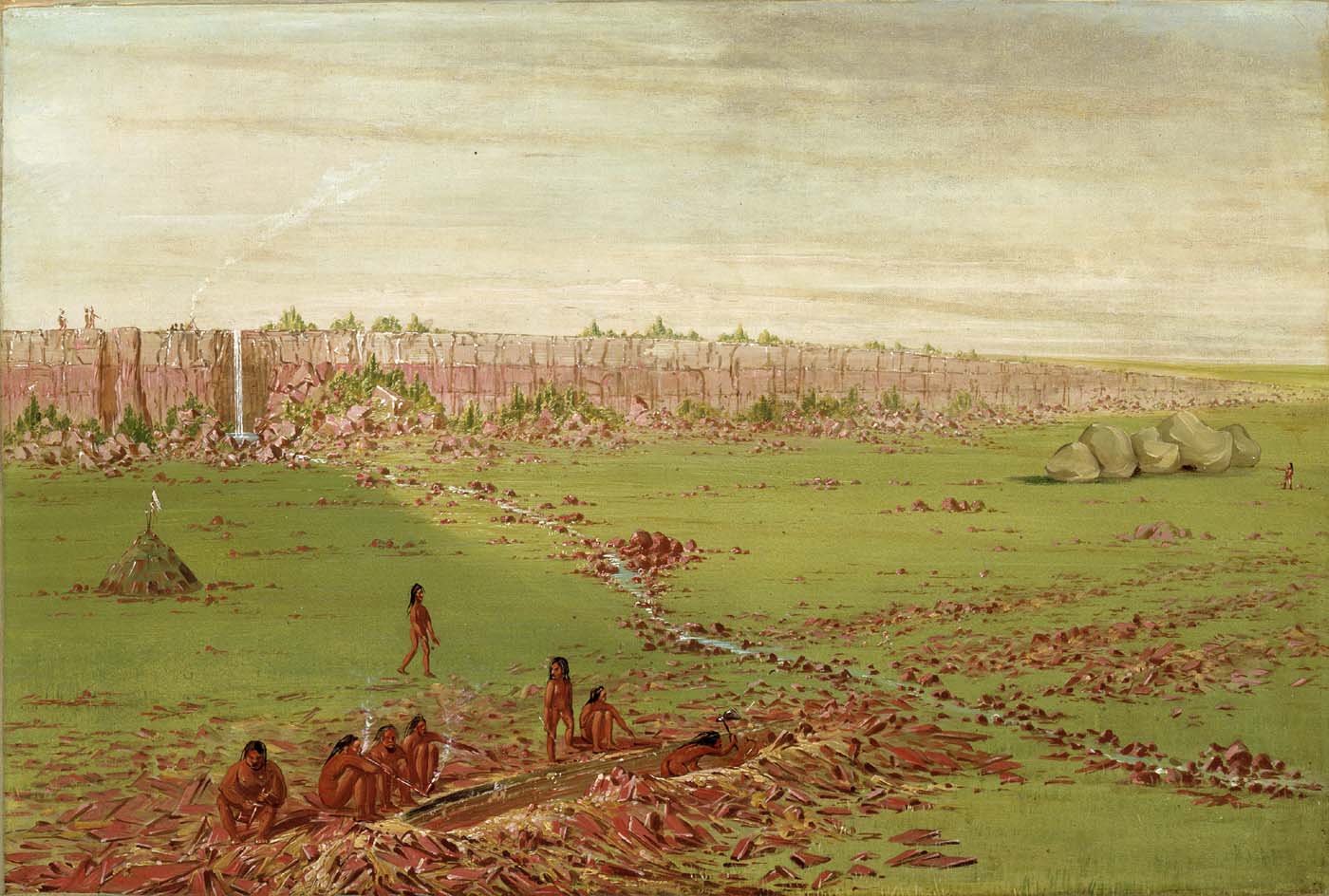
On the Coteau des Prairies every nation on earth climbed the same long ridge to get above the water, and the water closed over them where they stood together, and their flesh turned into the red stone the peace pipe is cut from. That is why the quarry has always been neutral ground: enemies dig side by side there because they are digging their own ancestors. North American flood traditions almost never stop at the drowning. The water takes a world apart and hands back another, and the world it hands back is the one people still live in — the clans and their offices, the crests scattered along a whole coast, the corn, the annual ceremony, the stone in the pipe.
Farther south the weather changes, but the work of the story does not. A Red Wind tears the Lacandon forest up while one dugout carries seed through six years of water. In Maleku country stones cast into the river heads make every current join until one just man retrieves them. Off Gunayala a sea snake grows toward an island as the ground shakes and the island goes down; among the Kalinago, the flood of the Hurricane leaves peaks, cliffs and an archipelago where one country had been. Each ending is still a beginning.
The rope that holds
Four traditions along one stretch of the Northwest Coast tell the same story with the same piece of equipment. Water rises; families load canoes with food and water; they tie the canoes to a mountain with cedar-bark rope; the rope holds; they come down afterwards and rebuild.
At Nch’ḵay̓, the mountain settlers renamed Garibaldi, the Squamish account opens at the end of the glacial period itself: the ice melts, the water climbs, and the cedar line is made fast to the peak. Across the strait the W̱SÁNEĆ tie themselves to ȽÁU,WELṈEW̱, the last ground above the flood, and when Raven announces land they come off the mountain with a new name — the Emerging People — which is the point of the story. In the K’ómoks valley Quoi Qwa Lak dreams the warning in time, the rain covers the mountains, and the glacier itself turns into the White Whale Queneesh and carries the people through. On the Elwha, Ed Sampson Sr. told it as families tethering freight canoes to two peaks that grow taller as the water rises.
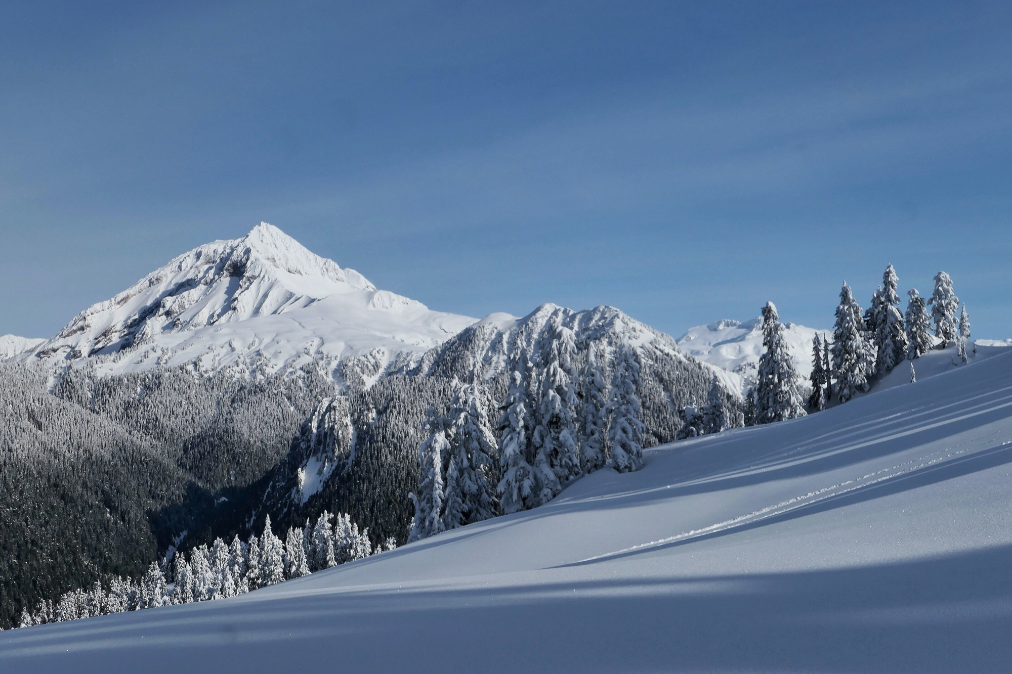
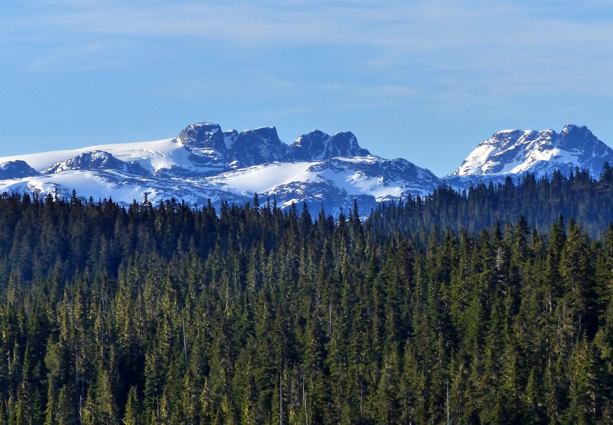
These stories sit on a coast that genuinely moved. Rising seas cut the larger Ice Age landmass into the Haida Gwaii archipelago, and Haida accounts remember people walking across places that are open water now. Marine diatoms — the glassy shells of sea plankton — survive in sediment on the high Tsinni Tsinni terrace above the Bella Coola valleys, exactly where Nuxalk tradition puts an older ocean and dangerous tidal currents miles inland. An arm of the sea filled much of the Fraser Valley at the close of the Pleistocene, and a Fraser River Salish elder said the great water began at salt water and came up the valley; another remembered ancestors living in a country newly out of the water and still bare of trees. Alan McMillan and Ian Hutchinson laid the traditions and the sediments side by side and found them describing the same coast.
The rope is the detail to hold on to. It is not an ark that drifts wherever it is sent. It is a mooring: the people stay where they belong, above their own country, and when the water goes down they climb back into it. Four times along one coast, the line holds.
The rope that breaks
Then, on the upper Skeena, it parts.
The people of Temlaham mistreat a trout. The water begins to rise, and it rises for twenty days. They stretch elk skin over the canoes to keep them dry and drop anchor-lines to the mountaintops. Some families climb the mountains on foot instead and drown up there. One line after another gives way, and the canoes go off in every direction across a submerged country. When the water falls, twenty days later, each family is somewhere else — and stays.
The people of TlEmlạx·ám are bad. They maltreat a trout, and then the Deluge sets in. For twenty days the waters rise. They cover their canoes with elk skin. The anchor-lines of many canoes break, and they drift away. Some people climb the mountains and are drowned… Then the waters sink again, and the people settle in the places where they happen to be. In this manner the crests are scattered over the whole coast. After the Flood, there is only clay, no trees, and the people live in tents.
— Franz Boas, Tsimshian Mythology, 31st Annual Report of the Bureau of American Ethnology (1916), p. 727
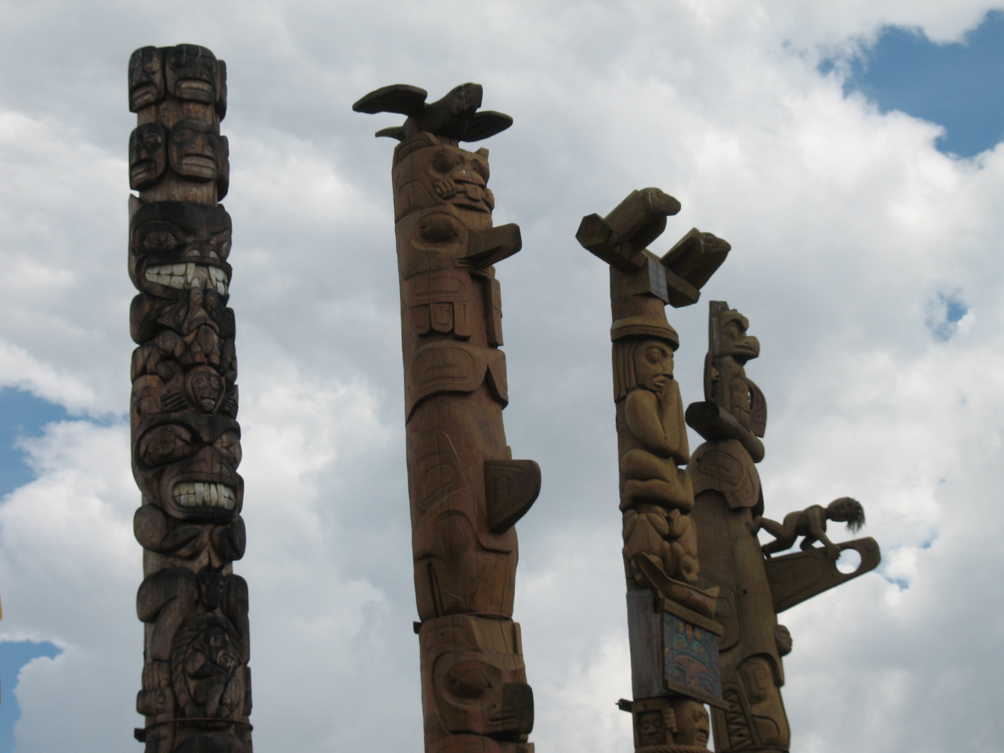
Those scattered crests are the whole point. The crest is the Northwest Coast’s legal instrument: the carved and painted figure that says which house you belong to, which names you may take, which stretch of river and beach and hunting ground is yours, whom you may marry. A crest belonging to Temlaham turning up two hundred miles down the coast is not decoration. It is a title deed with a history, and the history is a rope that snapped in a flood.
So the failure is the productive one. Where the Squamish and W̱SÁNEĆ lines hold and a people comes back down onto its own mountain, the Tsimshian lines break and a whole social geography goes out with the current. Temlaham does not explain how one village survived the water. It explains why the coast is arranged the way it is — why these people hold that crest in that place — and it does the explaining by the specific mechanical accident of a mooring giving way.
And one further line in Boas. After the flood, he reports, there is only clay, no trees, and the people live in tents for a long time. The Skeena valley was under Cordilleran ice, and freshly deglaciated ground is exactly that: bare clay, no forest, a long wait before anything will grow. The same detail turns up on the Fraser, where an elder remembered ancestors living in country newly out of the water and still bare of trees. Two peoples describing the ground the water left behind describe the ground the ice left behind.
Proving you can make it rain
The most exact flood in North America comes up out of the ground inside a single Hopi village.
Four years earlier a ghost had told the people of Palatkwapi where to plant their prayer-sticks. On the fourth morning of an old man’s counting song, water begins coming out of the ground at every one of those places at once — and out of the fireplaces in the kivas, and out of the water jars standing in the houses — with Balolookongs, the horned water serpents, shooting up through it in all parts of the village. The walls come down on the people inside. In one house a few old men climb the meal shelves, crouch there, and turn into turkeys; the water rises until their tails hang in it, which is why turkeys today have no feathers on their heads.
The chiefs, gathered in the high house at the east end that the water has not reached, grind beads and turquoise to powder and make it into two balls on a tray of prayer-sticks. Then they dress the village chief’s son — the young man whose behaviour caused all this — in a plain white kilt, with black zigzag lines painted down his legs and arms and body, and they dress his sister as a Flute maiden: white robe, white kilt, an eagle-breath feather above the forehead, her chin painted black with white lines running ear to ear. The two of them wade out into the flooded village carrying the offering. The young man takes hold of the great serpent and presses it under. Brother, sister and serpents go down together, and none of them comes back up.
The turquoise powder hardens the ground, because turquoise is a hard substance. The people bake piki, set out a food altar east of the ruin, eat a little of each kind as they file past it, and walk north over the mud.
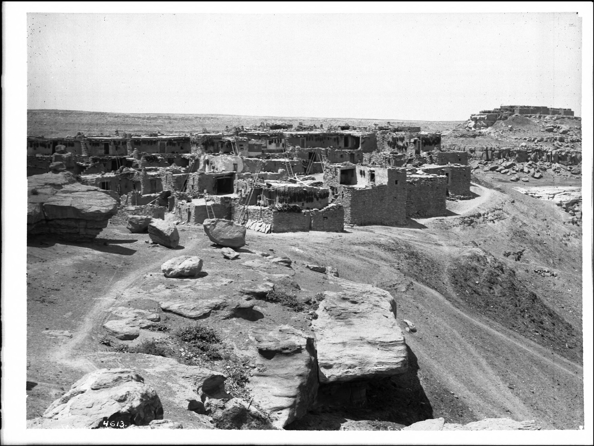
Where they walk to is the rest of the story, and Sikanakpu of Mishongnovi told H. R. Voth that part separately. The Batki clan and the Sand clan come up from Palatkwapi together. On the road they feed themselves by a division of labour: the Sand clan spreads sand on the ground and plants corn in it, and the Batki clan sings until it thunders and rains, and the crop comes up in a day. They stop a long while at Homolovi. They try Awatovi and are not welcome. They arrive at Mishongnovi on Second Mesa in northern Arizona, where the Bear, Parrot and Crow clans already hold the village and its ceremonies — and there, in Voth’s flat rendering, they were asked what they knew to produce rain and crops.
They spread the sand. They make the corn grow. And their leader is made chief of the village.
Then the practical sequel. The spring at Toriva was small, so the Batki emptied into it the mud, grass and water they had carried up from the Little Colorado in a móngwikuru, and the flow increased. They were taken into the Antelope and Blue Flute fraternities, which is why Sikanakpu, a Batki man, is the one who lays out the cloud symbols in the Blue Flute ceremony. Before the Batki came, Voth was told, the corn at Mishongnovi was small; they made it rain and it grew large.
This is a charter in the strict sense: a flood story whose work is to say who holds which office in a named village, and on what grounds. The grounds are weather power. The clan is admitted because it can make it thunder and rain.
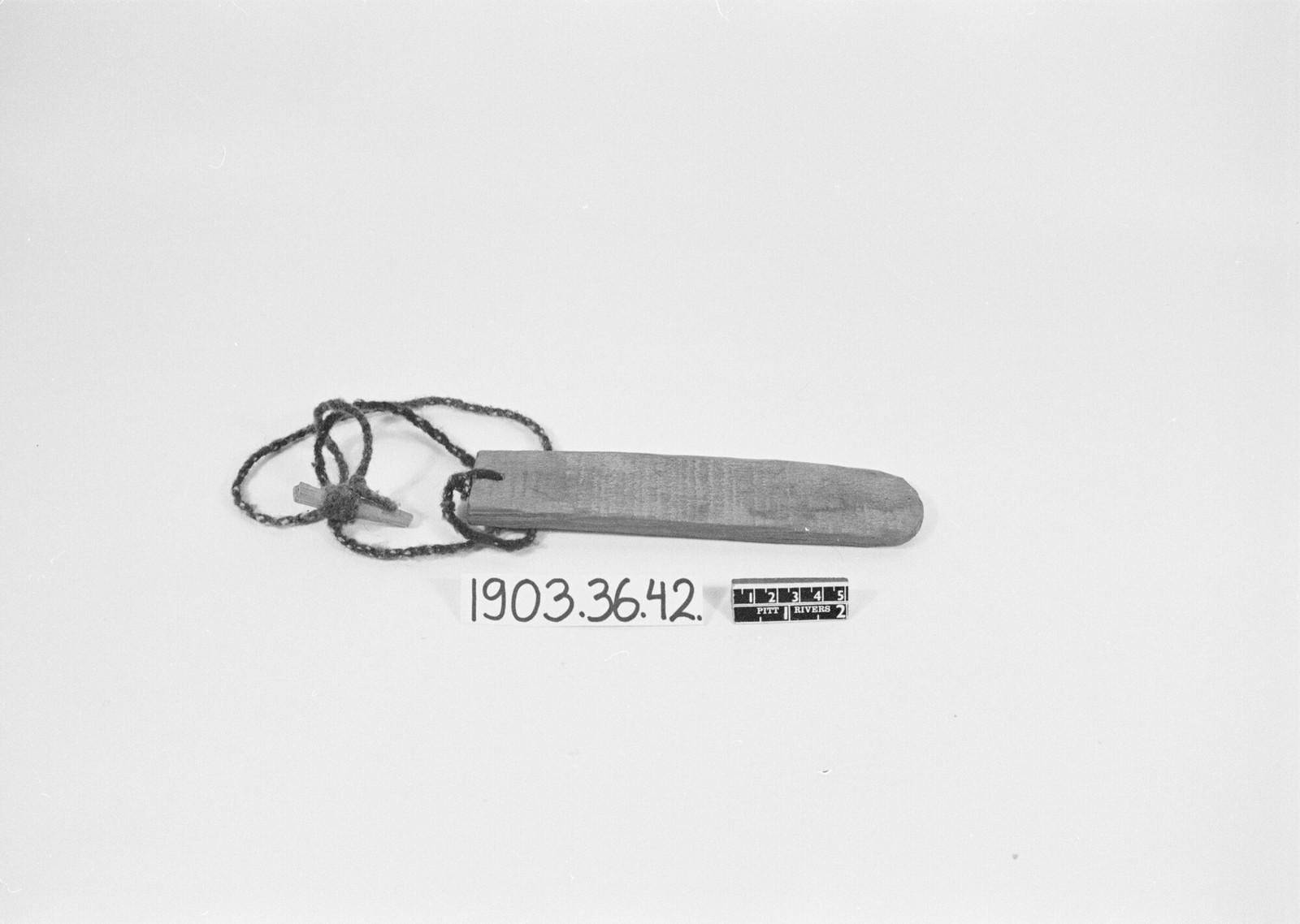
The thunder-stick came off Second Mesa in 1903, from the village the Batki reached, and its recorded purpose is to make thunder and bring rain — the exact competence the clan had to demonstrate at the door. The flood tradition and the instrument meet in one village, among one people, on one piece of business: the clan that came out of the water holding weather power, and the whirled board that makes the weather.
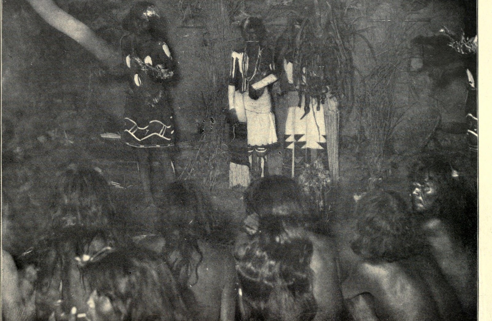
Two hundred miles north the Diné flood is a floor between worlds. In the fourth world Coyote steals the Water Monster’s two children and hides them in the fold of his robe, and nobody sees him do it. Deer and antelope start running past from east to west. On the fourth morning the Locust scouts come back and say a vast flood is coming from the east, and by dawn the water stands as high as mountains all round the horizon. The Squirrels plant piñon and juniper, the Weasels plant spruce and pine, and every tree branches out and stops growing. Then two men come up the hill with bags of earth from seven sacred mountains, and out of that earth grows the great reed the people climb to reach the world above. The flood is the mechanism by which one world is exchanged for the next.
The survivors who were corn
On the upper Missouri the Arikara answer the flood with agriculture.
Long ago, the narrator Hand told George Dorsey, there were large people on the earth, strong enough to fear nobody, and they made fun of all the gods in the heavens. Nesaru looked down and said he had made them too strong. Before the water came, the animals helped him take the people he liked and turn them into grains of corn, and carry them down into a cave big enough for animals and people together.
The flood killed the giants. And the people underground knew nothing about any of it — because they were not people then. They were corn.
Nesaru planted corn in the sky to remind him where he had put them. When it ripened he turned an ear of it into Mother Corn and sent her down to find them, with Badger and Mole digging the way out toward the light. There is no mountain in this story and no raft. The survival mechanism is seed: dormancy, storage, germination. The Arikara come out of the flood the way a crop comes out of a cache pit, and the primacy of corn in Arikara life is the same fact as the survival of the Arikara.
South of Panalachic in the Mexican Sierra Madre, the Ráramuri put two children on a mountain called Lavachi, which means gourd, and let the water go down. They come off it carrying three grains of corn and three beans. The rock is still soft after the flood, and their footprints are in it, and you can go and see them. They plant the corn, sleep, dream that night, harvest — and every Ráramuri alive is descended from those two children. A whole people and its agriculture restart from six seeds and a soft rock.
In the same sierra the Wixárika restart from a warning and a dog. Nakawé, the grandmother of growth, tells Watákame to build a box-shaped vessel, carry seeds and take a black female dog. After five stages of flood the vessel grounds beside a sacred mountain, and birds cut the valleys that let the five seas out. Then the dog becomes a woman, and she and Watákame renew humanity and agriculture together — a goddess at one end of the story and a dog-wife at the other, and the seed corn riding between them.
Their Cora neighbours keep the flood itself in daily use. A few miles east of Santa Teresa there is a deep lake in a volcanic hollow, and the Cora say it is the only thing remaining of the great flood. They call it Mother, and also Brother, after the Morning Star. There are no fish in it, only turtles and ducks. Its water heals the sick and strengthens the well, and there is no ceremony in Cora religion for which it is not required: it is mixed with ordinary spring water and sprinkled over the people with a red orchid, or with a deer tail stretched on a stick. Elsewhere on this map the flood leaves a shoreline, a charter, a stone. Here it leaves a liquid, and the liquid is still working.
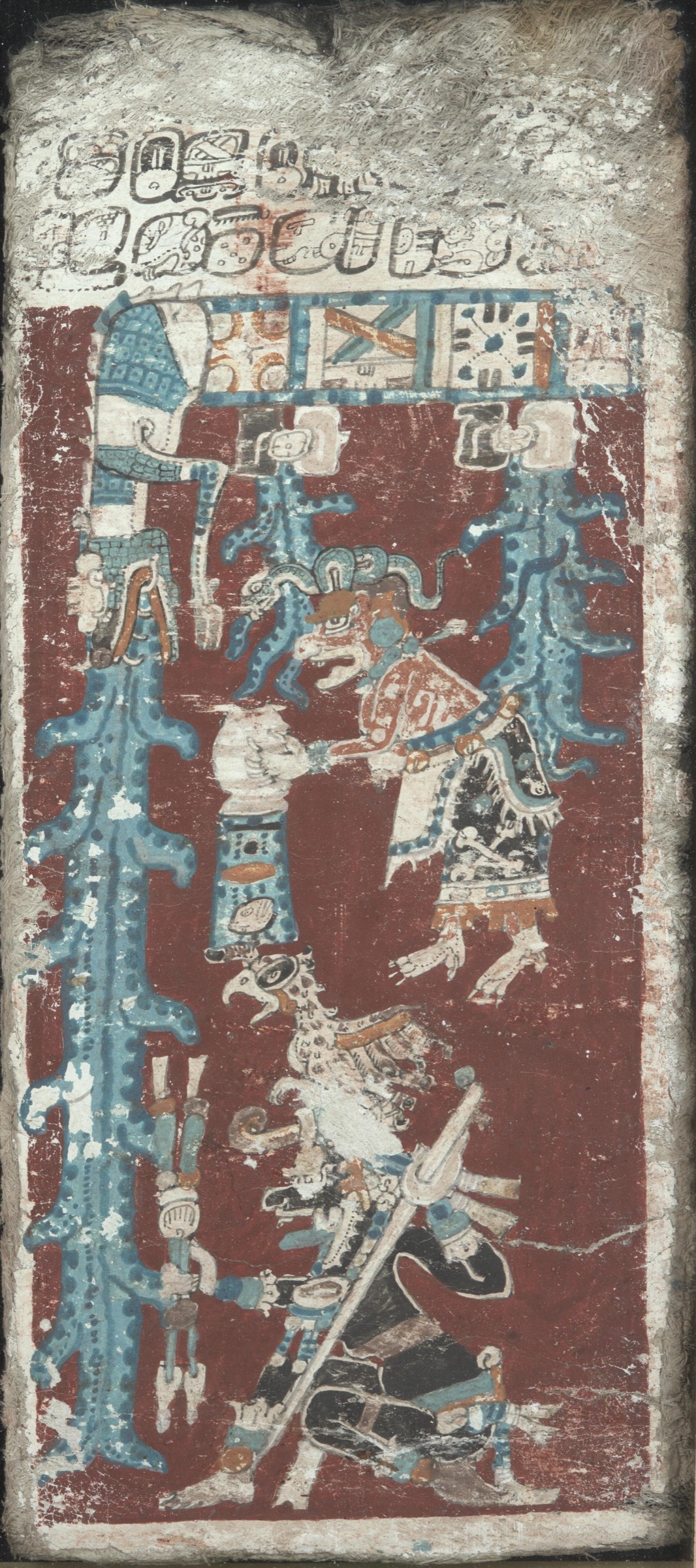
Further south the flood clears the ground for the corn people. The effigies carved of wood in the Popol Vuh looked like people and spoke like people and filled the whole earth, but their faces were dry, and they had no blood in them, and they did not remember who had shaped them. So Heart of Sky planned a flood, and a great resin came down out of the sky, and a black rain fell day and night, and everything the effigies owned turned on them. The grinding stones spoke first: every day you did holi, holi on our faces; now we will grind your flesh. Then the dogs: you never fed us; now try our teeth. The ones who got away into the forest are the monkeys, which is why a monkey looks like a person.
It is a destruction with a purpose. The wooden people are cleared off the board so that the maize people can be made, and the monkey in the trees keeps a human face. Even here, where the flood is resin falling out of the sky and no shoreline is at stake, the water is doing the job it does at Temlaham and Mishongnovi. It is the hinge on which the present arrangement of the world turns.
The man who walks in once a year
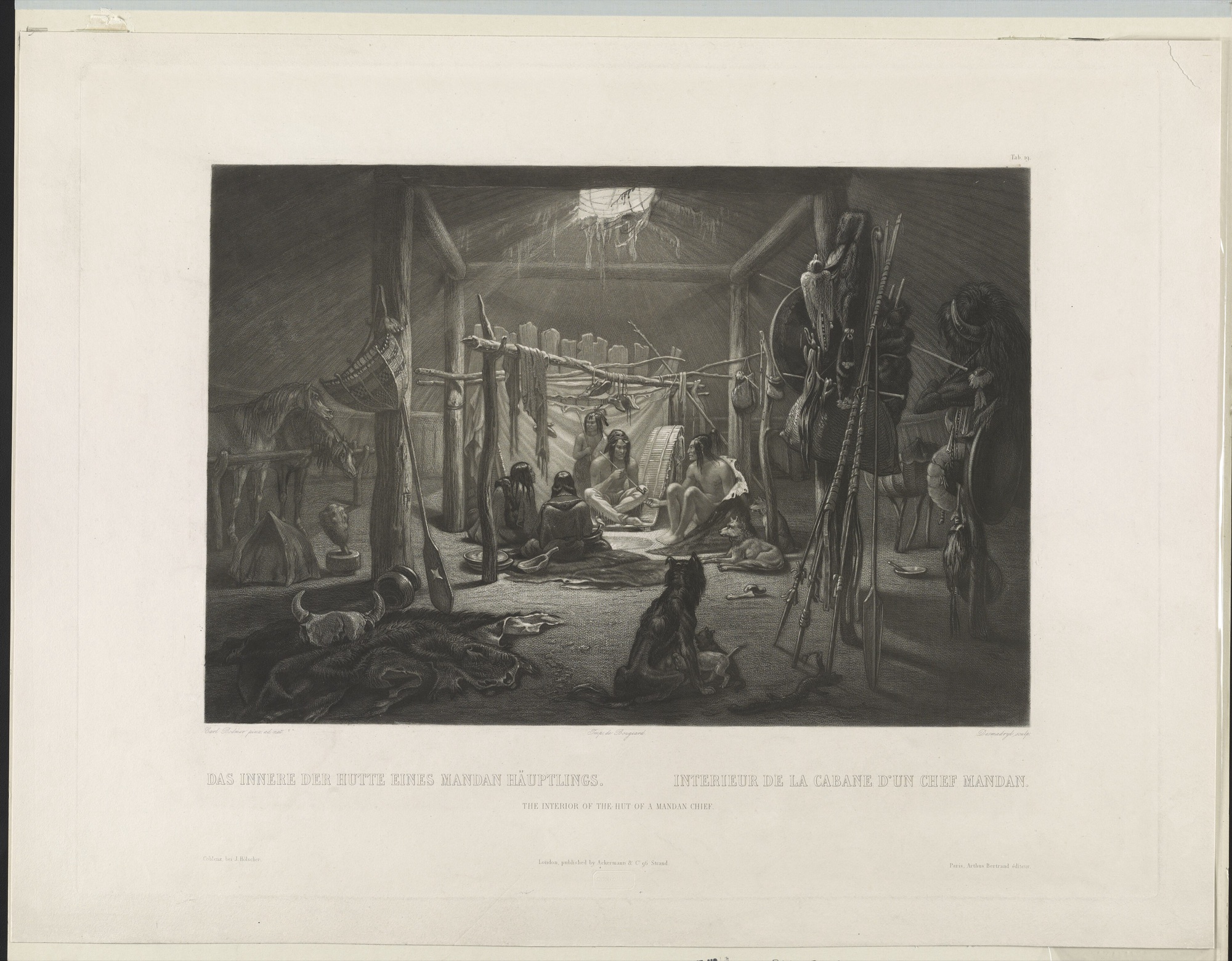
At the Mandan village on the Knife River the flood was not recited. It arrived.
Once a year a man appeared on the prairie to the west, painted, carrying a pipe, and the chiefs went out and brought him in. He was Nu-mohk-muck-a-nah, the First or Only Man. Everyone else stayed shut inside. He went to each lodge in turn and stood in front of the door crying until the owner came out and asked who was there and what he wanted.
To this Nu-mohk-muck-a-nah replied by relating the destruction of all the human family by the Flood, excepting himself, who had been saved in his “Big Canoe,” and now dwelt in the West; that he had come to open the Medicine Lodge, that the Mandans might make the necessary sacrifices to the water, and for this purpose it was requisite that he should receive at the door of every Mandan’s wigwam some edged tool to be given to the water as a sacrifice, as it was with such tools that the “Big Canoe” was built.
— George Catlin, O-Kee-Pa: A Religious Ceremony of the Mandans (1867), p. 12
He collected an edged or pointed tool of iron or steel from every household — kept ready, Catlin noticed, for the occasion — and carried them into the Medicine Lodge, where they lay for four days. At sundown on the fourth they were thrown from the rocks into deep water in front of the whole tribe. At sunrise the next morning he called out the fifty or so young men who had come of age in the past year, and they appeared painted head to foot in white and red and yellow and blue and green, each with his shield on his left arm and his medicine bag in his right hand, and followed him into the lodge for the O-kee-pa. Then he handed the conductor of the ceremonies the great pipe that had been saved in the Big Canoe with him, shook hands with the chiefs, said he would be back in a year, and walked off over the hills he had come from.
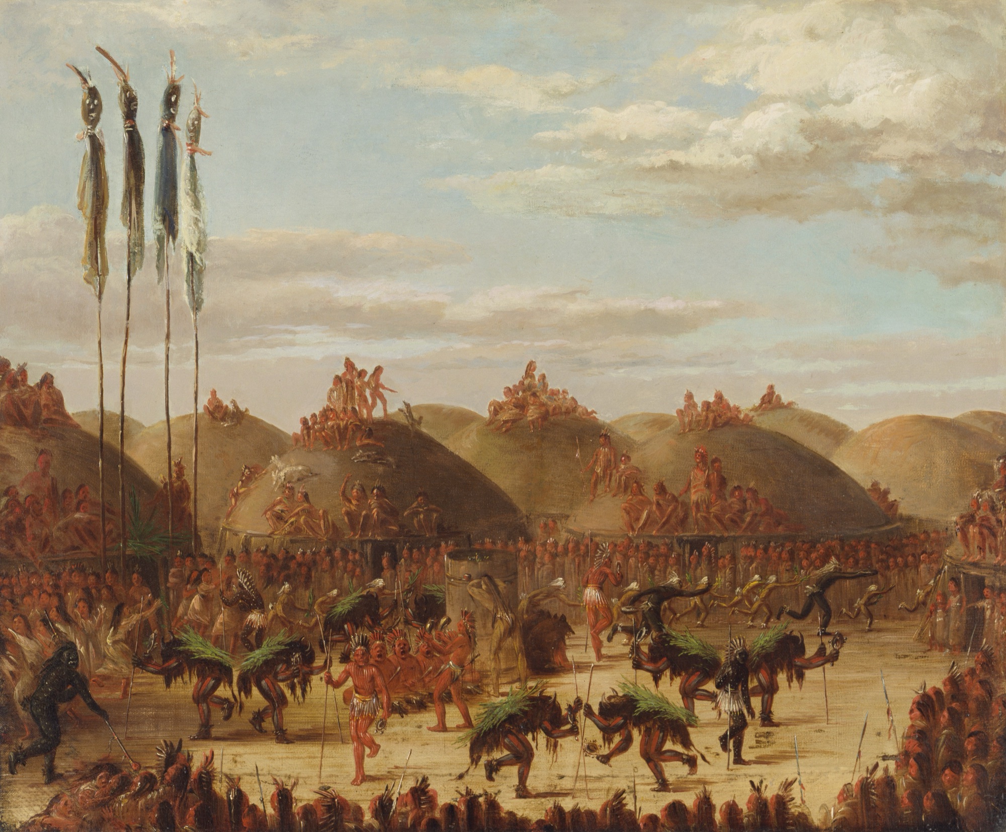
The sharpest case on the continent has a calendar and a bill. The flood is not a memory the Mandan hold; it is a debt they service, in metal, at a fixed date, at the door of every house — and the same event determines which young men are initiated this year. Catlin was scrupulous about one thing: he argued that the willow bough, the turtle dove and the whiteness of Lone Man were mission teaching laid over the rite. The Big Canoe, the edged tools, the four days and the sacrifice to the water are Mandan.
Flesh into stone
Catlin got the pipestone tradition four years before he wrote it down, on the Upper Missouri, from a Nehiyaw man who had been to the quarry and who was giving him a red stone pipe at the time.
That in the time of a great freshet, which took place many centuries ago, and destroyed all the nations of the earth, all the tribes of the red men assembled on the Côteau du Prairie, to get out of the way of the waters. After they had all gathered here from all parts, the water continued to rise, until at length it covered them all in a mass, and their flesh was converted into red pipe stone. Therefore it has always been considered neutral ground — it belonged to all tribes alike, and all were allowed to get it and smoke it together.
While they were all drowning in a mass, a young woman, K-wap-tah-w (a virgin), caught hold of the foot of a very large bird that was flying over, and was carried to the top of a high cliff, not far off, that was above the water. Here she had twins, and their father was the war-eagle, and her children have since peopled the earth.
The pipe stone, which is the flesh of their ancestors, is smoked by them as the symbol of peace, and the eagle’s quill decorates the head of the brave.
— George Catlin, Letters and Notes on the Manners, Customs, and Condition of the North American Indians, vol. 2 (1841), Letter 54, p. 168
Look at what that tradition is doing. It has to account for three things at once — why the stone is red, why the ground is neutral in a region where nothing else is, and why the pipe smoked over a peace agreement is cut from this seam and no other — and it accounts for all three with a single event. Everyone drowned in one place, together; the stone is their flesh; therefore no nation can own the quarry, and therefore the pipe made from it is the instrument of peace between nations. The flood does not merely precede the institution. It is the institution’s title.
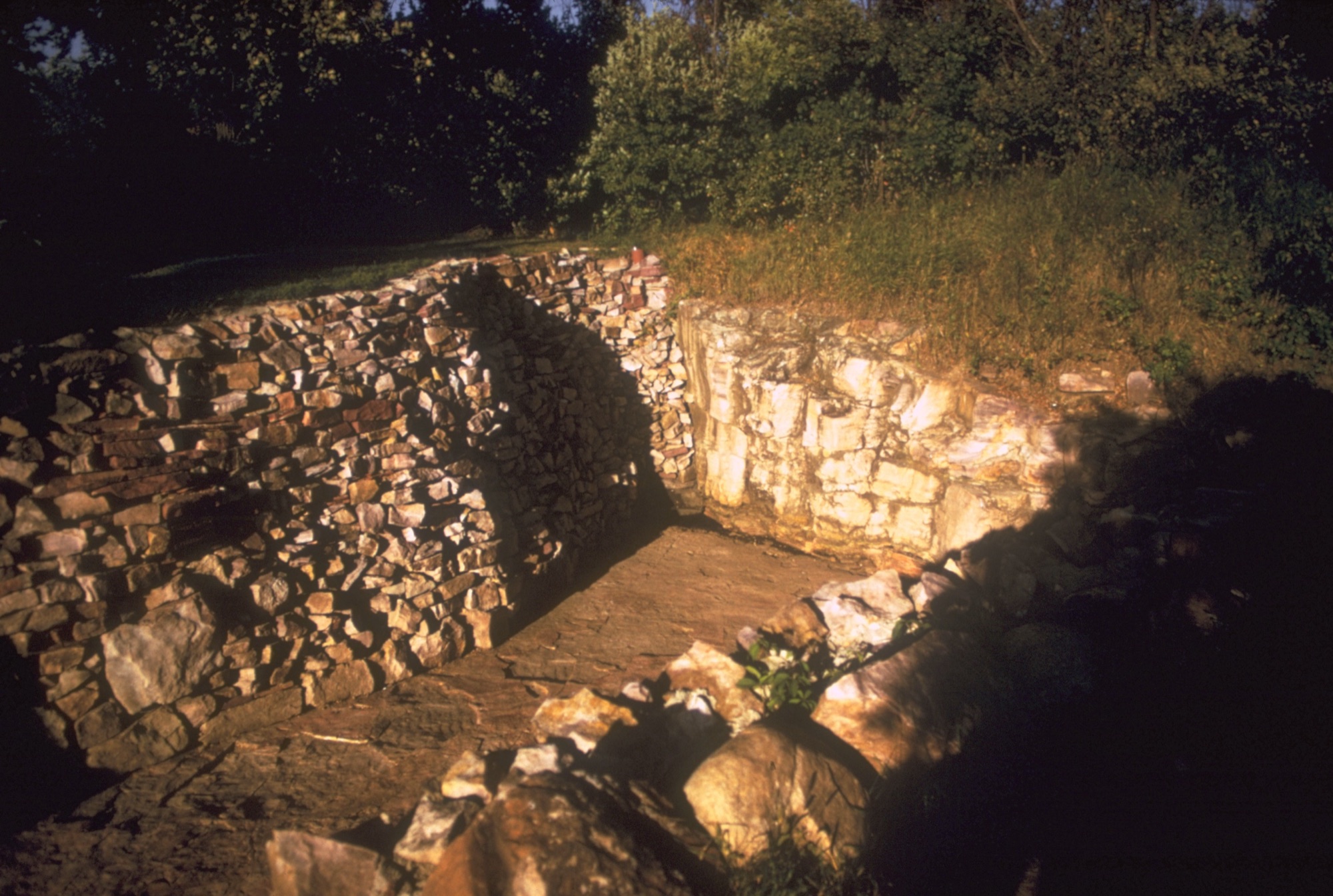
Catlin also recorded what was said to him and his companion when they arrived to take some of it away. It is the clearest statement of the doctrine anyone has put on paper, and it was delivered by a man holding the pipe against his bare arm.
“You see that this pipe is a part of our flesh. The red men are a part of the red stone. If the white men take away a piece of the red pipe stone, it is a hole made in our flesh, and the blood will always run. We cannot stop the blood from running.” — a Dakota speaker at the Red Pipe Stone Quarry, in Catlin, Letters and Notes, vol. 2, p. 174
The Coteau des Prairies is in fact a highland that stood between two lobes of the Laurentide ice sheet, and the pipestone is a soft seam sealed under quartzite and glacial till. That is where the material comes from geologically. What the tradition makes is a rule about who may dig, and the rule has held for as long as anyone has been watching.
The dog that showed the bone
In the Cherokee telling a man’s dog starts going down to the river every day to look at the water and howl. The man loses patience and scolds it, and the dog speaks.
“Very soon there is going to be a great freshet and the water will come so high that everybody will be drowned; but if you will make a raft to get upon when the rain comes you can be saved, but you must first throw me into the water.” The man did not believe it, and the dog said, “If you want a sign that I speak the truth, look at the back of my neck.” He looked and saw that the dog’s neck had the skin worn off so that the bones stuck out.
— James Mooney, Myths of the Cherokee, 19th Annual Report of the Bureau of American Ethnology (1900), p. 261
He believes it then. He builds the raft, loads his family and provisions, and the rain covers the mountains and drowns everyone else. When it is safe to come off, he hears dancing and shouting on the other side of the ridge; he climbs to the top and looks over, and everything is still, and all along the valley lie great piles of the bones of the drowned. Then he knows that the ghosts had been dancing.
Mooney knew perfectly well that most of the Cherokee flood versions he was offered were the Bible handed back to him, and he said so. He singled out this one, and that ending in particular, as the part that was not.
Now the Natchez version, taken down by John Swanton from Natchez speakers living among the Creek. A man’s dog looks westward and howls, and the man’s hen and chickens start dancing about in the stomp dance. The dog gives him four days’ notice, tells him to build a raft, to pile wood on it and keep a little fire burning, and to plait a hickory rope to tie it so it will not drift into the ocean. Then the mountains burst open and the water pours out of them. From the raft he watches people climbing into trees and dangerous creatures swimming about eating them. At the top of the flood the dog asks to be thrown off. Seven days after the water begins to fall, people start coming to the raft for fire — some naked, some in rags, some very well dressed — and afterwards he keeps hearing noises to the east like a crowd, and goes to look and finds nobody, only insects. An old man comes and stands by him and explains: the people who came for fire were people who had died a long time ago, and all those noises are made by people you think are not living.
Two peoples five hundred miles apart, with different languages and different histories: a dog that watches the water and howls, a dog that speaks, a dog that demands to be thrown in, a raft, a drowned world, and an ending in which the dead can be heard but not seen. Swanton drew the conclusion and named a direction.
The Flood myths of the Natchez (Natchez 1) and Cherokee (Cherokee 14) are so nearly alike that it is evident they are from a common source. The most probable suggestion regarding them would be that the Natchez had borrowed their tale from the Cherokee.
— John R. Swanton, Myths and Tales of the Southeastern Indians, BAE Bulletin 88 (1929), p. 269
That is a diffusion chain with an arrow on it, drawn by the man who collected both texts. It is worth more than a dozen resemblances noticed from a distance, because Swanton is arguing from the shape of two narratives he took down himself, and he commits to which way the borrowing ran. Traditions travel. When a story turns up twice, the interesting question is the route, and the Southeast is one of the few places on the continent where somebody has answered it.
A light in the north
Peter Pitchlynn, later Principal Chief of the Choctaw Nation, gave Catlin the shortest deluge on the continent and the most cinematic.
Our people have always had a tradition of the Deluge, which happened in this way: there was total darkness for a great time over the whole of the earth; the Choctaw doctors or mystery-men looked out for daylight for a long time, until at last they despaired of ever seeing it, and the whole nation were very unhappy. At last a light was discovered in the North, and there was great rejoicing, until it was found to be great mountains of water rolling on, which destroyed them all, except a few families who had expected it and built a great raft, on which they were saved.
— Peter Pitchlynn, in Catlin, Letters and Notes, vol. 2 (1841), p. 127
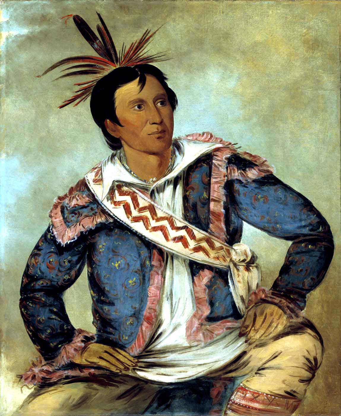
Darkness over the whole earth, a light appearing in the north, rejoicing — and then the light resolving into mountains of water rolling on. The Laurentide margin lay to the north of Choctaw country, and a wall of ice on the horizon is a light in the north. In Pitchlynn’s telling the light comes first and then resolves into water, which is the sequence in which anyone standing south of an ice sheet meets one.
Two other Southeastern floods turn on who laughed. In the Alabama telling a frog predicts that the world will be nearly lost in the waters. One man throws it in the fire; another takes it out and heals it, and is told to build a raft and pack a thick layer of grass under the deck so the beavers cannot cut holes through the wood. He builds it out in the open and people stand around laughing at him. When the flood comes the fish come with it, and some of the people catch them and say they are having a good time. The raft rises. Nobody else gets on. The birds fly up and take hold of the sky and hang there with their tails half in the water, and the red-headed woodpecker, pressed flat against the sky, says: my tail is in the water.
Down on the Louisiana coast the Chitimacha keep the same woodpecker — claws hooked into the sky, tail half under water, and the sediment the disturbed water left on it marking his tail off sharply from the rest of him to this day — and they put snakes on the ark. When the great deluge came the people baked a great earthen pot, and two of them rode the water in it, and two rattlesnakes rode with them. That is why the rattlesnake is the friend of man: in old times one guarded each house, entering whenever the owner went away and retiring when he came back. After the sea subsided the woodpecker was sent to find land and came back with nothing; the dove came back with a single grain of sand, and it was laid on the water and stretched out to make the dry land, which is why the dove is called Ne-hé’temon, Ground-watcher — it saw the ground come out. Two survivors in a pot, and the flood’s lasting charter is a snake with a domestic office, the guardian of the house, whose friendship with people dates from the water.
West of there, the Caddo begin from the opposite problem. A long hot dry season came and all the waters of the earth dried up, and the people wandered looking for water until they went out of their minds. In the dry riverbeds they found dead fish and turtles and cut them to pieces and threw them about, blaming them for the water going away. Then they looked up and saw a man coming toward them out of the western sky with a small green leaf in his hand. He moved the leaf in four directions and drops of water fell from it, and the water rose over the treetops and over every mountain but one; and he led the people he chose up that mountain and made it rise as the water rose, because he was stronger than Cold or Heat. The ones left behind did not drown. They turned into alligators.
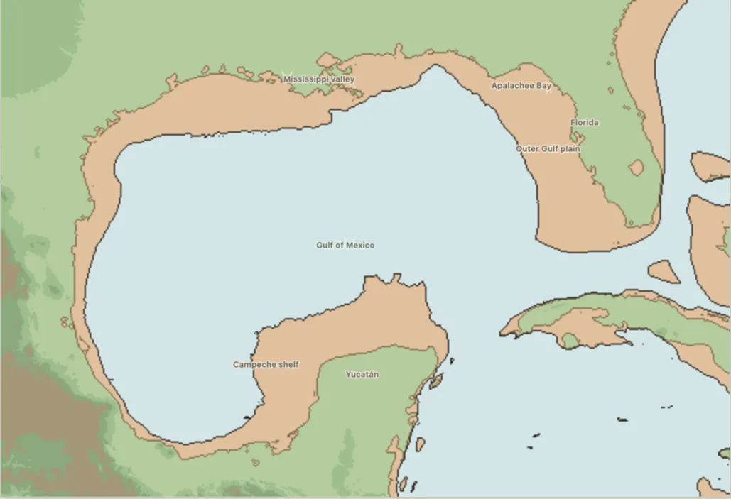
On the far side of the continent, at Jolon in Salinan country, two mussels live in a lake and raise the water every so often until a man is thrown in to them. This goes on until the people are so reduced in number that they refuse to throw in any more. So the mussels make the water of the lake and the water of the ocean come together, and the deluge follows. Afterwards the diving ducks go down for earth and fail; Eagle puts a heavy weight on Kingfisher’s back and sends him down, and he reaches the bottom, but the sea is so deep that he is dead when he surfaces; Eagle takes the earth from between his claws, brings him back to life, and makes the world out of it. H. W. Henshaw took that down in 1884. It is the one plot in this group in which a lake and the ocean join and land becomes sea, and it belongs to a people living inland of a coast that moved many kilometres east as the sea rose.
The drowned edge
At St Michael on Norton Sound, E. W. Nelson recorded a flood in which marine water covers the whole country except one central mountain. People survive in an umiak and fish as they drift above the drowned land; the current and the waves, working over the submerged ground, cut the ridges and hollows the story then points to. When the water falls they follow the retreating shore back toward the coast.
Norton Sound was dry country in the last glacial period. It went under as the early- and middle-Holocene sea advanced across the Bering shelf, drowning a landmass the size of a continent and cutting Asia from America. Which stage of that long rise the St Michael story describes has not been established. What the story insists on is local: the water comes from the sea, the refuge is a nearby mountain, and the flood leaves the shape of the land behind it as its signature.
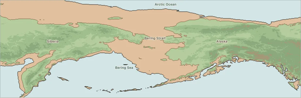
Further east the Arctic accounts turn on evidence rather than refuge. Franz Boas recorded a Central Inuit tradition in which the ocean rises over the mountains and carries drift ice across their summits, leaving fish, shellfish, seals and whales stranded high above the later shore — and the stranded sea life is offered inside the story as the proof that this happened. At the Mackenzie Delta, Émile Petitot recorded a flood driven by wind rather than shaking: the water goes over the dwellings, the families lash all their boats into one great raft, and An-odjium, Son of Owl, throws his bow and his earrings into the water and calms it.
And several hundred kilometres inland, among people with no coast at all, Petitot took down from Sa-kfa-nél-kfa-woha in June 1864 a story that ends in a wave. A young man walking by the sea calls to a whale to swallow him, and throws himself in. The whale keeps him three days. His sister stands on the shore crying, and when the whale surfaces she hears his voice from inside saying its insides are burning him, and telling her to throw in one of her moccasins and keep hold of the laces. The whale swallows the moccasin, the young man catches it, and his sister pulls until the whale vomits him onto the beach half dead. Then the whale, furious at losing him, hits the sea with its tail so hard that the waves stand up like mountains, and when they come down on the land they swallow it, and only the two of them are left.
Inland on the Koyukuk, the flood is the hinge between two worlds, and one of them was better. In the Distant Time the earth was covered by a flood, and only the animals were saved: Raven put them on a raft by pairs — just by pairs, no calves or anything — and that exact balance is what the new world was started from. The world Raven made was at first a world of order and perfection. But Raven is a trickster, and he took his own creation apart and made it over as the imperfect world we have now, a world where rivers flood and people die. It is the one Edenic frame on this map — a post-flood golden age, deliberately broken by its maker — and it is not a museum piece: each spring, Koyukon people watch the rising river with the old floods in mind.
When the ice-dammed lakes broke
The end of the Ice Age moved a great deal of water across the interior, and the interior traditions know it as something that breaks loose rather than something that rises.
In Katzie history the Great Flood drives people to Golden Ears and Mount Cheam, and when it falls the families multiply and salmon return to the rivers; Duncan McLaren compares the sequence with the sudden emptying of an ice-dammed lake in the Fraser system. Kalapuya floodwater fills the Willamette Valley and people run for Marys Peak, and in the longer cycle Panther and Deer appear, Coyote dies, and the survivors recover fire; Grand Ronde scholarship sets that cycle beside the late-glacial megafloods that swept the valley over and over. At Lalíik — Rattlesnake Mountain, whose name means land standing above water — Yakama sources keep the mountain and the Ice Age floods joined in a single sentence.
Flathead country preserves two incompatible stories, and both of them are hydraulics. In one, a wounded lake monster drinks Flathead Lake dry and drags the water off inside its own body through Big Draw; when the water bursts free the people run to Baldy Mountain and Hawk sings the flood down, and Big Draw is left behind as the monster’s path. In the other, a giant beaver dams the old outlet at Big Arm, then dams the southern outlet near Polson, until heavy snowmelt breaks the southern barrier and opens the modern Flathead River. The two dams sit where glacial ridges sit, and the final break follows the last drainage of ancestral Lake Flathead.
In the upper Great Lakes the water beings kill Nanabozho’s wolf relative; when he strikes back they flood the world; he and the animals survive together, and Muskrat dives and comes up with the earth that becomes the ground. Colin Elder compares related Anishinaabe flood and Nanabush histories with Great Lakes deglaciation.
On the Peace River the Dane-zaa flood is snow. It piles up through four summers without warmth and then melts all at once, and some of the people escape by becoming waterbirds, and the bird people fetch up the earth and rebuild the land. Of every tradition on this map, that is the one whose physical mechanism sits closest to the thing the whole map is about: ice that accumulates, and then goes.
And on the Atlantic, in Mi’kma’ki, the water builds. It rises fast and islands begin to form; a man and a woman survive in a canoe; Beaver dies trying to make them an island, and Muskrat finishes it. Matthew Betts and Brian Suttie compare the account directly with the rapid postglacial sea rise and island formation of about 11,000 to 10,000 years ago. In Mi’kma’ki the flood is not the end of a country. It is the making of one, by animals who dive and fail and dive again.
The question that makes the answer
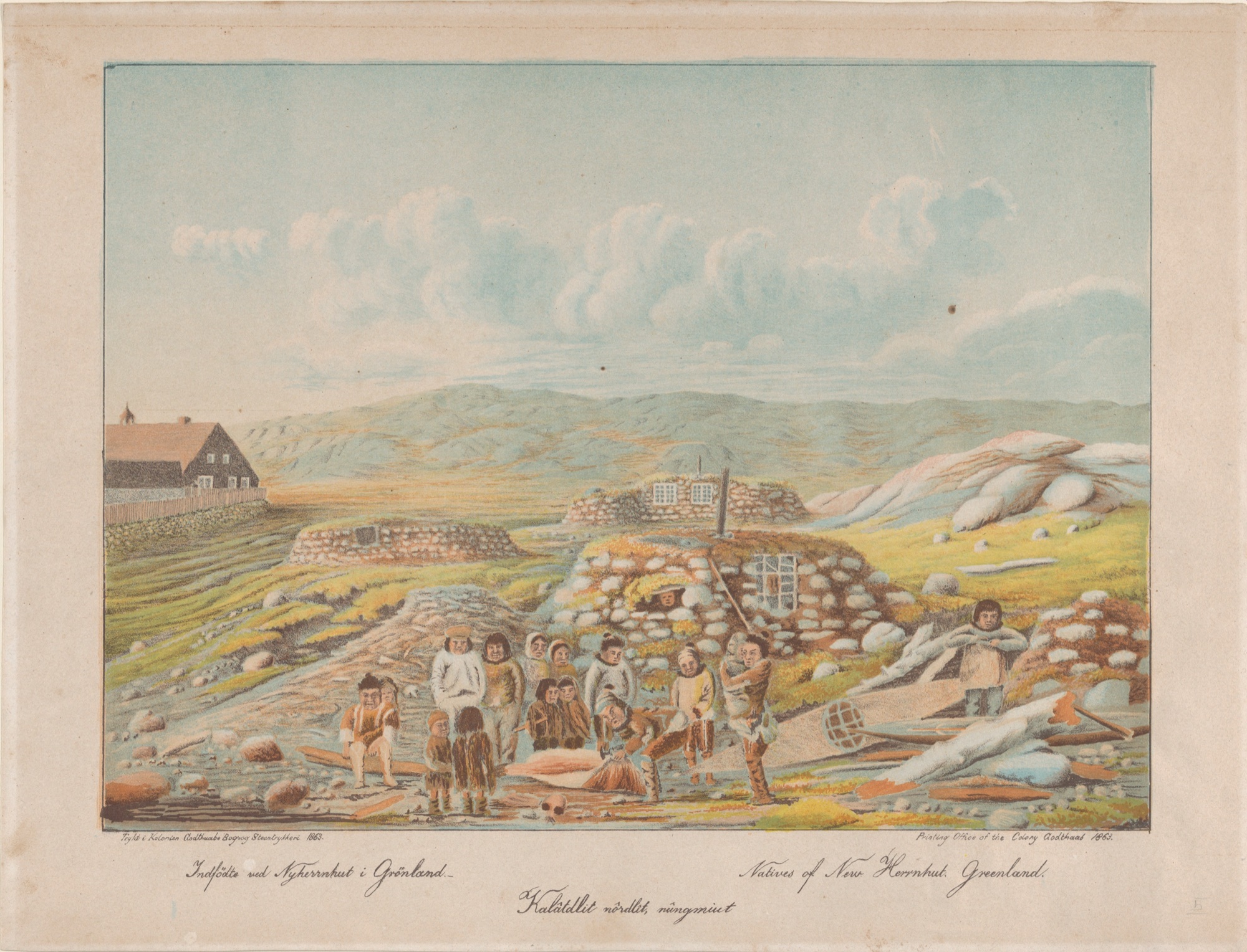
Hinrich Rink spent twenty years in Greenland and collected two thousand pages of narrative from about fifty named storytellers. He was therefore in a position to say exactly how a flood tradition gets into the record when there was not one there before, and in 1875 he did.
“The mode most generally adopted by travellers when making inquiries among a barbarous or foreign people about their traditions is that of selecting certain facts as subjects for questioning them upon, such as how their country was originally peopled, if their first ancestors came from the West or from the East, if they happened to know anything about a great deluge, &c. By this mode of inquiry the natives most likely, finding that they have no real information to offer, in order to satisfy the questioner and get rid of the trouble he causes them, will be influenced in their answers chiefly by what they think the questioner would best like to hear.” — Hinrich Rink, Tales and Traditions of the Eskimo (1875), p. 91
Fifty pages earlier he had applied the rule to the specific case. Statements that some tradition of the Deluge exists in Greenland, he wrote, “cannot be accepted without doubt and reservation, because they may have partly originated from the questioners themselves, who pretend to have heard them from the Greenlanders, but have probably involuntarily acted upon the latter by their prepossessed mode of questioning.” His own method followed from it: never ask about a deluge; ask people to tell you what they actually tell each other at their own gatherings, and take down what comes.
Greenland has no point on this map, and that absence is Rink’s doing. It converts the rest of the map into evidence. Le Page du Pratz asked the Natchez temple guardian about a flood and got a short answer shaped by the asking. Ed Sampson Sr. said plainly that the Elwha flood is the flood in the story of Noah. Angela Sidney compared her Tagish flood with the Bible herself. Where a story survives that comparison and still has a named mountain, a named clan, a named spring, an anchor-line and a crest, the local material is precisely the part nobody imported.
One more body of material is kept off this map on purpose, and for the opposite reason: it is too well dated. The Cascadia traditions — Huu-ay-aht at Pachena Bay, Makah, Quileute, Hoh, Nuu-chah-nulth — describe a night of shaking followed by a wave that emptied villages, and that night can be given a date: 26 January 1700, fixed by Japanese tide records of an orphan tsunami and by the death rings of drowned coastal trees. They are extraordinary documents, and they are reportage. A wave with a year attached is a different object from a flood no telling can date, and letting a documented night in 1700 stand in for the end of the Ice Age would cost this map the thing that makes it worth drawing. Alsek, where a glacier dam failed around 1852, and Mount Meager, whose landslide dammed the Lillooet about 2,360 years ago, are excluded on the same principle.
Mapped traditions
All mapped traditions
| No. | Place and tradition | What the story remembers | World after the water | Why it may remember the end of the Ice Age | Source |
|---|---|---|---|---|---|
| Coasts, islands and waters released by melting ice | |||||
| 1 | St Michael / Norton Sound — Norton Sound community | Sea water covers the country until only a high mountain remains. A few people survive in an umiak, fishing as they drift above the drowned land. | As the water falls, the survivors follow the retreating shore back toward the coast. | Norton Sound was flooded as the sea crossed the Bering shelf after the Ice Age. No study has yet tied this telling to one stage of that long rise. | E. W. Nelson, The Eskimo about Bering StraitSt Michael flood account |
| 2 | Southern Haida Gwaii / Hecate Strait — Haida | The earth sinks and the sea rushes across inhabited country. Families reach a high mountain by canoe; other Haida accounts remember people walking across places that are open ocean today. | The surviving communities inhabit the new islands of Haida Gwaii, where former crossings and homes now lie beneath the sea. | Archaeologists compare these traditions with the rapid sea rise that broke the larger Ice Age landmass into the Haida Gwaii archipelago. | McMillan and Hutchinson, “When the Mountain Dwarfs Danced”Haida Gwaii traditions and sea-level history |
| 3 | Bella Coola Valley / Tsinni Tsinni — Nuxalk | The ocean once reaches far up the Bella Coola valleys. One telling warns of dangerous tidal currents many miles inland from the modern shore. | The places remembered as tidal water now stand high and far inland. | Microscopic remains of marine life survive in sediments on the high Tsinni Tsinni terrace, showing that the late-Ice-Age sea once reached this far inland. | McMillan and Hutchinson, “When the Mountain Dwarfs Danced”Nuxalk accounts and Tsinni Tsinni terrace evidence |
| 4 | Lower Fraser Valley — Fraser River Salish | A great flood comes from the salt water and reaches far up the Fraser Valley. Another elder remembers ancestors living in a newly exposed country that was still bare of trees. | As the water leaves, people enter the open valley before forests return. | Near the end of the Ice Age, an arm of the sea filled much of the Fraser Valley to the height described in the account. | McMillan and Hutchinson, “When the Mountain Dwarfs Danced”Fraser River Salish accounts and Fraser Valley sea levels |
| 5 | Stave watershed / Katzie country — Katzie / Central Coast Salish | In Katzie history, a Great Flood drives people to Golden Ears and Mount Cheam. | When the water falls, families multiply again and salmon return to the rivers. | Duncan McLaren compares this sequence with the sudden emptying of an ice-dammed lake in the Fraser system near the end of the Ice Age. | Duncan McLaren, “Stave River Archaeological Project”Katzie history and the Stave–Fraser drainage comparison |
| 6 | Nch’ḵay̓ / Mount Garibaldi — Sḵwx̱wú7mesh / Squamish | When the Ice Age ends, melting glaciers raise the water over the country. Families load canoes and tie them to Nch’ḵay̓ with cedar-bark rope. | They descend as the water falls and rebuild their communities. | Squamish community sources themselves place the Great Flood after the Ice Age and name Nch’ḵay̓ as the refuge mountain. | Squamish Nation, “The Great Flood Story”Community account from Nch’ḵay̓ |
| 7 | ȽÁU,WELṈEW̱ — W̱SÁNEĆ | Rising salt water drives W̱SÁNEĆ families into canoes. They tie themselves with cedar rope to ȽÁU,WELṈEW̱, the last mountain above the flood. | Raven announces land, and the survivors call themselves the Emerging People. | The community account names a precise refuge mountain in a strait transformed by sea rise after the Ice Age. No study has yet identified one event behind the story. | W̱SÁNEĆ flood-history archiveȽÁU,WELṈEW̱ refuge account |
| 8 | Willamette Valley / Marys Peak — Kalapuya / Grand Ronde | Floodwater fills the Willamette Valley and people flee toward Marys Peak. In the longer cycle, Panther and Deer appear, Coyote dies, and survivors recover fire. | Fire returns to a valley repeatedly remade by water. | Grand Ronde scholarship and a federal tribal study compare the cycle with late-Ice-Age floods that repeatedly swept through the Willamette Valley. | Federal Kalapuya studyKalapuya flood cycle and Willamette Valley floods |
| 9 | Big Draw / Baldy Mountain — Kootenai | A wounded lake monster drinks Flathead Lake dry and drags its water-filled body through Big Draw. When the water bursts free, people run to Baldy Mountain and Hawk sings the flood down. | Water returns to the lake, while Big Draw remains as the monster’s path. | Researchers compare the flood with Glacial Lake Missoula and the empty lake with a much later drought. The story’s sequence does not exactly match either event. | Johnson and colleagues, Flathead Lake traditions and geologyBig Draw and Baldy Mountain account |
| 10 | Flathead Lake outlets / Polson — Flathead Lake account; storyteller not identified | A giant beaver blocks an old outlet of Flathead Lake at Big Arm, then dams the southern outlet near Polson. Heavy snowmelt breaks the southern barrier and opens the modern Flathead River. | The lake drains by its present southern route. | The two dams resemble glacial ridges at Elmo and Polson, while the final break follows the last drainage of ancestral Lake Flathead after the Ice Age. | Johnson and colleagues, Flathead Lake traditions and geologyGiant-beaver account and ancestral Lake Flathead outlets |
| 11 | Upper Great Lakes — Anishinaabe / Nanabozho | Water beings kill Nanabozho’s wolf relative. When he strikes back, they flood the world; Nanabozho and the animals survive together, and Muskrat dives for the earth needed to make land again. | Muskrat’s gift becomes the ground on which life begins again. | Colin Elder (2025) connects Anishinaabe flood and Nanabush traditions with Great Lakes deglaciation. His examples differ from Schoolcraft’s telling of the wolf’s death and the retaliatory flood; this telling carries no date of its own. | Henry Rowe Schoolcraft, Algic Researches, vol. I (1839)“Manabozho, or the Great Incarnation of the North”, p. 167 — the tree asked three times to grow, the loon that surfaces lifeless, and the muskrat that comes up with earth in its paw |
| 12 | Mi’kma’ki / Nova Scotia — Mi’kmaq | Water rises rapidly across Mi’kma’ki and islands begin to form. A man and woman survive in a canoe; Beaver dies trying to build them an island, and Muskrat completes it. | As the water falls, an inhabited coast of islands appears. | A regional archaeology study compares the account with rapid sea rise and island formation about 11,000–10,000 years ago. | Betts and Suttie, The Archaeology of the Atlantic NortheastMi’kmaq flood tradition and island formation |
| Ancient deluges and renewed worlds | |||||
| 13 | Mackenzie Delta — Inuvialuit (Tchiglit): An-odjium | Wind drives water over the Mackenzie Delta and submerges the dwellings. Families lash their boats into one great raft; An-odjium, ‘Son of Owl,’ throws his bow and earrings into the water and calms the flood. | The joined boats carry the community through the dangerous water. | Petitot describes wind, not an earthquake. A storm surge or wind-pushed river water therefore fits better than a tsunami, but the story has not been tied to a dated event. | Émile Petitot, Traditions indiennes du Canada Nord-Ouestpp. 6–7; Frazer I, p. 327 |
| 14 | Baffin region — Central Inuit | The ocean rises over the mountains and carries drift ice across their summits. Fish, shellfish, seals and whales are left high above the later shore, while many people escape in boats. | The stranded sea life becomes visible proof, within the story, that water once covered the heights. | Boas recorded this explanation in the nineteenth century. Geologists now explain high marine remains through Ice Age seas, glaciation and the slow rise of the land, not one mountain-high flood. | Franz Boas, The Central Eskimopp. 637–638; Frazer I, pp. 327–328 |
| 15 | Southeast Alaska — Tlingit: Yehl’s flood | Raven’s storm covers trees and mountains. Shamans warn people to store food; those who prepare survive, and a Stikine clan account remembers people climbing a mountain with a bear and a mountain goat. | When Raven removes the water-filled hat, the flood pours back to sea and survivors rebuild their towns and clan histories. | Swanton recorded several related tellings, not one single flood story. No particular earthquake, tsunami or Ice Age event has been identified behind them. | John R. Swanton, Tlingit Myths and Textspp. 119–121, 231 and 432–433; Frazer I, pp. 316–319 |
| 16 | Don Island–central coast — Heiltsuk | The sea covers the central coast until only three mountains remain. Two men, one woman and a dog survive on Ko-Kwus, a low hill on Don Island that rises with the water. | As the sea retreats, Ko-Kwus remains the named refuge of the survivors. | George Dawson recorded the account from a Heiltsuk chief in 1878. Its exact mountain is compelling, but no study has tied it securely to the 1700 tsunami or to sea rise after the Ice Age. | George M. Dawson’s Heiltsuk account, reproduced by FrazerFrazer I, pp. 320–321 and source notes |
| 17 | Green Lake — St’át’imc: Ntcinemkin | Rain joins Green Lake, Green River and the surrounding waters into one flood. Ntcinemkin takes one child from each family into a great canoe, which drifts among the mountains until it grounds at Smimelc. | He arranges marriages and sends the survivors to the best food places around Pemberton, Green Lake, Lower Lillooet, Anderson and Seton, repopulating St’át’imc country. | The story names lakes, valleys and terraces shaped by glaciers and draining water. No single ancient flood has yet been identified behind it. | James A. Teit, ‘Mythology of the Thompson Indians’p. 342; Frazer I, pp. 321–322 |
| 18 | Thompson River — Nlaka’pamux: Coyote after the flood | Water covers the Thompson country except the highest mountains. Three men reach the Nzuke’ski Mountains by canoe, while Coyote survives and returns to human form as the flood withdraws. | The retreating water leaves mountain lakes, streams and fish; Coyote’s descendants become the people of the renewed country. | The Thompson valleys held large glacial lakes near the end of the Ice Age and later drained rapidly. Teit did not claim that the story remembered one of those events. | James A. Teit, Traditions of the Thompson River Indianspp. 19–20 |
| 19 | Lower Columbia — Kathlamet Chinook | Beaver weeps for five days, and his tears flood the world. Animal persons survive in canoes while Muskrat dives beneath the water and returns with mud. | The recovered earth becomes land again, giving the survivors a world to inhabit. | Boas recorded the story in Kathlamet Chinook. The lower Columbia has known river floods and tsunamis, but the account does not identify which kind of water it remembers. | Franz Boas, Kathlamet Textspp. 20–25 and 252–253; Frazer I, pp. 325–326 |
| 20 | Northern Plains — Niitsitapi-Blackfoot: Old Man’s raft | Old Man and the animals wait on the highest mountain while floodwater covers the world. Otter, Beaver and Muskrat fail to find earth; Duck returns dead with a little soil, and Old Man uses it to make land. | Old Man gathers the people, gives them differently colored waters, and establishes the Blackfoot, Piegan and Blood languages. | This is a story of land and peoples created after a flood. No particular river, lake or Ice Age event has been linked to it. | Blackfoot narratives summarized by FrazerFrazer I, pp. 309–310 and notes |
| 21 | Elbow River region — Tsuut’ina: raft and beaver earth | A man and woman survive a world-covering flood on a raft with animals and birds. After other divers fail, Beaver returns with mud and the survivors spread it into a new earth. | People and animals leave the raft and repopulate the growing land. | No known lake or river flood has been linked to this story. The story’s work is the making of a new world. | Early Tsuut’ina account summarized by FrazerFrazer I, pp. 314–315 and notes |
| 22 | Fort Good Hope region — K’asho Got’ine-Hareskin: Kuñyan | Kuñyan foresees water rising from every side and builds a raft lashed with roots. His family and pairs of animals survive; Beaver brings up mud, and Kuñyan breathes it into a growing earth. | Fox measures the expanding land, and Bittern and Plover release the remaining floodwater into rivers and lakes. | The story gives the Fort Good Hope country a new network of rivers and lakes after the flood. No dated geological event has been proposed. | Kuñyan account summarized by FrazerFrazer I, pp. 310–312 and notes |
| 23 | Quebec–Labrador — Innu: Messou | Messou kills giant lynxes or lake monsters, and their lake overflows across the earth. Otter and Muskrat dive for soil so he can rebuild the land. | In one early telling, Messou’s union with Muskrat also begins renewed human life. | A Jesuit recorded this Innu story in 1633, making it one of North America’s earliest written flood accounts. It is not tied to a known geological event. | Paul Le Jeune, Jesuit Relation of 1633Thwaites vol. 5, pp. 155–157; Alexander pp. 42–43 |
| 24 | Wisconsin — Menominee: Manabush and the water panthers | Water panthers kill Manabush’s wolf brother. When he strikes back, they flood the world; he climbs a pine that keeps growing above the water while Otter, Beaver and Mink dive in vain. | Muskrat returns with earth, Manabush revives him, and new land and trees spread across the water. | The flood grows from a conflict among powerful water beings and ends with a new world. No particular Wisconsin flood has been identified behind it. | Hartley Burr Alexander, North American Mythologypp. 43–44 and cited Menominee source |
| 25 | Natchez, Mississippi — Natchez | A Natchez temple guardian says the ‘ancient word’ taught that water destroyed nearly everyone. A small remnant survives on a very high mountain; another account says the flood extinguishes every earthly fire. | The survivors repopulate the earth, and a red cardinal brings fire back from heaven. | Le Page du Pratz recorded the tradition in the eighteenth century after asking about a flood. The mountain is unnamed, and his biblical questions may have shaped the account. | Antoine-Simon Le Page du Pratz, Histoire de la LouisianeFlood notice; Frazer I, p. 291 |
| 26 | Gila River — Akimel O’odham: Elder Brother’s jar | A coming flood is announced. Elder Brother seals himself inside an earthen jar, Coyote rides a log, and Earth Doctor enters the ground. | When the water falls, the three survivors dispute who came first and re-establish the world. | Russell recorded the story without connecting it to a historical flood. Another O’odham telling places a survivor’s boat on Santa Rosa Mountain. | Frank Russell, The Pima Indianspp. 206–213 (26th Annual Report of the Bureau of American Ethnology pagination); Frazer I, pp. 284–287 |
| 27 | Sierra Madre Occidental — Wixárika: Watákame and Nakawé | Nakawé warns Watákame to build a box-shaped vessel, carry seeds and take a black female dog. After five stages of flood, the vessel rests by a sacred mountain and birds cut valleys that release the five seas. | The dog becomes a woman, and together she and Watákame renew humanity and agriculture. | Lumholtz recorded a Wixárika story filled with local sacred geography and farming knowledge. No geological event has been identified behind it, and resemblance to an ark does not settle how the story developed. | Carl Lumholtz, Unknown Mexico, vol. 2Flood chapter near pp. 22–27; Frazer I, pp. 277–279 |
| 28 | Basin of Mexico — Mexica-Nahua: Nata and Nena | Titlacahuan warns Nata and Nena that water will destroy their world age and tells them to hollow a cypress and enter it. Everyone else becomes fish; after the pair emerge and cook fish against orders, divine beings transform them. | The flood closes the fourth of the Mexica world ages and prepares the world that follows. | The account survives in a colonial Nahuatl manuscript and shares some features with Genesis. It also belongs to the Indigenous cycle of destroyed worlds, so its history cannot be reduced to biblical borrowing. | Codex Chimalpopoca, Anales de CuauhtitlanVelázquez ed., Leyenda de los Soles, p. 120 (Tata and Nene); Frazer I, pp. 275–276 |
| 29 | Hispaniola — Macorix-speaking community, Hispaniola | Yaya kills his son Yayael and hangs his bones inside a gourd. The bones become fish; when the four sons of Itiba Cahubaba steal and drop the gourd, water and fish pour out without end. | The broken gourd becomes the sea. | Friar Ramón Pané recorded the account around 1498 in a Macorix-speaking setting on Hispaniola. | Ramón Pané, An Account of the Antiquities of the Indianschapters 9–10, pp. 13–14 |
| Community histories and transformed landscapes | |||||
| 30 | Lalíik / Rattlesnake Mountain — Yakama Nation and Columbia Plateau peoples | During the Ice Age floods, people climb Lalíik—the mountain whose name means land standing above water. | Lalíik remains the ancestral refuge above the remade Columbia country. | Yakama legal and federal sources preserve this link between the mountain and the Ice Age floods. Geological evidence confirms that enormous floods crossed the surrounding country, although the age of the telling itself cannot be measured. | Yakama Nation legal complaintp. 4, lines 12–18; NPS Junior Ranger booklet p. 5 |
| 31 | Lake Cle Elum to the Columbia — Kittitas and Yakama | Coyote battles Wishpoosh, the giant beaver of Lake Cle Elum. The lake bank breaks and water rushes through the Kittitas and Yakima valleys toward the Columbia. | Wishpoosh’s body becomes the Chinook, Cayuse, Nez Perce, Yakama and other peoples, placing their origins in the transformed river country. | The route crosses country shaped by late-Ice-Age lakes, glacial ridges and floods. The much older Columbia Gorge was already there. | Judson, Myths and Legends of the Pacific Northwestpp. 100–105 |
| 32 | Comox Glacier / K’ómoks Valley — Pentlatch and K’ómoks | Quoi Qwa Lak dreams a warning, and families prepare canoes, food and cedar rope. Rain covers the mountains until the glacier becomes the White Whale Queneesh and carries the people to safety. | The survivors rebuild, and Queneesh remains guardian of the K’ómoks Valley. | K’ómoks sources place the Great Flood in a transformation era beginning about 12,000 years ago. The valley did experience very high seas after the Ice Age, but no single flood has been matched to the story. | K’ómoks community planprinted p. 32 / PDF p. 35; community school telling pp. 2–4 |
| 33 | Atlin–Tagish lakes — Tagish, Angela Sidney | People see the water rising and build bark-rope rafts, but animals overturn many of them. At mountains near Atlin and Primrose Lake, elders point to rock formations shaped like the surviving rafts and their twisted ropes. | The surviving families return to country where Atlin, Little Atlin and Tagish once formed a much larger body of water. | The named places fit a landscape reshaped by melting ice and high lakes. Angela Sidney also compares the story with the Bible, so its age cannot be assumed. | Angela Sidney, Tagish Stories‘The Flood,’ p. 19 |
| 34 | Sleeping Bear and the Manitou islands — Anishinaabek | A mother bear and cubs flee hunger by swimming across the great lake. The cubs drown before reaching shore. | The Manitou islands rise where they disappear, while the mother remains as Sleeping Bear Dune. | A National Park Service wayside places the story beside the glacial history of the islands, whose highest ridges stood above meltwater about 11,000 years ago. The tale creates islands rather than describing people surviving a flood. | National Park Service, ‘How These Islands Came to Be’Sleeping Bear / North Manitou wayside |
| 35 | Fort Chipewyan — Mikisew Cree, Elder Rita Marten | Wesakechak waits on a raft with Otter, Beaver and Muskrat while water covers everything. Muskrat returns nearly dead with a little earth, and Wesakechak revives him. | Wesakechak rolls the earth into a ball, blows on it and creates the world; Elder Rita Marten says the story will pass from generation to generation. | This telling comes directly from a Mikisew Cree elder and community publication. It describes a world renewed after flood, but no particular Ice Age event has been identified. | Mikisew Cree First Nation, Wesakechak Creation StoryElder Rita Marten, pp. 1–2 |
| 36 | Peace River country — Dane-zaa | Snow piles up through four summers without warmth, then melts into a deluge. Some people escape by becoming waterbirds. | The bird people retrieve earth and rebuild the land after the snowmelt flood. | The delayed snowmelt makes this story unusually close to a flood caused by melting ice. Goddard recorded the explanation after asking questions and did not name the storyteller, so the connection remains tentative. | Goddard, The Beaver Indiansp. 256 n. 2 and pp. 256–257 |
| 37 | Elwha River / Olympic Mountains — Klallam, Ed Sampson Sr. | As drinking water becomes salty, families prepare freight canoes and tether them to two peaks above the Elwha. The peaks grow as water rises. | When the flood recedes, surviving Klallam speakers drift to distant lands and establish new communities. | Ed Sampson Sr. identifies this as the same flood told in the story of Noah. The local Elwha scenes may therefore combine Klallam tradition with a biblical story learned after contact. | Klallam Language Program, FloodEd Sampson Sr., transcript §§9:00–20:45 |
| Clan charters, ceremonies and the corn world | |||||
| 38 | Musangnuvi / Mishongnovi, Second Mesa — Hopi (Batki and Sand clans) | Four years after a ghost told the people where to plant prayer-sticks, water comes up out of the ground at every one of those places — out of the kiva fireplaces, out of the water jars in the houses — with water serpents shooting through it. The houses fall. The chief’s son, painted with black zigzags, and his sister, dressed as a Flute maiden, wade out carrying turquoise and beads, and the young man takes hold of the great serpent and presses it under. | Brother, sister and serpents go down together and none come back. The ground hardens and the people set out north over the mud. The Batki and Sand clans reach Mishongnovi, are asked what they can do to bring rain and crops, spread their sand and make corn grow — and their leader is made chief of the village. | A clan and ceremonial charter rather than a water memory. Palatkwapi is remembered as lying somewhere south of the mesas; the source does not locate it. The flood comes up out of the ground inside one village, not from a sea. | H. R. Voth, The Traditions of the HopiField Columbian Museum Anthropological Series VIII (1905), tale 12, pp. 48–63, flood at pp. 52–55; clan charter at tale 11, p. 47, from Sikanakpu |
| 39 | Temlaham, upper Skeena River — Tsimshian | The people of Temlaham on the Skeena mistreat a trout, and the water begins to rise. For twenty days it climbs. They stretch elk skin over their canoes and drop anchor lines to the mountaintops. Some climb the mountains on foot instead, and drown there. | One line after another parts, and the canoes drift off in every direction. When the water goes down each family is somewhere else, and stays. That is how the crests of Temlaham came to be scattered along the whole coast. There were no trees on the new ground, only clay, and for a long time the people lived in tents. | No scholar has published a comparison. The detail that after the water there is only clay, no trees, and people live in tents is a fair description of freshly deglaciated ground, and the Skeena valley was under Cordilleran ice. | Franz Boas, Tsimshian Mythology31st Annual Report BAE (1916), tale 7 “Story of the Deluge,” p. 113, with the summary at notes p. 727; full text in Boas, Tsimshian Texts, BAE Bulletin 27 (1902), pp. 243–253 |
| 40 | Dinétah, upper San Juan — Diné | In the fourth world, Coyote takes the Water Monster’s two children and hides them in the fold of his robe, and nobody sees. Deer and antelope start running past from east to west. On the fourth morning the Locust scouts come back and say a vast flood is coming from the east. By dawn the water stands as high as mountains all around the horizon. | Squirrels plant piñon and juniper and Weasels plant spruce and pine, but every tree branches out and stops growing. Then two men come up the hill with bags of earth from seven sacred mountains, and out of it grows a great reed the people climb into the world above. | A passage between world-levels, not a landscape event. Its geography is the fourth world. | Washington Matthews, Navaho LegendsMemoirs of the American Folk-Lore Society V (1897), §§179–187, pp. 74–77 |
| 41 | Qualla Boundary, Cherokee, North Carolina — Cherokee (Eastern Band) | A man’s dog begins going down to the river every day to look at the water and howl. When the man scolds it, the dog speaks: a great freshet is coming, everybody will drown, build a raft — but throw me into the water first. The man doubts it until the dog shows him the back of its neck, where the skin is worn away and the bone is showing. | He builds the raft, loads his family, and the rain covers the mountains. When it is safe to come off he hears dancing and shouting beyond the ridge; he climbs up and everything is still, and the whole valley is heaped with the bones of the drowned. | Purely narrative; no landform is named. Mooney notes that the other recorded Cherokee versions are the Bible retold, and singles out this dancing-ghost ending as the part that is not. | James Mooney, Myths of the Cherokee19th Annual Report BAE, Part 1 (1900), tale 14 “The Deluge,” p. 261; notes pp. 444–445 |
| 42 | Coteau des Prairies, the Red Pipe Stone Quarry — Pan-Plains quarry tradition | Many centuries ago a great freshet destroyed all the nations of the earth. Every tribe of the red men came up onto the Coteau du Prairie to get above the water. They gathered there from all parts, and the water kept rising, and at last it closed over them where they stood in a mass, and their flesh was turned into the red pipestone. | Because they all died there together the quarry has always been neutral ground, belonging to every nation alike, where enemies dig and smoke side by side. One young woman caught hold of the foot of a great bird flying over and was carried to a cliff above the water; her twins were fathered by the war-eagle, and the people descend from them. | The Coteau des Prairies genuinely is a highland that stood between two lobes of the Laurentide ice sheet, and the pipestone is a soft seam in quartzite under glacial till — but no scholar has connected the tradition to that. Its own work is to explain why the stone is red and why the ground is neutral. | George Catlin, Letters and Notes on the North American Indiansvol. 2 (1841), Letter 54, p. 168; told to Catlin by a Nehiyaw man on the Upper Missouri |
| 43 | Mih-tutta-hang-kusch, Knife River — Mandan | Once a year a man appears on the prairie west of the village, painted and carrying a pipe, and the chiefs bring him in. He is the First or Only Man. He goes to every lodge door in turn, crying, and tells the owner that every human being on earth was destroyed by the water and that he alone came through it in the Big Canoe — which is why he must now be given an edged tool from every household. | The tools lie in the Medicine Lodge four days, and at sundown on the fourth they are thrown from the rocks into deep water, a sacrifice so the same thing will not happen again. He hands over the pipe that was saved in the Big Canoe with him, says he will be back in a year, and walks back over the hills. | A world flood with a real annual rite attached; its function is calendrical and initiatory rather than geological. Catlin himself argued that the willow bough, the turtle dove and the white Lone Man were missionary teaching, and those elements are left out of this row. | George Catlin, O-Kee-Pa: A Religious Ceremony of the Mandans1867, pp. 10–13; water-sacks said to hold water from the Deluge, p. 21 |
| 44 | Fort Berthold, upper Missouri — Arikara | Long ago there were large people on the earth, strong enough that they feared nobody, and they made fun of all the gods in the heavens. Nesaru looked down and said he had made them too strong. Before the water came, the animals helped him turn the people he liked into grains of corn and take them down into a cave big enough for animals and people together. | The flood killed the giants. The people underground knew nothing about it, because they were not people then, they were corn. Nesaru planted corn in the sky to remind him where they were, and when it ripened he turned an ear of it into Mother Corn and sent her down to find them, with Badger and Mole digging the way out toward the light. | Agricultural theology rather than refuge: the survival mechanism is becoming seed corn and being stored underground. No landform is named. | George A. Dorsey, Traditions of the ArikaraCarnegie Institution Publication 17 (1904), tale 3 “The Origin of the Arikara,” pp. 12–13ff.; narrator Hand |
| 45 | Lavachi, south of Panalachi, Chihuahua — Rarámuri (Tarahumara) | When the world became full of water, a little girl and a little boy climbed up on a mountain called Lavachi, which means gourd, south of Panalachic. They stayed there until the waters went down. | They came down bringing three grains of corn and three beans. The rocks were still soft after the flood, and their footprints are in them. They planted the corn, slept, dreamed that night, harvested — and every Rarámuri is descended from the two of them. | Landscape explanation rather than hazard memory: the story exists to account for footprints in soft rock on a named mountain, and for the descent of a whole people from two children. No date is available. | Carl Lumholtz, Unknown Mexicovol. 1 (1902), “Deluge Legends,” p. 298 |
| 46 | Q’umarkaj, Santa Cruz del Quiché — K’iche’ Maya | The effigies carved of wood looked like people and spoke like people and filled the whole earth, but their faces were dry and they had no blood in them and they did not remember who had shaped them. So a flood was planned by Heart of Sky, and a great resin came down out of the sky. | A black rain fell day and night, and everything they owned turned on them. The grinding stones said: every day you did holi, holi on our faces; now we will grind your flesh. The dogs said: you never fed us; now try our teeth. The ones who escaped into the forest are the monkeys, which is why a monkey looks like a person. | A world-age destruction inside a five-age scheme, and the flood is resin. No landscape reading is available or appropriate. | Popol Vuh, Christenson literal translation“The Fall of the Effigies of Carved Wood,” pp. 71–76, lines 680–837 |
| Southeast, Plains and the far shores | |||||
| 47 | Choctaw settlements west of the Mississippi — Choctaw | There was total darkness for a great time over the whole earth. The Choctaw doctors watched for daylight for a long time and finally despaired of ever seeing it, and the whole nation was very unhappy. At last a light was discovered in the north, and there was great rejoicing — until it was found to be great mountains of water rolling on. | It destroyed them all except a few families who had expected it and had built a great raft, and on that raft they were saved. | No published comparison exists. Darkness, then a light in the north resolving into mountains of water, is the most physically suggestive image in this group, and the Laurentide margin lay to the north. The coordinate is a broad anchor on Choctaw country. | George Catlin, Letters and Notes on the North American Indiansvol. 2 (1841), “The Deluge,” p. 127; from Peter Pitchlynn |
| 48 | Alabama-Coushatta country, Polk County, Texas — Alabama and Koasati | A frog predicted that this world would be nearly lost in the waters. One man threw it in the fire; another took it out, healed it, and was told to make a raft and pack a thick layer of grass underneath so the beavers could not cut holes through the wood. He built it in the open and people stood around laughing. | When the flood came the fish came with it, and some of the people caught them and said they were having a good time. The raft rose. Nobody else got on. The birds flew up and took hold of the sky and hung there with their tails half in the water, and the red-headed woodpecker, flat against the sky, said: my tail is in the water. | The narrative interest is moral — who mocks, who is pitied, who is drowned. No landform is named. | John R. Swanton, Myths and Tales of the Southeastern IndiansBAE Bulletin 88 (1929), “Alabama 3. The Flood,” pp. 121–122, with the Koasati lizard variant appended |
| 49 | Caddo country, Binger, Oklahoma — Caddo | A long hot dry season came and all the waters of the earth dried up. The people wandered looking for water until they went out of their minds, and in the dry riverbeds they found dead fish and turtles and cut them to pieces and threw them about, blaming them for the water going away. Then they looked up and saw a man coming toward them out of the western sky with a small green leaf in his hand. | He moved the leaf in four directions and drops of water fell from it, and the water rose over the treetops and every mountain but one. He led the people he chose up that mountain and made it rise as the water rose, because he was stronger than Cold or Heat. The people left behind in the water did not drown; they turned into alligators. | The drought-before-flood sequence and the mountain that grows are narrative devices; the Caddo homeland on the Red River has no landform in the story. | George A. Dorsey, Traditions of the CaddoCarnegie Institution Publication 41 (1905), tale 8 “The Flood,” pp. 18–19; narrator Wing |
| 50 | Jolon, Salinan country — Salinan | Before the deluge two mussels lived in a lake, and every so often they raised the water until a man was thrown in to them. This went on until the people were so reduced in number that they refused to throw in any more men. So the mussels made the water of the lake and the water of the ocean come together, and the deluge followed. | Afterwards the diving ducks went down for earth and failed. Eagle put a heavy weight on Kingfisher’s back and sent him down; he reached the bottom, but the sea was so deep that he was dead when he surfaced. Eagle took the earth from between his claws, brought him back to life, and made the world out of it. | No published comparison exists, and this is the one plot in the group that says a lake and the ocean joined — land becoming sea. The Salinan valleys lie inland of a coast that moved many kilometres east as the sea rose. | J. Alden Mason, The Ethnology of the Salinan IndiansUCPAAE 10(4) (1912), “Mythological Notes,” p. 194; earth-diver at p. 191; recorded by H. W. Henshaw, 1884 |
| 51 | Tłı̨chǫ country, Great Slave Lake — Tłı̨chǫ (Dogrib) | A young man walking by the sea saw a whale come up and called out to it to swallow him, and threw himself into the water. The whale kept him three days. His sister stood on the shore crying, and when the whale surfaced she heard his voice from inside saying its insides were burning him, and telling her to throw in one of her moccasins and keep hold of the laces. | The whale swallowed the moccasin, the young man caught it, and his sister pulled until the whale vomited him onto the beach half dead. The whale, furious at losing him, hit the sea with its tail so hard that the waves stood up like mountains, and when they came down on the land they swallowed it. Only the two of them were left. | Mountainous waves falling on the land, told several hundred kilometres inland by people with no coast. Petitot’s own explanation — that the story arrived from the Pacific — is his nineteenth-century speculation and is recorded here as his, not adopted. The coordinate is a broad anchor. | Émile Petitot, Traditions indiennes du Canada Nord-Ouest1886, “Le déluge des L’in-tchon-ppeh,” pp. 319–320; narrator Sa-kfa-nél-kfa-woha, June 1864 |
| 52 | A lake east of Santa Teresa del Nayar — Cora (Náayeri) | A few miles east of Santa Teresa there is a deep lake in a volcanic hollow. The Cora say it is the only thing remaining of the large flood. They call it Mother, and also Brother, after the Morning Star. | There are no fish in it, only turtles and ducks. Its water heals the sick and strengthens the well, and there is no ceremony in Cora religion for which it is not required; it is mixed with ordinary spring water and sprinkled over the people with a red orchid or with a deer tail stretched on a stick. | Landscape explanation rather than hazard memory — the lake is volcanic. What the tradition supports is a living ritual water source, and that is this row’s value. | Carl Lumholtz, Unknown Mexicovol. 1 (1902), p. 490 |
| Earth-divers, arks and the world built back | |||||
| 53 | Prairie Band Potawatomi country, Kansas — Potawatomi: Wi’sakä and the muskrat | A man sits weeping in a canoe on a world of water with no shore anywhere in sight. Muskrat dives beneath the waves and comes back with mud, and the animal chiefs build land out of it around the canoe. | Wi’sakä marks out the rivers, raises the grasses and the trees, and teaches the people to make houses, mats, pots and food. The world becomes habitable because its first makers work at it together. | Purely cosmological; no landform is named. | Alanson Skinner, The Mascoutens or Prairie Potawatomi IndiansBulletin of the Public Museum of the City of Milwaukee 6, part 3 (1927), pp. 332–333 |
| 54 | Charenton, Louisiana — Chitimacha, from Benjamin Paul | When the great deluge came the people baked a great earthen pot, and two of them saved themselves in it, borne up on the surface of the water. Two rattlesnakes went with them, and that is why the rattlesnake is the friend of man: in old times one guarded each house, entering whenever the owner went away and retiring when he came back. While the flood prevailed the red-headed woodpecker hooked his claws into the sky and hung there, and the water rose so high that his tail was partly submerged, and the sediment the disturbed water left on it marks his tail off sharply from the rest of him to this day. | After the sea had subsided the woodpecker was sent to find land and came back empty-handed. Then the dove was sent, and returned with a single grain of sand. It was placed on the surface of the sea and made to stretch out to form the dry land. So the dove is called Ne-hé’temon, Ground-watcher, because it saw the ground come out when the great flood subsided. | Purely cosmological; no drowned coast or named landform occurs. Recalled by Benjamin Paul, sometimes with considerable difficulty, and recorded by Swanton — Gatschet had collected abundant Chitimacha language material thirty years earlier and gathered no myths at all. | John R. Swanton, Indian Tribes of the Lower Mississippi ValleyBAE Bulletin 43 (1911), pp. 357–358; narrator Benjamin Paul |
| 55 | Six Nations of the Grand River, Ontario — Haudenosaunee, in E. Pauline Johnson’s telling | Once this earth was entirely submerged in water, and for many days a busy little muskrat swam about looking in vain for a foothold of earth to build his house in. He met a turtle swimming at leisure and complained that he was tired of incessant swimming and longed for land such as his ancestors enjoyed. The turtle told him to dive. He plunged down and rose with his two little forepaws grasping earth from the bottom of the sea. Place it on my shell, said the turtle, and dive again for more. | Each load he brought up found the last one doubled, so the building went on at double compound increase, and the world grew its continents and its islands, and now rests on the shell of a turtle. Ask an Iroquois whether any men survived and he will say: why should men survive — the animals are wiser than men, let the wisest live. How, then, was the earth repeopled? The otter was a medicine-man; swimming and diving about he found the corpses of men and women, sang his medicine-songs and they came to life, and he brought them fish until they were strong enough to provide for themselves. | Purely cosmological; no landscape reading is available. This is Johnson’s own account of the tradition of ‘mine own people’, set down deliberately as a contrast to the Squamish Deep Waters she prints beside it, and it carries no locality and no narrator but herself. | E. Pauline Johnson (Tekahionwake), Legends of Vancouver1911, ‘The Deep Waters’, pp. 48–52; the Iroquois account at pp. 50–51 |
| 56 | Apoala, Mixteca Alta, Oaxaca — Mixtec / Ñuu Dzaui | In the year and the day of darkness, before there were days or years, the world was chaos and confusion, the earth was covered with water and there was only slime upon its face. Two gods appeared in human form, One Deer surnamed Lion Serpent and One Deer surnamed Tiger Serpent, and raised a great rock with sumptuous palaces upon it on a high hill beside the town of Apoala. On the highest part of the house stood a copper axe with its cutting edge upward, and on that edge rested the sky; the rock was called, in that language, the place where the sky was. Their two sons made the first offering ever made in the world — ground henbane burnt in clay censers — and pierced their ears and tongues with flint lancets and sprinkled the blood on the trees with a willow branch, asking that the sky be made, that there be light in the world, and that the waters be gathered so the earth might appear. | Then, the account says, there was a general flood in which many of the gods were drowned. After it had passed, the creation of heaven and earth was begun again by the god they called Maker of All Things; the human race was restored, and in that manner the Mixtec kingdom was peopled. | Cosmological and dynastic. Apoala is a real place and the rock above it is named for holding up the sky, but the narrative orders a world and founds a kingdom rather than remembering a changed landscape. García copied it from a painted book with a written commentary held by the vicar at Cuilapa, who would not sell it; the original is lost. | Gregorio García, Origen de los indios del Nuevo Mundo2nd ed. (Madrid 1729), libro V cap. IV, ‘Del Origen de los Indios Mixtecos’, pp. 317–319, the flood at p. 319 |
| California: the refuge and the people raised again | |||||
| 57 | Sacramento Valley, Konkow country — Valley Maidu / Konkow | Of old the Indians abode tranquilly in the Sacramento Valley and were happy. All on a sudden there was a mighty and swift rushing of waters, so that the whole valley became like the Big Water, which no man can measure. They fled for their lives, but a great many were overtaken and slept beneath the waves, and the frogs and the salmon pursued swiftly after them and ate many. All were drowned but two, who escaped into the foothills. | From those two sprang many tribes and a mighty nation with one chief over it. He went out on a knoll overlooking the wide waters and knew that they covered fertile plains his ancestors had inhabited, and nine sleeps he lay there without food, his mind on one thing only: how did this deep water cover the face of the world? At the end of nine sleeps he was changed, and no flint-pointed arrow could pierce his skin. Then he commanded the Great Man to let the water off the plains, and the Great Man rent open the side of the mountain, and the water flowed away into the Big Water. | It names the Sacramento Valley and a mountain torn open to drain it, but no scholar has linked the account to a postglacial event. Powers names no narrator. | Stephen Powers, Tribes of CaliforniaContributions to North American Ethnology III (1877), ‘Legend of the Flood’, p. 290 |
| 58 | Jamestown, Tuolumne County — Central Sierra Miwok, from Thomas Williams | Prairie Falcon told his people to get ready — Eagle, Flicker, Dove, Woodpecker, Quail, Kingbird, Hummingbird — and they went north to the place where his father always goes. Rattlesnake was carried and then dropped in the water and had to swim; he reached his home, which the water had not quite covered, and then the water rose over the mountain and he was drowned. Water flooded the entire world. Dove was sent out to survey it and reported that all human beings were dead. | This happened after the people had drowned and after the great mountains had been changed. Eagle asked Coyote to bring the people back. Coyote slept on a rock and dreamed of a skeleton, and the skeleton woke him and told him to sing. Coyote sang in a great cave — come back, all of you girls, come back, all of you old people, come back — and sang and cried for days and nights. Then he went to the chief and said: I shall bring the people back, but they will not be the same people. They will be very nearly the same people, but they will be a little different. The chief laughed. | The refuge mountain is unnamed and the water is cosmological. What the story carries is its aftermath: a world repopulated slightly wrong. Recorded from Thomas Williams of Jamestown, formerly an utentbe, in 1913–14. | E. W. Gifford, Miwok MythsUCPAAE 12(8) (1917), tale 6 ‘The Flood’ and tale 7 ‘The Repeopling of the World’, pp. 310–314; narrator introduced at pp. 283–284 |
| 59 | Table Bluff, Humboldt Bay — Wiyot, from Dandy Bill | Dandy Bill said that many thousands of years ago there was a flood all around Table Bluff. One man prophesied that a flood would cover all the earth and all the hills, but some people would not believe him. A woman made a water-tight basket large enough to hold a boy and his sister. She gave the boy a stone knife about four inches long, put a tight cover on the basket and smeared it with pitch. Roll, roll, roll went the basket in the waves. | By and by the boy could not feel it rolling any more. He cut a hole in the basket and found that the water had all gone down. Then he saw raccoon tracks and frog tracks. He built a brush hut, married his sister, and the world became peopled again. | Table Bluff is a precise coastal landform, but no published comparison connects Dandy Bill’s account to Humboldt Bay, to coastal change or to sea-level rise, and none is asserted here. In its own telling it is an undated deluge, distinct from the Humboldt flood of 1862. | L. L. Loud, Ethnogeography and Archaeology of the Wiyot TerritoryUCPAAE 14(3) (1918), pp. 281–282; narrator Dandy Bill |
| 60 | Pico Blanco, Santa Lucia Range — Rumsien Costanoan / Ohlone | When this world was finished, the eagle, the hummingbird and Coyote were standing on the top of Pico Blanco. When the water rose to their feet, the eagle carried the other two to the Sierra de Gabilán, and there they stood until the water went down. | The eagle sent Coyote down to see whether the world was dry, and then told him to look in the river. Coyote came back and said: there is a beautiful girl. She will be your wife, said the eagle, in order that people may be raised again. Coyote asked how the children would be made and proposed the knee, then the elbow, then the eyebrow, then the back of the neck, and each was refused, until the hummingbird cried: this place will be good, here in the belly. Coyote was angry and wanted to kill him, and the eagle raised his wing and the hummingbird flew into his armpit, and Coyote looked for him in vain. | Pico Blanco is a named starting place, not evidence of a drowned shore, and no physical comparison is carried. Told in Monterey by two old women, Jacinta Gonzalez and Maria Viviena Soto; Kroeber printed the fragments because he thought there was slender prospect that much more Costanoan material could ever be obtained. | A. L. Kroeber, ‘Indian Myths of South Central California’UCPAAE 4(4) (1907), myth 1 ‘The Beginning of the World’, pp. 199–200; the two bearers named at p. 191 |
| 61 | Upper Sacramento, Wintu country — Wintu: the dream and the lamprey | A man dreamed of wind and said the world was going to be destroyed. The wind came, and the rain, and the trees fell, and the people went one after another until none remained. He stood alone leaning against the post of the earth lodge, and when the post came loose he went too, last of all. So the world was destroyed and water alone was left. | He-who-is-above looked down from the north and looked all around in a circle, and in the middle of the water something was barely visible: a lamprey, which had come first into existence, lying alone on the bedrock, with a little mud on the rocks beside it. The water lay there long, very long, no one knows how long, and then began to recede southward, and as it receded it turned into a multitude of creeks. At last there lay a little earth that had come into being, and that earth turned into all kinds of trees. This is all. It has been transformed. | A landscape charter rather than an event memory, and there is no human repopulation in it at all: the world after the water is creeks, ground and trees. | Du Bois and Demetracopoulou, Wintu MythsUCPAAE 28(5) (1931), tale 3, pp. 286–287 |
| Basin, Subarctic and Arctic renewals | |||||
| 62 | Harney Valley and Malheur Lake, Oregon — Wadatika Northern Paiute, from Patotzi | Of old the earth was deluged, but there were already men over yonder in the mountains, and at that time the men were lost. When the water dried up the men were still lost. These men were called men-dispersed-by-the-flood. The Buffalo eaters, the Bannocks, were in the mountains too because of the flood, and when the water dried up they had a territory over by that mountain. | It happened that the sun was weeping, and so was Gray Wolf. At that time these mountains were covered by the flood. The sun saw these men and told them to come this way, and they all made a large boat out of reeds and escaped in it. So these men were called wadaseed-eaters-by-water-dispersed. This, the Creator of Men taught to the men who came after that time. | A mountain refuge and a reed boat are compatible with a deep-time deluge, but no named scholar ties the account to a specific Ice Age lake or flood, and the telling names none. Recorded from Patotzi, ‘Foam’, known to whites as Captain Louey Crook, of the Wadatika band, by W. L. Marsden, who worked in Northern Paiute without an interpreter. | M. Nichols, ed., Notes on Northern Paiute EthnographyBerkeley 1963, text 50 ‘Flood and Fire Myths’, printed p. 45; the narrator’s life is given as Document 1 |
| 63 | Fort McPherson, Teetł’it Gwich’in country — Gwich’in: the ice melts | The Gwich’in say that many years ago all of the northern part of Canada was covered with ice. One day, due to the heat of the sun, the ice melted and there was a great flood. One man had time to build a raft for his wife and himself, with a little shelter on it. Many animals swam toward them and tried to get on, and they took as many as they could until the raft was in danger of sinking. Among them was the beaver, who saw a poor little ground squirrel clinging to a branch and kindly took him on his back; then a large porcupine asked for a ride too and jumped on the squirrel’s back, and the beaver was nearly submerged and could not argue, because if he opened his mouth he would drown. | That is why the beaver has a flat back with no fat on it and all his fat on his belly, why the ground squirrel is flattened above and below, and why the porcupine has no fat on his belly and only on his back. And because the beaver and the porcupine have been such enemies since, you must never go hunting the two of them on the same day, or you will be unlucky. | The telling itself says the flood came from ice melting off northern Canada, which is unusually close to deglaciation — but the source identifies no event. The text is given for the Gwich’in generally; the coordinate anchors on the Gwich’in Language Centre at Fort McPherson, from whose material the excerpt comes. | Gwich’in Elders, More Gwich’in Words About the LandGwindòo Nành’ Kak Geenjit Gwich’in Ginjik, Gwich’in Renewable Resource Board (2001), p. 45, from Dr Elizabeth Cass material at the Gwich’in Language Centre; reprinted in the NWT Biodiversity Action Plan, printed p. 4 |
| 64 | Ibyuk Pingo, Tuktoyaktuk — Inuvialuit | An Inuvialuit hunter, his wife, his son and an orphan girl survived a great flood by building a raft. The boy, who was the spirit of the Raven, caught Ibyuk Pingo as it floated on the waves and kept it from sinking, and the family landed on it. | When the water fell, the formerly barren landscape was transformed into the wildlife-rich country it is today. The son and the orphan girl married and had many offspring, and those are the Inuvialuit as they are known now. | Ibyuk is exact — the tallest pingo in Canada, on the Tuktoyaktuk peninsula — but the source makes no geological identification, and a pingo is an ice-cored mound heaved up through permafrost rather than anything a flood could float. The row is a descent charter fixed to a real landmark. It is a separate tradition from the Mackenzie Delta account at row 13, which is also Inuvialuit. | Alunik, Kolausok and Morrison, Across Time and Tundra, through the Yukon North Slope traditional-use studyYukon North Slope Inuvialuit Traditional Use Study (WMAC 2017), printed p. 6, quoting Across Time and Tundra (2003), pp. 11–12 |
| 65 | Huslia, Koyukuk River — Koyukon: Raven’s raft | In the Distant Time the earth was covered by a flood, and only the animals were saved. Raven put all the animals on that raft by pairs — just by pairs, no calves or anything — and that is the balance the new world was started from. | This is the world Raven made. At first it was a world of order and perfection, but Raven is a trickster; he took his creation apart and made it over as the imperfect world we have today, a world where rivers flood and people die. Each spring Koyukon people watch the rising river with the old floods in mind. | Purely cosmological; Huslia is where the telling was recorded, not where the flood happened. Koyukon speakers themselves set the raft beside Noah’s Ark and hold that the raft story is the older of the two, so that the one proves the truth of the other — a comparison made by the tellers, and recorded here as theirs. | Catherine Attla, As My Grandfather Told It; Make Prayers to the RavenAttla, Sitsiy Yugh Noholnik Ts’in’ (1983), pp. 127–138, learned from her grandfather Francis Olin; ‘The Bible and the Distant Time’, American Archive. |
| 66 | Kobuk, upper Kobuk River — Kuuvanmiit Iñupiat: Raven Toolooak | The world was water and the people waited on a mountain top while it covered everything. Raven Toolooak saw a clump of floating tundra go by and harpooned it. | The tussock grew until it was ground enough to live on. A scrap of floating turf became the renewed world. | Purely cosmological, and Kobuk is a broad community anchor. The harpooned floating tussock belongs to a Western Arctic Raven-land complex also reported from Noatak and Point Hope, noted as a cluster without any established transmission history. | J. Louis Giddings, Kobuk River PeopleUniversity of Alaska Studies of Northern Peoples 1 (1961), p. 69 |
| Bering Strait: the island that came apart | |||||
| 67 | Inetlin and Imegelin, the Diomede Islands — Maritime Chukchi, of the Yupik islanders | Inetlin and Imegelin were one island then, two mountains with a low spit between them and a channel so narrow that people crossed it on whale vertebrae laid down as stepping stones. The hunter Tėpkėlin had an unknown sea creature brought up and flayed. That night a storm came over the settlement and the sea came with it. Tėpkėlin and his wife were killed and the spit between the mountains was carried away. | At sunrise the survivors looked out and there was open water where their houses had stood. The two mountains were left as the two islands, Big and Little Diomede, and the strait between them has run there ever since. | This is the sharpest before-and-after map in the northern corpus: one island with a walkable neck, then two islands and a strait. The Diomedes are bedrock highs of the Bering land bridge, and Gualtieri and Brigham-Grette show Little Diomede stood above the ice through the last glacial; Jakobsson and colleagues date the rapid drowning of central Beringia to about 11,000 years ago. The narrative compresses that into a single night and no one has published the comparison. Told in 1948 by Pakayka of Yandagai, aged sixty-two. | G. A. Menovshchikov, Skazki i mify narodov Chukotki i KamchatkiNauka 1974, no. 59 ‘Obrazovanie proliva’, pp. 223–225; recorded and translated from Chukchi by P. Ya. Skorik. Beringian chronology from Jakobsson et al., Climate of the Past 13 (2017), pp. 991–1005, and Gualtieri & Brigham-Grette, Arctic 54 (2001) |
| Mexico and the Maya world: former peoples and renewed ground | |||||
| 68 | Papantla, Veracruz — Totonac: the hollow tree and the temazcal | Leandro Lamur told two endings to the flood. In one, a man survives inside a hollowed tree, lights a fire after the water falls and is changed into a monkey by Saint Michael. In the other, only a man and his female dog remain; he discovers her taking off her dog skin at the temazcal and preparing food. | The vulture is assigned carrion, monkeys acquire their human likeness, and the man and transformed dog marry and repopulate the world. | Lamur, a Totonac farmer from Papantla, told these in Spanish in 1953 from stories learned from his grandfather. God and Saint Michael are explicit, and Horcasitas himself discusses European influence. These are two Totonac tellings of the Christian era. | Fernando Horcasitas, ‘Dos versiones totonacas del mito del diluvio’Tlalocan 4.1 (1962), pp. 53–54; told by Leandro Lamur at Papantla in 1953 |
| 69 | Chumayel, Yucatán — Yucatec Maya: the sky falls and the world is set again | A sudden rush of water comes as the sky falls. After the destruction, the four Bacabs are set in place, followed by the world trees and pillars that hold the new order. | A renewed dawn follows. The water-rush is one movement inside a larger creation sequence in which the damaged cosmos is braced and begun again. | The point marks the manuscript town, not an event site. The surviving Book of Chilam Balam of Chumayel was assembled in the colonial period and preserves several textual strata; the passage is secure, but it is not an untouched transcript from before contact and has no proposed physical event. | Ralph L. Roys, trans., The Book of Chilam Balam of ChumayelCarnegie Institution Publication 438 (1933), chapter X, pp. 99–101: sudden water and fallen sky at p. 99; Bacabs and renewed creation at pp. 100–101 |
| 70 | Lacandon Forest, Chiapas — Lacandon Maya: the six-year Red Wind flood | Hachäkyum tells Äk’inchob to make a dugout and take animals, people and seed aboard. Chäk-Ik’-al, the Red Wind Lord from the east, tears up the trees as the water climbs nearly to the sky; unprotected canoes turn into crocodiles and everything outside dies. | The flood lasts six years and its retreat ten more. Äk’inchob burns and replants the exposed country and remains the protector of the Lacandon. | The eastern wind, the dugout and the long rebuilding belong to a Lacandon people-age destruction, but the source does not tie it to a dated hurricane or palaeoclimate episode. | R. Jon McGee, ‘The Flood Myth from a Lacandon Maya Perspective’Latin American Indian Literatures Journal 5.1 (1989), pp. 73–74 |
| 71 | Lower Pánuco and Huasteca country — Nahua-speaking Coxtecame / Huasteca | Nanahuatzin creates the Coxtecame, but exhausting the soil through over-cultivation brings his corrective flood. Rabbit in the Moon warns a family, and a father, mother, son and two daughters survive on high ground. | Transformations into vulture, chiltote and hummingbird help account for the animals and the renewed people of the Huasteca. Cedar enters the explanation of human difference. | This is an agricultural-ethics and ethnogenesis charter, not evidence for a Pánuco flood. | Neville Stiles, ‘The Creation of the Coxtecame and Other Huastecan Tales’Latin American Indian Literatures Journal 1.2 (1985), pp. 98–102; the related ark-like variant at pp. 114–117 is not counted separately |
| 72 | Cerro de San Juan, Copala, Oaxaca — Copala Triqui: the hill that rose with the water | Water and Cerro de San Juan rise together until the hill prevails and a few people remain above the flood. One survivor reaches God’s house, disobeys an instruction and is changed into a monkey. | God remakes peoples from white earth, ash and soot. Stone metates, bowls and griddles shown on the summit are identified as the survivors’ utensils, fixing the deluge to a visible hill and its artifacts. | Manuel Camilo Ramírez Santiago told the story at San Miguel Copala in 1972. Christian God and a racialized recreation are explicit: the recorded form is a Triqui landscape charter shaped in the colonial world. | Barbara E. Hollenbach, ‘A Copala Trique Deluge Story’Latin American Indian Literatures 6.2 (1982), lines 1–14, 19–32, 33–43 and 44–62; narrator and date in the introduction |
| 73 | Jacaltenango, Huehuetenango — Jakaltek / Popti’ Maya: the bird that cleans the world | The water rises over even the highest hills and destroys everything alive. One house floats with all the animals inside it. Ho Ch’oc, the clarinero, returns from the first reconnaissance; Usmij’, the vulture, lands among the drowned and eats instead of reporting back. | The vulture is refused entry because of the smell and is assigned the work of clearing carrion from the renewed world. | Víctor D. Montejo, born in Jacaltenango, published stories learned from his mother and community elders. A floating house and assembled animals resemble ark traditions, but the source does not justify declaring the account either wholly biblical or wholly independent; no physical event is proposed. | Víctor D. Montejo, ‘Cuentos tradicionales de Jacaltenango, Guatemala’Mesoamérica 10 (1985), pp. 411–415 for provenance and pp. 417–418 for ‘El pájaro limpiador del mundo’ |
| The Central American isthmus: rivers, mountains and peoples after water | |||||
| 74 | Río Prinzapolca watershed, Nicaragua — Panamaka Sumu: Suko and the giant boa | Suko eats part of an immense catfish caught in Cualigua Creek. His thirst cannot be quenched; beside the water his body swells into a giant boa, and the people find him coiled in a tall ceiba. At that moment a flood covers the whole country. | Everyone drowns except Suko, his wife and their children. A fishing episode in a named tributary becomes a family-survival flood for the Prinzapolca watershed. | Conzemius recorded this in 1921 from a Panamaka Sumu narrator of Tasbapauni. The story names no dated river or coastal event. | Eduard Conzemius, Ethnographical Survey of the Miskito and Sumu IndiansBureau of American Ethnology Bulletin 106 (1932), pp. 130–131; narrator identified as Panamaka Sumu from Tasbapauni, Río Prinzapolca |
| 75 | Río Frío headwaters, Costa Rica — Maleku / Guatuso: the stones in the river heads | Four envoys warn the first humanity before the world changes. The sky darkens and reddens, rain falls in torrents, and a deity throws small stones into the river headwaters so that the rivers overflow and join. One just man alone is left floating in the water. | The gods rescue him and send him beneath the flooded river heads to recover the stones. When they are removed the land dries, the gods promise not to destroy everyone together again, and a new humanity follows. | The river mechanics are unusually exact, but they do not identify one dated Río Frío flood. Constenla’s edition supplies a Maleku text, literal and free translations, and named narrators from Palenque Margarita; this is a people-age cataclysm and moral charter, not a geological correlation. | Adolfo Constenla Umaña, ‘Dos textos guatusos sobre los profetas del cataclismo’Lingüística Chibcha 22 (2003), pp. 61–64 and 97–102, especially text I lines 305–455; narrators at p. 68 |
| 76 | Talamanca, Costa Rica — Bribri: the destruction of the Tcho’däwe | After the violent Tcho’däwe kill a ritual specialist, one of his relatives sits down and sings for rain in revenge. Four days pass, then four more; the water fills the country to a mountain’s foot. The narrator pauses to say that this is what Spanish speakers call a diluvio. | The Tcho’däwe dive near Mount Nomösöl and surface at Mount Mulérök, but they die. Sibö eliminates the former people and creates the beings to whom the narrator says: those are us. | The transcript supports a bounded rain-driven inundation with two named mountains, not necessarily a globe-covering flood. It is distinct from Bribri and Cabécar accounts in which felling a great tree creates the sea, and no dated Talamanca event is claimed. | Carla Victoria Jara, ‘Tipología del orden de palabras en bribri’Revista de Filología y Lingüística 28.2 (2002), pp. 130–138; rain at lines 54–60, inundation and diluvio gloss at 61–66, mountains and destruction at 68–78 |
| 77 | Cabécar territories, Costa Rica — Cabécar: the first inhabitants | The first inhabitants, Kablàwà, possess great knowledge and can communicate with other worlds. Sibö destroys them in a flood. | After that people-age ends, Sibö creates the present Cabécar people. The catastrophe is the boundary between an earlier humanity and the community of the current world. | This concise account comes from a Cabécar educational publication written by educators from several territories. It establishes the succession of peoples rather than a place or a plot. | Säñayuäklä sö kasenewewa ñayuäkläskaCabécar educational publication, author list p. 4 and ‘Nuestras Historias que nos mantiene en el camino’, p. 69 |
| 78 | Chiriquí–Bocas del Toro region, Panama — Ngäbe / colonial ‘Guaymí’ attribution | Noncomala destroys the people of the colonial ‘Provincia del Guaymí’ with water. Nubu preserves semen emitted by a sleeping man and plants it after the destruction. | The sound portion produces men and women; the corrupted portion produces monkeys. Flood and cultivation become an early colonial account of human and animal difference. | The passage is attributed to the Dominican Adrián de Ufeldre, active in the region in 1622–37, and survives through Juan Meléndez’s 1682 history. ‘Guaymí’ is a colonial exonym and province, not a precise modern community point; the recorder’s Christian and hostile framing stays part of the evidence. | Juan Meléndez, preserving Adrián de Ufeldre’s Guaymí accountPanama National Library reproduction, printed p. 148; later scholarly transcription in Enrique Margery Peña, Revista de Filología y Lingüística 12, p. 26 |
| Gunayala and the Lesser Antilles: islands taken and divided | |||||
| 79 | Western Gunayala, Panama — Guna: Dad Aiban’s drowned island | A young nele dreams of a whale-man whose arrival is surrounded by warnings. The horizon goes still; a sea snake rises and grows as it moves toward the island; the ground shakes, the waves climb and the island sinks. | Those returning hear a maraca, flutes, song and children crying from the drowned place. Inaiduli interprets the Babigar account as instruction about territory, outside technologies, forgotten custom and danger in the present. | Martínez Mauri recorded Inaiduli’s interpretation in 2023 under Guna institutional authorization. Her study separately documents elder memory of the 1882 Panama earthquake and tsunami; it does not collapse Dad Aiban’s cycle into that historical event. | Mònica Martínez Mauri, ‘De Muu giagua a Neg guaide’Revista Española de Antropología Americana 55.2 (2025), pp. 207–214; authorization at pp. 209–210, 1882 memory at p. 211, Inaiduli’s 2023 Dad Aiban account at pp. 212–213 |
| 80 | Dominica and the Lesser Antilles — Kalinago: the flood of the Hurricane | The master of the Chemens is angered when cassava and ouicou are not offered. Rain falls for several days and nearly everyone drowns; a few escape in pirogues and on a mountain. La Borde calls it the ‘déluge de l’Ouragan’ — the flood of the Hurricane. | The water leaves mornes, pitons and cliffs and separates the islands from the mainland. A hurricane deluge is made into the origin of an archipelago. | This is an early colonial French record, first published in 1674, not a dated storm report and not a village-level performance from modern Dominica. Its mechanism and its island-separation consequence are explicit, while the point remains an archipelago anchor. | Sieur de La Borde, Relation exacte … des Caraïbesfirst published 1674; reprinted in Voyage curieux du R. P. Labat, Leiden 1704, pp. 528–529 |
The world after the water
Set the eighty traditions side by side and the drowning turns out to be the least of what they are for.
The Batki clan comes out of the water with an office: chief of Mishongnovi, held on the strength of thunder and rain. The people of Temlaham come out of it holding crests in places their ancestors never lived, and the map of the Northwest Coast is the record of which lines broke first. The nations on the Coteau come out of it as the stone itself, which is why the quarry cannot be owned and why the pipe that seals a peace is cut from their flesh. The Arikara come out of it as corn and are the people of corn ever after. The Ráramuri come out of it as two children with six seeds, and every Ráramuri descends from them. The Mandan come out of it owing the water an edged tool from every lodge, every year, for as long as the village stands — and the year’s young men are made warriors at the same ceremony. The Blackfoot come out of it into differently coloured waters and three languages. The St’át’imc come out of it with marriages arranged by Ntcinemkin, the man who saved them — one child taken into his canoe from each family, and each survivor sent afterward to the best food place around Pemberton and Green Lake and Lillooet. The W̱SÁNEĆ come off the mountain with a name.
That is the pattern this series has been tracking from the Persian Gulf to Sahul, and North America states it as plainly as anywhere on earth. The water is not primarily a disaster to be remembered. It is the hinge between one arrangement of the world and the next, and the traditions are overwhelmingly interested in the second one, because the second one is where the tellers live. A Tsimshian house explaining its crest, a Hopi village explaining why a Batki man lays out the cloud symbols, a Dakota man explaining why anyone at all may dig at Pipestone: each is standing inside the world the flood produced, pointing at the thing in front of him, and saying where it came from.
Where the water in the story matches water the ground can still show — the marine shells on the Tsinni Tsinni terrace, the sea in the Fraser Valley, the archipelago cut out of Haida Gwaii, the islands built off Nova Scotia, the Flathead outlets, the megaflood floor of the Willamette, the drowned shelf under Norton Sound — the two accounts agree, and the tradition is doing what its tellers always said it did: handing on the shape of a country that changed. The rest of the continent’s floods hand on something better protected than a shoreline. They hand on the clan, the crest, the corn, the ceremony and the peace, which are the parts of that old world their keepers had every reason to carry through intact.
Key sources
Map. Terrain: GEBCO; sea levels: Lambeck et al. 2014.
Charters and ceremonies. H. R. Voth, The Traditions of the Hopi (Field Columbian Museum Anthropological Series VIII, 1905): the destruction of Palatkwapi is tale 12, pp. 48–63, with the flood at pp. 52–55; the Batki and Sand clans’ arrival at Mishongnovi is tale 11, p. 47, told by Sikanakpu. Franz Boas, Tsimshian Mythology (31st Annual Report BAE, 1916): “Story of the Deluge,” p. 113, with the summary quoted here at p. 727; the full narrative is in Boas, Tsimshian Texts, BAE Bulletin 27 (1902), pp. 243–253. George Catlin, O-Kee-Pa: A Religious Ceremony of the Mandans (1867), pp. 10–13. George A. Dorsey, Traditions of the Arikara (Carnegie Institution Publication 17, 1904), tale 3, pp. 12–13, narrator Hand; and Traditions of the Caddo (Publication 41, 1905), tale 8, pp. 18–19, narrator Wing.
The Southeast and the dog. James Mooney, Myths of the Cherokee (19th Annual Report BAE, 1900), tale 14, p. 261, with the notes at pp. 444–445. John R. Swanton, Myths and Tales of the Southeastern Indians (BAE Bulletin 88, 1929): the Natchez flood at pp. 213–214, the Alabama and Koasati floods at pp. 121–122, and the argued Cherokee-to-Natchez borrowing at p. 269. George Catlin, Letters and Notes, vol. 2 (1841): the Choctaw deluge from Peter Pitchlynn at p. 127, the pipestone tradition at p. 168, and the speech at the quarry at p. 174.
The Southwest, Mexico and California. Washington Matthews, Navaho Legends (1897), §§179–187, pp. 74–77 — the published narrative only; no restricted ceremonial material is used here. Carl Lumholtz, Unknown Mexico, vol. 1 (1902), p. 298 for the Ráramuri and p. 490 for the Cora lake. Allen J. Christenson’s literal translation of the Popol Vuh, “The Fall of the Effigies of Carved Wood,” lines 680–837. J. Alden Mason, The Ethnology of the Salinan Indians (UCPAAE 10:4, 1912), p. 194, recorded by H. W. Henshaw in 1884.
Mesoamerica, Central America and the Caribbean. Fernando Horcasitas, “Dos versiones totonacas del mito del diluvio” (1962), pp. 53–54; Ralph L. Roys, The Book of Chilam Balam of Chumayel (1933), pp. 99–101; R. Jon McGee on the Lacandon Red Wind flood; Neville Stiles on the Coxtecame; Barbara Hollenbach’s Copala Triqui text; Víctor D. Montejo’s community-authored Jacaltenango collection; Eduard Conzemius, Ethnographical Survey of the Miskito and Sumu Indians (1932), pp. 130–131; Adolfo Constenla’s bilingual Maleku edition; Carla Victoria Jara’s Bribri transcript; the Cabécar educator publication Säñayuäklä sö kasenewewa ñayuäkläska; Mònica Martínez Mauri’s authorized Gunayala study; and La Borde’s seventeenth-century Kalinago relation. Each card preserves the exact locator and states whether its surviving form is colonial-Christian, community-authored, early colonial or a living account.
Coasts, lakes and the Arctic. McMillan and Hutchinson 2002; the Squamish community account; the W̱SÁNEĆ archive; the K’ómoks community plan; Nelson’s The Eskimo about Bering Strait; Betts and Suttie on Mi’kma’ki; McLaren 2003; the federal Kalapuya synthesis; David G. Lewis; Johnson and colleagues on Flathead Lake; Schoolcraft’s Algic Researches (1839), vol. I, p. 167; Colin Elder, “Tracking the Early History of the Upper Great Lakes Using Anishinaabeg’s Histories” (2025), pp. 9–14; Émile Petitot, Traditions indiennes du Canada Nord-Ouest (1886), pp. 6–7 and 319–320. Community-controlled additions include Yakama Nation materials, Angela Sidney’s Tagish Stories, Elder Rita Marten’s Mikisew Cree account and the Klallam Language Program. Each card on the map gives the individual work and locator.
On collecting. Hinrich Rink, Tales and Traditions of the Eskimo (1875), pp. 38 and 91.
Ice. The grounded ice on the map is not drawn by hand. It is the published NADI-1 margin chronology — A. S. Dalton et al., “Deglaciation of the North American Ice Sheet Complex in calendar years based on a comprehensive database of chronological data: NADI-1,” Quaternary Science Reviews 321 (2023) 108345 — whose shapefile archive is released under CC BY 4.0. Twelve of its calendar-year time steps are generalized to map scale; the Show range control draws the same date’s minimum and maximum credible margins.
As far as we know, the pairing of Sikanakpu’s clan charter at Mishongnovi with the Mishongnovi thunder-stick is made for the first time on this page.
Continue the series: Sahul, Sundaland, East Asia, South Asia, the Mediterranean Near East, Doggerland, South America, and the coasts where it is not remembered. The series hub, Twelve Drowned Worlds, maps the drowned landscapes the nine essays are standing on.