Atlas Essay — 2026-08-11
Flood Myths of South America
From Trinidad and the Guianas to the Chaco, the Araguaia and Tierra del Fuego

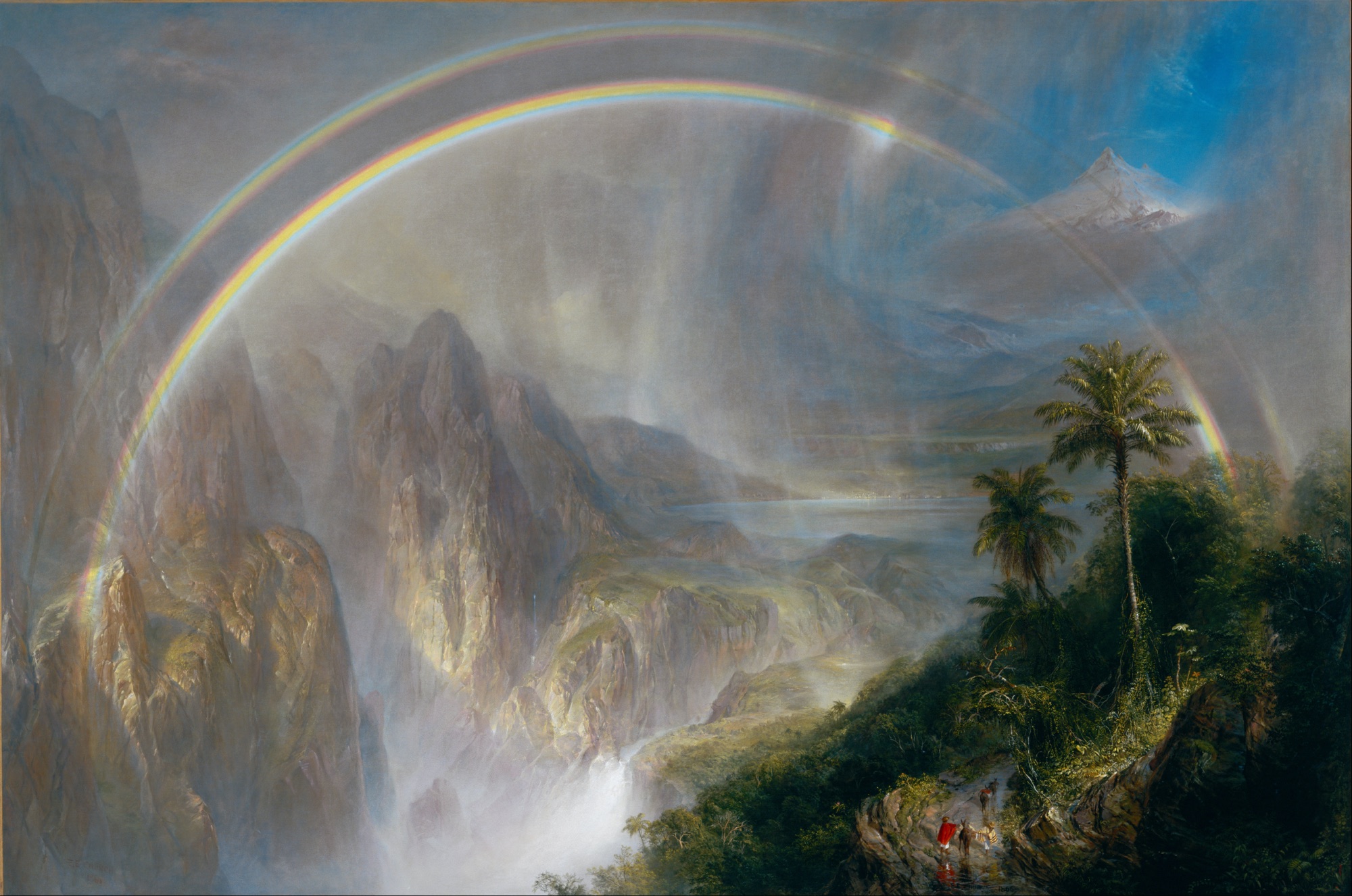
A flood rises over southern Brazil until only the summit of the Serra Krinjijimbé is left above water, and three peoples swim for it with lit firebrands held in their mouths. Two of the three tire and go under. Their souls go into the mountain, and then — this is the part that matters — they dig their way back out through the rock by two separate roads and return as the Kayurukré and the Kamé, the two halves of Kaingang society, who marry each other’s daughters to this day. That is what a flood story is for in the interior of South America. On the continent’s coasts, at Trinidad and the Strait of Magellan and Chiloé, the water remembers a country that is gone. Inland it does something else and does it everywhere: it takes a world apart and hands back the society people are living in now.
The dry crossing at Serpent’s Mouth
Warao tradition remembers the Columbus Channel and the Serpent’s Mouth as dry country joining Trinidad to the mainland. A hurricane arrives, the ground splits, and the ocean fills the new passages. It is not an island-wide deluge. It is the origin of one specific channel and the permanent loss of one specific route.
Arie Boomert sets the tradition beside the archaeology and the sea-level history and finds them describing the same thing. People walked to Trinidad before it was an island; postglacial water separated Trinidad from the mainland between about 7000 and 6000 BC; the Gulf of Paria reached its broad modern contours about a millennium later. An independent UNESCO synthesis singles out the same Warao memory of a dry Serpent’s Mouth as a survival of regional history in oral form.
The journey changes its means of travel. The old crossing needs feet; the new one needs a boat. The Warao become renowned makers and traders of dugout canoes, and their visits to southern Trinidad continue into modern times. The drowned route ends the walk without ending the relationship between the island and the delta.
When Patagonia became islands
The Selk’nam ancestors cross from the north on foot, return home, and cross again. Their road runs through dry isthmuses to Karukinká, Tierra del Fuego. Then an earthquake brings lightning, thunder and days of torrential rain. When the sky clears, they set out for their northern homeland, Wuomská, and can no longer find the crossings they have used so often. Water has cut their way home. José Luis Miguel Kalapacte, whose family came from Bahía Felipe and Gente Grande on the island’s northern coast, told this history to José María Beauvoir, who published it in 1915. Geological reconstruction puts the final flooding of the land bridge around 8,000 years ago, with people already living in the region.
Táiyin breaks the island out of a country ruled by a woman who will let nobody drink. Táita covers the lakes and pools with skins, keeps the hunting weapons for herself, and gives hungry people scraps of meat and drops of water. Táiyin kills her with a slingstone, but her blood fouls the water. He throws the dirty water away, then takes up stones. Each blow tears a fissure that fills at once: northward the Strait of Magellan, southward the Beagle Channel, eastward the separation of Isla de los Estados, westward the many islands. His grandfather K’aux stops him before the remaining land is broken up too.
Fresh water now lies within everyone’s reach. Táiyin scatters it into springs, streams and lakes, tells K’aux to divide the land, and shows the people Táita’s bows and arrows. Each man makes his own weapons and goes hunting. The new waterways accompany a new freedom to drink, feed a family and inhabit the country. An island takes shape, and with it the order of ordinary life.
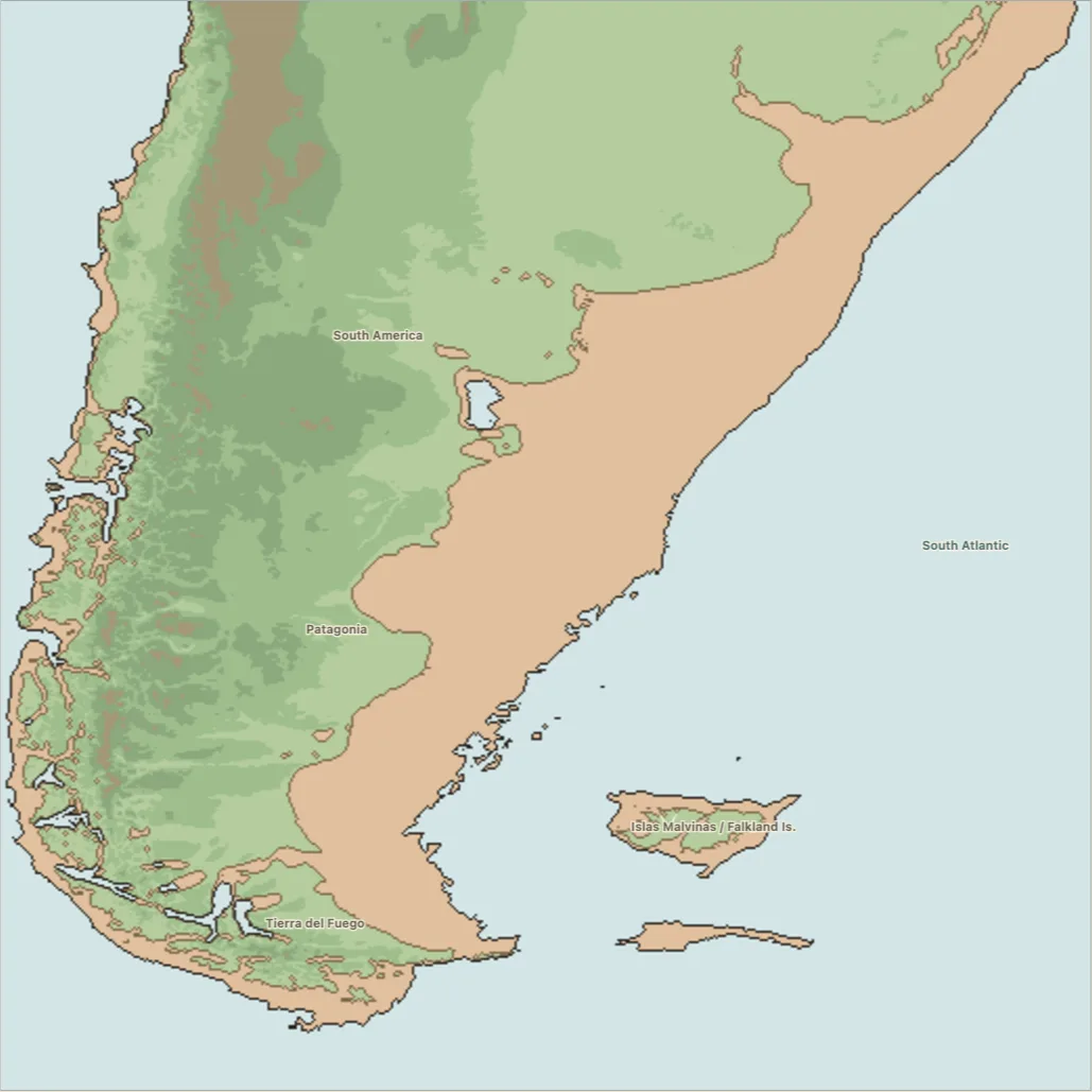
Gusinde recorded a third Fuegian telling in which water covers the whole land and its hills, people flee to the rocks, and some of them do not come back as people: they become sea lions and birds, and shamans afterwards pool their strength to hold off another advance. The island world that story ends in — marine animals, refuge rocks, bird colonies, shamanic authority over the sea — is the island world the Selk’nam lived in. Rafael Karsten took down a fourth, in which weeks of snow and sleet bring inundation, cold and hunger, and there is no summer at all. Four Fuegian tellings, four different causes, one archipelago.
The birth of the Chiloé archipelago
In the Chilote and Huilliche Cai Cai–Ten Ten cycle, the sea serpent raises the water and the earth serpent raises the hills to answer it. High ground surrounded by new sea becomes the archipelago, named hill by hill. The specifically island-making version fits a postglacial comparison better than the broad Trengtreng–Kaikai complex to the north, which Mapuche-led research reads as a durable working model of the recurring earthquake, tsunami backwash, subsidence and uplift of the active Chilean margin.
Farther north along the Chilean coast, the last refuges on Chiloé hold plants as well as people. Cai Cai wakes from a millennial sleep to find that people have left his protection in the sea and gone to live on land. He sends the waves after them. Ten Ten lifts the summits above the rising water, and the struggle continues for centuries around those last places of hope. At its end the two serpents look upon Chiloé: a country still drowned between the surviving heights. The hills have kept their inhabitants; the sea has kept the land between them.
Those two readings are not rivals. They are the same instrument used at two timescales. On the Tirúa coast the contest between the serpents is a manual for what the ground does every few generations; on Chiloé it is the account of how the islands came to be islands at all. What both hold is the shape of the country afterwards: refuge heights with names, and water where there was none.
The drowned come back as the clans
Now go inland, and the flood changes employer.
Telêmaco Borba published the Kaingang deluge at Curitiba in 1908, from the Tibagi country of Paraná, and it opens the way the coastal stories do — with rising water and one summit left. What happens next is not a rescue. The Kaingang, the Kayurukré and the Kamé all swim for the Serra Krinjijimbé carrying lit brands of firewood in their mouths. The Kaingang and a few Kurutons reach the top, some standing on the rock and some, for want of room, clinging to the branches of the trees. The Kayurukré and the Kamé tire and drown, and their souls go to live inside the mountain.
The survivors wait many days without food, expecting to die, until they hear the singing of the saracuras — wood rails — coming with earth in baskets and throwing it into the water, which withdraws slowly. The people shout at the birds to hurry; the birds quicken their song and call in the ducks to help. The birds work from the side where the sun rises, and that is why the rivers of that country all run west into the great Paraná. The men who had waited it out in the branches came down as monkeys, and the Kurutons who had clung there came down as howlers.
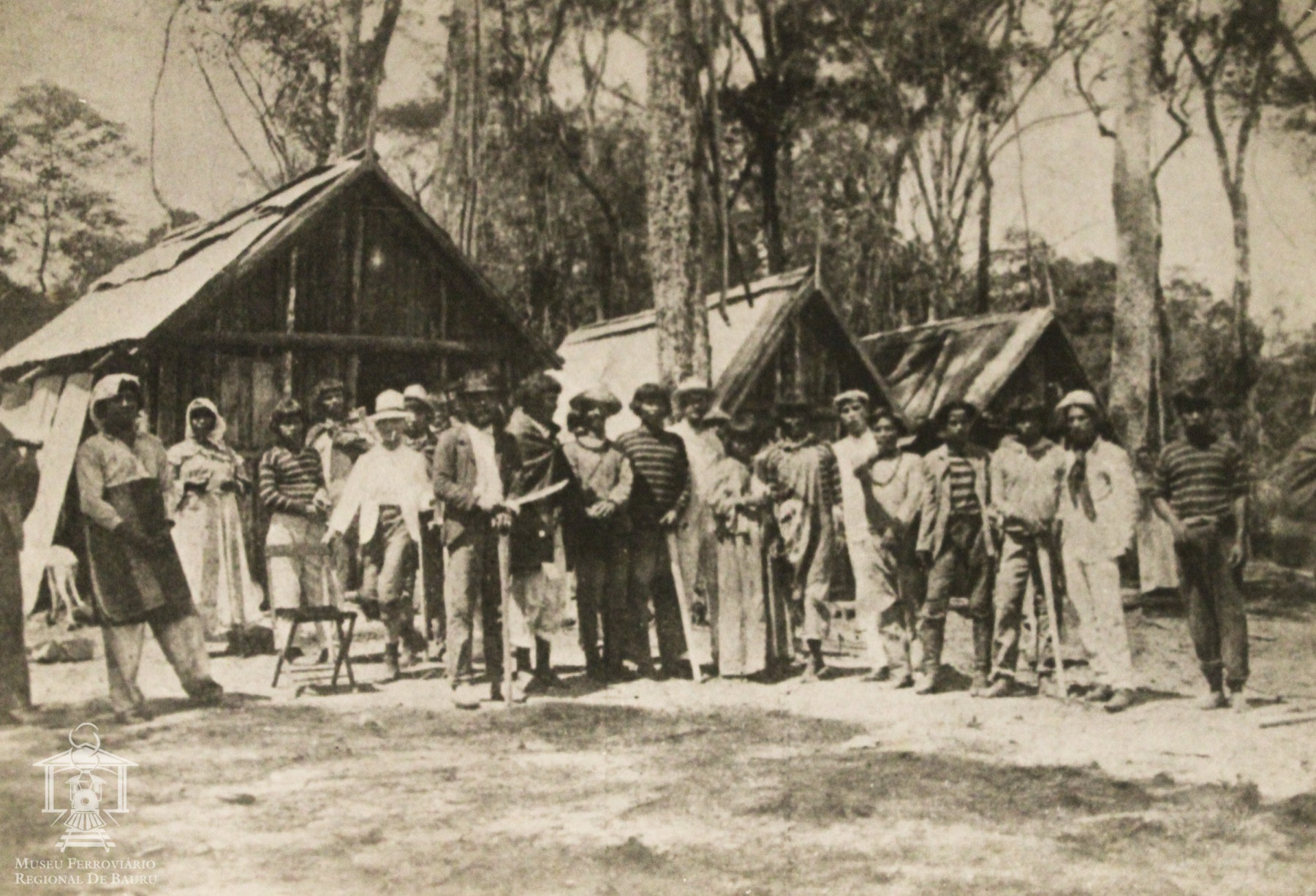
Then the flood does its real work. The Kayurukré and the Kamé, whose souls had gone into the mountain, begin to dig their way out through the inside of it, and after long labour they emerge by two separate paths. Kayurukré’s road was flat and stoneless and a fine stream sprang up along it, which is why his people have small feet. Kamé’s road went through broken rock, and he and his people bruised and swelled their feet on the march, which is why they have big ones; no water rose on their road either, so they had to ask Kayurukré for it, and he gave them leave to drink whenever they needed. Out on the open ground the two of them made the animals of the world by night, out of ash and charcoal, Kayurukré making the tapir and the anteater and the good bees, Kamé making the pumas, the venomous snakes and the wasps to fight them.
And then they married.
“They came to a great field, joined the Kaingang, and agreed to marry the young men and the young women. They married the Kayurukré first to the daughters of the Kamé, and these to the daughters of those, and as there were men left over they married them to the daughters of the Kaingang. That is why Kayurukré, Kamé and Kaingang are kin and friends.” — Telêmaco Borba, Actualidade Indígena (Curitiba, 1908), p. 22
That is the ending of a flood story, and it is a marriage rule. Everything preceding it — the firebrands, the birds with baskets, the two tunnels, the small feet and the big feet — exists to arrive there. The Kaingang did not survive a disaster. They were made by one, in halves, and the halves are why a Kaingang marriage is possible at all.
Six hundred miles north-west, in Mato Grosso, the Salesian father Antonio Colbacchini printed the Bororo lenda do dilúvio in 1919 with the same architecture and none of the same furniture. A man shoots and wounds the yellow spirit Jacomo. The waters come up over the whole country and one man alone reaches the top of a mountain. He heats stones and drops them into the water until it sinks back — a survivor who does not wait out the flood but boils it off. He fathers children on a doe, and their children are more human than they are, and their children more human again, until the line is human. And then the line splits, into Tugarege and Cerae, the two halves a Bororo village is still built from.
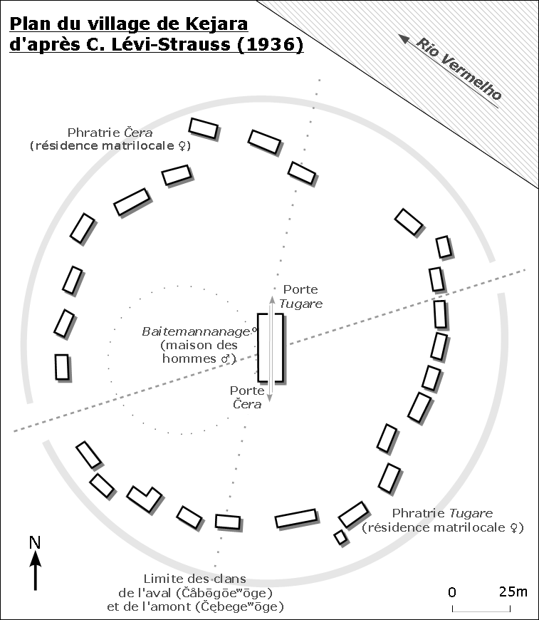
A Bororo village is a circle. Draw one line across it and you have the whole social order: the houses on one side belong to Çera, the houses on the other to Tugare, a man of one half takes a wife from the other, and the men’s house in the middle has a door on each side so that a man leaves it into his own country. Everything the Bororo do — who buries whom, who paints whom, who may sing what — runs along that line. The flood put it there. The deluge is not remembered as a thing that happened to the Bororo; it is the reason there are two kinds of Bororo.
Two unrelated languages, a thousand kilometres apart, and the same move: the flood as the origin of a two-part society, with the drowned themselves coming back as the parts. It does not run in the family. The other Macro-Ge peoples who live in moieties — Xavante, Krahó, Apinajé, Kayapó — do not derive them from a flood. Kaingang and Bororo are the two who do, and they are the clearest thing in the continent’s interior corpus.
The coast got there first. The oldest recorded flood on the continent is the Tupinambá telling André Thevet took down at Cabo Frio in the sixteenth century, and it is already a story about two. The brothers Tamendonare and Ariconte quarrel; Ariconte strikes the ground until water erupts and covers the earth; and two couples survive — in two separate trees. Each couple becomes the ancestor of a renewed people. Three and a half centuries before an ethnographer reached the Tibagi, the first flood anyone wrote down in South America was ending the way Kaingang and Bororo floods end: with humanity handed back in halves.
Among the Kayapó of central Brazil, a hunter digging out an armadillo cuts what he takes for a thick vine. It is the artery of the Earth. Water pours out and inundates the world. People climb the tallest trees, where hunger makes them too weak to descend. They do not die: they become the hornets and termites that still nest in the crowns. An old woman takes two children into a large wooden mortar, seals it with wax and ties little gourds of seeds to the vessel. The seeds travel with the family, while the treetop refugees keep their place as insects. The two ways of surviving divide the life of the new world.
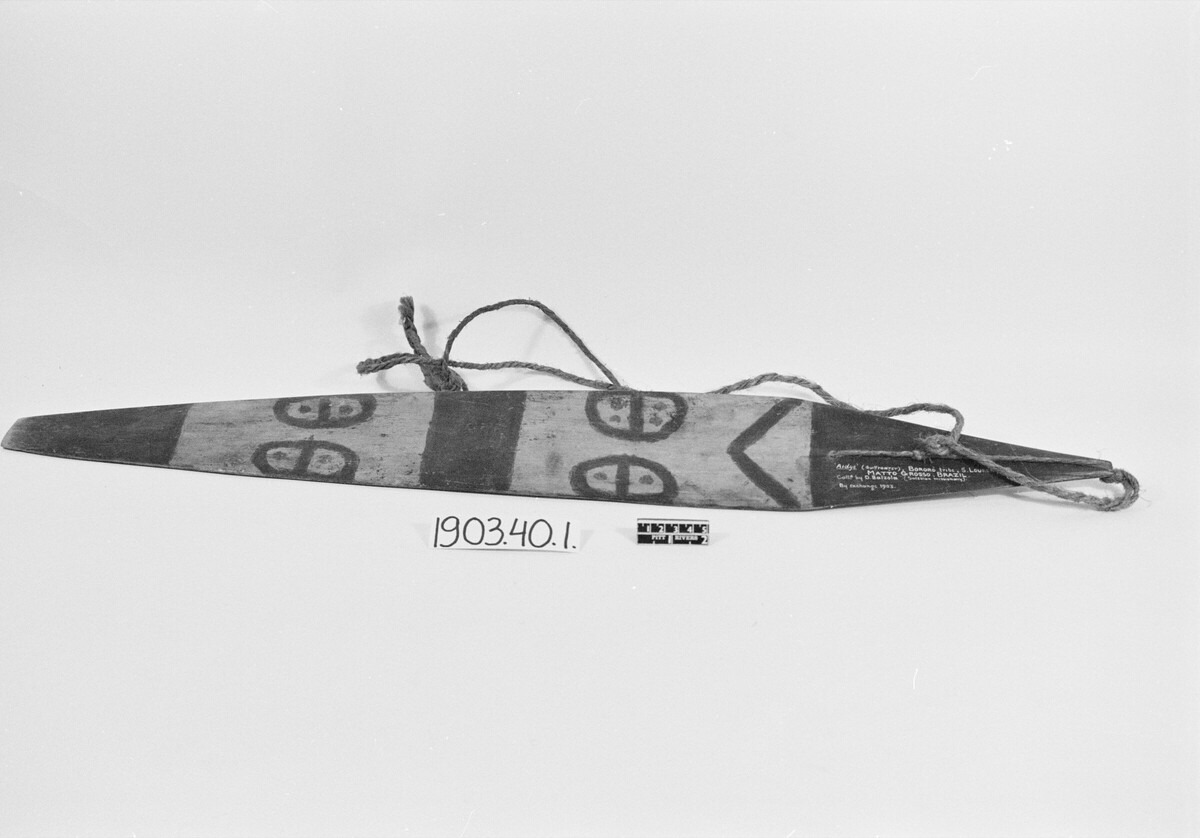
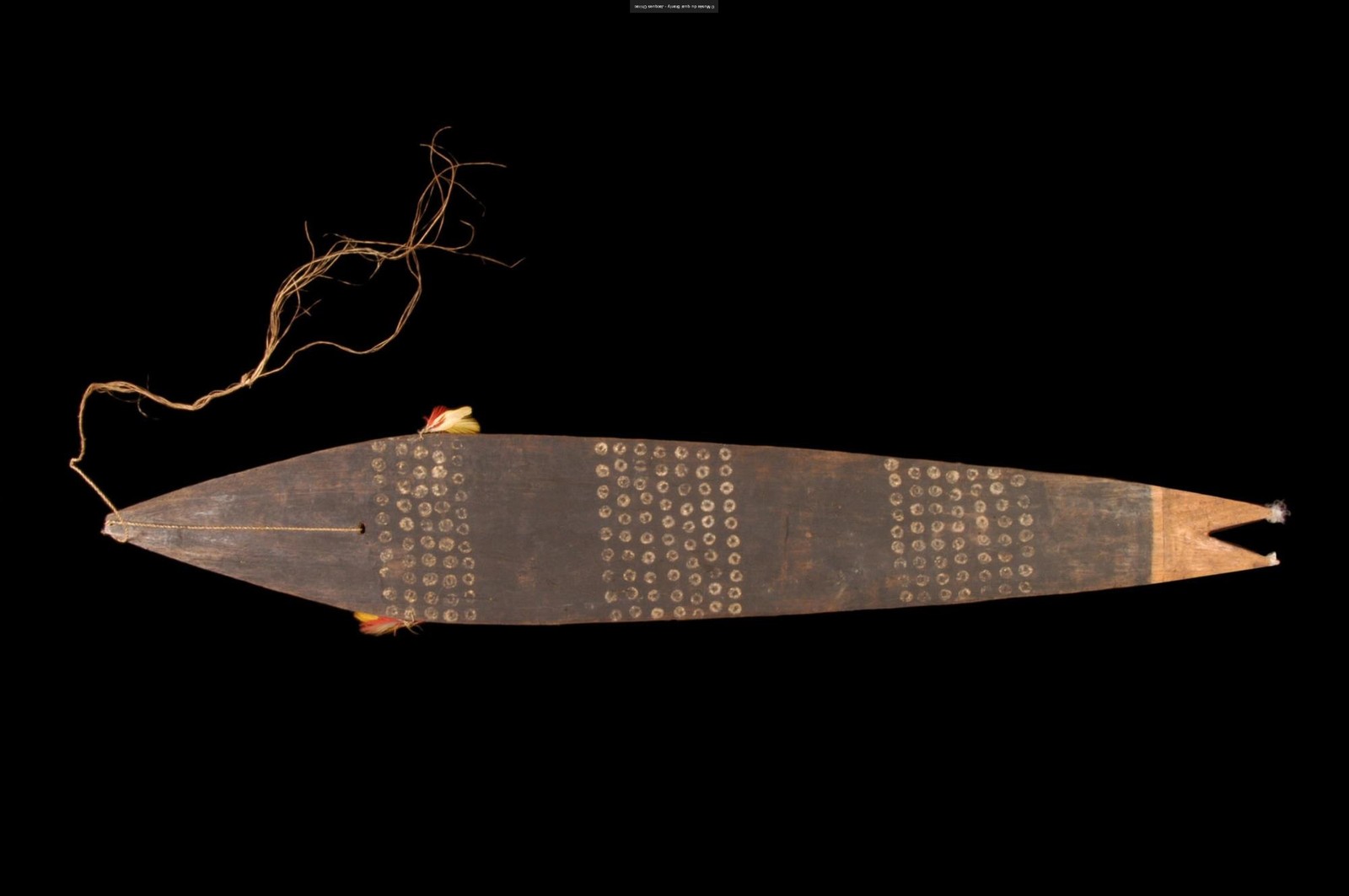
The people whose flood story ends with the drowned climbing back out of a mountain to found the clans keep an object whose whole office is to let something that lives at the bottom of the water speak at a funeral.
The water was inside the trees
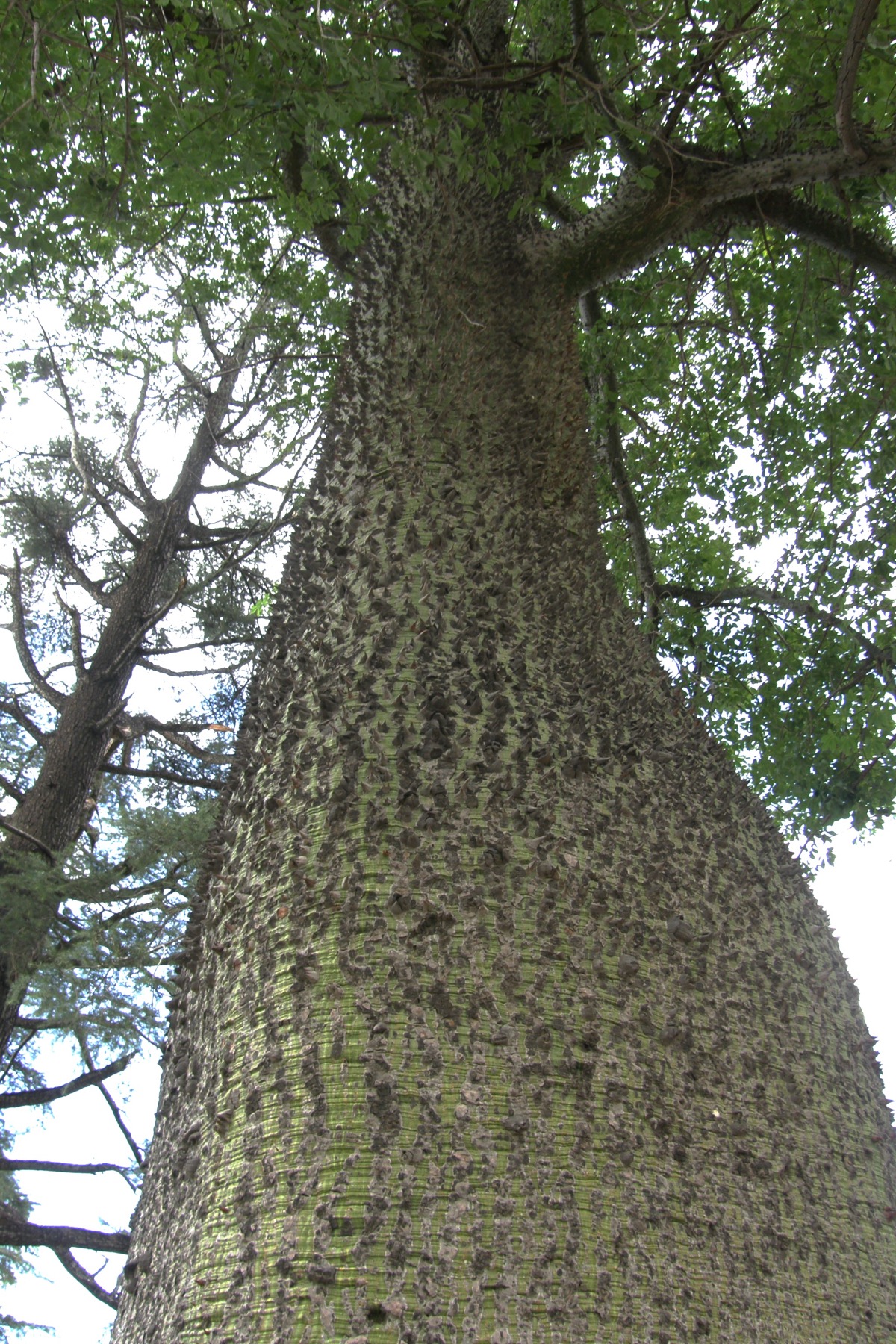
On the Pilcomayo, where Bolivia, Argentina and Paraguay come together in the dry Chaco, the flood has a different premise altogether. The water is not in the sky and not in the sea. It is locked inside the trees.
The Mataco — Wichí — tell it this way. When the world was not yet properly made, all the water there was and all the fish there were lived inside the bottle trees, and one good man owned them. People gathered to him because of the fish; he was the reason anyone ate. There was a dorado in there, and he told a man to leave it alone. The man shot it. The bottle tree broke and the water came out over everyone. The owner made an otter and sent it away with the flood to live in it, and then he made the earth.
A second Mataco telling from the lagoon country downriver runs the plot again with a different ending. A wanderer and the son he had spoken into being come to a village where the people keep a dorado in a bottle tree. He shoots it, and the sea comes out. The chief holds the water back with his staff, then hands the wanderer a smaller staff and makes him walk the sea out of the country himself; where the man finally turns into a gourd and stops it, a lagoon and a stream are left standing. The released waters of the world, corralled by two men with sticks, ending as a pond you can point at.
Now the part that makes this more than a good story. The same plot — the bottle tree, the named fish, the prohibition, the shooting, the flood — is told by the Toba as well. Mataco is Matacoan. Toba is Guaycuruan. These are unrelated language families sharing one river. A generic deluge crossing that boundary would prove nothing; whole continents share generic deluges. But this plot is not generic. It specifies the container, the species, the instruction and the weapon, and it specifies them the same way on both sides of a family line. That is a borrowing, and a borrowing is a trail — the strongest one this continent has produced.
The stump is the mountain
The Chaco is not the only place where the water starts inside a tree. Six hundred miles north, in the Cariban highlands of the Guianas, three peoples of one language family tell three solutions to the same plot.
The Akawaio of the upper Mazaruni put it first. Sigu warns the people before the great world tree is cut. A monkey opens its water-filled stump; the flood comes out; survivors shelter in a palm or a cave and carry seeds and fire through it, and afterwards fire, plants, animals and peoples spread out through the Guianas. The Macushi of the Rupununi keep the flood and drop the tree: one man survives in a canoe, a rat brings him maize, and Makunaima turns stones into new people. Same family, same country, and the story has already begun trading its parts around.
The third telling is the one Theodor Koch-Grünberg took down from the Taulipáng narrator Mayúluaipu, and it is the best of them. Five brothers — Makunaima, Manápe, Anzikilan, Wakalámbe and Anike — lived at the foot of Roroíma, and they were hungry. The agouti Akúli, who was a man in those days, found deep in the forest a huge tree called Wazáka that bore every good fruit there is — every kind of banana, papaya, cashew, orange, maize — and ate from it every day and told nobody. Makunaima caught him out by lifting his lip while he slept and finding a scrap of banana in his mouth.
So they went and felled it. Akúli begged them not to — don’t cut it down, don’t cut it down, or a great deal of water will come! — and stopped up with fruit rind and beeswax every hole the axe made. Manápe cut anyway, softening the wood with a spoken formula until the axe sank in. And the tree came down.
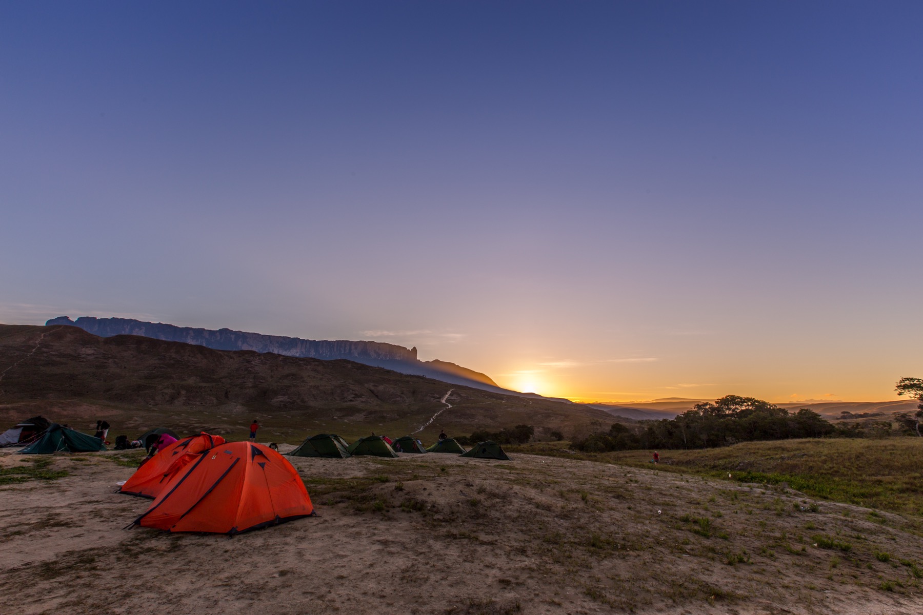
Had it fallen this way, the story says, there would be bananas in the forest here. It fell the other way, to the north, and a great deal of water burst out of the stump, and with the water came the fish — a kind of trahira, very large — and they all went to the far side too. So over there the forest is full of banana groves nobody planted and lacks for nothing, and the rivers hold pirahiba and surubim, the great fish; and on this side the fish are few and small. The bananas belong to the Mauari, the mountain demons, whose houses are Roraima and the other tables, and only the shamans see them.
This is not a memory of water. It is a landform etiology with a flood inside it, and it is doing three jobs at once: it explains a mountain, it explains why the fruit and the big fish are over there and not here, and it explains who owns the north. That is a large amount of work for one story, and it is the reason the story is still told.
Three tellings, one family, one plot, three destinations — a cosmogony in the Mazaruni, a repopulation in the Rupununi, a mountain and a fishery on Roraima. Then look back at the Pilcomayo, two thousand five hundred kilometres south. There, the world’s water and the world’s fish are inside a tree; a man is told to leave the great fish alone; he shoots it; the tree breaks and the water comes out over everyone. On Roraima the world’s water and the world’s great fish are inside a tree; a man is told not to cut it; he cuts it; the water and the fish come out and go north. Same container, same prohibition, same forbidden stroke, same released fish — on opposite ends of the continent, in languages with nothing in common. Whatever carried that from one end to the other, it was not the plot being obvious. A narrow story travelled intact, and each society that received it set it to work on the piece of the world it most needed explained.
What the river taught the story
The interior floods are cosmological in cause and exact in practice. The knowledge in them is river knowledge, and it shows in the details a fisherman would notice.
Curt Nimuendajú recorded the Ticuna deluge on the upper Solimões. A man’s dog began to speak in human words. It told him a great flood was coming, that it was going to Mount Vaipį, and that he should come along. The man would not follow a dog to a place he did not know. So the dog told him instead to have a big canoe ready, and left.
The water burst boiling out of the ground and covered everything. The family rode it out in the canoe, moored to a tree by a liana — and as the water climbed they had to lengthen the liana again and again. That is not myth. That is what you do on the várzea, on a river that rises ten metres a year, and anyone who has moored a boat in flooded forest knows the arithmetic of it. They came aground at last on Vaipį, left the canoe there — it is said to be on the mountain still — and followed the long vine home.
On the upper Rio Negro and the Içana, the Baniwa flood is the widest charter in this group, and it belongs to the creator himself. Iaperikuli walked the country naming the rivers with the animals coming along behind him. Then he darkened the world and raised the river until every animal alive was crowded into one abiu tree. The night monkey Dzauikwapa dropped fruit to test how deep the water was, then hollowed a fruit out and rode it down past the grandfather piranha; thunder came and split the tree open, and a dove brought back razor-grass — the sign there was food again. The rivers still carry the names Iaperikuli gave them, and the animals still hold the places he put them in. This one flood hands out the river names, the animals’ stations, the night monkey’s poison song and the shaman’s way into the world, all at once — and it does so in the country of the yuruparí, the sacred-flute and anaconda-ancestor cults of the northwest Amazon, where the man who named the rivers is also the head of the family the flutes speak for.
The Yaruro of the Capanaparo, in the Venezuelan llanos, take the observation further. People stopped saying that Kuma was the mother of the water and of everything else, so Kuma rained until nothing stood above the water but one tree on the upper Capanaparo and one hilltop. A man and his sister held on in the tree; a man and his aunt on the hill; a giant fish circled below them, and they ate bark and leaves. The water went down an arm’s length a day.
An arm’s length a day is a measured rate, and the Capanaparo floods its entire plain every wet season, leaving exactly the isolated tree-and-hilltop islands the story strands its people on. The tradition has watched this happen. And then it uses it: the two men married the two women, and when a later brother and sister married, an uncle turned their children into a jaguar and a snake — which is why no Yaruro marries a sister, and why the Yaruro, the jaguar and the snake are kin. A whole cosmological flood, observed to the arm’s length, spent on a rule about who you may not marry.
On the Araguaia the Karajá do it in one stroke. The great water came, and it would not stop raining, and there was nowhere left to go. Then Maíjǫri, the first of the animals, came and took the people who had given up and walked them up the tall two-peaked mountain near the mouth of the Tapirapé. The water rose no higher than that summit and the Karajá lived. The mountain has carried Maíjǫri’s name ever since.
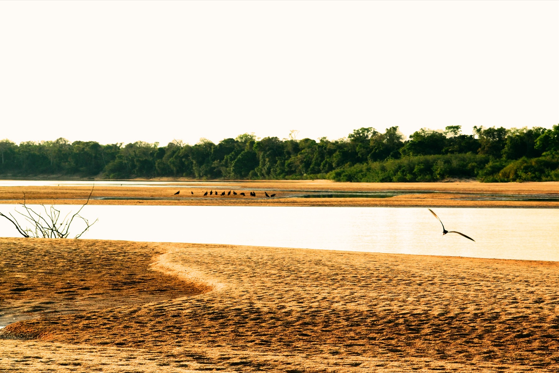
At the continent’s other named refuges — Villca Coto in Huarochirí, Ancasmarca in the Antisuyu, the Sierra de la Ventana on the pampa, Jeepüsü in the Guajira — the mountain is named for itself. The Karajá peak is named for the rescuer. The Araguaia gave that story its water; the Karajá decided what it should commemorate, and they chose the one who did the walking.
Jeepüsü earns a second look because its flood is spun. An old spinner’s cotton becomes pursuing ocean spray — the sea manufactured out of a woman’s own craft — and a young man escapes it by boat to Jeepüsü, whose hill grows while the water rises and shrinks again when it falls. A water mark and a stone boat remain on the hill. On a continent where the flood is usually a punishment or an accident, the Wayuu made it a textile.
Chucuito, and a very large lake
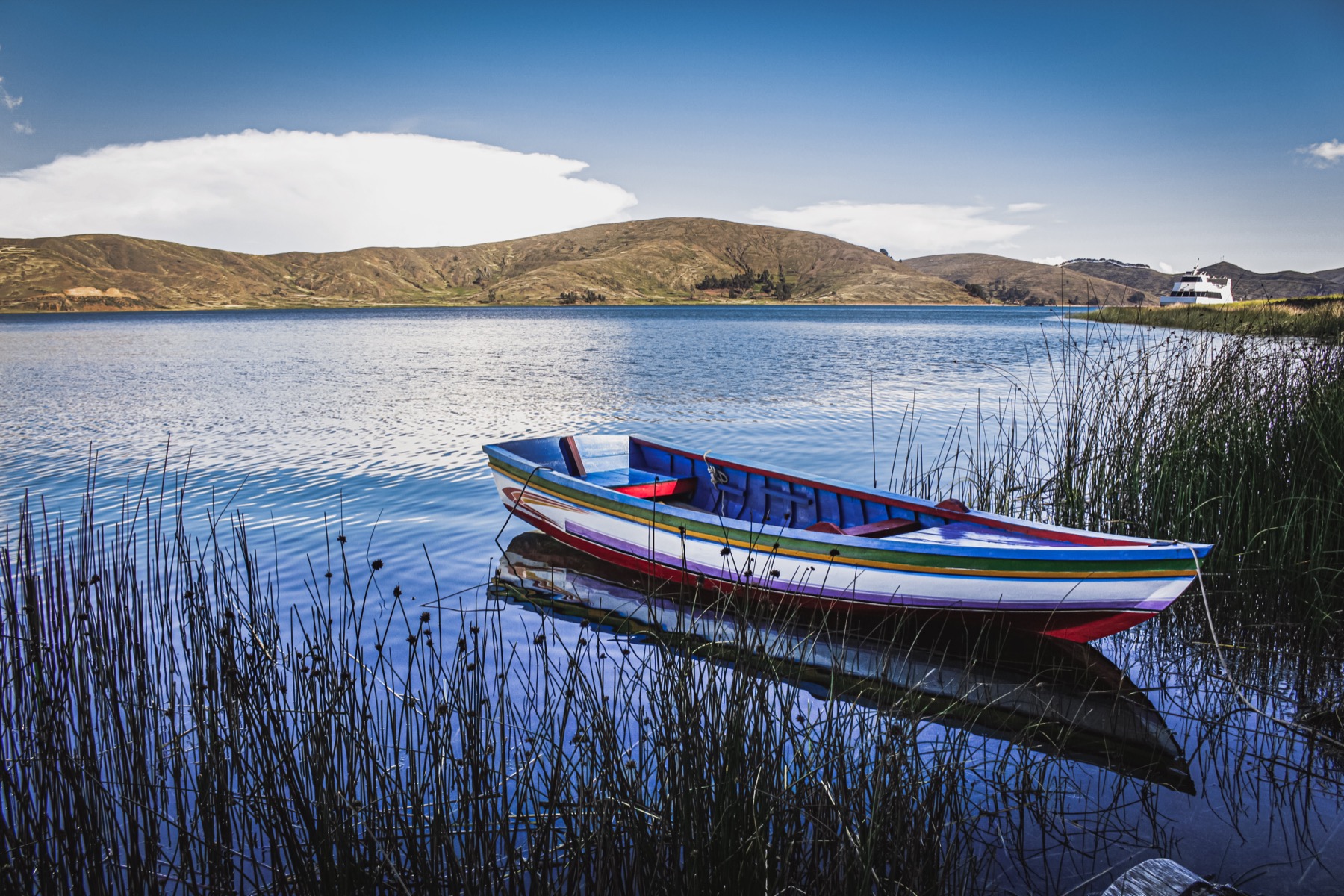
At Chucuito on the Peruvian shore of Lake Titicaca, Harry Tschopik recorded an Aymara account of the beginning of things in four lines. The earth lay under water. Snake and Frog fought each other for the mastery of it. The sun came between them, dried the water off, and gave the earth back to people.
The temptation here is obvious. Titicaca’s palaeolake highstands were real, and they were enormous — the basin has held water tens of metres above the modern lake. A flood tradition recorded on its shore looks like the obvious place to find that water remembered. It is not. Nothing in the text reaches for the lake: no water is named, no shoreline, no refuge, no ascent, no survivors. What the story has instead is a snake and a frog wrestling for the world, which is a cosmogony of a wholly different family, at home from the Andes to the Amazon.
The Kogi of the Sierra Nevada de Santa Marta, on Colombia’s Caribbean coast, ask the same discipline for the opposite reason. Konrad Preuss took down a deluge in which the chief Žántana, seeing people lying with animals and with their own kin, opens the doors of the sky; Mama Seižankua builds a boat and puts into it the four-footed animals, the birds and every kind of plant; the elder brother Mulkueikai goes in and shuts the door. That is the Genesis sequence — the loaded ark, the shut door, the mountain landing — recorded from a people under long missionary pressure. What is Kogi in it is the rest: the boat comes to rest on the ridge of the Sierra Negra, and the rain that fell for four years was red and green, and left standing lagoons that took nine ages to dry, exactly as the Mámas had said. Four years of red and green rain is nobody’s Genesis.
And the north coast keeps the counter-case: a flood that ends an order instead of founding one. The Lambayeque dynasty descended from Naylamp held power beside a green-stone idol he had installed; the ruler Fempellec decided to move it. Unprecedented rain fell for thirty days, and a year of hunger and sterility followed. The priests and nobles blamed the ruler, bound him and threw him into the sea, and his line’s authority ended in the water with him. Everywhere else on this continent the flood hands an order over. At Lambayeque the cult object is the order, the rain is the penalty for touching it, and the sea is where the dynasty is disposed of.
The tide that answered a coup
The southernmost flood in the world is about who owns a ceremony.
In Yaghan tradition the Kina — the masked lodge of the Beagle Channel people — belonged first to the women. They held it exactly as the men held it in Gusinde’s day: a closed house, painted spirits, and the other sex kept out by the terror of what came out of it. Hánuxa, the moon-woman, presided. Then the men discovered what the spirits were, took the house, and kept it.
Hánuxa answered with water. She sent a great tide against the men who had seized her ceremony; the people fled to the five highest peaks of the archipelago; and when the water fell they came down — with the men still holding Kina. The flood does not undo the coup. It closes the question. The world after the water is the one in which the lodge belongs to the men, and the moon keeps the grievance without the power to reverse it.
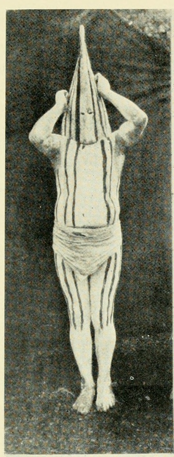
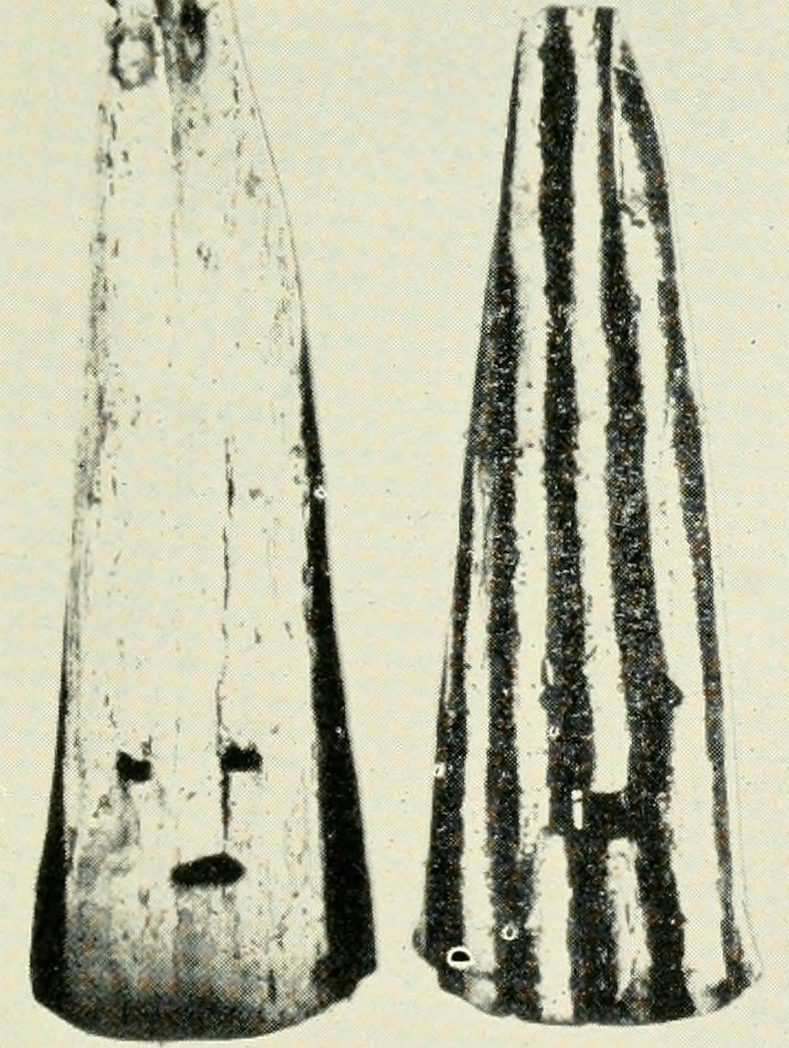
That is the charter move at its most candid — the Kaingang drowned come back as the moieties, and the Yaghan men come down off the peaks holding Kina, the flood hired as the notary of the new order. And it is told at the far end of the earth from the one other place this exact story turns up. In Arnhem Land the Djanggawul sisters own the sacred things until the men take them, and the flood-bringing python attends the ceremony the men now hold. Whether one story travelled or one settlement was twice notarised the same way, the two ends of the inhabited world tell the seizure of the women’s ceremony with a flood standing beside it.
The Yaghan keep a second flood, and it turns on an offended bird: Lexuwakipa, the ibis-woman, brings months of snow and ice, and when it melts the water goes over the mountains. Two causes, one archipelago, and in both the world that comes back down off the peaks is the one the tellers were living in when Gusinde and Wilbert wrote it down.
Mapped traditions
All mapped traditions
| No. | Place and tradition | What the story remembers | World after the water | Story and landscape | Source |
|---|---|---|---|---|---|
| Dry crossings and island transformations | |||||
| 1 | Serpent’s Mouth / Columbus Channel — Warao–Trinidad tradition | The Serpent’s Mouth was dry ground and Trinidad was the far end of a walk. Then a hurricane came. The trees of the forest came crashing down with a noise like thunder, the soil split open, and the waves of the ocean filled the cracks. | The crossing is gone and the island stands off by itself across the Columbus Channel. The Warao keep going there by canoe. | Arie Boomert, the archaeologist of Trinidad and the lower Orinoco, dates the definite separation of the island to about 7000–6000 BC, with the modern contours of the Gulf of Paria reached a millennium later, and sets this Warao tradition beside that date himself. Lennox Honychurch makes the same comparison for UNESCO by way of Wilbert. Banwari Trace puts people on southwest Trinidad at 7,800–7,900 years ago, placing people in the region while the coastline was changing. | Arie Boomert, The Indigenous Peoples of Trinidad and Tobagop. 16, footnote 4 for the narrative, with the separation date in the main text of the same page; Lennox Honychurch in UNESCO World Heritage Papers 14 (2005), p. 23, citing Johannes Wilbert, Mystic Endowment (Harvard, 1993), p. 7; Banwari Trace dating from Tankersley et al., Latin American Antiquity 29.4 (2018), pp. 681–695 |
| 2 | Strait of Magellan — Selk’nam dry-crossing tradition | Selk’nam ancestors walk south across dry isthmuses to Karukinká, return to their northern homeland, and come again. An earthquake brings thunder, lightning and several days of torrential rain. When the sky clears, they try to go home to Wuomská, but the familiar crossings have vanished. | The surviving communities become island people in a country newly divided by sea. | People lived in the region before the last dry route disappeared about 8,000 years ago. The story names that lost crossing and the island created in its place. | José María Beauvoir, Los ShelknamLos Shelknam (1915), printed p. 178 (scan image 187); testimony of José Luis Miguel Kalapacte. |
| 3 | Magellan–Beagle channel country — Selk’nam Táiyin | Táita hoards freshwater and hunting weapons, giving the people only scraps and drops. Táiyin kills her, throws away water fouled by her blood, then hurls slingstones. Each opens a fissure that fills with water: the Strait of Magellan, Beagle Channel, the separation of Isla de los Estados and the western islands. K’aux stops him before the whole country is broken apart. | Táiyin scatters clean water into springs, streams and lakes. He tells K’aux to divide the land and shows the people Táita’s bows and arrows. Each man makes his own weapons and hunts. The island country takes shape with a new freedom to drink, find food and inhabit the land. | The story names waterways formed when the sea entered southern valleys after the Ice Age, but no study has shown how old the telling is. | Museo Chileno de Arte Precolombino, Selk’nam Táiyin narrativeFrom the Gusinde corpus |
| 4 | Beagle Channel / five peaks — Yaghan Hánuxa–Kina variants | The moon-woman Hánuxa sends a great tide against men who seized women’s Kina ceremony. Canoes reach one of five peaks above the water. | The survivors return, and men keep control of Kina after the flood. | The Beagle Valley flooded as glaciers retreated, but no study has dated the story to that change. | FUCOA Yaghan community-education volumep. 46 |
| 5 | Chiloé Archipelago — Chilote / Huilliche Cai Cai–Ten Ten | In Gustavo Boldrini’s Chilote telling, Cai Cai wakes from a millennial sleep and sends the sea after people who have moved onto land. Ten Ten lifts the hilltops above the rising water. Their contest lasts centuries around the heights where people and plants take refuge. | Chiloé remains a drowned country between surviving heights: the refuge hills are islands, and the sea holds the land between them. | Victoria Reyes Pacheco sets the Cai Cai–Ten Ten contest beside the postglacial making of the archipelago: glacial melt and rising seas turning a coastal range into refuge hills, and the hills into islands. The Parque Tantauco exhibition sets Boldrini’s telling beside Renato Cárdenas’s account of the glaciers shaping Chiloé into lakes, lagoons and archipelago. | Reyes Pacheco, Chiloé flood tradition and landscapeRevista Nothofagus (2020), Chiloé comparison; Boldrini’s telling from Parque Tantauco / Fundación Futuro, “¿Cómo se formó Chiloé?”, Descubro mi Quellón, Flora y fauna exhibition, panel 5. |
| Refuge, renewal and social order | |||||
| 6 | Cabo Frio — Tupinambá: Tamendonare and Ariconte | Tamendonare and Ariconte quarrel, and Ariconte strikes the ground until water erupts and covers the earth. The two couples survive in separate trees. | Each couple becomes the ancestor of a renewed people. | The coast near Cabo Frio changed after the Ice Age, but the story says that a blow to the ground—not a wave from the sea—causes the flood. | André Thevet, La Cosmographie universellevol. 2, fols. 914v–915v; Frazer I, pp. 254–256 |
| 7 | Upper Marañón–Ecuadorian Amazon — Shuar flood variants | Separate Shuar accounts tell of an old man and sons, a couple in a cave, and two brothers who later meet parrot-women. Each survives a different flood. | Each telling renews human life through a different family and kinship solution. | These are separate community tellings rather than one flood, and no Ice Age event has been identified behind them. | Paul Rivet, ‘Les Indiens Jíbaros’L’Anthropologie 19, pp. 235–236; Frazer I, pp. 261–262 |
| 8 | Upper Mazaruni — Akawaio: Sigu and the world tree | Sigu warns people before cutting the great world tree. A monkey opens its water-filled stump and releases a flood; survivors shelter in a palm or cave and preserve seeds and fire. | Fire, plants, animals and peoples spread through the Guianas after the water falls. | The flood may draw on river-basin experience, but its sacred tree and released water have not been tied to a dated physical event. | William H. Brett, The Indian Tribes of Guianapp. 378–384; im Thurn pp. 379–381 |
| 9 | Guiana coast and interior — Lokono-Arawak: Marerewana | Marerewana foresees destruction by fire and flood and gathers survivors into a canoe tethered to a tree. | The family leaves the canoe and restores human life after the paired catastrophes. | The coast and rivers changed after the Ice Age, but the story joins fire and flood as a sacred world-ending pair rather than naming one physical event. | William H. Brett, The Indian Tribes of Guianapp. 398–400; Frazer I, p. 265 |
| 10 | Rupununi — Macushi: Makunaima and the rat’s maize | A flood leaves one man alive in a canoe. A rat brings maize, and Makunaima turns stones or other objects into new people. | Food and humanity return to the renewed world. | The Rupununi floods widely, but no single event has been linked to the story. | Richard Schomburgk, Reisen in Britisch-Guiana IIpp. 319–320; Frazer I, p. 266 |
| 11 | Encaramada–middle Orinoco — Tamanac: Amalivaca | Amalivaca and a companion survive a flood that covers the Orinoco country. They cast moriche-palm fruits behind them, and new men and women arise. | Named rocks along the river remain as marks of the renewed world. | The Orinoco changed greatly after the Ice Age, but Humboldt did not connect this account to one physical event. | Alexander von Humboldt, Personal NarrativeOrinoco and Encaramada passage; Frazer I, pp. 266–267 |
| 12 | Cañar highlands — Cañari: Huacayñán and the macaw women | Water rises while Huacayñán grows above it, saving two brothers. After the flood, two macaws become women and join them. | Their six children become the ancestors of the Cañari people. | Andean glaciers left high lakes and flood paths, but no local event has been linked to the growing mountain and macaw-women account. | Cristóbal de Molina, Narratives of the Rites and Laws of the YncasMarkham translation, pp. 4–7; Frazer I, pp. 268–269 |
| 13 | Tiwanaku–Lake Titicaca — Viracocha after the Unu Pachakuti | Viracocha destroys an earlier people by flood and darkness, then makes new peoples at Tiwanaku and sends them toward their homelands. | Distinct peoples receive their dress, languages, songs, crops and appointed places. | Lake Titicaca changed after the Ice Age, but no single rise or fall of the lake explains the different Viracocha accounts. | Cristóbal de Molina, Narratives of the Rites and Laws of the YncasMarkham pp. 3–6; compare Cieza, ch. 5 |
| 14 | Camiri–Bolivian Chaco — Chiriguano-Guaraní: Aguara-Tunpa | Aguara-Tunpa sends fire and then water. A boy and girl survive on a floating mate-gourd while a toad protects or restores fire. | The children grow and repopulate the Ava Guaraní world. | No ancient flood has been identified behind this paired fire-and-water story; it belongs first to sacred history. | Bernardino de Nino, Etnografía chiriguanapp. 131–133; Frazer I, pp. 272–273 |
| 15 | Bahia coast — early Tupi: Janipata and his pregnant sister | Janipata and his pregnant sister survive a great flood while other people perish. | Their descendants repopulate the country. | Rising seas drowned part of the Bahia coast, but this early account is too brief to connect to one place or event. | Hartley Burr Alexander, Latin-American Mythologyp. 311, reporting Fernão Cardim, Tratados da terra e gente do Brasil |
| Regional deluges and worlds remade | |||||
| 16 | Beagle Channel — Yaghan / Yamana, Lexuwakipa | Snow and ice cover the earth. When they melt, water rises over the mountains and canoe survivors reach five remaining peaks. | The survivors descend and begin life again after the ice-melt flood. | The story directly names melting ice as the cause of the flood, but no study has established when the account arose. | Wilbert and Simoneau, Folk Literature of the Yamana IndiansText 7, pp. 7–9; motif A1016.3 on p. 34 |
| 17 | Puerto Edén — Kawésqar, José Tonko Wide | After a forbidden sea otter is killed, storm and swell cover the low earth. Two people reach a hill while falling water leaves whales and orcas among the trees. | The pair build a grass shelter; dreams restore food and fire. | The surrounding fjords were invaded by the sea after the Ice Age, but a tsunami or exceptional storm remains an equally strong explanation. | FUCOA / CIREN Kawésqar community textJosé Tonko Wide, 1975; Spanish p. 42 / English p. 74 |
| 18 | Lago Budi–Tirúa coast — Mapuche: Trentrén and Kaikai | At a named Trentrén hill, the sea serpent raises the ocean while the earth serpent raises the refuge. Drowned people become fish or stone. | Survivors descend from living refuge hills, carrying ancestry and knowledge into the reshaped coast. | Published Mapuche-led research reads the contest as a durable model of recurring earthquake, tsunami backwash, subsidence, uplift and refuge on named heights—not as a record of one assigned event. | Bastías Curivil and colleagues, Mapuche cosmovision and geologyDOI 10.17704/1944-6187-40.2.581; compare Nadia Painefil, FUCOA pp. 50 / 95 |
| 19 | Purén — Mapuche | Cai Cai covers the earth with sea while Ten Ten rises or floats. Drowned people become fish, and sacrifice calms the water. | The survivors descend and repopulate the country. | Purén lies inland, so earthquake or local flooding fits at least as well as a changed ancient shoreline. | José Bengoa, Historia del Pueblo Mapuche1996, pp. 9–10; FUCOA Spanish p. 49 / English p. 94 |
| 20 | Southern Patagonia — Aónikenk / Tehuelche | Rain, springs, rivers and ocean rise to destroy violent former beings. A dove later returns with grass. | New people, dog, guanaco and rhea appear; the couple receives horse and tent and resettles the earth. | The Patagonian shelf was lost to rising seas, but the horse and tent show that this telling also carries material from after European contact. | Wilbert and Simoneau, Folk Literature of the Tehuelche IndiansText 61, p. 104 |
| 21 | Jeepüsü / Keepüsü, Guajira — Wayuu | An old spinner’s cotton becomes pursuing ocean spray. A young man escapes by boat to Jeepüsü, whose hill grows while the water rises. | The hill shrinks after the water falls; a water mark and stone boat remain. | The Wayuu name the hill the survivors climbed, though it has not been fixed to a modern map; the point marks the Wayuu homeland. | Wilbert and Simoneau, Folk Literature of the Guajiro Indians IMichel Perrin collection, text 29, pp. 85–86 |
| 22 | Sierra de la Ventana — Puelche | A flood covers the earth except Sierra de la Ventana. | People emerge from mountain caves and repopulate the world. | The refuge is a real inland mountain, but no specific ancient flood has been linked to it. | John M. Cooper, ‘The Patagonian and Pampean Hunters’Handbook of South American Indians I, p. 168 |
| 23 | Ancasmarca / Antisuyu — Andean shepherd tradition | Llamas stop eating and read a warning in the stars. A shepherd, six children, food and animals climb Ancasmarca while the hill rises above the flood. | The hill sinks after the water falls, and the six children repopulate the province. | Water released from melting Andean ice is possible, but no event in the Vilcanota region has been linked to the account. | Cristóbal de Molina, Fables and Rites of the YncasMarkham translation, pp. 9–10 |
| 24 | Eastern Paraguay — Aché | Water covers the world; people become capybaras and their souls rise. One man survives in a pindo palm, and a woman arises from him. | The pair descends after the water falls and continues human life. | The story names no waterbody or particular landscape that could identify a physical event. | León Cadogan, ‘Baiõ Kará Wachú’América Indígena 22(1), 1962, p. 81 |
| 25 | Upper Purus — Huni Kuin | A month of rain and overflowing rivers leaves Nete on a tree raft. Another survivor becomes a monkey. | Nete makes children from gourds and teaches crops, cooking and house-building. | The story’s renewed society is unusually detailed, but the flood most directly resembles prolonged flooding on Amazonian rivers. | André-Marcel d’Ans, La verdadera Biblia de los Cashinahuapp. 94–106 |
| 26 | Chambira — Urarina | Kuánra brings darkness and flood. A family survives in a food-giving tree, and the land afterward is a vast beach. | A sky canoe brings spouses, and the sequence establishes weaving, childbirth and postpartum law. | A storm or river flood in the Amazon fits better than an ancient rise of the sea; the story’s chief concern is the social world formed afterward. | Bartholomew Dean, ‘The Poetics of Creation’LAILL 10(1), narrative pp. 25–28 |
| 27 | Cahuapanas–Paranapura — Kanpopiyapi | Konpanama sends prolonged rain and darkness after fishing abuse. Two brothers survive in a growing sapota tree with birds and animals. | The water falls, and marriages, transformations and divine commands establish later social rules. | The account may describe an Amazonian rain or river flood. Some Christian wording in translation also makes its earlier history uncertain. | Nancy Ochoa Siguas, 1992pp. 163–180, story especially pp. 170–180 |
| 28 | Maini–Copipitone–Manuelaba mountains — Sikuani | Water destroys everything across the land. A few people survive on three named mountains. | There, the text says, the generations were preserved. | The mountain names are exact but have not been securely located; the point marks the wider Sikuani country rather than a single summit. | Wilbert and Simoneau, Folk Literature of the Sikuani Indiansp. 115 |
| Named outlets, ocean refuges and cold-world floods | |||||
| 29 | Tequendama Falls–Bogotá savanna — Muisca: Chibchacum and Bochica | Chibchacum causes the Sopó and Tibitó waters to rise across the Bogotá savanna. Bochica opens the outlet at Tequendama with a golden staff but leaves rivers for future drought. | The waterfall drains cultivable country while useful water remains inside the ordered landscape. | The Bogotá savanna did hold a great Pleistocene lake, and its outlet is the Tequendama: Bochica’s opened rock follows the water’s real exit. The lake drained tens of thousands of years before the savanna was settled, so the story reads as the landscape explained rather than remembered — the falls handed the myth its hydraulic shape. | Pedro Simón; EGU Geolog landscape comparisonPrimary: Noticias historiales, Second Part, Third Noticia Historial, ch. IV, pp. 288–291; Chibchacum is the flood agent |
| 30 | Villca Coto, Huarochirí — Huarochirí Quechua: the warning llama | A llama refuses to eat because it knows the ocean will overflow in five days. It warns its owner to carry food to Villca Coto, where animals crowd onto the mountain. | The ocean covers every other summit and then retreats; the prescient llama and its human companion preserve life above it. | The scale is cosmological, but this is an old, explicitly marine inundation tied to a named refuge—not an ordinary remembered river flood. | The Huarochirí Manuscriptch. 3, §§29–34, pp. 51–52 |
| 31 | Chotuna–Chornancap, Lambayeque — Lambayeque: Fempellec moves the idol | Fempellec tries to move the green-stone idol installed by Naylamp. Unprecedented rain lasts thirty days, followed by a year of hunger and sterility. | Priests and nobles blame the ruler, bind him and throw him into the sea, ending his authority. | Published research reads the sequence as a cultural memory of severe El Niño rain and political failure. It identifies a recurring coastal process rather than one dated episode. | Cabello Valboa; Billman and Huckleberry on El Niño politicsPrimary narrative: Miscelánea antártica, Part III, ch. XVII |
| 32 | Serra do Mar–Itariri — Apapocúva-Guaraní: Guyraypotý | As the earth collapses and burns, the sea rises as a wall and overtops the mountains. Guyraypotý’s plank house floats and rises while his wife dances. | The water cools the burning earth, and the dancing household escapes upward from the ruined world. | The oceanic ascent is undated and cosmological, yet it belongs beside the immense postglacial transformation of Brazil’s Atlantic coast rather than beside an ordinary river flood. | Curt Nimuendajú, Apapocúva-Guaraní world destruction1914, pp. 332–334; Guaraní text pp. 401–403 |
| 33 | Río Gallegos hinterland — Aónikenk / Tehuelche: a Big Water | An ancient big water covers the lower country and kills many people. Survivors escape to the ‘big lands’ — the mountains. | Human life continues from the mountain refuges above the drowned low country. | The low-country and mountain contrast stands beside the vast Patagonian shelf lost after the Ice Age. The collector proposed a physical reading, but the tradition itself gives no date. | Ramón Lista, Mis exploraciones y descubrimientos en la PatagoniaBuenos Aires 1880, pp. 116–117: old men said that in remote times they numbered thousands, but a big water, «una agua grande», covered all the low lands, «todas las tierras bajas», and destroyed a great number; the few who remained saved themselves in the mountains. Lista calls the tradition a reference to a great deluge, «un gran diluvio». |
| 34 | Tierra del Fuego — Selk’nam: inundation transformations | Water covers the whole land and its hills. People flee to rocks; some become sea lions and birds, and shamans later combine their strength to halt another advance. | Marine animals, birds, refuge rocks and shamanic authority remain joined in the inhabited island world. | The marine transformations sit naturally beside Tierra del Fuego’s drowned shelf and the straits that opened through it as the ice went. | Martin Gusinde, Die Selk’nam, via Wilbert & SimoneauWilbert & Simoneau, Folk Literature of the Selknam Indians: Martin Gusinde’s Collection of Selknam Narratives (UCLA Latin American Center, 1975), pp. 73–74, translating Gusinde, Die Feuerland-Indianer I (1931), p. 625 |
| 35 | Tierra del Fuego — Selk’nam / Ona: There Was No Summer | Weeks or months of snow and sleet produce widespread inundation, cold and hunger. There is no summer, and many people die. | The survivors pass through a cold-water catastrophe unlike the separate Selk’nam sea-lion transformation flood. | A flood caused by prolonged snow and sleet belongs among cold-world and ice-melt traditions, though the source offers no date or exact palaeoclimate match. | Rafael Karsten, Indian Tribes of the Argentine and Bolivian ChacoHelsingfors 1932, pp. 211–212 |
| Interior deluges, moiety charters and the origin of water | |||||
| 36 | Serra Krinjijimbé / Tibagi — Kaingang | A great flood rose until only the summit of the Serra Krinjijimbé stood clear. The Kaingang, the Kayurukré and the Kamé all swam for it with lit firebrands held in their mouths. The Kayurukré and the Kamé tired and went under, and their souls went to live inside the mountain. | Water-birds carried earth in baskets and built the land back up. Those who had waited out the flood in the branches became monkeys, and the drowned dug out through the mountain by two paths and came back as the Kayurukré and the Kamé, who marry each other’s daughters still. | A moiety charter rather than a water memory: the flood exists to explain why Kaingang society has two halves and why they intermarry. | Telêmaco Borba, Actualidade IndígenaCuritiba 1908, pp. 20–27, myth 1 |
| 37 | Rio São Lourenço, Mato Grosso — Bororo | A man shot and wounded the yellow spirit Jacomo. The waters came up over the whole country, and one man alone reached the top of a mountain. | He heated stones and dropped them in until the water sank back. He fathered children on a doe, and their children were more human than they were, until the line was human again and split into the two halves, Tugarege and Cerae, that a Bororo village is still built from. | A moiety charter of the same type as the Kaingang telling. The mountain is unnamed and the mechanism is not a physical process. | Antonio Colbacchini, A Tribu dos BorórosRio 1919, pp. 43–45, “Lenda do dilúvio” |
| 38 | Mouth of the Rio Tapirapé, Araguaia — Karajá | The great water came over the land and would not stop raining, and the Karajá had nowhere left to go. Then Maíjǒri, the first of the animals, came and took the people who had given up and led them up the tall two-peaked mountain near the mouth of the Tapirapé. | The water rose no higher than that summit and the Karajá lived. The mountain has carried the name of Maíjǒri ever since, after the animal that walked them up it. | The Araguaia floods enormous areas of the Ilha do Bananal every wet season, and the named two-peaked mountain is real high ground in the right relation to that floodplain. No deep-time reading is available. | Wilhelm Kissenberth, Zeitschrift für Ethnologie44/1 (1912), pp. 36–59, at p. 49; narrator Alfredo |
| 39 | Mount Vaipį, upper Solimões — Ticuna | A man’s dog began to speak in human words and said a great flood was coming, that it was going to Mount Vaipį, and that he should come along. The man would not follow a dog to a place he did not know, so the dog told him instead to have a big canoe ready, and left. | The water burst boiling out of the ground and covered everything. The family rode it out moored to a tree by a liana they had to lengthen again and again. They came aground at last on Vaipį, left the canoe there — it is said to be on the mountain still — and followed the long vine home. | The canoe moored by a liana that has to be lengthened as the water climbs is precise várzea practice. Against that, the water bursts from the ground rather than rising from the river, which is a cosmological cause. | Curt Nimuendajú, The TukunaUCPAAE 45, Berkeley 1952, p. 141 |
| 40 | Sierra Nevada de Santa Marta — Kogi (Kágaba) | People were lying with animals and with their own kin. The chief Žántana saw it and opened the doors of the sky. Mama Seižankua built a boat and put into it the four-footed animals, the birds and every kind of plant, and the elder brother Mulkueikai went in and shut the door. | Red and green rain fell for four years and left lagoons standing everywhere. The boat came to rest on the ridge of the Sierra Negra, and Mulkueikai waited nine days there, and nine ages more before the lagoons dried, exactly as the Mamas had said. | The boat, the loaded animals, the shut door and the mountain landing are the Genesis sequence, and Preuss recorded after long missionary contact. The Sierra Negra refuge and the four-year red-and-green rain are Kogi; the ark frame likely is not. | Fischer & Preuss, Mitos KogiQuito: Abya-Yala 1989, pp. 39–40, §§38–43 |
| 41 | Mount Roraima — Taulipang (Pemón) | Five brothers lived at the foot of Roroíma. They found a tree that carried every fruit there is, and one of them cut it down, though he had been warned how much water it held. All the water in the trunk came out at once. | The stump remained standing where the tree had grown, and it is Mount Roraima. The flood carried the fruit and the fish away to the other side of the country, and that is why the bananas and the big fish are found over there and not here. | A landform etiology rather than a water memory: the flood is a by-product of felling the world tree, and its real work is to explain the mountain and the distribution of fish and fruit. | Theodor Koch-Grünberg, Vom Roroima zum Orinoco IIStuttgart 1924, pp. 36–38, “Der Weltbaum und die grosse Flut” |
| 42 | Cerro Guanay — Piaroa (De’Aruwa) | A sacred bird told Póman-Ichaj and his wife Jiudej Tucusita that a flood was coming and that they should build high up on Mount Guanary. They built there, and the water came. | A pendare tree gave milk and nursed their children. From those children came the Piaroa and the peoples living around them. | Cerro Guanay is a real tepui and a real refuge, but the story is an ethnogenesis and nothing in it points at an event. | Armellada & Bentivenga de Napolitano, Literaturas Indígenas VenezolanasCaracas: Monte Ávila 1991, pp. 318–321 |
| 43 | Upper Capanaparo River — Yaruro (Pumé) | People stopped saying that Kuma was the mother of the water and of everything else, so Kuma rained until nothing stood above the water but one tree on the upper Capanaparo and one hilltop. A man and his sister held on in the tree, a man and his aunt on the hill, and a giant fish circled below them while they ate bark and leaves. | The water went down an arm’s length a day and the four of them came off and gathered turtles. The two men married the two women, and when a later brother and sister married, an uncle turned the children into a jaguar and a snake — which is why no Yaruro marries a sister, and why the Yaruro, the snake and the jaguar are kin. | The Capanaparo floods its whole plain annually, leaving exactly the isolated tree-and-hilltop islands the story puts its survivors on, and a fall of an arm’s length a day is an observed rate. The story’s own purpose is nonetheless a marriage rule. | Vincenzo Petrullo, The Yaruros of the Capanaparo RiverBAE Bulletin 123, Washington 1939, pp. 245–246 |
| 44 | Pilcomayo bottle-tree country — Mataco (Wichí) | When the world was not yet properly made, all the water and all the fish were inside the bottle trees, and one good man owned them. People gathered to him because of the fish. One bad man shot the dorado he had been told to leave alone. | The bottle tree broke and the water came out over everyone. The owner made an otter and sent it off with the flood to live in it, and then he made the earth. | An origin-of-water and origin-of-fish story: water is inside the trees before it is in the world. No event reading is available. | Wilbert & Simoneau, Folk Literature of the Mataco IndiansUCLA 1982, p. 160, tale 76 “Creation of the Earth” |
| 45 | Pilcomayo lagoon country — Mataco (Wichí) | A wanderer and the son he had spoken into being came to a village where the people kept a dorado in a bottle tree. He shot it, and the sea came out. | The chief held the water back with his staff, then gave the wanderer a smaller one and made him walk the sea out of the country himself. Where he finally turned into a gourd and stopped it, a lagoon and a stream were left standing. | The same released-waters plot as its neighbour, ending in a small landform etiology. Neither telling reaches an event. | Wilbert & Simoneau, Folk Literature of the Mataco IndiansUCLA 1982, pp. 155–156, tale 73 “The Release of Waters” |
| 46 | Chucuito, Lake Titicaca — Aymara | The earth lay under water, and Snake and Frog fought each other for the mastery of it. | The sun came between them, dried the water off, and gave the earth back to people. | Titicaca’s palaeolake highstands were real and large, but nothing in the text supports the connection: no lake is named, no shoreline, no refuge, and the agents are a snake and a frog. | Harry Tschopik Jr., “The Aymara”Handbook of South American Indians II, Washington 1946, p. 571 |
| The Chaco, the Bolivian slopes and the sacred-flute rivers | |||||
| 47 | Kraolândia, Maranhão–Tocantins — Krahó (Timbira) | Pud and Pudleré, Sun and Moon, quarrelled over a hunt. There was hot capybara fat and there was boiling water, and then a flat turtle was dug out of the ground, and the world-flood came up out of the hole it left. | The water goes over everything, and the quarrel of the two brothers is what set it going. Narrator Yavu-Boaventura. | Cosmological, and specifically not a moiety charter — which matters, because the neighbouring Kaingang and Bororo floods are. The Xavante, the Apinajé and the Kayapó do not derive their moieties from a flood either: the charter does not extend across the family. | Wilbert & Simoneau, Folk Literature of the Gê Indians, vol. 1UCLA Latin American Center 1978, Craho text at pp. 38–48; the flood at p. 40; narrator Boaventura |
| 48 | Northern Chaco, Alto Paraguay — Chamacoco (Ishír) | A man dug a deep pit, put his family down into it and sealed the mouth over them with earth. Then he waited in the dark. He heard the crested screamer singing somewhere above the water, and after a while he heard its feet walking on the ground over his head. | The bird walking overhead is how he knows there is ground again, and the family comes up out of the earth it was buried in. | A cosmogonic water, and a telling absence beside it: the Chamacoco do not carry the bottle-tree flood the Mataco and Toba tell. | Wilbert & Simoneau, Folk Literature of the Chamacoco Indians (UCLA 1987)pp. 125–126, in the volume’s deluge chapter at pp. 105–126 |
| 49 | Pilcomayo Chaco — Nivaclé (Chulupí) | The sky-boy Tawpatax killed the woman who tried to nurse him. A cloud came down and taught him how to destroy the people, and he did it: the earth sank, and everything living went down into it. | Nothing. There are no survivors and nothing is founded — an unusual shape for the continent, where the flood is almost always the start of something. | A total-erasure flood with no coast in it. The Nivaclé, like the Chamacoco, do not carry the bottle-tree plot of their Mataco neighbours. | Wilbert & Simoneau, Folk Literature of the Nivaklé Indians (UCLA 1987)p. 89 |
| 50 | Eastern Chaco, upper Pilcomayo — Chorote | Two tellings. In the first, new people come down from above onto dry earth, and a man gives birth to a girl out of his own hand and has to marry her. In the second, the earth sinks, the water that was under it seeps up through the ground, and a large white animal from the sky picks the boys out of it one by one. | In the first telling the forced marriage is where people begin. In the second the boys are simply lifted clear. | Bierhorst reports a Chorote bottle-tree flood too, which makes them a third carrier of the Mataco–Toba plot (The Mythology of South America, 1988, p. 123). | Wilbert & Simoneau, Folk Literature of the Chorote Indians (UCLA 1985)pp. 38–41, the volume’s deluge run |
| 51 | Chapare, eastern Bolivian foothills — Yuracaré | Tiri broke off one of his toenails and made a companion out of it, Karu. A bird showed the two of them a pot that filled itself again every time it was emptied. Tiri hit the pot with his stick, and the flood that came out of it drowned Karu. | Tiri found the bones afterwards and brought him back to life. The pair go on to marry pospo birds and to fix, between them, how children are born and why men die. | The flood is one act inside a culture-hero cycle whose real subject is mortality, not water. No landscape claim is made. | Alfred Métraux, “Tribes of the Eastern Slopes of the Bolivian Andes”Handbook of South American Indians III (1948), p. 503; Métraux abridging d’Orbigny, Voyage dans l’Amérique méridionale (1844) |
| 52 | Tacana country, northern Bolivia — Tacana | All the rivers rose at once. A fish that ate people went through the survivors one after another until a boy killed it, and one couple got away up a high mountain. | The couple on the mountain are what is left, and the people come from them. | A river flood with an unnamed refuge. The source does not name the mountain, so the point anchors the Tacana country rather than a summit. | Karin Hissink & Albert Hahn, Die Tacana I: ErzählungsgutKohlhammer, Stuttgart 1961, pp. 495–497 |
| 53 | Uapui and the Aiari, upper Rio Negro and Içana — Baniwa (Hohodene) | Iaperikuli walked the country naming the rivers with the animals coming along behind him. Then he darkened the world and raised the river until every animal alive was crowded into one abiu tree. The night monkey Dzauikwapa dropped fruit to test how deep the water was, then hollowed a fruit out and rode it down past the grandfather piranha. Thunder came and split the tree open. | A dove brought back razor-grass, and that was the sign there was food again. The rivers still carry the names Iaperikuli gave them, and the animals still hold the places he put them in. | The widest charter in this group: the flood hands out the river names, the animals’ places, the night monkey’s poison song and the shaman’s way into the world, all at once. It belongs to the northwest Amazonian yuruparí belt of sacred flutes and anaconda ancestors. | Robin M. Wright, The History and Religion of the Baniwa Peoples of the Upper Rio Negro Valley (Stanford, 1981)Iaperikuli and the flood in the Hohodene origin narration, p. 559 |
| 54 | Vaupés — Cubeo | The flood was sent because the abuhuwa, the forest cannibals, had been killing people. Those who got to a high hill lived through it. | There are fewer monsters in the forest now than there were, and that is what the water was for. | The water is sent as pest control: what it clears out is the abuhuwa, and the forest is emptier of them afterwards. The hill goes unnamed in the source, so the point marks the Vaupés rather than a summit. | Lawrence E. Sullivan, Icanchu’s Drum: An Orientation to Meaning in South American Religions (1988)p. 74, carrying the cause verbatim: “because abuhuwa, cannibal monsters of the forest, were killing people” |
| 55 | Northern Chaco — Ayoreo | A man saw the flood coming and did not go anywhere. He stayed in his house, and the house floated, and everyone around him drowned. | He comes through it because his house came through it. Nothing else is founded. | A cosmological flood: the house floats, the world is renewed, and no coast is in it. This is the floating-house telling, one of many Ayoreo flood variants in the same volume. | Wilbert & Simoneau, Folk Literature of the Ayoreo Indians (UCLA 1989)p. 52 |
| 56 | Nambicuara country, western Mato Grosso — Nambicuara | A flood destroyed human life and one old woman alone came through it. | Humanity was made again out of her children, by several marriages among them, and the people now alive descend from that line. | Cosmological, and very thinly recorded. Lévi-Strauss gives it in summary from his own manuscript rather than as a full telling. | Claude Lévi-Strauss, “The Nambicuara”Handbook of South American Indians III (1948), p. 369 |
The world after the water
Set the fifty-six traditions side by side and the continent divides cleanly, not by how good the stories are but by what they are for.
On the coast, the flood remembers. Warao tradition holds a dry Serpent’s Mouth that the ocean took; Selk’nam tradition holds walking routes that stopped being walkable; the Chilote cycle holds the making of an archipelago out of refuge hills. These are the only places where the water in the story and the water in the shelf record are describing the same event, and they sit where you would expect them to sit — on the drowned edges, Trinidad, the Fuegian straits, the Chilean channels, the Atlantic Brazilian shore where Guyraypotý’s plank house floats up as the sea comes over the Serra do Mar.
Inland, the flood constitutes. It is not a lesser use of the story; it is the more common one, and on this continent it is the more elaborate one. The Kaingang flood makes two marriage classes and equips them with feet, water rights and animals. The Bororo flood makes Çera and Tugare and hands them a village plan. The Yaruro flood ends in the prohibition on marrying a sister and a kinship with the jaguar and the snake. The Urarina flood establishes weaving, childbirth and the law of the lying-in. The Huni Kuin survivor makes children out of gourds and teaches crops, cooking and house-building. Viracocha, after the Unu Pachakuti, does not merely remake people — he issues them their dress, their languages, their songs, their crops and the country each is to live in. The Cañari flood ends with two macaws becoming women, and their six children are the Cañari. The Piaroa flood ends with a pendare tree nursing the children who become the Piaroa and their neighbours.
That is the pattern, stated plainly: the flood is the mechanism by which a society explains that it is the shape it is. The East Asia essay can put a number on it — of 232 minority flood texts from the Chinese southwest, 79 per cent end by instituting the present order, the surnames, the peoples, the marriage of the surviving brother and sister. Nobody has counted South America that way. What it offers instead is the cleanest demonstration of the two uses standing side by side on one map, close enough to compare: a Selk’nam story about a road that went under, and eight hundred miles of Ge and Chaco and Guiana country where the story is about how the village is laid out.
The two uses are one instrument. Whether the water takes away a walking route or takes away an undivided humanity, the story is about a world going under and a different world being handed back — and it is always the second world, the one after, that the tellers are living in. That is why the Kaingang and the Bororo do not put their ancestors in a boat. They put them at the bottom. The drowned are the important ones. They go into the mountain, and they come out as the halves that make a marriage possible, and the whole point of the flood is that the people telling it are descended from the ones who did not make it to the top.
Key sources
Horace Banner, “Mitos dos índios Kayapó”, Revista de Antropologia 5.1 (1957), pp. 49–50, section 15, for the Earth’s artery, the living treetop refugees and the wax-sealed mortar with seeds tied to it.
Map. Terrain: GEBCO; sea levels: Lambeck et al. 2014.
Coasts. The Trinidad case rests on Arie Boomert, The Indigenous Peoples of Trinidad and Tobago (2016), pp. 15–17, with “Kaíri, Trinidad” (2010), pp. 29–30. Selk’nam testimony is in Beauvoir 1915, printed p. 178 (scan image 187), with the geological frame in Rabassa et al.; the complete Táiyin narrative is reproduced from Martin Gusinde’s Los Indios de Tierra del Fuego, tomo I, vol. II, by the Museo Chileno de Arte Precolombino. The sea-lion transformations come from Gusinde, Die Feuerland Indianer I (1931), p. 625, and Rafael Karsten (1932), p. 211. Yaghan material is from the FUCOA community volume, p. 46, and Wilbert and Simoneau, Folk Literature of the Yamana Indians, text 7. Beagle Channel sea level: Bujalesky 2011. The full Chiloé version above is credited to the Chilote writer Gustavo Boldrini in Parque Tantauco and Fundación Futuro’s “Descubro mi Quellón: Flora y fauna”, panel 5. The exhibition places it beside ethnographer Renato Cárdenas’s account of the glacial shaping of Chiloé, with geological changes ending about 14,000 years ago. Victoria Reyes Pacheco (2020) sets the serpents’ contest beside the postglacial drowning that turned a coastal range into the archipelago; the process-level reading of Trentrén and Kaikai is Bastías Curivil and colleagues.
Moiety charters. Telêmaco Borba, Actualidade Indígena (Curitiba, 1908), pp. 20–27, myth 1 — the firebrands, the saracuras, the two roads through the Serra Krinjijimbé, and the marriages, quoted above from p. 22 in translation. Antonio Colbacchini, A Tribu dos Boróros (Rio, 1919), pp. 43–45, “Lenda do dilúvio” — the heated stones, the doe, and the split into Tugarege and Cerae. The Kejara village plan follows Claude Lévi-Strauss, “Contribution à l’étude de l’organisation sociale des Indiens Bororo,” Journal de la Société des Américanistes 28 (1936).
Chaco and Guiana. Wilbert and Simoneau, Folk Literature of the Mataco Indians (UCLA, 1982), tale 76 at p. 160 and tale 73 at pp. 155–156. Theodor Koch-Grünberg, Vom Roroima zum Orinoco II: Mythen und Legenden der Taulipang- und Arekuná-Indianer, story 2, “Der Weltbaum und die grosse Flut,” told by the Taulipáng Mayúluaipu — the five brothers, Akúli’s warning, the fall to the north, and the author’s own footnote that Roraima “in fact bears a certain resemblance to a gigantic tree stump.” The Akawaio world tree is in William Brett, The Indian Tribes of Guiana, pp. 378–384; the Macushi telling in Richard Schomburgk, Reisen in Britisch-Guiana II, pp. 319–320.
Rivers. Curt Nimuendajú, The Tukuna (UCPAAE 45, Berkeley 1952), p. 141 — the speaking dog, Mount Vaipį and the lengthened liana. Vincenzo Petrullo, The Yaruros of the Capanaparo River (BAE Bulletin 123, 1939), pp. 245–246. Wilhelm Kissenberth, Zeitschrift für Ethnologie 44/1 (1912), p. 49, from the narrator Alfredo, for Maíjǫri and the two-peaked mountain. Armellada and Bentivenga de Napolitano, Literaturas Indígenas Venezolanas (Caracas, 1991), pp. 318–321, for the Piaroa at Cerro Guanay.
Andes and Sierra Nevada. Harry Tschopik Jr., “The Aymara,” Handbook of South American Indians II (BAE Bulletin 143, 1946), p. 571 for Snake and Frog. Fischer and Preuss, Mitos Kogi (Quito: Abya-Yala, 1989), pp. 39–40, §§38–43. For the rest of the Andes: Pedro Simón on Chibchacum and Bochica, the Huarochirí Manuscript ch. 3 for the warning llama at Villca Coto, Cabello Valboa on Fempellec, and Cristóbal de Molina on Viracocha and Ancasmarca.
Continue the series: Sahul, Sundaland, East Asia, South Asia, the Mediterranean Near East, Doggerland, North America, and the coasts where it is not remembered. The series hub, Twelve Drowned Worlds, maps the drowned landscapes the nine essays are standing on.