Atlas Essay — 2026-08-11
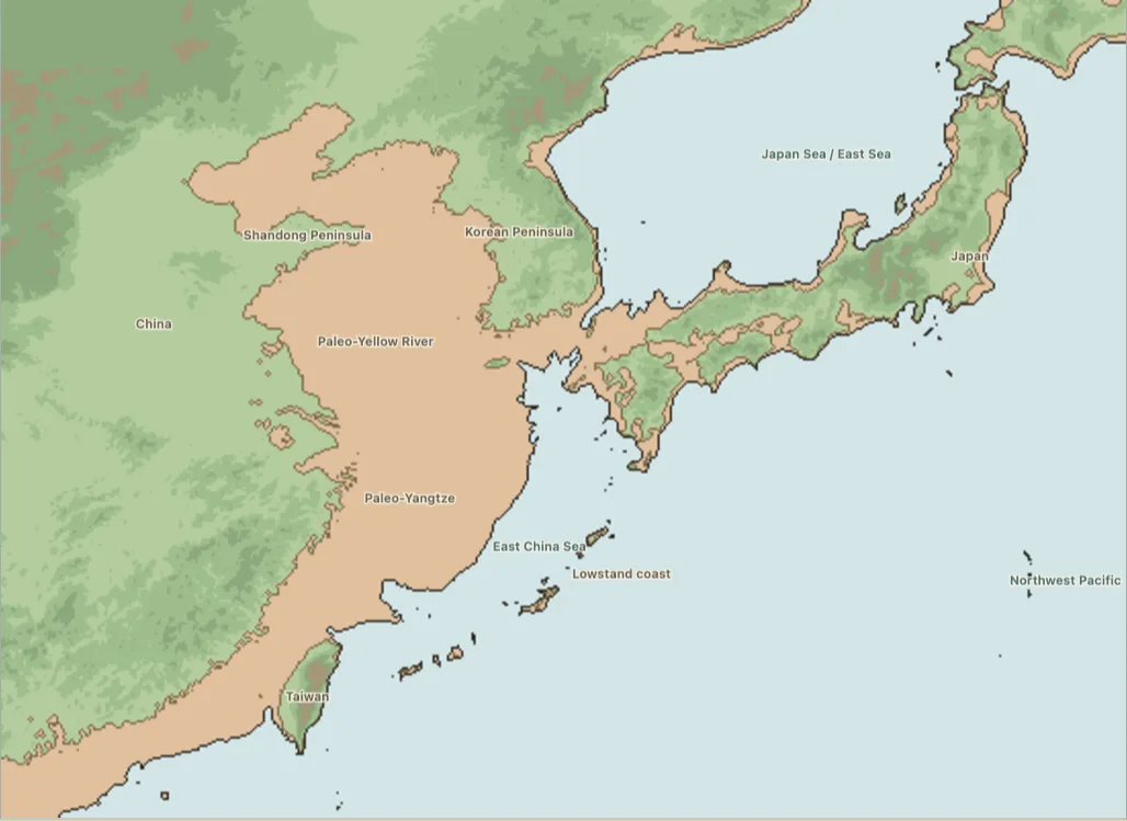
Flood Myths of East Asia
From Yunnan and the Yellow River to Tuva, Kamchatka, Korea, Taiwan and the Ryukyus

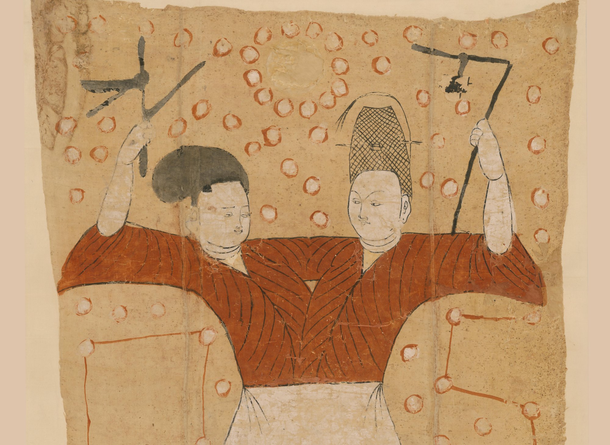
In a village in Yao’an county, western Yunnan, singers still sit up for three nights and sing the peoples out of a gourd. The water had covered everything and left a brother and a sister; they married, she bore a gourd, they pierced it, and out came the Han, the Dai, the Yi, the Lisu, the Miao, the Tibetan, the Bai and the Hui, one after another, in the order the singers still keep. That is what the flood is for in East Asia. Across seventy-two mapped traditions — drowned plains, sunken cities, caldera lakes kicked open, a coast that rose as another sank — water takes a world apart and hands back another, and the world it hands back is the one people are living in: its surnames, its marriage rule, its coastline, its music and its neighbours.
The flood hands out the surnames
Wang Xianzhao read two hundred and thirty-two flood texts from the minority peoples of southern China and sorted them by how they finish. Seventy-nine per cent of them finish the same way: with the production of the surnames, the clans, the languages or the peoples of the present world. The water is not the subject of these stories. The water is the device that clears the stage. What the story is about begins after the water goes down, and what it is about is who you are and whom you may marry.
At Huayuan in the Xiangxi hills the sequence is bare and fast. The water took everything and left a brother and a sister; they married because there was no one else; and what the sister bore was not a child but a lump of flesh. They cut it up and scattered the pieces over the country, and where the pieces fell, people stood up. They were Wu and Long and Shi and Ma and Liao — and those are still the five surnames of the Xiangxi Miao. Every marriage arranged in that country since has been arranged against that list. The flood is not an event these families remember. It is the register they consult.
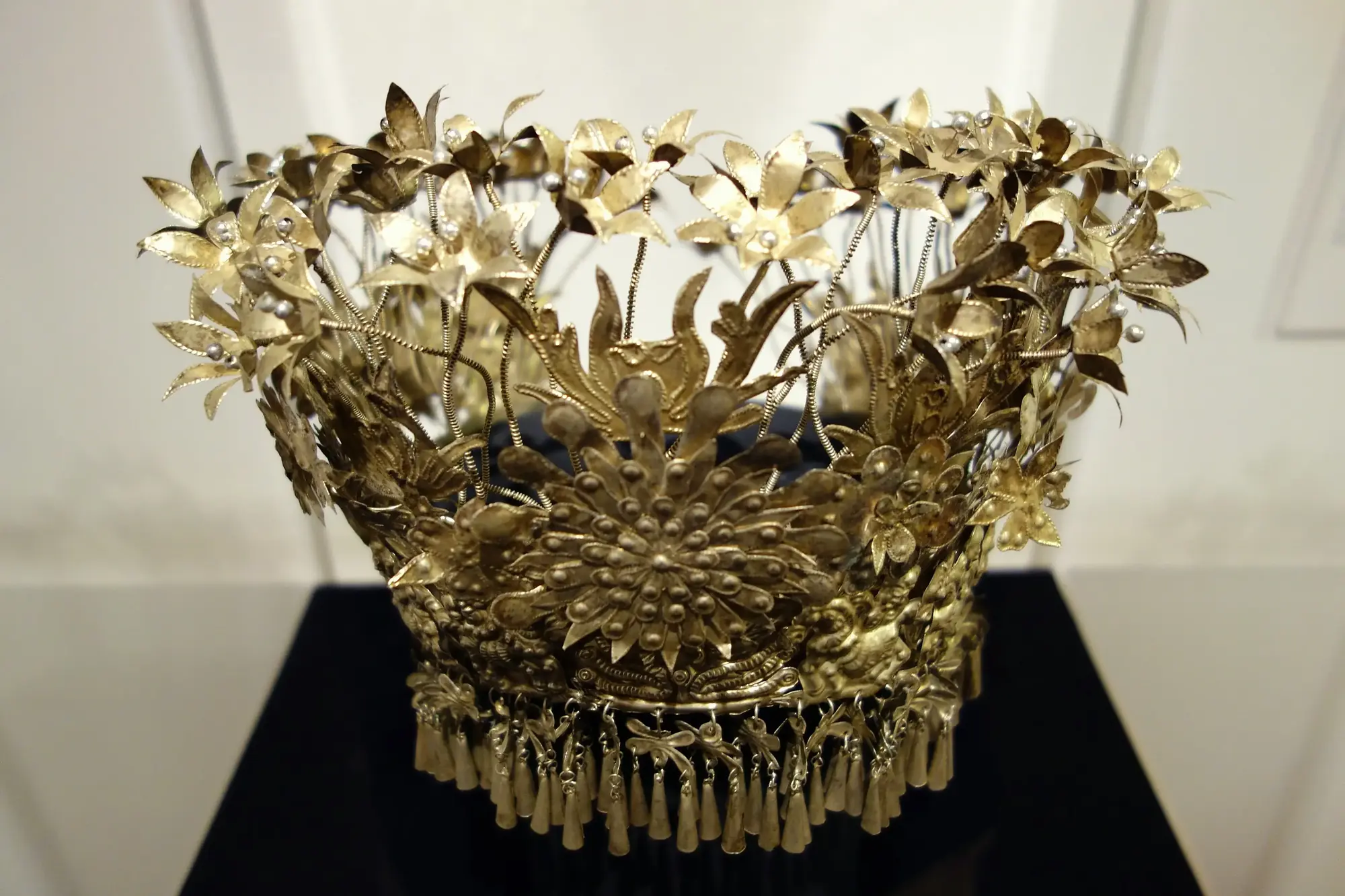
The same engine runs at every scale. In Taijiang, in the Miao heartland of southeastern Guizhou, Jang Vangb quarrelled with the Thunder God, and the Thunder God answered by drowning the world; Jang Vangb and his sister sealed themselves inside a great gourd and rode the water out, argued long and hard about whether a brother might marry a sister, and in the end did. What was born was a ball of flesh. He took a blade to it, and the pieces became the different peoples, who went off in different directions and have lived apart ever since. At Libo in southern Guizhou the pair bore four lumps and a crow carried them off to the four quarters: the first became the Yao, the second the Shui, the third the Buyi, the fourth the Han. Four peoples who share one valley are told there that they share one birth and one bird.
Among the Jianghua Yao of southern Hunan the survivors’ child is a winter melon. They split it and threw the seed across the country, and the seed that landed on the high mountains came up as Yao while the seed that landed on the flat ground came up as Han. That is an account of a settlement pattern — who has the mountains, who has the plain — converted into an account of descent. It puts the arrangement of the countryside beyond argument by putting it before history. The Landian Yao of Funing tell it with a debt attached: Fuxi and his sister come through the water, the child is again a melon, and it is Pan Wang who puts the knife into their hands and tells them what to do with it, so that the people who come out of the pieces arrive already owing him something.
Where the flood produces surnames rather than peoples, it produces them by the hundred. At Laole, a Gaisu Yi village in Kaiyuan, a brother and sister cling to a tree, survive, and their first child is a mass of flesh; they cut it into one hundred pieces and hang them from trees, from stone and from a cow horn, and the pieces become fifty women and fifty men whose surnames follow the places where they hung. The founding pair are still in the village, embodied in a paired ancestor temple. Among the Buyi of the Guizhou uplands, Fuge and Ximei cut their lump apart and out of it come the hundred surnames, every family name there is. These stories do not produce humanity in general. They produce the specific register of who may marry whom, which is the thing a village actually has to know.
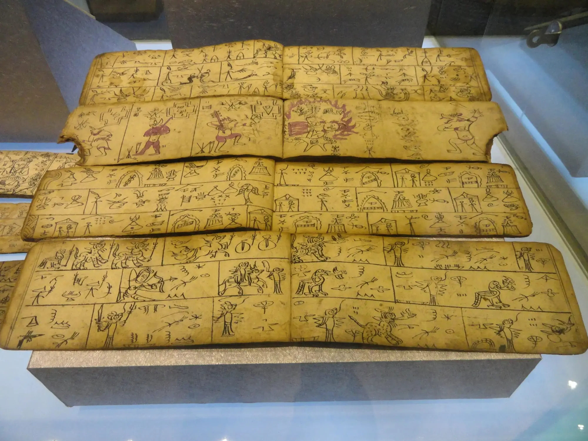
The Naxi of Lijiang push the logic one step further and use the flood to explain not only who the neighbours are but why they cannot be understood. Chongrenli’en was the one man the deluge did not take. He married Chenhongbaobai, a woman of the sky, and they had three sons who were mute for a long time; when at last they spoke, they said the same sentence in three different languages. The eldest went off and fathered the Tibetans, the second the Naxi, the third the Bai. Three brothers, one sentence, three tongues — and the whole linguistic map of the upper Yangtze is thereby a fact about a family rather than a fact about time.
The Yi of Chuxiong keep the fullest version of all, and they keep it in performance. At Mayou village in Yao’an the flood leaves a brother and sister; the sister bears a strange gourd; they pierce it, and out step the Han, the Dai, the Yi, the Lisu, the Miao, the Tibetan, the Bai and the Hui. The singers of Mayou still sing them out in that order, for three nights running, at festivals, at weddings, at funerals and at house-raisings. A wedding in that village is therefore held inside a recitation of where every people on earth came from, and the couple being married are being fitted into a list.
The specialist who carries that recitation is the bimo, the Yi ritual priest — and the bimo’s kit includes a bullroarer. A hundred and forty kilometres south of Mayou, in the Nisu Yi village of Hechamo in the Ailao Mountains, the anthropologist Li Yongxiang sat in on a healing rite against a sickness-bringing spirit called Ni, lodged in an oak tree behind the village, and watched the bimo make and whirl a thing called tatu.
They also make a pine knife, called “tatu.” The pine is shaved very thin, and the wooden knife is tied at the edges with sword-grass; when it is whirled during the ritual it gives off a buzzing sound. This knife is used to cut off the retreat of the “Ni.”
Li Yongxiang, “The Yi People’s Concepts of Illness and Traditional Therapies,” Minzu Yanjiu 2009(4)
The pine slat is shaved to a blade, bound with grass, swung until it buzzes, and used to cut something off — the retreat of a spirit. It is the same office, in the same mountains, that sings the eight peoples out of the gourd.
Further east the survivor pair do not merely found lineages; they become the ritual power those lineages depend on. In Fenghuang, in western Hunan, Rui Yifu’s field materials of the 1930s found flood traditions across the eastern and northern parts of the county in which a brother and sister survive, marry and restore humanity — and then remain, as the ancestors whose authority runs through the Nuo rites that protect later communities. The pair do not vanish when the water falls. They take office.
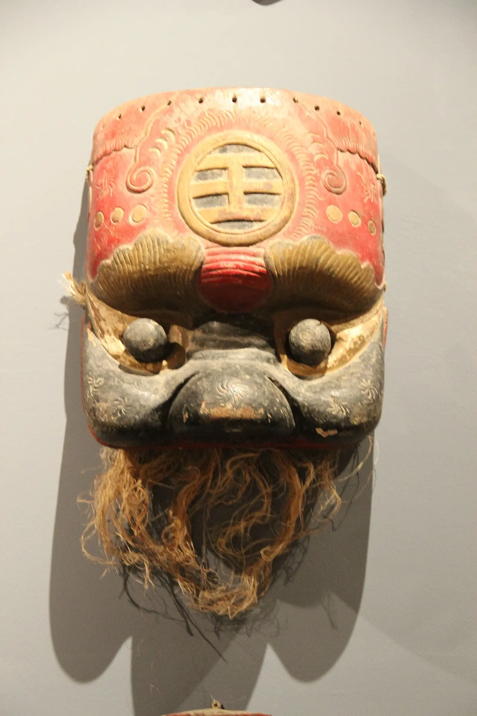
At Jiaji village in Kaiyuan, recorded from the bema Wang Shaoxian in 2010, the survivors’ marriage has to be licensed before it can found anything: people seize the sky deity’s dragon-horse, thunder and rain destroy the world, a brother and sister ride it out in a wooden tub, and paired millstones and paired winnowing baskets are rolled or thrown to see whether the match is permitted. The tradition is still joined to Pula Yi funerary and ancestral ritual. In the Liangshan Yi epic Le’eoteyi the test comes earlier: a divine messenger disguised as a wild boar warns three brothers, assigns them chests of gold, silver and wood, and only the youngest, in the wooden one, survives to cross a bridge to heaven, marry a celestial daughter and return as an ancestor. And at Xianqin Gorge in Qin’an, Fuxi and Nüwa float out of the Dadiwan country by gourd along the Qingshui and Hulu rivers, and their marriage is sanctioned when smoke from fires lit on facing mountains joins in the sky.
Millstones that meet at the bottom of a slope, smoke columns that braid, winnowing baskets that fall the right way up: the southwest Chinese flood does not end when the water goes. It ends when a marriage has been made legal.
The gourd goes south
The border between China and mainland Southeast Asia is about two hundred years old. The gourd is a great deal older, and it does not stop at it.
Go south-west out of Guizhou and the same machine keeps running. Among the Khmu of northern Laos a brother and sister spare a bamboo rat, and it tells them the water is coming; they get inside a hollow drum and ride the flood in it. What they produce afterwards is not a child but a bottle gourd, and when a red-hot iron is put through the shell the peoples come out one after another — Lamet, Khmu, Chinese, Hmong, Mien — each carrying its own language and its own way of living. In the Lawa villages of Mae Sariang in northern Thailand the pregnancy lasts ten years and produces a gourd, and out of it come the Lawa, the Thai, the Karen, the Chinese and the Europeans; when a bridge breaks under them as they scatter, their speech divides with them. At Pa Pae they will show you two rocks and a tree at abandoned Ban Tau-pung and tell you which is the gourd and which the survivors’ boat.
In the Kachin hills of northern Burma, above Bhamo, the vessel is a drum again — a great oval one, carrying two orphans with nine cocks and nine iron needles, who drop a needle and loose a cock in turn to test for ground, until the last needle rings on something solid and the last cock crows over dry land. What follows is the harsher form of the mechanism. A child of the surviving line is killed, cut apart and scattered, and the renewed human race springs from the pieces.
That is the same operation as the lump of flesh the Buyi cut apart to get the hundred surnames, and the same as the Yi gourd pierced to release the Han, the Dai, the Yi, the Lisu, the Miao, the Tibetan, the Bai and the Hui. The first issue of the flood is never an ordinary child. It has to be opened before there are people, and what comes out is already sorted into nations.
At Muang Thaen, where Điện Biên Phủ now stands, the Lao carry it one step further than anyone in China does. Phya Then’s rain takes a world that would not obey; the gourds are left on the ground and opened, first with a hot iron and then with a chisel, and the peoples come out in their appointed order. Then Khun Borom is sent down to govern, and his seven sons leave to found the kingdoms. The flood does not merely produce peoples in this telling. It produces a political map.
South-east of the gourd country the survivors get scarcer still. In the Katu telling from Ban Kandon, the whole ancestry of a people is a woman and a male dog — Ya Mek and Ma Teuk, alone on two mountains while the world floods — and what the dog carries through the water is fire in a calabash. The peoples come out of the gourd already speaking; the Katu come down off the mountain already warm. Either way the story refuses to restart the world with bare survival. It insists on handing something across the water.
The Wa, the Chin and the Palaung all have origin gourds and origin eggs with no flood anywhere near them, so a gourd on its own is not evidence of a deluge tradition. What travels is the whole sequence — water, siblings, an abnormal birth, an opening, and the nations.
Sky, marriage, reed-pipe
Nüwa does not escape the flood in a vessel. In the Huainanzi the sky itself has broken, the four corners have failed and water is spreading over everything, and she goes to work on the structure: she smelts five-coloured stone and mends the sky with it, cuts the legs off the great turtle and stands them at the four quarters, and drives the flood down. It is the largest size the story is ever told at — not a levee but a cosmos — and it is also the size at which the pattern of the whole region is easiest to see, because what she leaves behind is not simply dry land.
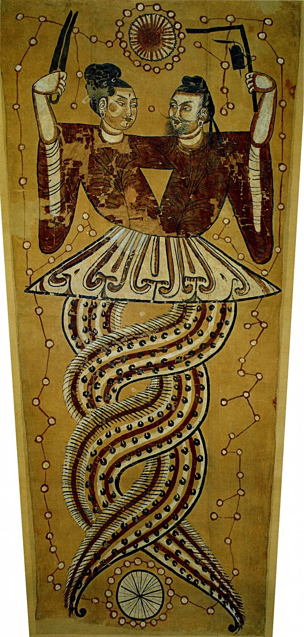
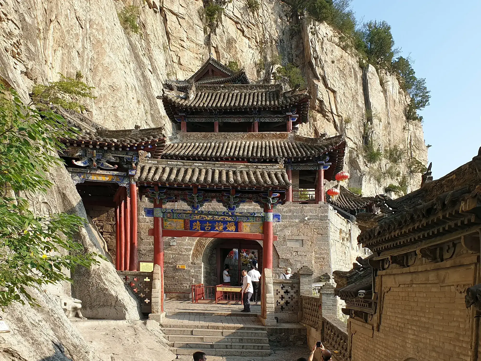
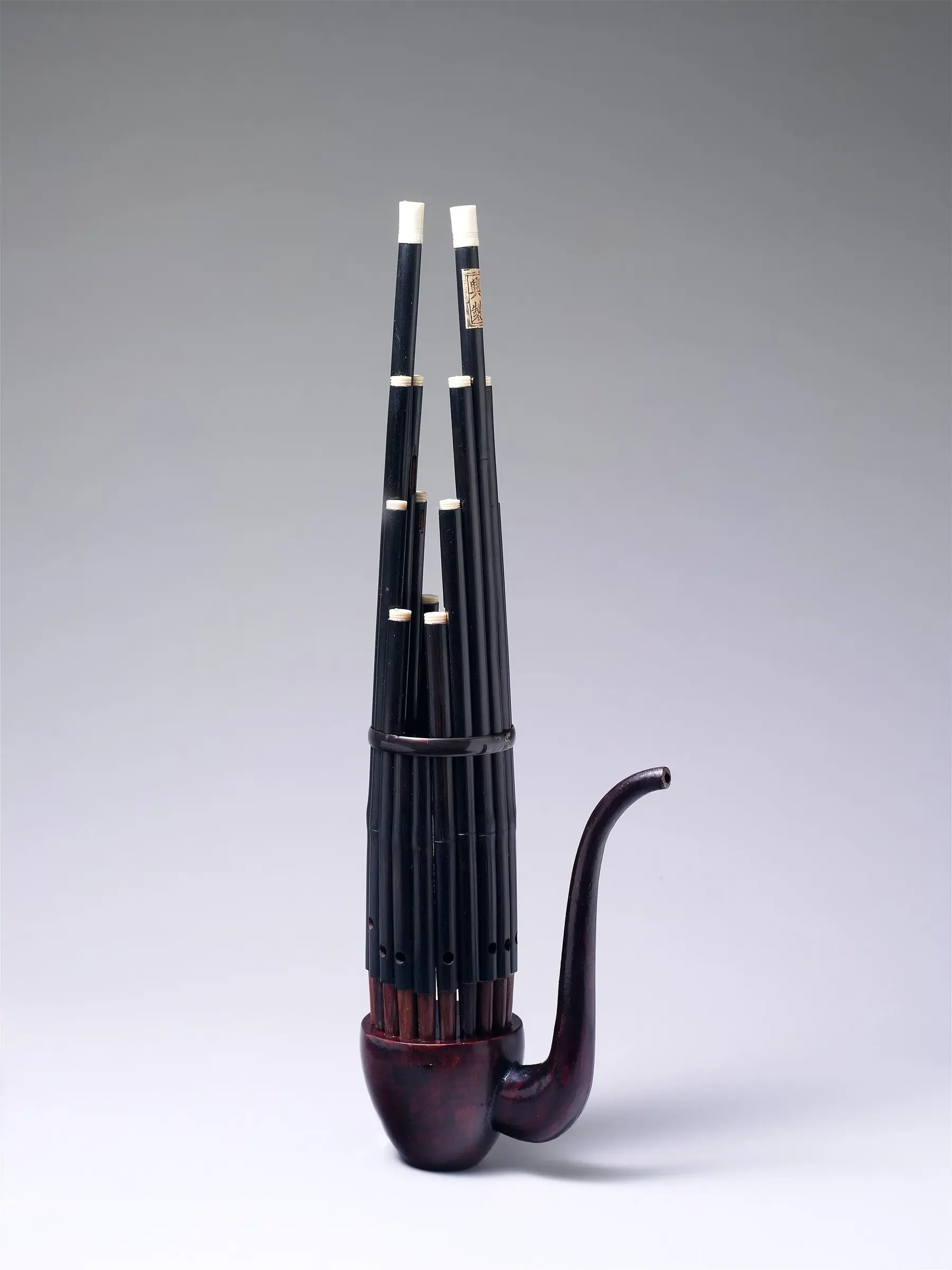
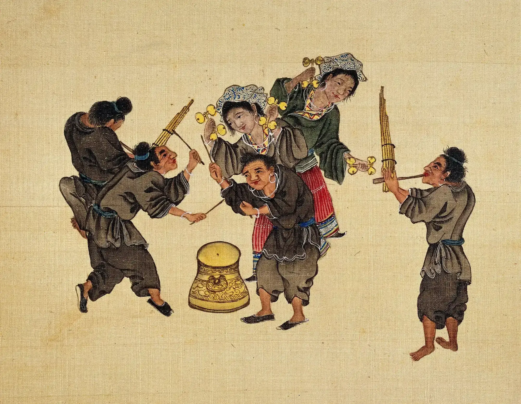
Four hundred kilometres east of the Yellow River bend, at Wahuang Gong on Zhonghuang Mountain in Shexian, the rite that honours her runs for the first fifteen days of the third lunar month, and it praises her, in one breath, for three things: she put down the flood, she instituted marriage, and she made the reed-pipe. A world, a kinship system and a musical instrument, in a single sentence, as one act.
That sentence is the grammar of this entire map. It is not enough for the water to leave. The world that comes back has to arrive complete — with a rule about who may marry whom, and with something to play. The Miao who cut the flesh into five surnames and the liturgy at Shexian that thanks Nüwa for the sheng in the same breath as the flood are doing the same work at different volumes.
The man who cut the channels
If Nüwa rebuilds a cosmos, Yu rebuilds a state. Under Yao the water rises across the land; Gun tries to dam it and fails; Yu cuts channels, orders the rivers and leads the water to the sea, and out of the drained country come the Nine Provinces, an ordered human world with a government on it. Later tradition makes him the founder of the Xia. It is the same completed-world ending as the gourd and the melon, told by a bureaucracy instead of a village: what the flood produces is administrative geography.
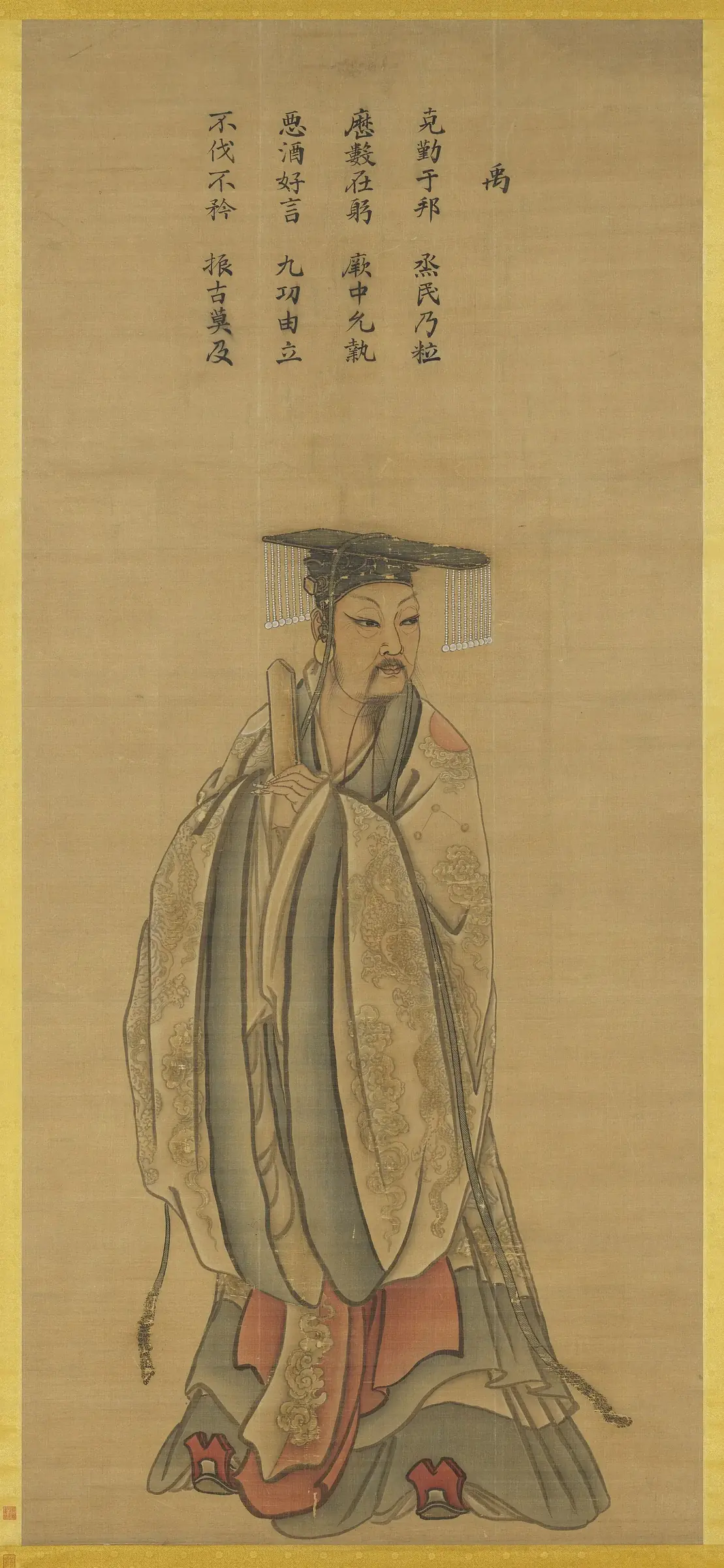
The Gun–Yu tradition dates itself to no era and names no gorge, which is why it sits on this map as a broad anchor on the upper Yellow River rather than an event site. A landslide-dam outburst at Jishi Gorge around 1920 BC has been proposed as the flood behind it; that identification is disputed, is absent from the early texts, and falls far outside the postglacial window this map reconstructs. Yu’s flood is better read at the size the texts give it. It is not one valley’s bad year. It is the condition the world was in before there was a world worth governing.
When the lion’s eyes turn red
In the lake-and-marsh country south of the Yangtze the flood arrives with a warning sign attached, and the sign is almost always the same. There is a stone figure at the gate — a lion, a turtle, a guardian beast. Someone has been kind to it, or has been told to watch it. When its eyes turn red, run. Somebody paints them red as a joke, and a city goes under.
The oldest telling on this map is the one the Soushen Ji carries about the sinking of ancient Chao, at Lake Chaohu in Anhui. Floodwater strands a gigantic fish; everyone in the city eats it except one old woman; the fish’s supernatural father tells her that when the stone turtle’s eyes turn red the city will sink. A child paints them. A dragon-child leads the old woman uphill, and behind her the streets of Chao go down into what is now the lake. The moral is exact and unforgiving: the one person who did not take a share of the fish is the one person who gets out.
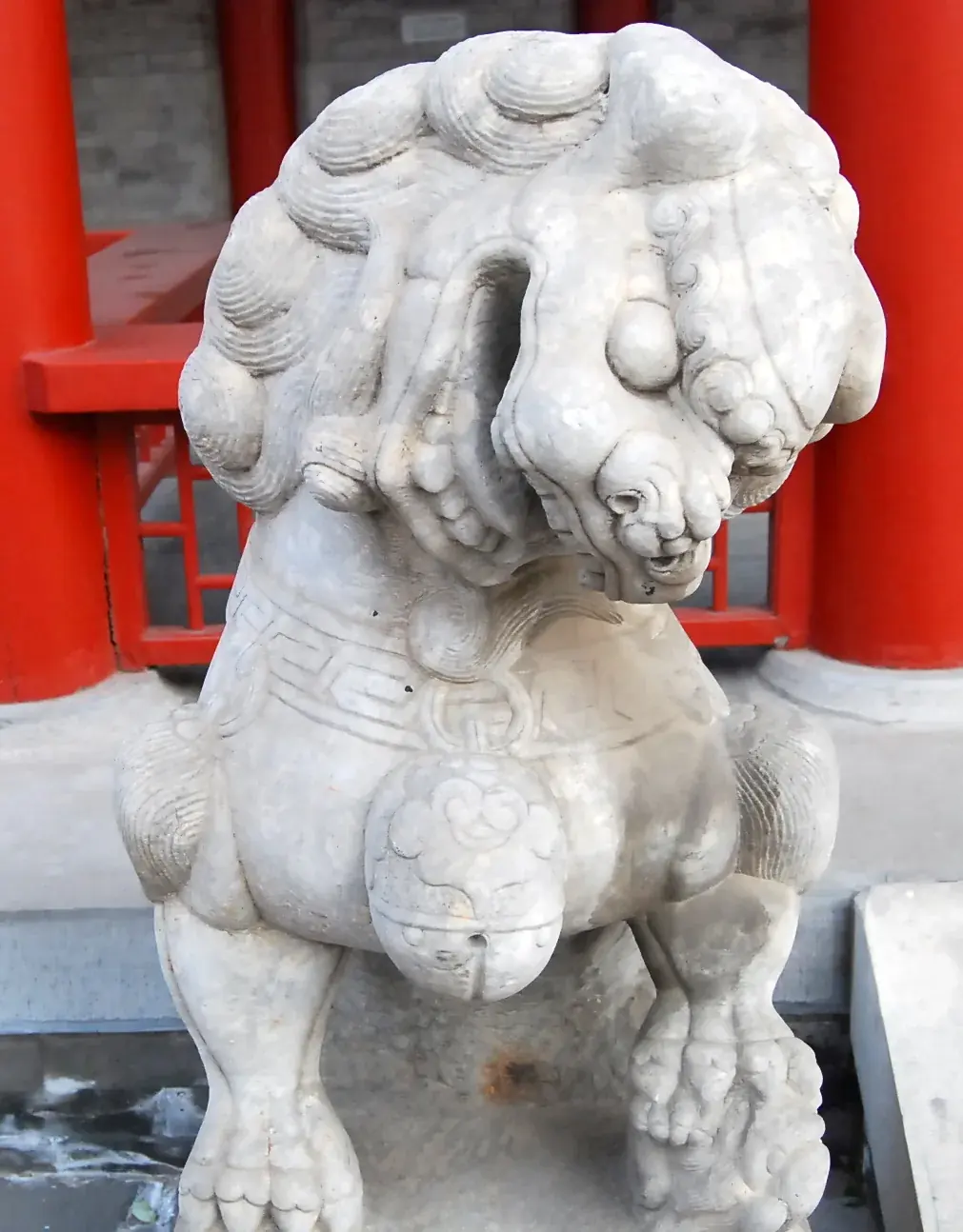
Liu Xicheng gathered this family of tales as the lu chen or sunken-land legends and traced them back through the literary record to the sixth century, mapping their modern distribution across the Wu-speaking lake country. Its members are strung along the shore and the water like a chain: Lake Tai, where the greedy city of Cizhou goes down and one girl gets out by watching the stone lions at the gate; Dianshan Lake at Qingpu, where the ground gave way one night on a settlement whose warning had been given and ignored; and Shanghai, where an old woman reads the sign, urges flight, and watches the water rise behind her until the plain is an inland sea. In the Lake Tai telling the girl is told to plant a chopstick at every place she stops, and behind her the bamboo shoots push up beside the water jars and the flood comes out of the shoot-holes; Cizhou is the lake now, and her chopsticks are the reed-beds that hold the water at its edge. A neighbouring version puts the drowned place at Shanyang, a county between Suzhou and Wuxi, and says that when the lake is clear you can see its houses on the bottom.
The hinge of the whole family is a telling written down in Fuyang County by the collector Ye Jingming and published in 1930. In Fuyang a boy fed a rice-cake, every day for three years, into the mouth of the stone lion at the gate. One day the lion spoke to him: when there is blood at my mouth, the world will be destroyed — get inside me. A butcher wiped his hands on the stone. The boy saw the blood, fetched his sister, and the two of them climbed into the lion’s belly, which was enormous and ran all the way to the sea. When they came out there was no one left alive anywhere. He proposed marriage; she set the test. They carried a millstone to a hilltop, took a half each, rolled them down opposite slopes — and the halves came together at the bottom. So they married, and there are people again.
That is the drowned-city story and the sibling-survivor story welded into one object. The red-eyed stone figure belongs to the Wu lowlands; the millstone rolled down facing slopes belongs to the Miao and Yi uplands a thousand kilometres southwest. Fuyang has both, in sequence, in one narrative, and the join is invisible. The same warning sign turns up again on the Korean coast, in the sinking-village tradition recorded at Wonsan, with the same red-eyed stone and the same lone compassionate survivor — the chain runs from the Yellow Sea down through Anhui to the Zhejiang hills without a break. And the machine is running as far away as Upper Burma: at Indawgyi Lake the Tamansai offend the nats, a widow named Kyep is warned in three dreams and flees, springs rise and drown the whole valley, and the neighbours who ignored the warning become the fish in the lake that replaces them. A warning sign, one singled-out survivor, a valley that becomes a named lake — with a broken taboo as the trigger and a woman as the remnant.
Liu’s own reading of why this family lives where it lives is a physical one, and he keeps it modest. Ground in the Wu lake country really does subside and drown: he cites the Han-period notice of Liyang going under in a single night, and the field debate of 1935 over subsidence between Suzhou, Wuxi and the lake. That is deltaic subsidence on a Holocene-to-historical scale, and it is enough. These are stories told in a country where the ground is known to go.
Dongjing sank, Fujian rose
On the Fujian coast the trade is explicit. East of the shore, where the strait is now, there was land, and on the land was a city called Dongjing. Dongjing went down, and Fujian came up in its place. Along the same coast the saying is told with different pairs: Dongjing sank and Nan’ao rose; Wujiao sank and Damao rose. Every version is an exchange. One place is spent so that another can exist.
Dongjing sank, Fujian rose.沉东京,浮福建 — coastal saying of southern Fujian and Chaoshan
The evidence people point to is on the beach. Fishermen still snag worked stone off that bottom. At Shenhu Bay in Jinjiang the tide goes out over the stumps of a drowned forest and a bed of dead oysters, and those stumps are shown to visitors as the country that went under.
Xu Qihao and his colleagues went through the historical, sociological and geological sides of the claim together, and what they found is better than the legend’s own account of itself. There was never a sunken Dongjing. But the coast does preserve real submergence, at two very different depths and two very different ages: an oil-fir forest standing on the sea floor at about 7,500 BP, and submerged beach-rock ruins of three to four thousand years ago. Their reading is that the saying splices the traces of several thousand years of crustal deformation onto a much later and much sharper memory — the Song court perishing at sea. The drowned land is real and postglacial. The date the legend wears is a later graft.
What survives that stripping is the grammar, and the grammar has a twin on the other side of the strait. In the Puyuma account from Katipol, inhabited land once lay between Green Island and Orchid Island, and in the deluge Taiwan rose while the eastern country sank; five siblings rode it out in a mortar, two became the sun and the moon, and the rest came ashore to establish the human world. Two coasts of one strait, and one idea between them: the sea does not simply take. It trades. A country is spent and a country is paid out, and the one you are standing on is the one that was paid.
Korean ponds and peaks
A recording made at Eupnae-ri in Dangjin in August 1979 says that the Hanjin shore was once joined land. Yi Ji-ham surveyed it, predicted that the ground would burst, and cleared the residents before the sea came through — and the breach stopped at the staff of a salt seller who had been walking slowly along behind him. The bay replaces the joined ground; the celebrated magistrate gets the credit, and the salt seller, who said nothing, is the one who decides where the coastline stops.
Namu Doryeong, the Son of the Tree, works at the other extreme of scale. His father is a tree, and when the water covers the world he rides it, pulling ants and mosquitoes and another boy out of the flood as he goes, until he reaches a high peak where an old woman lives with her daughter. The rescued animals repay him by helping him through the marriage trials, and he and the boy he saved found the later human lines. It is told the length of the peninsula.
Two Korean tellings keep the flood small and local and lose nothing by it. At Saseok-ri in Namwon, a narrator in 1979 remembered that when Daegang-myeon lay underwater, boats ran between Goribong and Gwangdong and tied up to a ring whose trace was still in the rock — the whole flood compressed into one mooring on an inland peak. At Jangjamot in Paju, a rich man refuses a monk and his daughter-in-law secretly gives rice; she is told to flee and not look back, and she carries her loom toward Gorangpo, turns at the sound of the world breaking, and becomes stone as the estate goes under. The house-site is the pond now, and the loom-bearing stone stands as the one witness the water left behind. It is the flood at its smallest — one household drowned, one woman carried out of it — and it is told at ponds all over the peninsula, and at Rawa Pening in central Java, where a village that turned a stranger away goes under and the woman who fed him rides it out in a rice mortar.
Japanese lakes and a fire on the hill
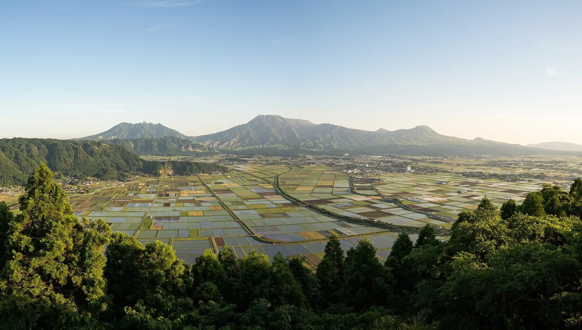
Aso begins as a vast lake filling the caldera. Takeiwatatsu tries to kick through the rim at Futae Pass and fails, then strikes at Tateno and opens an outlet, and the water goes out through it. The lake floor becomes an inhabited agricultural basin, and the god’s fall at the gap gives Tateno its name. Sediments confirm repeated lakes inside the caldera, and Tateno is indeed its outlet; no single drainage phase can be attached to the story. But the plot is a familiar one by now — the water is not fought, it is given somewhere to go, and the ground it vacates is farmland. Yu cut channels for the same reason. So did the Truku and Seediq survivors on Taiwan, who found the water’s blocked outlet and cleared it.
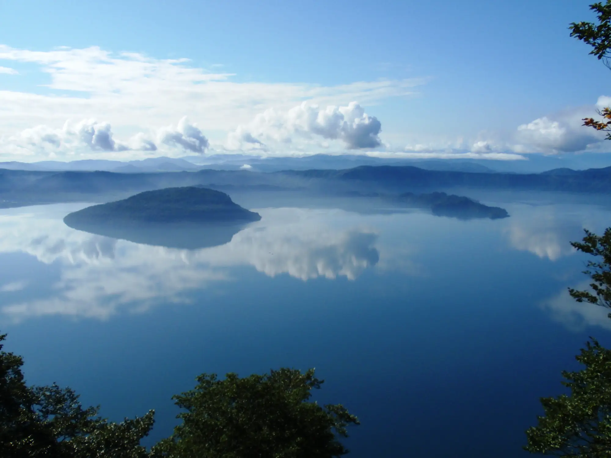
Northward, the water is made rather than drained. Hachirōtarō ate three forbidden char, turned into a vast serpent, dammed ten streams and made Lake Towada out of them; driven out by the monk Nansobō, he travelled through a whole northern world of lakes and tried to turn the Kazuno basin into another one. Towada, Hachirōgata and Lake Tazawa end up bound into one sacred geography, with linked tutelary beings, rivalries and a divine marriage — three bodies of water with quite different physical histories, held together by one serpent’s career.
One Japanese fire belongs to another order of story. At Hirogawa in 1854, Hamaguchi Goryō burned rice sheaves on high ground between two Ansei-Nankai waves to guide nine stranded villagers uphill, and Lafcadio Hearn later moved the fire to before the wave and made it summon a whole village. It is a superb story, and it carries a year. A wave with a date on it is a different object from a flood that no telling can date.
The starkest Japanese founding is far out in the Izus, on Hachijōjima, and its survivor is a woman alone. A great wave takes the people of the island. Tanaba is already pregnant, and she is the one who lives; she comes ashore at the river mouth at Ōkago and bears her child after the water has taken everyone else. Mother and son become husband and wife, and the two of them are the beginning of the island’s people. She is not only told about. The landing place is marked at Ōkago, her grave is at Sueyoshi, and both were entered in the 1871 official survey of the island’s shrines and historic sites — a founding mother with an address, on an island whose whole population runs through one woman who was carrying its future when the wave came.
Ainu land that moves
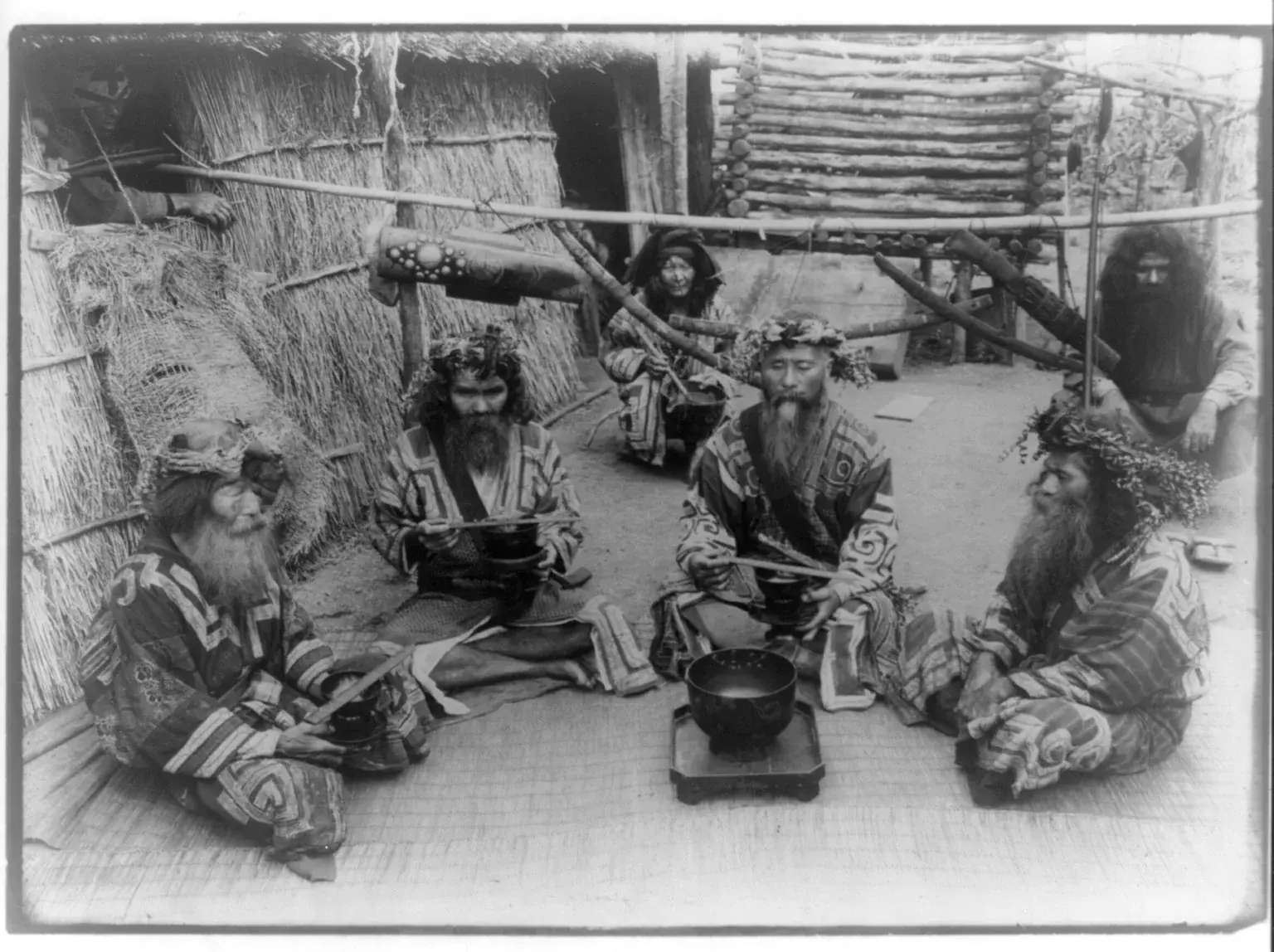
In the north the world remade by water is not the social order but the ground itself. In Kushiro, inherited accounts describe strong shaking, fissuring, and a tsunami running along named routes and around Lake Harutori, carrying offshore gear inland — and they carry a rule for descendants attached: leave the low water-country quickly and go up. At Lake Kussharo a giant amemasu overturns boats until Otashitonkuru wounds it, and in its struggle it tears a mountain loose and drops it into the lake, where it becomes the island Nakajima; the hollow it came out of fills as a smaller lake. Farther out along the Kuril chain, Yamamoto Tasuke’s tradition ends a multi-year war with earthquakes and eruptions: settlements are buried, the land splits and sinks into the sea while other ground rises as mountains, Kurunse’s country is destroyed, and what is left standing is the island chain. At Samani a great wave is said to have carried a whale, or its bones, into the six- and seven-hundred-metre Samatki range, where people afterwards said they had seen the remains.
A fish tears off a mountain and leaves it standing in a lake. A war ends in subsidence and uplift. The sea puts its animals on a ridge. These are not stories about a wave; they are stories about a landscape with no fixed shape, in which the ground is one of the moving parts.
Taiwan’s changed ground
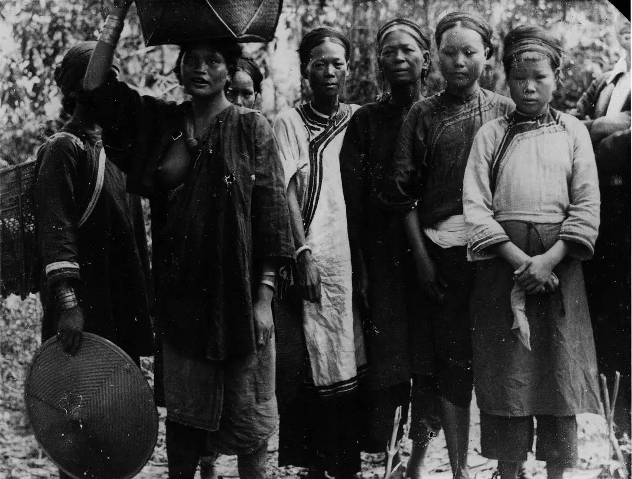
Taiwan gives the whole range line by line. Atayal, Saisiyat, Kavalan, Truku, Seediq, Pazeh, Puyuma, Rukai, Paiwan, Tao and Amis accounts each keep their own plot and their own ground. Three Atayal traditions alone go three separate ways. At Da-ke-lang the water covers the country and only a human sacrifice makes it fall. At Nan’ao the former world is flat before the water turns it into a sea, and as the water withdraws it cuts the present valleys and leaves fish in the rivers. At Tapachien a brother and sister are given up, and the departing water becomes the Dajia and the Da’an, two rivers named for the woman and the man.
On Taiwan’s northeastern coast, Kavalan ancestors escape a sinking ancestral island in a wooden boat and drift north until they find the grass-covered Yilan plain. Their descendants divide into lowland and mountain peoples, explaining the later relations between neighbours. Farther west, Pazeh survivors wait out the water on Guanyin Mountain, come down to Fengyuan, found four clans and end with sixteen settlements.
A Truku pair rides in a basket toward the end of the sea, measuring the voyage with mustard seeds. Seediq voyagers reach the sea’s blocked passage and clear it. Both return to a country cut into new valleys, with fish lying where food had been stored. The water has made channels through the land, and planting begins again.
In Saisiyat country in northwestern Taiwan, the vessel is a weaving loom. A brother and sister reach Li-tou Mountain, but the sister dies. Her brother cuts her body into pieces, wraps them in leaves and lowers the bundles into the water, asking for human life to return. They become the ancestors of distinct families. Another telling carries a lone man to a mountain, where a god divides his body: flesh becomes Saisiyat, bones Atayal, and entrails cast into the sea become Han. A household tool carries the remnant of humanity, and the body inside it becomes the difference between neighbours.
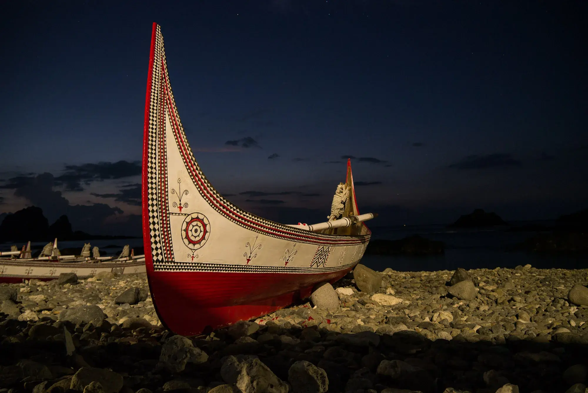
On Orchid Island the Tao tell it with a completed inventory. In the account from Iḥaḷalai, a pregnant woman overturns a piece of coral and the sea gushes out from underneath it, drowning the villages and then the mountain itself. Ten people reach Ipigaun and wait there ten years for the water to fall. What they do next is given item by item: they found six named villages, put taro and yam back into cultivation, obtain tools, rebuild the houses, and restore the distribution of meat at feasts. Ten years above the water, and then a functioning society reassembled part by part — that list is the story. A tsunami or a typhoon is a better physical fit here than any slow rise of the sea.
Elsewhere on Taiwan the rebuild is the whole plot. In Rukai country seven days of rain and darkness dissolve the earth until only Kindo’or, a few distant mountains and Sansan Island remain above it. Deer, crow and earthworm fetch back the essentials: fire, crops, and new soil to put them in. Marriage rules follow, and the country is repopulated.
At Da’niao, on the southeast coast, a Paiwan brother and sister cling to weeds as rain washes away their village and its mountains. Their old crops lie on the sea floor. A half-cricket makes a new mountain with its droppings, and the two climb it. Fire passes through a beetle that eats a still-burning insect; the siblings rescue the flame and keep it alive. They must travel far to find yam and millet seedlings. With no other people left, they marry. Their children are born with disabilities, their grandchildren still struggle, and their great-grandchildren are healthy. New villages grow from that third generation.
At the Paiwan village of Patjavat, the surviving siblings keep something smaller: a broken piece of cooking pot. A half-worm makes hill soil, but the two cannot cook until a lizard-like creature comes carrying a burning torch in its mouth. They take the fire, which never goes out. On the new ground they find shoots of sweet potato, taro and millet. Here the children improve across three births, rather than three generations, and the telling ends with a prohibition on sibling marriage. Pot, flame, planting stock and marriage rule are what it takes to begin again.
Kapayuanan gives the rebuilt earth an owner. Water normally disappears into the monster Taruvar on the plains. When its mouth is blocked, the flood covers the smaller mountains, and people flee to Tumapalapalai. A muntjac swims to Palasidang for fire so they can cook. At last Taruvar’s mouth opens and the water drains. The chiefs find worms hanging in the trees and feed them staple food. Their droppings become soil. That is why all the land belongs to the chiefs: they fed the creatures that made it. The flood has ended, but the act of feeding still determines who owns the country.
Among the Amis, survivors at Dou-lan come down the river recovering millet, rice and yam planting stock. At Dabalang the surviving pair’s first children have to be put right by ritual before they can become the ancestors of named clans; at Cilangasan, Sura and Nakao begin Amis descent and its millet calendar. Fire, soil, crops and the right marriages: these are the minimum contents of a working world.
Ryukyu islands
Hatoma and Hateruma sit close together on the map and tell quite different stories. On Hatoma, a tsunami kills everyone but a brother and sister who reach the island’s highest point, where a deity is waiting; when the sea withdraws the deity leads them back down, and their union establishes the island’s later people. On Hateruma the flood falls as burning oil, and the founding pair survive it inside a cave — and what they emerge into is a kinship order, with the Utsizamari groups and the island’s western and eastern ritual halves already in place.
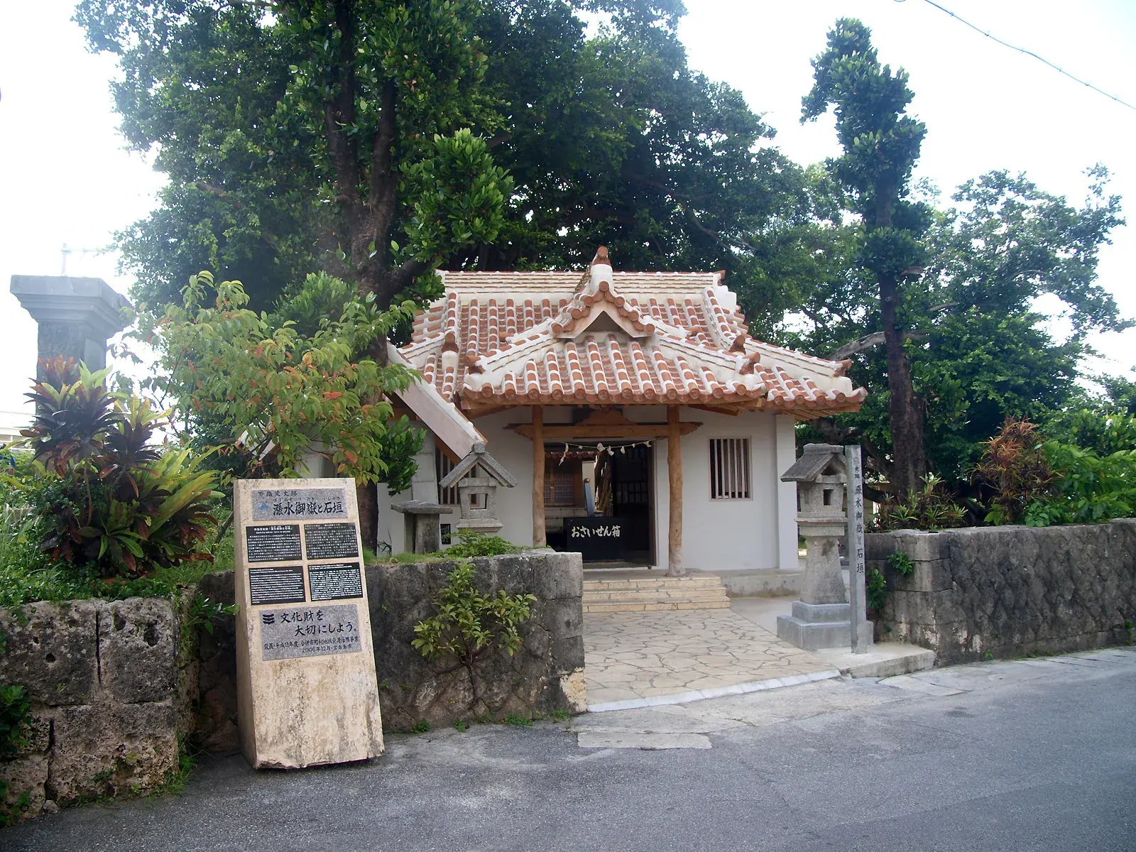
At Harimizu on Miyako the water is not the destroyer at all. A heavenly rock is cast into the sea, gathers soil about itself, becomes the island, and the founding deities come down onto the new ground and establish living beings and human descent. It is the same transaction as Shenhu Bay read from the other end: there, a country is spent so a coast can rise; here, the sea simply delivers the land. Across the archipelago the creation texts, the sibling-survivor accounts and the memory of historical waves belong to different periods and different islands, and taken one at a time they give the whole regional range in miniature — a cave and a kinship order, a peak and a descent, a rock in the sea that becomes an island.
And on Tarama, between Miyako and Ishigaki, the flood’s first issue is a snake. A great wave goes over the island and leaves nobody but the Unazē brother and sister; there is no one else alive, so they marry. What they have first are not people: a serpent, a lizard, a giant clam and hemp come before any human child does. Then the human children come, the island has descendants again, and the two founders stay on, remembered at their shrine. The flood’s first issue is never an ordinary child: it has to be opened, or gotten past, before there are people. The mainland answers with a gourd and a lump of flesh; Tarama answers with a snake.
The ice sea over Changbai
The northernmost telling on this map is also the strangest. In the Manchu creation cycle, ages beyond counting go by and then the Ice Sea of the northern sky comes down. Floodwater and mountains of ice go over the land; the earth is water and the sky is water too. One willow on Changbai Mountain and one stone pillar in the northern sea stay standing and hold the sky up.
Then comes the ending this whole essay has been about. The few who lived through it on the heights did not know how to make families, and the spirits came down and taught them how a marriage is properly made — and that instruction is the beginning of the order the Manchu live under. Water arrives with ice in it, the world is reduced to a surface, and what is handed back is a wedding rule. The ice sea is the closest image in the Chinese corpus to a deglaciation.
The morning the lake broke its rim
North of everything, on the shores of Lake Baikal, the Buryat and Evenk keep the plainest deglacial account in this whole essay. Siberia lies under ice, and the first people live on the patches that stand out of it. As the ice goes, the meltwater gathers into Baikal until the lake is too full to hold, and it breaks the rock at its lower end and runs out toward the ocean. In the Evenk telling the people are standing there when it goes, and hear the mountain give way.
They call the breach angara, the gaping mouth, and the river that comes out of it keeps the name. The Buryats count their descent from the people who lived through it — so the lake, the river, its name and the line of the people are all left by the same morning.
The story was written down three separate times in the 1930s — from Ivan Ilich Efremov in 1937, from Georgii Maksimovich Shelkovnikov on Olkhon in 1938, from D. S. Aslamov in 1936 — and each teller gives the same machinery: ice, an overfull lake, a rock barrier that fails. Geology has since proposed exactly that. Arzhannikov and Arzhannikova reconstruct a partial collapse of the Primorsky Ridge opening the Angara about twelve thousand years ago, with a rapid fall in lake level. The chronology is fought over — Zolnikov and colleagues hold that neither the Angara landforms nor the Palaeolithic stratigraphy will carry a breach that late, and older estimates put the outlet far earlier. What the three tellers describe is not a flood at all but a lake losing one: the water leaves, the land is what arrives, and the people who watched it happen put their own beginning at the breach.
An iron raft and stones on hide straps
Farther west, in Tuva, the vessel itself gives the telling its name. In the Demir-Sal cluster a man and a woman survive with animals on an iron raft and come down on a named mountain after the water falls. Versions were recorded independently from the late nineteenth century onward, but later tellings also carry unmistakable biblical names and episodes. The older iron-raft core belongs on the map; so does the warning attached to it. This is a tradition with a history of contact, not evidence that Tuva witnessed one prehistoric deluge.
At the other end of the map, on Kamchatka, Georg Wilhelm Steller recorded a more tactile machine. When the great water came after Kutkh’s time, the Itelmen lashed tree trunks into rafts, put provisions and property aboard, and tied heavy stones to hide straps so the drifting rafts could be anchored. He printed the account in 1774, after surviving the 1737 Kamchatka tsunami himself. Steller placed the flood in mythic time, after Kutkh, and not in his own century.
Mapped traditions
All mapped traditions
| No. | Place and tradition | What the story remembers | World after the water | Possible physical setting | Source |
|---|---|---|---|---|---|
| Shanghai, Taiwan, Hanjin and Hatoma | |||||
| 1 | Liantang–Mao River, Shanghai — Jiangnan Chinese | A prosperous county occupied what is now the Mao River. After a warning involving blood, an old woman and a few neighbors escaped before the land sank and water covered its streets. | The river replaces the inhabited plain; local testimony says stone paving could once be seen underwater. | Ruan proposes that Shanghai stories of land sinking preserve memories of coastal change. The story itself cannot show how long that memory has been carried. | Ruan Kezhang, Shanghai land-sinking legendsLiantang/Mao River account; narrator Ping Degen, collected 1984 and checked 1987; source collection pp. 139–140 |
| 2 | Dabajian Mountain, Da-ke-lang tradition — Atayal: the last sacrifice at Dabajian | A huge flood drove people, beasts and snakes together onto Dabajian, the highest peak. For a time the animals and humans lived there without hostility. The people first threw a strong, intelligent dog into the water, but it did not fall. The sea god demanded a human. An ugly girl was sacrificed next, and still the flood held the mountain. | At last they gave the water a beautiful girl, sometimes named as the headman’s daughter. Only then did the deluge begin to subside. The force of the telling lies in its terrible sequence: neither a prized animal nor a disregarded person satisfies the water; it withdraws only after the community surrenders the person it values most. | Fanfan Chen, “Taiwanese Indigenous Myths”Atayal Da-ke-lang account, pp. 69–70 | |
| 3 | Nan’ao, Yilan County — Atayal of Nan’ao | The former world is flat before water turns it into a sea. As the water withdraws, it cuts the present valleys and leaves fish in the rivers. | The retreating water gives the country its valleys and rivers. People return to live on the reshaped ground. | The change from flat country to sea-cut valleys is unusually specific. A regional catastrophe may fit better than slow sea rise. | Li Yih-Yuan, The Atayal of Nan-AoAcademia Sinica, 1963, vol. 1, p. 232; compare Gauss 2022, p. 345, with the Atayal analysis at Vol. I, pp. 66–69 |
| 4 | Dabajian and the Dajia–Da’an headwaters — Atayal: the woman’s river and the man’s river | Rain went on until the country drowned and the people crowded onto Tapachien. To make the water leave, they sacrificed a brother and sister—the very pair who, in many flood traditions, would instead be charged with renewing humanity. | The flood withdrew as two great streams. One carried the woman’s association and the other the man’s, becoming the Dajia and Da’an river systems. The siblings do not found the people after the water: their deaths are written into the paired geography through which Atayal country drains from the mountains to the western plain. | Pu Chung-cheng, Reappearance of Atayal2008 exhibition catalogue, p. 51; Gauss 2022, p. 343, with the Atayal analysis at Vol. I, pp. 66–69. No open scan of the catalogue has been reached; the National Central Library, Taiwan holds it. | |
| 5 | Li-tou and Ji-lu-bi-ya mountains, Saisiyat country — Saisiyat: the loom that remade the peoples | When level ground became ocean, the Zhu siblings Pa-you-e-bo-yi and Ma-ya-ou-bu sailed a weaving loom to Li-tou Mountain. The sister soon died. Her grieving brother cut her body into pieces, wrapped them in li-ka-lu leaves and lowered them into the water in the loom, asking her to return as human life. The bundles became the ancestors of the Dou, Ri, Feng and eight other families; a separate survivor became ancestor of the Hu. | At A-la-wan the loom carries a lone man to Ji-lu-bi-ya. The god Ou-zhi-po-ye-he-peng kills him so humanity will not disappear: flesh cast into the sea becomes Saisiyat, entrails become Han and bones become Atayal. A coastal rendition sends the ancestors away from drowned western lowlands toward Dabajian. Across the tellings, the loom changes from household implement to vessel, generative chamber and carrier between vanished land and a newly differentiated human world. | Fanfan Chen, “Taiwanese Indigenous Myths”Saisiyat Ji-ya-ya-he and A-la-wan accounts, pp. 71–72; compare Gauss 2022, pp. 437–438 for the western-coast/Dabajian rendition | |
| 6 | Imorod, Orchid Island — Tao | Sea water overwhelms Imorod and forces the remaining people upward. A small remnant endures on high ground until the water falls. | The survivors descend, rebuild settlement and renew Tao life on the altered island. | The island and sea water are explicit. A tsunami or typhoon is a simpler explanation than sea rise spread over many centuries. | Fanfan Chen, “Formosan Flood Myths”Tao/“Yami” Imorod account, pp. 76–77 |
| 7 | A drowned ancestral island and the Yilan Plain — Kavalan: rice below, sweet potatoes above | Water burst from the ground and the ancestral island sank. Everyone died except the siblings Abaskua and Tilunukua. They built a wooden boat, surrendered it to wind and sea and drifted north to Yilan, then a vast waste of miscanthus. Tilunukua began cutting trees for paddy fields; Abaskua tied the grass tops into boundary markers. Their quarrel divided the new country: he kept the lowland and rice, while she went into the mountains to plant sweet potatoes. | Abaskua later conceived a son by her brother. Tilunukua’s wife—a female dog said to have formerly been human—also bore a human son. Because both children were male, the two lines could not simply unite. Abaskua declared that when their descendants met they would fight and take one another’s heads; Tilunukua accepted that each line must be left free. The flood voyage therefore becomes a charter for settlement, crops and a dangerous relationship between people of plain and mountain. | Shimizu, “Abaskua and Tilunukua”Kavalan text in Shimizu, Kavalan Myths and Traditions as Recorded in the Original Language, trans. Erika Kaneko, Academia Sinica, 1998, pp. 165–200; compare Gauss 2022, pp. 376–382 | |
| 8 | Degiyak Bulowan, Taroko — Truku | Water covers a formerly flat country and rises toward its last mountain, Degiyak Bulowan. People throw a girl into the approaching water, but the flood does not stop. A man and woman set out in a great basket toward the end of the sea, dropping mustard seeds one by one to measure the journey. When the cup is empty, they reach the end of the water; suddenly it begins to recede. | They return to valleys and streams cut into the old plain. Fish fill their barns and fields, some already rotting. Taro and sweet potatoes grow well when they plant again. | The measured voyage ends as the water begins to recede. It washes the formerly flat country into valleys and small streams that remain when people return. | Kim Kwang-Ok, The Taruko and Their Belief SystemOxford DPhil thesis, 1980, p. 145; compare Gauss 2022, pp. 511–512, with the Truku analysis at Vol. I, pp. 114–115 |
| 9 | Towakkon / Towaqqa, Seediq country — Seediq | Seawater rises over the land and a pair survive in a basket. At the bottom or end of the sea they clear a blocked opening, allowing the water to drain. | They return to fish-filled houses and granaries, replant sweet potatoes and obtain an abundant harvest. | Sea water, a blocked outlet and the return to farming all matter, but Towakkon’s exact location remains uncertain and the outlet may belong to sacred geography rather than a remembered flood. | Alois Pache 1964, with Gauss’s English renderingAlois Pache, Die religiösen Vorstellungen in den Mythen der formosanischen Bergstämme, Studia Instituti Anthropos, Wien-Mödling 1964, p. 122; Gauss 2022, p. 461, with the Seediq analysis at Vol. I, pp. 110–112; antecedent in Ogawa and Asai 1935. |
| 10 | Guanyin Mountain–Fengyuan, central Taiwan — Pazeh | Ocean covers the central plain, burying villages, farms, people and animals. A sibling pair survives at Taubozuariwtsu or Guanyin Mountain while water remains for six days. | They descend to Paradan/Fengyuan, found four clans and ultimately establish sixteen settlements. | The western plain is a plausible setting for rising sea water. The story’s six days describe narrative time, not the date or duration of a physical event. | Pu Chung-cheng, Literary History of Taiwan Indigenous PeoplesVol. 1, 2012, p. 108; Gauss 2022, pp. 526–528, with the Pazeh analysis at Vol. I, pp. 89–90. No open scan has been reached; the National Central Library, Taiwan holds it. |
| 11 | Iḷaḷalai–Ipigaun, Orchid Island — Tao | A pregnant woman overturns coral and the sea gushes out, drowning villages and even the mountain. Ten people reach Ipigaun and wait ten years for the sea to ebb. | They found six named villages, renew taro and yam cultivation, obtain tools, rebuild houses and restore feast distribution. | The ten-year wait and named rebuilding make this a different Tao account from Imorod. A tsunami or typhoon remains more likely than slow sea rise. | Asai Erin, A Study of the Yami Language1936, p. 65; Gauss 2022, pp. 479–480, with the Yami/Tao analysis at Vol. I, pp. 120–125. Asai, A Study of the Yami Language, J. Ginsberg, Leiden 1936, via Leiden University Library. |
| 12 | Taurayan–Ragasan–Cilangasan — Amis | Sea deities warn of an inundation, after which a tidal wave destroys the ancestral home. Sura and Nakao survive in a mortar and reach Ragasan or Cilangasan. | Their marriage begins later Amis descent and is tied to millet cultivation and its ritual order. | The named route and rebuilding are strong, but a sudden tidal wave points more naturally to a tsunami than to gradual sea rise. | Frazer, Folk-Lore in the Old Testament1918, vol. 1, pp. 226–227; Gauss 2022, pp. 318–320, with the Amis analysis at Vol. I, pp. 57–65; compare Mabuchi 1974, pp. 100–101. |
| 13 | Karara–Tsatsula’an–Tsilayasan–Amanalai — Amis | The sea suddenly covers the earth and three sibling pairs escape in mortars or a wall panel to separate named refuges. Stone pillars and the transformed country explain parts of the present landscape. | The survivors re-establish descent groups, millet, rice, other plants, hogs and harvest ritual. | The three routes may preserve several eastern-coast traditions rather than one event. More information about each telling is needed before their refuges can be separated. | Huang, “Past and Present of Ami”Free China Weekly, 1 October 1983; Gauss 2022, pp. 313–316, with the Amis analysis at Vol. I, pp. 57–65; Free China Weekly microfilm, National Central Library, Taiwan. |
| 14 | Karara–Tsatsula’an–Tsilayasan–Amanalai — Tafalong Amis: the luminous bride and the star-dead | At Karara, Majau and Tsinatsinau had a daughter, Tejamatsan, whose body shone too brightly to be hidden. Two sons of the sea god sought her. Her parents promised her to Kodunkun, the thunder god, but his brother Kalawatsan came first, found her by the light escaping every hiding place and carried her east. Kodunkun demanded that the brothers share her by season. When her parents refused, thunder shook the sky and the sea drew away. They yielded too late: the returning water swallowed the inhabited earth. | Most of the drowned became stars, while old wooden columns turned into eastern Taiwan’s stone pillars. Pilukalau and Marokirok rode a great mortar to Tsatsula’an and had twelve children, ancestors of several peoples. Tsihtsih and Patorau reached Amanalai on a wall panel. Lutsi and Lalakan drifted to Tsilayasan; their daughters founded the Tafalong and Kiwit lines. The luminous bride, the flood and the migrations were carved on the Kakita’an ancestral house itself. | Huang, “The Past and Present of the Tribes of Ami”Free China Weekly / Taiwan Review, 1 October 1983; Tejamatsan, the rival suitors and the three survivor routes; compare Gauss 2022, pp. 313–316 | |
| 15 | Hanjin shore, Dangjin — Korean | The Hanjin shore was once joined land. Yi Ji-ham surveys it, predicts that the ground will burst and clears the residents before the sea opens through it. The breach stops at the staff of a salt seller who had walked slowly behind him. | The bay replaces the joined ground, while the salt seller’s quiet foresight surpasses the magistrate’s celebrated wisdom. | The 1979 telling makes dry land into sea, but no study has linked its breach to a dated change in Asan Bay. | Korean Oral Literature archive, “The story of Hanjin sea opening”POKS.GUBI.GUBI.1_21361; Hanguk Gubi Munhak Daegye 4-1; recorded at Eupnae-ri, Dangjin, 25 August 1979; narrator Lee Chang-won |
| 16 | Katipol / Revoaqan, Taitung — Puyuma | The narrative places inhabited land between Green and Orchid Islands before a deluge in which Taiwan rises and the eastern country sinks. Five siblings survive inside a mortar. | Two become the sun and moon; the others land at RuvuaHan or Panapanayan and establish the human world. | The drowned inhabited country is striking, but geology does not support Taiwan rising from the sea while the deep corridor to its east sank in a recent human past. | E. I. Sterk translation, Taiwan Literature 242009, p. 17; Gauss 2022, pp. 407–408, with the Puyuma analysis at Vol. I, pp. 91–96. Taiwan Literature: English Translation Series 24, UCSB Center for Taiwan Studies. |
| 17 | Karyala–Kindo’or–Sansan Island — Rukai | Seven days of rain and darkness dissolve the earth until only Kindo’or, distant mountains and Sansan Island remain. Siblings and animals survive while deer, crow and earthworm recover essentials of life. | Fire, crops, new soil, marriage rules and human repopulation are established on remade land. | Named peaks remain above the flood, but rain, newly made soil and animal helpers place the story firmly in a sacred age. | Li Jen-kuei, Rukai TextsLi Jen-kuei, Rukai Texts, Institute of History and Philology Special Publications 64.2, Academia Sinica, 1975, pp. 218–226; Gauss 2022, pp. 422–424, with the Rukai analysis at Vol. I, pp. 97–100. |
| 18 | Ji-Peygahngen–Iranmilek–Iraralay, Orchid Island — Tao: Si-Mokam breaks from the first rock | Before human beings lived on Orchid Island there was a deluge. When the ocean ebbed and land appeared, the Supreme Being sealed a primordial person inside a hard rock and threw it down to Ji-Peygahngen, promising that he would break out after the god departed. The being who emerged was Si-Mokam. At first he was a ghost; as his descendants multiplied, they became human beings and occupied a great plain. | Earthquakes covered and destroyed the plain, setting the lineage in motion. It moved through Ji-Rakwak and Ji-Pogso, formed at Iranmilek and continued to Iraralay, where the solitary grandfather built a small house and worked for people above the village. His descendants became the people of lower Ji-Paptok. The story makes the present lineage through successive transformations: ghost into human, rock into ancestor and ruined plain into a chain of settlements. | “Our Grandfather Was a Ghost,” in Benedek, The Songs of the AncestorsBenedek 1991, pp. 225–230; complete English text; compare Gauss 2022, p. 481 | |
| 19 | Da’niao, Dawu — Paiwan | Rain washes away Da’niao and even the mountains. A brother and sister cling to weeds and wash onto a surviving slope. Their family and neighbours are dead; the old crops lie on the sea floor. A half-cricket makes a towering mountain with its droppings, and the siblings climb it. | Fire comes through a beetle eating an insect that is still burning. The siblings rescue the flame and keep it alive. They must search far away for yam and millet seedlings. With nobody else left, they marry. Their children are born with disabilities, their grandchildren still struggle, and their great-grandchildren are healthy. New villages grow from that third generation. | Rain causes the flood and a spirit raises the new mountain, but the former fields beneath the sea leave open the possibility of remembered land loss. | Frederick H. Lobb, Taiwan Folktales2011, Kindle location 799, “Observing Insects”; compare Gauss 2022, pp. 394–396, with the Paiwan analysis at Vol. I, pp. 83–88 |
| 20 | Dabalang–Ji-ya-a-shan near Qimei — Dabalang Amis: the rite that made human children | Ma-da-pi-da-pu and Gu-shun lived on A-ya-ba-na-ba-nai Mountain with their six children. When the flood came, only their son Ya-ya-kang and daughter Duo-jie escaped, riding a rectangular wooden mortar to Ji-ya-a-shan north of Qimei. With no other people left, the siblings married—but their children were snakes, lizards, frogs and turtles. | The god Ji-da saw what had happened and sent his child Da-ka-ji-rang nuo Ji-da to investigate. The messenger taught the couple the proper forms of worship and prayer. After they performed them, their children were born beautiful and healthy, and became the ancestors of every Amis clan. Survival alone does not renew the human world here: the decisive act is learning the rite that turns a desperate union into legitimate descent. | Fanfan Chen, “Formosan Flood Myths”Amis Dabalang account, p. 75 | |
| 21 | Dou-lan / Natawlan and Ge-gan — Amis | Rainwater destroys most inhabitants while a brother and sister escape in a mortar to Ge-gan west of Dou-lan. Along the river they recover millet, rice and yam planting material. | They return to Dou-lan, marry, restore cultivation and repopulate the settlement. | The named route and return to farming are clear. Rain and river recovery make a local flood more likely than an ancient rise of the sea. | Fanfan Chen, “Formosan Flood Myths”Amis Dou-lan account, pp. 75–76 |
| 22 | Hatoma Island, Yaeyama — Yaeyama Ryukyuan | A tsunami kills everyone except a brother and sister who escape to Hatoma’s highest point. A deity is also there and, after the sea withdraws, leads them down. | Their union establishes the island’s later descendants. | Recorded in 1963. The 1771 Meiwa tsunami devastated wider Yaeyama, but contemporary reports describe Hatoma village, sacred sites and wells as unharmed; a direct connection remains possible, not demonstrated. | Muratake Kei, Ryukyu Yaeyama creation talesMinzokugaku Kenkyu 30.3 (1965), p. 257; field recording made on Hatoma in 1963 |
| Mainland China | |||||
| 23 | Jishi Gorge–Yellow River — Gun–Yu textual tradition | Under Yao, water rises across the land. Gun fails to contain it; Yu cuts channels, orders rivers and leads the water to the sea, making settled country possible again. | The Nine Provinces become an ordered human world, and later tradition makes Yu the founder of the Xia dynasty. | Wu and colleagues linked a large landslide-dam outburst around 1920 BCE at Jishi Gorge to the Great Flood. Early Gun–Yu texts do not name the gorge, and other scholars dispute the proposed identification. | Gun–Yu texts and the Jishi Gorge debateBook of Documents, Yao Dian and Yu Gong; Wu et al., Science 353 (2016), pp. 579–582; Allan, Journal of Chinese Humanities 3 (2017), pp. 23–34 |
| 24 | Liangshan, Sichuan — Yi epic tradition | In the epic Le’eoteyi, a divine messenger disguised as a wild boar warns three brothers of a coming flood. The brothers are told to use gold, silver and wooden chests; only the youngest, in wood, survives. | He crosses a bridge to heaven, marries a celestial daughter and returns to become an ancestor of renewed humanity. | The messenger assigns gold, silver and wooden chests to the brothers. The celestial marriage and chosen vessels belong to sacred history; no geological event has been proposed. | Chen Jianxian, Chinese flood-myth types and distributionSection 5, 寻天女型; synopsis of the Liangshan Yi epic 勒俄特依 |
| 25 | Jiaji Village, Kaiyuan — Pula Yi: nine pairs from the floating tub | The first people had become cruel to the weak, deceitful and greedy; at last they stole the sky deity’s dragon-horse. The deity and his queen answered with thunder and ceaseless rain that destroyed the world. Only a brother and sister found a wooden tub and floated through the deluge. When the water fell, Shai-lao-peng told them that the broad fertile earth needed people again and ordered them to marry. | The pair resisted until heaven answered two tests: millstones rolled down from opposite mountains met, and two winnowing baskets came together as well. They married and produced nine pairs of twins. The husband was nominally head of the house, but the wife held its real authority. Their descendants divided into peoples: Aji became ancestor of the Han, Apo of the Pula, Azhe of a Luoluo branch, Axian of the Zhuang, Afei of the Hui and Amei of the Miao. | Wang Xianzhao, CASS field report from JiajiFieldwork of 25 August 2010; Jiaji Village, Bige Township; tradition bearer Wang Shaoxian | |
| 26 | Xianqin Gorge, Qin’an — Qin’an Fuxi and Nüwa: where the smoke joined | A gourd carried Fuxi and Nüwa, the only survivors of the flood, out of the Longcheng–Dadiwan country. They drifted down the Qingshui into the Hulu River, passed through Xianqin Gorge and reached the Anfu plain. Fuxi proposed that they renew humanity, but the marriage rules he himself had established forbade children of the same mother to marry. | They climbed opposing mountains, lit separate fires and asked heaven for a sign: joined smoke would permit the marriage, scattered smoke would forbid it. The two columns met. With sky as their tent and earth as their bed, the siblings married and recreated human civilization. The gorge was remembered as Xianqin—“kinship made manifest.” Another Qin’an telling gives the pair forty-nine days of rain, a cave and a giant lingzhi for food; an immortal’s geese and two meeting millstones sanction the same union, while Nüwa’s mulberry-leaf face covering becomes the bride’s red veil. | Qin’an County, local Fuxi–Nüwa traditionAccount of the gourd route through Longcheng, Dadiwan, the Qingshui and Hulu rivers, Anfu Chuan and Xianqin Gorge | |
| 27 | Fenghuang–Xiangxi, Hunan — Xiangxi Miao Nuo tradition | In flood traditions recorded across eastern and northern Fenghuang, a brother and sister survive the destruction, marry and restore humanity. | The survivor pair become Nuo ancestors whose ritual authority protects later communities rather than vanishing when the water falls. | Rui Yifu’s 1930s field materials establish a Fenghuang regional cluster, not one village performance or one physical event site. | Academia Sinica IHP Archives, flood myths and Fuxi legendsArchive feature item 06116; Rui Yifu’s eastern and northern Fenghuang investigations and 1938 study, reprinted 1989, pp. 1029–1061 |
| 28 | Lake Chaohu, Anhui — Soushen Ji drowned-city tradition | After floodwater leaves a gigantic fish, everyone eats it except an old woman. The fish’s supernatural father warns that the city will sink when a stone turtle’s eyes turn red; a child paints them, and a dragon-child leads the woman uphill as the city collapses. | A settled city becomes the lake country of ancient Chao, while the survivor and the stone turtle turn moral conduct into remembered topography. | The tale is transmitted in the Soushen Ji. Its literary and moral form is secure; it does not date the formation of Lake Chaohu. | Soushen Ji, the sinking of ancient ChaoSoushen Ji, juan 20, 古巢老姥 / 龙儿救姥; complete classical passage and later local variants |
| 29 | Laole Village, Kaiyuan — Gaisu Yi: one hundred surnames from the flesh-child | A brother and sister clung to the same tree and alone survived the flood. They married when the water fell, but their first child was a single mass of flesh. Frightened, the brother cut it into one hundred pieces and hung the pieces from trees, a stone and a cow horn. By the next morning they had become fifty women and fifty men. | The hundred children took surnames from the places where they had hung: a piece on a plum tree became Li, one on cypress became Bai, one borne by stone became Shi and one dried on the cow horn became Niu. Their descendants built Laole’s Human Ancestor Temple—also called the Human King or Sibling-Marriage Temple—where the founding brother and sister remain as paired statues, the woman holding their swaddled child. | Kaiyuan City, Laole ancestor templeMunicipal account published 7 September 2011; complete local plot and surviving paired temple images | |
| Korea | |||||
| 30 | Korean peninsula — Namu Doryeong: the lives that repay rescue | A heavenly woman rested beneath a tree, conceived a son by it and returned to the sky after giving birth. The boy grew up calling the tree his father and became Namu Doryeong, the Son of the Tree. His father warned him that when torrential rain felled the tree, he must climb aboard. The flood came and covered the world. As they floated, Namu Doryeong rescued ants and mosquitoes with his father’s permission. He then saved another boy against the tree’s warning that a human would repay kindness with betrayal. | They reached a house on the highest peak, where an old woman lived with her daughter and a slave girl. The rescued boy boasted that Namu Doryeong could separate millet scattered through sand, intending to ruin him; the ants performed the impossible task. The woman then hid the two young women in eastern and western rooms. A mosquito revealed where her daughter waited. Namu Doryeong married the daughter, the other boy married the slave girl, and their children renewed humanity. The smallest creatures remember mercy; the human he saved answers it first with treachery. | National Folk Museum of Korea, Namu DoryeongNational synthesis; compare AKS Article E0011344 and Hongcheon recording POKS.GUBI.GUBI.2_3523, which preserves a distinct local variant | |
| 31 | Goribong, Saseok-ri, Namwon — Korean local tradition | A Saseok-ri telling says that when Daegang-myeon lay underwater, boats ran between Goribong and Gwangdong and tied to a ring whose trace remained in a rock. | The mountain, route and ring-rock become witnesses to water high enough to turn inland peaks into moorings. | The 1979 recording preserves a local route and rock, though the collector supplies much of the flood interpretation before the narrator confirms it. No dated event has been linked to the tale. | Korean Oral Literature archive, “Goribong legend”POKS.GUBI.GUBI.1_0501_0040; recorded at Saseok-ri, Daegang-myeon, 31 July 1979; narrator Im In-gyu |
| 32 | Jangjamot, Jangjwa-ri, Paju — Jangjamot: the woman beneath the loom | A wealthy man named Song lived where Jangjamot lies now. Though rich, he was so miserly that he never gave alms, even when a monk came to his gate. His daughter-in-law heard their quarrel, secretly measured out a mal of rice and begged the monk not to blame her father-in-law. The monk accepted it and told her to bring the thing she valued most. She emerged carrying her loom on her head, and he led her toward Gorangpo with one command: whatever happened, she must not look behind her. | The sound of heaven and earth breaking open erupted behind them. Curiosity overcame her; she turned and instantly became stone, still bearing the loom. Song’s house vanished and its site became Jangjamot—the Rich Man’s Pond. The command not to look back, destruction of the corrupt household and petrified woman are why the Korean legend is routinely compared with Lot’s wife. Here the lasting witness is not a pillar of salt but a loom-bearing woman beside the water that swallowed an ungenerous house. | Gyeonggi Memory, Jangjwa-ri Jangja PondPaju local legend from 파주의 전설, 17 April 1995, SE0001179; comparison with Sodom and Gomorrah in the Academy of Korean Studies Encyclopedia, 장자못 설화 | |
| Japan | |||||
| 33 | Tateno Gorge, Aso — Takeiwatatsu tradition | Aso begins as a vast caldera lake. Takeiwatatsu fails to kick through the rim at Futae Pass, then strikes Tateno and opens an outlet through which the water drains. | The lake floor becomes an inhabited agricultural basin, and the god’s fall gives Tateno its name. | Lake sediments confirm repeated lakes inside the caldera, and Tateno is its outlet. The tradition has not been dated to any one drainage phase. | Japan Tourism Agency, “The Legend of the Creation of Aso”Official English account; geological companion: AsoPedia article 649 and MLIT R1-02893 |
| 34 | Lake Towada and the Three Lakes — Hachirōtarō tradition | After eating three forbidden char, Hachirōtarō becomes a vast serpent, dams ten streams and creates Lake Towada. Driven out by Nansobō, he travels through a northern world of lakes and tries to turn the Kazuno basin into another lake. | Towada, Hachirōgata and Lake Tazawa acquire linked tutelary beings, rivalries, divine marriage and ritual geography. | The cycle binds volcanic Towada, postglacial Hachirōgata and Lake Tazawa into one sacred landscape. Their different geological histories do not establish one remembered event. | Kazuno City, Hachirōtarō legendOfficial account of the serpent, ten-stream dam, Towada creation and attempted Kazuno inundation; compare Akita Prefecture archive 11285 |
| Ainu, Hokkaido and the Kurils | |||||
| 35 | Lake Harutori and Kushiro — Ainu oral traditions | Inherited accounts describe strong shaking, fissuring and a tsunami moving through named Kushiro routes and around Lake Harutori, carrying offshore gear inland. | The narratives preserve a rule for descendants: leave low water-country quickly for higher ground. | Takashimizu mapped the routes against local contours. Some reaches fit low corridors; one would cross a ridge above twenty metres. Repeated lake deposits do not date this account. | Niizato, Shigeno and Takashimizu, Ainu earthquake traditionsHistorical Earthquake 21 (2006), pp. 128–129, traditions T16–T17; Table 1, p. 133; compare Takashimizu 2005, pp. 192–193 |
| 36 | Nakajima, Lake Kussharo — Ainu oral tradition | A giant amemasu overturns boats until Otashitonkuru wounds it. In its struggle the fish tears loose a mountain and drops it into Lake Kussharo, where it becomes Nakajima; the hollow fills as a small lake. | Island, hollow and later earthquakes remain joined to the fish struggling beneath the new land. | The recording is place-specific, but the published study does not show that an earthquake created Nakajima or the neighboring hollow. | Niizato, Shigeno and Takashimizu, Kussharo tradition T2Historical Earthquake 21 (2006), pp. 124–125 and Table 1, p. 133; Sarashina Genzo’s 1955 recording from 弟子カムイマ |
| 37 | Kuril Island chain — Yamamoto Tasuke’s Ainu tradition | During a multi-year war, earthquakes and eruptions bury settlements. The land splits and sinks into the sea while other ground rises as mountains, destroying Kurunse’s country and leaving the island chain. | War ends in a remade archipelago: former country lies below water and surviving mountains define the later islands. | The Kurils are intensely seismic and volcanic, but no date, island, eruption or episode of uplift and subsidence has been tied to the tradition. | Niizato, Shigeno and Takashimizu, Yamamoto Tasuke tradition T18Historical Earthquake 21 (2006), pp. 129–130 and Table 1, p. 133; through Yamamoto Tasuke and Sato Naotaro |
| 38 | Samatki range, Samani–Urakawa — Ainu local tradition | A local account says a great wave carried a whale or whale bones into the six- to seven-hundred-metre Samatki range, where people later said they saw the remains. | The reported bones turn the inland mountain chain into a warning about the reach attributed to an extraordinary wave. | The public account supplies no narrator, original wording, examined specimen or event date. The bones are part of the narrated sign, not a verified tsunami deposit. | Mt Apoi Geopark, Samani disasters and Ainu legends9 March 2022; section on the Samatki mountain chain and reported whale bones; based on a 2019 local lecture and geopark guidebook |
| Ryukyu Islands | |||||
| 39 | Hateruma Island, Yaeyama — Hateruma Ryukyuan | A brother and sister survive a flood described as a downpour of burning oil inside a cave. They emerge as the island’s founders. | Their relationship orders Utsizamari kin groups and the island’s western and eastern ritual geography. | Burning rain, cave emergence and ritual structure make sacred island history a stronger reading than sea rise. Suzuki treats Hateruma’s grain-origin myth separately from this founder flood. | Suzuki, Myth and Ritual in HaterumaJapanese Journal of Ethnology 42.1 (1977), pp. 24–58; founder-flood synopsis in the English abstract |
| 40 | Harimizu Utaki, Miyako Island — Miyako Ryukyuan creation tradition | A heavenly rock is cast into the sea, gathers soil and becomes Miyako Island. Founding deities descend to the new ground and establish living beings and human descent. | The island and its people begin around Harimizu, which remains a sacred place within Miyako life. | This is an island-formation and human-founding tradition, not a flood-recession story. Different textual versions vary over which deity handles the rock. | Miyakojima City, Harimizu UtakiCity-designated historic site; creation material in Utaki Yuraiki (1705), pp. 68–69, and Miyakojima Kiji Shitsugi (1748), opening island-beginning account |
| Southwest China: the peoples made after the water | |||||
| 41 | Huayuan County, Xiangxi — Xiangxi Miao | The water took everything and left a brother and a sister. They married because there was no one else, and what the sister bore was not a child but a lump of flesh. They cut it up and scattered the pieces over the country. | Where the pieces fell, people stood up. They were Wu and Long and Shi and Ma and Liao, and those are still the five surnames of the Xiangxi Miao. Every marriage in the region since has been arranged against that list. | Not hazard memory. The refuge vessel in this family is a fertility container before it is a boat, and the narrative work is descent and marriage law; the water is the device that clears the stage. | Wang Xianzhao, 我国南方少数民族洪水神话的叙事艺术湖北民族学院学报 2007 no. 1, §4; place designation China ICH 苗族古歌 Ⅰ-1, 申报地区 湖南省花垣县 |
| 42 | Taijiang County, Qiandongnan — Hmu (Miao) | Jang Vangb quarrelled with the Thunder God, and the Thunder God answered by drowning the world. Jang Vangb and his sister sealed themselves inside a great gourd and rode the water out. When the land came back they argued long and hard about whether a brother might marry a sister, and in the end they did. | What was born was a ball of flesh. Jang Vangb took a blade to it and cut it into pieces, and the pieces became the different peoples, who went off in different directions and have lived apart ever since. | A descent charter rather than a water memory. Southeast Guizhou is argued to be a source of the sibling-spouse flood rather than a periphery of it, which makes this telling a centre of the type and not a variant. | Yang Lihui & An Deming, Handbook of Chinese MythologyABC-CLIO 2005, Type 2 (Miao transmission), p. 21; China ICH 苗族古歌, 申报地区 贵州省台江县 |
| 43 | Jianghua Yao Autonomous County — Yao | The two survivors of the flood married and the sister gave birth to a winter melon. They split it open and threw the seed across the country. | The seed that landed on the high mountains came up as Yao. The seed that landed on the flat ground came up as Han. The story says why the Yao live where they live, and makes that a fact about the flood rather than a fact about history. | Purely a charter: it explains a settlement pattern by descent rather than by any event. No landscape claim is made. | Wang Xianzhao 2007, citing 瑶族文学史§4, citing 黄书光等编, 瑶族文学史 (广西人民出版社 1988), pp. 12–16 |
| 44 | Libo County, Qiannan — Qingku Yao | The pair survived, married, and bore four lumps of flesh. A crow took them up and carried them away to the four quarters. | The first lump became the Yao, the second the Shui, the third the Buyi, the fourth the Han. Four peoples who share a valley are told here that they share a single birth and a single bird. | A charter for the ethnic composition of one county. No physical reading is available or appropriate. | Wang Xianzhao 2007, citing 瑶族文学史§4, 《兄妹结婚》; 瑶族文学史 pp. 12–16 |
| 45 | Funing County, Wenshan — Landian Yao | Fuxi and his sister came through the water alive, married, and produced a child shaped like a winter melon. Pan Wang put a knife into their hands and told them what to do with it. | They cut, and the new humanity came out of the pieces. The knife is Pan Wang’s, and so the people who follow come to him already owing him something. | Purely cosmological. The coordinate is a broad anchor: the source names two counties, 河口 and 富宁, and Funing is one of the two rather than a claimed event site. | Wang Xianzhao 2007§3, 《伏羲兄妹》 |
| 46 | Mayou village, Yao’an County, Chuxiong — Yi (Meige tradition) | The water rose and covered everything and left a brother and sister. They married, and the sister bore a strange gourd. They pierced it. | Out of the gourd came the Han, the Dai, the Yi, the Lisu, the Miao, the Tibetan, the Bai and the Hui, one after another. The peoples of the world all step out of one fruit, and the singers of Mayou still sing them out in the same order, for three nights running, at festivals, weddings, funerals and house-raisings. | A world-establishment charter with a living performance tradition. No landscape claim is made and none should be read in. | China ICH, 梅葛 (Meige)ICH feature 告诉你一个真实的“梅葛” (2009-01-12); bimo 骆庭才 (b. c. 1936), singers 郭有珍, 郭自林, 罗玉芳 |
| 47 | Lijiang — Naxi (Dongba tradition) | Chongrenli’en was the one man the deluge did not take. He married a woman of the sky, Chenhongbaobai, and they had three sons. The boys were mute for a long time, and when they spoke at last they said the same sentence in three different languages. | The eldest went off and fathered the Tibetans, the second the Naxi, the third the Bai. The flood is where the neighbours came from, and where the fact that they cannot understand one another came from. | A cosmological and ethno-genetic charter; the three-language episode is the point. No landscape claim is made. | Yang Lihui & An Deming, Handbook of Chinese Mythologypp. 21–22, Type 3; Dongba scripture 《崇搬图》, flood section |
| Sunken cities of the Wu country and the northern ice | |||||
| 48 | Wahuang Gong, Zhonghuang Mountain, Shexian — Han (Nüwa cult) | The water was everywhere and the sky was broken. Nüwa smelted coloured stone and mended it, cut the legs off the great turtle and stood them at the four corners of the world, and drove the flood down. | What she left behind was not only dry land. The rite performed on Zhonghuang Mountain every third lunar month praises her for three things in one breath: she put down the flood, she instituted marriage, and she made the reed-pipe. The world after the water arrives complete with its kinship rules and its music. | The flood here is cosmic — the sky is broken, not the levee. Zhonghuang Mountain does overlook a genuinely flood-prone gorge on the Qing Zhang River, but nothing in the text or the rite ties the myth to that river. | Huainanzi 览冥训; 女娲祭典 national ICH designationState Council 国发〔2006〕18号, first national batch, 申报地区 河北省涉县; temple fair 1st–15th of the third lunar month |
| 49 | Fuyang, Hangzhou — Wu-region Han | For three years a boy fed a rice-cake every day into the mouth of the stone lion. One day the lion spoke: when there is blood at my mouth, the world will be destroyed — get inside me. A butcher wiped his hands on the stone. The boy saw the blood, fetched his sister, and the two climbed into the lion’s belly, which was enormous and ran all the way to the sea. | When they came out there was no one left alive anywhere. He proposed marriage; she set the test. They carried a millstone to a hilltop, took a half each, and rolled them down opposite slopes, and the halves came together at the bottom. So they married, and there are people again. | Liu Xicheng argues that this legend family arose in the Wu lake-and-marsh country because ground there really does subside and drown, citing the Han-period notice of Liyang sinking in a night and the 1935 field debate on subsidence between Suzhou, Wuxi and the lake. That is deltaic subsidence on a Holocene-to-historical scale, and he makes no claim beyond it. This telling is also the hinge where the drowned-city family and the sibling-survivor family meet. | Liu Xicheng, 陆沉传说再探§2型; collector 叶镜铭, recorded in Fuyang County, published 1930. Live site now 403; cited from the Wayback capture |
| 50 | Lake Tai — Wu-region Han | Cizhou was a greedy city. An old immortal told one girl to watch the stone lions at the gate, run when their eyes turned red, and plant a chopstick at every stopping-place. The eyes turned red. She went. Behind her, bamboo shoots pushed up beside the water jars and the flood came out of the shoot-holes. | Cizhou is the lake now. Her chopsticks are the reed-beds that hold the water at its edge. In a neighbouring telling the drowned place is a county called Shanyang between Suzhou and Wuxi, and when the lake is clear you can see its houses on the bottom. | Part of the mapped 陆沉 sunken-land family of the Wu zone. The houses visible on the bottom in clear water is a narrative sign within this family rather than a survey observation. | Liu Xicheng, 陆沉传说再探§1型, example ⑽, with the 山阳城 notice; cited from the Wayback capture |
| 51 | Dianshan Lake, Qingpu — Jiangnan Han | The lake was ground, and the ground had a settlement on it, and one night it gave way. The warning sign had been given and had been ignored. | The lake is what is left. It sits on top of a place, and the legend exists to name what the water is standing on. | A local member of the same Wu sunken-land family as the Shanghai land-sinking legends. | Liu Xicheng, 陆沉传说再探§1型 conclusion, listing 青浦朱家角附近的氵殿山湖 among the explained lakes; cited from the Wayback capture |
| 52 | Shenhu Bay, Jinjiang — Minnan and Chaoshan coastal Han | East of the Fujian shore, where the strait is, there was land, and on the land was a city called Dongjing. Dongjing went down and Fujian came up in its place — one sank so the other could rise. Along the coast the same trade is told with different pairs: Dongjing sank and Nan’ao rose; Wujiao sank and Damao rose. | Fishermen still snag worked stone on that bottom. At Shenhu Bay the tide goes out over the stumps of a drowned forest and a bed of dead oysters, and those are shown as the country that went under. | Xu Qihao and colleagues conclude that no sunken Dongjing ever existed, and that the coast instead preserves real submergence at two very different depths — an oil-fir forest standing on the sea floor at about 7,500 BP, and submerged beach-rock ruins of 3,000–4,000 BP. Their reading is that the legend splices traces of crustal deformation across several thousand years onto the much later historical memory of the Song perishing at sea. The drowned land is real and postglacial; the dated dress is a later graft. | Xu Qihao et al., 关于“沉东京”传说的史学、社会学和地学的综合考辨泉州文史资料; named localities 东山县大路口村, 晋江深沪湾, 蚶江, 石狮, 漳浦, 南澳 |
| 53 | Wangmo County, Qiannan — Buyi | Fuge and Ximei were left after the water and married because there was no one else. What came was a lump of flesh, and they cut it apart. | From the pieces came the hundred surnames — every family name there is. The story does not produce people in general; it produces the specific register of who may marry whom. | A surname charter. The coordinate is a broad anchor: the source gives the text to the Buyi of the Guizhou region without naming a county, and Wangmo is a Buyi-majority county within it. | Wang Xianzhao 2007§2 and §4, 《洪水潮天》 |
| 54 | Changbai Mountain — Manchu | Ages beyond counting passed, and then the Ice Sea of the northern sky came down. Floodwater and mountains of ice went over the land. The earth was water and the sky was water too. One willow on Changbai Mountain and one stone pillar in the northern sea stayed standing and held the sky up. | The few who lived through it on the heights did not know how to make families, and the spirits came and taught them how a marriage is properly made. That instruction is the beginning of the order the Manchu live under. | A southward-flowing ice sea, floodwater arriving with ice mountains, and a world reduced to water is the closest image in the Chinese corpus to deglaciation. Against it: this is one epoch in a cyclical cosmogony, its recording history is contested, and no published scholar reads the ice sea as memory. The ice is noted and no claim is attached. | Gao Hehong, 《天宫大战》中的神与神话with China ICH notice 内容完整的满族创世神话《天宫大战》面世 |
| Island founders after the water: Tarama and Hachijōjima | |||||
| 55 | Tarama Island, Miyako — Tarama Ryukyuan | A great wave went over Tarama and left nobody on it but the Unazē brother and sister. There was no one else alive, so they married. | What they had first were not people: a serpent, a lizard, a giant clam and hemp came before any human child did. Then the human children came, and the island had descendants again. The two of them stay on as the island’s founders and are remembered at their shrine. | An undated island-founding tradition, and it is mapped as one. The telling names no year and no event. The 1771 Meiwa tsunami has been fitted onto several Yaeyama founder stories by later writers, but not onto this one. | Tarama Sonshi (多良間村史)Tarama Village Editorial Committee, 1973, p. 50; the Unazē brother-and-sister founder account, reproduced and discussed in University of the Ryukyus folklore scholarship |
| 56 | Ōkago, Hachijōjima — Hachijō islanders | A great wave took the people of the island. Tanaba was already pregnant, and she was the one who lived through it. She reached land and bore her child after the water had taken everyone else. | Mother and child became husband and wife, and the two of them are the beginning of the island’s people. Tanaba is not only told about: she is said to have come ashore at the river mouth at Ōkago, where a marker stands at the spot, and her grave is at Sueyoshi. Both were entered in the 1871 official survey of the island’s shrines and historic sites. | Undated in the telling, and left that way. Hachijōjima has documented historical tsunami impacts, 1605 among them, and the Tanaba story names none of them; no Ice Age reading is supportable either. Even the water is not fixed — the Sueyoshi accounts have her caught by her long hair in pine or cedar branches during a mountain landslide rather than a sea wave. A mother-and-child variant rather than the Ryukyuan sibling form, and the museum calls it Japan’s only instance of a southern origin-legend type widely known across the western Pacific. | Hachijōjima History and Folklore Museum, “The Legend of Tanaba”museum exhibition text — “all the islanders were swept away by a great tsunami, and only she, a pregnant woman, survived”; earliest written record in Mukashi no Itoshima Banashi, where the child is a daughter. The Tanaba grave record is at https://www.hihfm.jp/guide_JP/4/19/56.html |
| Mainland Southeast Asia: the gourd and the peoples out of it | |||||
| 57 | Muang Thaen, Điện Biên Phủ — Lao and Tai, the Khun Borom cycle | Rain sent by Phya Then swallows a world that would not obey. When the water goes down, giant gourds are left on the ground at Muang Thaen, and they are opened — first with a hot iron, then with a chisel. | The peoples come out of the gourds in their order. Khun Borom is sent down to govern the country, and his seven sons leave it to found the kingdoms, so that the flood ends not merely in survivors but in named polities and a political map. | A first-order world-establishment charter: the flood is the reason there are separate peoples and separate kingdoms. No scholar has compared it with a dated landscape change, and the early witnesses arrange the flood, the gourd and the founding of the kingdoms differently enough that they should not be silently harmonised. | Louis Finot, “Recherches sur la littérature laotienne”, BEFEO 17 (1917)pp. 159–160, section “Le déluge”; also Louis Delaporte, Voyage d’exploration en Indo-Chine, vol. 1 (1873), p. 473, and Auguste Pavie, Mission Pavie — Études diverses II (1898), pp. 81–82 |
| 58 | Northern Laos, Luang Prabang country — Khmu (Kammu) | A brother and sister spare a bamboo rat, and it warns them that the water is coming. They shut themselves inside a hollow drum and ride the flood in it while the inhabited earth is erased. | What the two of them produce is not a child but a bottle gourd. A red-hot iron opens it, and the Lamet, the Khmu, the Chinese, the Hmong, the Mien and the rest come out one after another, each carrying its own language and way of living. | Three of the shapes this map already follows arrive together here: the division of peoples, the abnormal first birth, and a drum as the vessel of survival. The coordinate is a cultural anchor for the Khmu country, not an event site. | Kristina Lindell, Jan-Öjvind Swahn and Damrong Tayanin, “The Flood: Three Northern Kammu Versions”, Acta Orientalia 37 (1976)pp. 183–200, especially pp. 193–198 |
| 59 | Kachin Hills, above Bhamo — Jinghpaw (Kachin) | The whole earth floods. Two orphans get inside a great oval drum with nine cocks and nine iron needles, and drop a needle and loose a cock in turn to test the water. When the last needle rings on the ground and the last cock crows, there is dry land. | One survivor is killed. The other and Ningcut have a child whose body is cut apart and scattered, and the renewed human race springs from the pieces and spreads over the world. | The abnormal issue that must be cut apart before people exist is the same mechanism the Buyi, the Miao and the Yao tell; here it arrives with a drum ark attached. Hanson also recorded that Nat priests recited creation, the flood and the races at the great feasts. | Ola Hanson, “Kachin Traditions and Religion”, Missionary Review of the World, April 1896pp. 273–274 (PDF pp. 34–35); the priests as professional custodians of the recitation at p. 274 |
| 60 | Mường Bi, Tân Lạc, Hòa Bình — Mường, from Đẻ đất đẻ nước | A sacred turtle warns Dịt Dàng that an immense water is coming. Boats and rafts carry human life through it. | When the flood withdraws, Ông Thu Tha and Bà Thu Thiên put back the grass, the plants and the living creatures. Earth and water are born again into a world that can be inhabited — which is what the epic’s title says it is about. | A major performed epic with a complete survival-and-restoration sequence, still recited. | Sử thi Mường, vol. 1overview at pp. 28 and 47; confirmation and comparison in Hồng Đức University Journal 69 (2024), p. 66 |
| 61 | Mai Châu, Hòa Bình — Tai of Mai Châu, from the Ẳm ệt | Tạo Cặp and nàng Kè are the only two people the flood leaves. A roof beam becomes their raft, and from it they call up to Then. | Their union repeoples the emptied land, and the Tai and the other peoples descend from them. | A clear flood-survival and repeopling charter recorded from a named epic. In a complementary version a gourd appears, but as a shelter the survivors get into, not as an abnormal birth — a distinction worth keeping when the gourd is being tracked across this map. | Hà Sủm, ed., Ẳm ệt — Sử thi thần thoại dân tộc Thái Mai Châu (2001)cited text pp. 559 and 567, reproduced and discussed at pp. 62–63 of the Hồng Đức University study |
| 62 | Kbal Spean, Phnom Kulen — Khmer | Water covers the Khmer land until nothing is above it but the peaks of Phnom Kulen. A giant white rat breaks a passage through the mountain, and the Buddha crosses by the opening it makes. | Ta Prohm kills the rat. The oceans draw back to the bounds they keep now, and ordered land is left around the sacred river. | An undated deluge attached to a named and visitable landscape, with an explicit restoration — but no human survivor and no genealogy. It should be read against the broader Khmer sense of a country that was formerly underwater, which scholarship has generally referred to the annual inundation rather than to any single ancient event. | Soumya James, “Embedding Meanings in Text, Image and Context”, UDAYA Journal of Khmer Studies 16 (2025)p. 93 and n. 37, citing Jean Boulbet, “Kbal Spean, La Rivière aux Mille Linga”, p. 15 |
| 63 | Pa Pae and La’Ub, Mae Sariang — Lawa | Only a brother and sister come through the primeval water. After a pregnancy of ten years she gives birth to a gourd, and the peoples are let out of it as it is opened — Lawa, Thai, Karen, Chinese, Europeans. | In the La’Ub telling the gourd bursts and the peoples scatter when a bridge breaks under them, and their speech divides as they go. Two rocks and a tree at abandoned Ban Tau-pung are pointed out as the gourd and the survivors’ boat. | The gourd birth and the division of peoples in one story, with the unusual addition of physical markers on the ground. Obayashi recorded interpreted summaries rather than full-language texts, which should stay visible; no scholar has connected the Ban Tau-pung rocks to any dated inundation. | Taryo Obayashi, “Myths and Legends of the Lawa and Karen in Northwestern Thailand”, Japanese Journal of Ethnology 29.2 (1964)p. 114 for the flood and the birth; pp. 121–122 for the Ban Tau-pung localisation |
| Baikal: the lake that broke its rim | |||||
| 64 | The Angara outlet, Lake Baikal — Buryat and Evenk | Siberia lies under ice, and the first people live on the patches that stand out of it. As the ice goes the water gathers into Baikal until the lake is too full to hold, and it breaks the rock at its lower end and runs out toward the ocean. In the Evenk telling the people are standing there when it goes, and hear the mountain give way. | They call the breach angara, the gaping mouth, and the river that comes out of it keeps the name. The Buryats count their descent from the people who lived through it, so the lake, the river, its name and the line of the people are all left by the same morning. | Three separate recordings — from Ivan Ilich Efremov in 1937, Georgii Maksimovich Shelkovnikov on Olkhon in 1938, and D. S. Aslamov in 1936 — give the same account of ice, an overfull lake and a rock barrier that fails. S. G. and A. V. Arzhannikov reconstruct exactly that: a partial collapse of the Primorsky Ridge opening the Angara about twelve thousand years ago, with a rapid fall in lake level. The fit is unusually close, and it is contested — I. D. Zolnikov and colleagues hold that neither the Angara landforms nor the Palaeolithic stratigraphy will carry a terminal-Pleistocene breach, and older estimates put the outlet far earlier. No scholar has yet set these three field records against either chronology. | Buryat and Evenki Angara outlet records, 1936–38G. M. Shelkovnikov, Olkhon 1938, ‘Как появилась Ангара’; I. I. Efremov, Baunt 1937, ‘Как две реки получили название Ангара’, published in Eliasov 1969, p. 189; D. S. Aslamov, Tunka 1936 as context. Geology in Arzhannikov & Arzhannikova, Doklady Earth Sciences (2025), doi 10.1134/S1028334X25606625, against Zolnikov et al., Archaeology Ethnology & Anthropology of Eurasia 41.4 (2013), pp. 38–49 |
| Hainan and mainland Southeast Asia: worlds restored after water | |||||
| 65 | Pong Yaeng, Mae Rim, Chiang Mai — Hmong, northern Thailand | A world flood destroys humankind; only a brother and sister survive the water. | God instructs the siblings to marry and restore people. Their first child is a limbless mass of flesh, and divine intervention is needed before humanity can continue. | This is a local Hmong collection from two villages near Chiang Mai, not a generic Hmong relocation. It is a world-establishment story; the text offers no dated flood or landscape change. | Rattanaphon Atthammarat, Hmong folktales of Pong YaengWikhro Nithan Phuen Ban Chao Khao Phao Hmong, M.Ed. thesis, Srinakharinwirot University, 1989, p. 94; the Sirindhorn Anthropology Centre record identifies the 49-tale collection as from Ban Buak Chan and Ban Buak Toey and summarizes the flood narrative. |
| 66 | Yanwoling, Changhua River, Hainan — Li / Hlai | Floodwater covers the plains, the mountains and everything on the earth. Tianfei and Guanyin, a brother and sister, survive by holding onto a gourd and reach Yanwoling as the water falls. | The siblings become the ancestors of the renewed people, and the story is carried into the third-day-of-the-third-month festival and memorial at the refuge hill. | A ritual and origin charter at a named Hainan refuge, not evidence for a dated episode of sea-level rise. The point is a broad anchor for Yanwoling on the Changhua River. | State Ethnic Affairs Commission, “The Li third-month-third festival”27 March 2009: 洪水泛滥,淹没了平原和山岭,吞没了大地的一切; the account names the sibling survivors, their gourd, and 燕窝岭 beside the 昌化江. |
| 67 | Luang Namtha country — Lanten (Mun) | A flood annihilates the world except for Bok Njee and Thea Mui, a brother and sister, whose enormous gourd reaches Heaven. | Their bitter-melon child becomes the source from which all the peoples come. The flood therefore establishes both survival and human difference. | A Lanten ritual narrative recorded in the rice-soul complex, distinct from the nearby Khmu drum-and-gourd versions. The coordinate is a cultural anchor, not an event site. | José Estévez, Lanten rice-soul ritual“On the Lanten Methods to Fetch the Hon or Living Force of the Original Rice” (2024), pp. 216–217: the entire world is annihilated, only Bok Njee and Thea Mui survive, and their child yields the peoples. |
| 68 | Ban Kandon, Xekong — Katu | The world is flooded. Ya Mek and the male dog Ma Teuk alone survive on the mountains Phu Kratae and Phu Kong King. | Ma Teuk brings fire in a calabash, and the human descendants of the survivors become the Katu. The story binds escape from the water to the arrival of fire and a people. | A Katu village tradition recorded during a New Kandon field visit. It is a local origin narrative, not a claim that a particular ancient flood drowned the valley. | Arunee Sriruksa, Katu tales and beliefs“The Development of Cultural Tourism through Tales and Beliefs”, International Journal of Innovation, Creativity and Change 12.10 (2020), printed p. 199 (PDF p. 4); New Kandon field visit and village head Wipad Saengmanee. |
| 69 | Kouk Thlok / Angkor Borei — Khmer: Preah Thaong and Nagi Soma | All the land is under water except Kouk Thlok, which stands as an island. In the origin cycle, the naga king drinks up the ocean so that Kampuchea can be made dry land. | The withdrawn sea becomes the country of the Khmer founding couple, Preah Thaong and Nagi Soma. Water has made a kingdom possible. | Versions disagree about the location of Kouk Thlok, so this is an approximate Angkor Borei anchor. The tradition is an origin of land and polity; scholarship connects its formerly-underwater image to recurring inundation, not to a single Ice-Age event. | Rüdiger Gaudes, Preah Thaong and Nagi SomaAsian Folklore Studies 52 (1993), pp. 333–358: p. 334 on land covered by water and Kouk Thlok as an island; p. 335 on the naga king drinking the ocean; p. 338 on annual inundation. |
| 70 | Indawgyi Lake — Tamansai Shan | After the Tamansai offend the nats, a widow named Kyep is warned in three dreams and flees. Springs then rise and flood the entire valley; the others become fish. | The water becomes Indawgyi Lake, while the escape makes Kyep the human remnant of the drowned valley. | A named lake-origin narrative with a precise local setting. It should not be turned into evidence for a global deluge or a terminal-Pleistocene event; the historical gazetteer records a 1711 eruption and casualties, not the flooded-valley plot given here. | François Robinne, Fils et maîtres du lacchapter IV, retelling the Tamansai account and citing J. G. Scott and J. P. Hardiman, Gazetteer of Upper Burma and the Shan States II.1 (1901), pp. 257–261; compare Myanmar Digital News, “Indawgyi Lake and Shwe Myintzu Ye Lae Pagoda”. |
| Inner and northern Asian edge: iron raft and anchored timber | |||||
| 71 | Büren-gol and the upper Yenisei, Tuva — Tuvan: Demir-Sal, the iron raft | A frog’s movement makes the Great Sea boil over. A prescient elder loads people and provisions on an iron-clad raft while the water destroys everyone outside it; related early records put an old survivor on an iron raft and later tellings ground enormous iron-fastened rafts on Mount Buura. | Kezer Chingis remakes mountains, forest, fire and human culture after the water. The local iron raft and mountain carry the renewed world even where the narrative frame has travelled. | The source history is contested. Potanin’s 1879 corpus also contains an overt Ham/Cham version, and Oinotkinova classifies the southern-Siberian flood family as biblical material localized through early Christian contact. The frog, Demir-Sal and Buura are local, but they do not prove independence; Safyanov’s later lake-breach version is editorially compromised and is not used as a geomyth here. | Ahmet T. Hallaç, ‘The Flood Legend of the Tuvans: Demir-Sal’Gaziantep University Journal of Social Sciences 25.1 (2026), pp. 385–419, especially pp. 389–390 and 393–397; underlying Potanin, Ocherki severo-zapadnoi Mongolii IV (1883), p. 208, nos. 42b and 42g |
| 72 | Bolsheretsk and western Kamchatka — Itelmen: the rafts anchored below the waves | After Kutkh disappears, a great inundation drowns many people. Canoes cannot master the waves, so the survivors lash large trees into rafts, load their food and possessions and lower heavy stones on hide straps as anchors to keep from being swept out to sea. | When the water falls, the rafts remain high on the mountains. Survival is fixed to local coastal technology: timber, hide lines and stone anchors rather than a drifting ark. | Steller recorded this between 1738 and 1744 and gives no Noah, animal cargo or bird test. He arrived after the 1737 Kamchatka tsunami, but places the flood in mythic time after Kutkh; the technology fits a coastal catastrophe, while identification with that or any other event would be speculation. | Georg Wilhelm Steller, Beschreibung von dem Lande Kamtschatka1774, printed p. 273; Steller’s Itelmen account recorded 1738–44. Concorded as Walter Anderson, Nordasiatische Flutsagen (1923), text 20, pp. 24–25 |
Water makes worlds
East Asia tells the flood at six sizes — cosmos, kingdom, island, village, field and family — and one logic governs every one of them. A caldera becomes farmland. A household becomes a pond. A greedy city becomes Lake Tai, and the reed-beds along its edge are the chopsticks the one warned girl planted as she ran. A stone thrown into the sea becomes Miyako. A gourd is pierced and eight peoples walk out of it in order.
Nothing thins as the scale drops, because the ending is always the same ending. The flood Nüwa stops by patching the sky and the pond that swallows one rich household are the same event told at the reach the teller could see, and each closes with an inventory of what the water left behind: a coastline, a channel to the sea, a valley cut by the retreat, six villages, seed corn, fire, a stone lion, a name for a people, a rule about who may marry whom. Seventy-nine of every hundred southern minority tellings end by naming the surnames or the peoples of the present world, and the ones that do not still end by naming a river, a lake or a province.
That is why the liturgy at Shexian says what it says. It thanks Nüwa in one breath for putting down the flood, for instituting marriage and for making the reed-pipe, and it is right to run the three together, because in these stories they are one act. The water is what has to be got out of the way before a world can be handed over. Mainland, peninsula, archipelago and outer island, from the Ailao Mountains to the Kurils, East Asia remembers water as the thing that unmakes a world — and remembers, in the same breath and with the same precision, the surnames, the crops, the rivers and the marriages that were issued with the one that came back.
Key sources
Robert Early and John Whitehorn, One Hundred Paiwan Texts (Pacific Linguistics 542, 2003), text 053, Patjavat, pp. 236–240, and text 068, Kapayuanan, pp. 300–302, for the broken pot, fire-bringing creature and chiefly ownership of soil. The Da’niao telling is Frederick H. Lobb, Taiwan Folktales (2011), Kindle location 799: a half-cricket, beetle and three generations, distinct from Patjavat’s half-worm, torch and three births. Fanfan Chen, “Taiwanese Indigenous Myths”, pp. 71–72, for the two Saisiyat loom tellings; Shigeru Tsuchida, “Preliminary Reports on Saisiyat: Phonology” (1964), pp. 51–52, records a related pirogue-and-body-division account from Para’in-a-’Asin (Zhang Qingchang).
Map. Shorelines: Li et al. 2014, Dong et al. 2018 and Zhou et al. 2014; terrain: GEBCO; sea levels: Lambeck et al. 2014.
The southwest Chinese material follows Wang Xianzhao, “The narrative art of flood myths among the southern minority peoples of China” (Hubei Minzu Xueyuan Xuebao 2007, no. 1), whose classification of 232 texts supplies the seventy-nine per cent figure and the Jianghua, Libo, Funing and Buyi tellings; Yang Lihui and An Deming, Handbook of Chinese Mythology (ABC-CLIO, 2005), pp. 21–22, for the Taijiang and Lijiang types; and the Chinese national intangible-heritage designations for Meige at Mayou and for the Miao ancient songs of Huayuan and Taijiang. The Shexian rite is designated in the first national batch (State Council 国发〔2006〕18号); the cosmic passage is Huainanzi, “Lanming xun.”
The sunken-city family follows Liu Xicheng, “A further look at the lu chen legends”, for the Fuyang, Lake Tai and Dianshan tellings and for the sixth-century pedigree and the modern Wu-zone distribution; the Fuyang text was collected by Ye Jingming and published in 1930. Shanghai follows Ruan Kezhang. Shenhu Bay follows Xu Qihao and colleagues, “A combined historical, sociological and geological examination of the ‘sinking Dongjing’ legend”; the source-history of the saying itself is Shi Aidong 2023. Mainland coverage more broadly follows Chen Jianxian’s survey of 433 variants from 43 peoples, together with early texts, field reports and local public archives.
Taiwan follows named Formosan publications gathered and translated by Aaron Valdis Gauss, The Formosan Great Flood Myths (2022); each Taiwan card names the publication and page behind its telling, and links to Gauss’s English text where the original is not openly available. Korean coverage uses recording-level entries in the Academy of Korean Studies oral-literature archive alongside national syntheses. Japanese and Ainu cards use municipal, ministry and historical-earthquake sources, chiefly Niizato, Shigeno and Takashimizu, Ainu earthquake traditions, Historical Earthquake 21 (2006), and Takashimizu’s Hokkaido survey of forty Ainu records. Ryukyuan entries come from island-specific ethnography, early local records and municipal cultural documentation.
The northern edge uses the 1936–38 Buryat and Evenki field records for the Baikal breach; Ertuğrul Hallaç’s source-critical reconstruction of the Tuvan iron-raft tradition, which separates its early attestations from later biblicalized forms; and Georg Wilhelm Steller’s 1774 Itelmen account, printed at p. 273 with its timber rafts, hide straps and stone anchors.
Every point stands on a reading of its own source: a named recording place, a distinct plot, a locatable landscape. Where a tradition is genuinely region-wide its point is a broad anchor rather than an invented event site. Historical tsunami stories are kept as labelled comparisons, not as evidence for survival from the end of the Ice Age. For the worlds rebuilt after water in the Chinese textual tradition, see Mark Edward Lewis, Flood Myths of Early China.
Continue the series: Sahul, Sundaland, South Asia, the Mediterranean Near East, Doggerland, North America, South America, and the coasts where it is not remembered. The series hub, Twelve Drowned Worlds, maps the drowned landscapes the nine essays are standing on.