VILSTEREN1987-001 - archaeological find
Huis Dever snorrebot
Netherlands - South Holland - Lisse, Huis (Huys) Dever - Europe - Low Countries
Play / practical
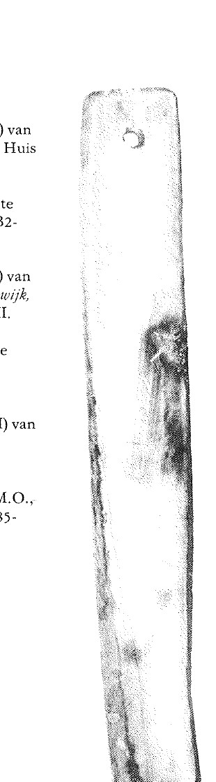
snorrebot
Source term: snorrebot (type I)
snorrebot: Dutch for a 'whirring bone'; here, an end-holed blade swung freely on a cord.
Children once made the air hum above Huis Dever with a pale ivory blade, probably cut from walrus tusk. A cord through the end hole let the toy spin on its long axis as it circled overhead; faster turns raised its note, slower turns lowered it. In Dutch this was a snorrebot — literally a 'whirring bone' — a name also used for quite different pull-string buzzers. This long, end-holed form is the true free-flying kind.
Het eerste type is langwerpig, soms ook spindelvormig, met aan één zijde een doorboring. … De snorrebotten uit Lisse (83) en Beverwijk (84) zijn voorbeelden van het eerste type.
The first type is elongated, sometimes also spindle-shaped, with a perforation at one end. … The snorrebotten from Lisse (83) and Beverwijk (84) are examples of the first type.
Van Vilsteren, Het Benen Tijdperk (1987), p. 52
- Object
- A long, narrow blade of probable walrus ivory, 18.6 cm long, with a single small cord hole near its squared end, found at Huis Dever in Lisse.
- Function
- A children's humming toy: swung overhead on a cord, spinning on its long axis and changing pitch with the speed of the swing.
- Source
- Van Vilsteren, Het Benen Tijdperk (1987), p. 52
- Source location
Page references
Van Vilsteren 1987, printed p. 52, cat. 83; inv. Dev. B2-69
- Source confidence
- high OpenStreetMap anchor for Huis Dever, Heereweg, Lisse - the named find place in the catalogue entry, and a building-level anchor, but not an excavation-unit or findspot coordinate; the catalogue gives no feature or layer.
- Toy / secular survival