HESJEDAL2009-001 - archaeological find
Normannsvika slate blade
Norway - Finnmark - Melkøya, Hammerfest - Northern Europe
Function not recorded Candidate only
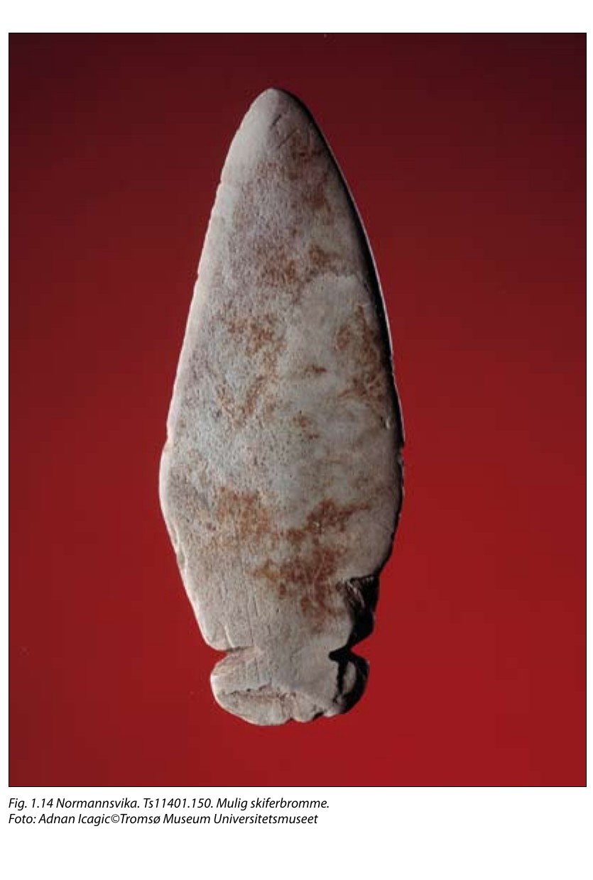
Source term: bromme / skiferbromme
bromme: Norwegian for a bullroarer (cf. brumme, to hum or drone); skiferbromme, 'slate bullroarer'.
At Normannsvika on Melkøya, an island of a few hectares off Hammerfest, the excavators came down onto the floor of Tuft 1 and found two slate tools lying flat, one two centimetres above the other: a double-edged knife, and what they wrote down as probably a bullroarer. Both sat level with the base of the hearth stones beside them, which is how the team knew they were on the real living floor and not in later fill. Charcoal from the same layer came back at 5535 ± 64 radiocarbon years, somewhere between 4500 and 4240 BC. The report will not go past 'probably' in the text or 'possible' under the photograph, and nobody has tested the blade for wear or for sound - the date belongs to the floor, not to the thing lying on it.
I lag C ble det blant annet funnet to skiferredskaper, en tveegga kniv og det som trolig er en bromme (Ts11401.149 og 150).
In layer C, two slate tools were found, among other things: a double-edged knife and what is probably a bullroarer (Ts11401.149 and 150).
Hesjedal, Ramstad and Niemi, Undersøkelsene på Melkøya, Tromura 36 (2009), p. 28
- Object
- Ts11401.150, a worked slate blade published as probably a bullroarer; excavated lying flat on the occupation floor of Tuft 1 in layer C, two centimetres above a double-edged slate knife (Ts11401.149), with both objects level with the base of the adjacent hearth stones. The report gives no dimensions in the passage.
- Function
- Not recorded.
- Source
- Anders Hesjedal, Morten Ramstad and Anja Roth Niemi, Undersøkelsene på Melkøya: Melkøyaprosjektet - kulturhistoriske registreringer og utgravninger 2001 og 2002, Tromura Fellesserie 36 (Tromsø Museum Universitetsmuseet, Universitetet i Tromsø, 2009), ISBN 82-7142-050-X, ISSN 1891-1943
- Source location
Page references
Hesjedal, Ramstad and Niemi 2009, printed p. 28 (text) and p. 29, Fig. 1.14; accession Ts11401.150
- Source confidence
- medium Melkøya island representasjonspunkt from the Norwegian national place-name register (Kartverket SSR, 'Melkøya', øy i sjø, Hammerfest, Finnmark). Normannsvika is one of the three Melkøya project excavation areas and is not itself a registered place name, and the report's passage supplies no coordinate for Tuft 1; this is an island-level anchor on an island of a few hectares, not a findspot.