No. HOWITT1904-001
Narrang-ga / Narungga restricted bullroarer
Yorke Peninsula, South Australia
Restricted
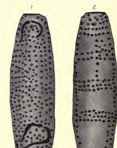
Source term: bull-roarer
On Yorke Peninsula, across Spencer Gulf from Port Lincoln, the Narrang-ga practised circumcision, and a boy who learned he was wanted for the rite would sometimes hide in the bush, only to be hunted down. At the ceremony he was made to drink blood from his own arm; an old man covered his eyes while the prepuce was cut and then buried at the place of initiation, after which the young man carried a fire-stick wherever he went for about a year. Throughout, no one spoke above a whisper. The bull-roarer belonged to this rite, and showing it to the wrong eyes was once a death sentence for two.
The bull-roarer is used, but it is not lawful for any woman, or uninitiated person, to see it. Formerly such an offence was punished with death, both of the person who showed it and the person to whom it was shown.
Howitt 1904:672 (The Native Tribes of South-East Australia)
Particulars
- Object
- Howitt says the Narrang-ga used the bull-roarer in circumcision ceremonies and illustrates opposite sides of the object.
- Function
- Circumcision/initiation ceremony instrument; women and uninitiated people were forbidden to see it, formerly under death penalty.
Source
A. W. Howitt, The Native Tribes of South-East Australia (London: Macmillan, 1904), pp. 671-672, fig. 40, after T. M. Sutton