No. PNG167
King / Kalil
Papua New Guinea · New Ireland · Oceania · Sahul
Restricted
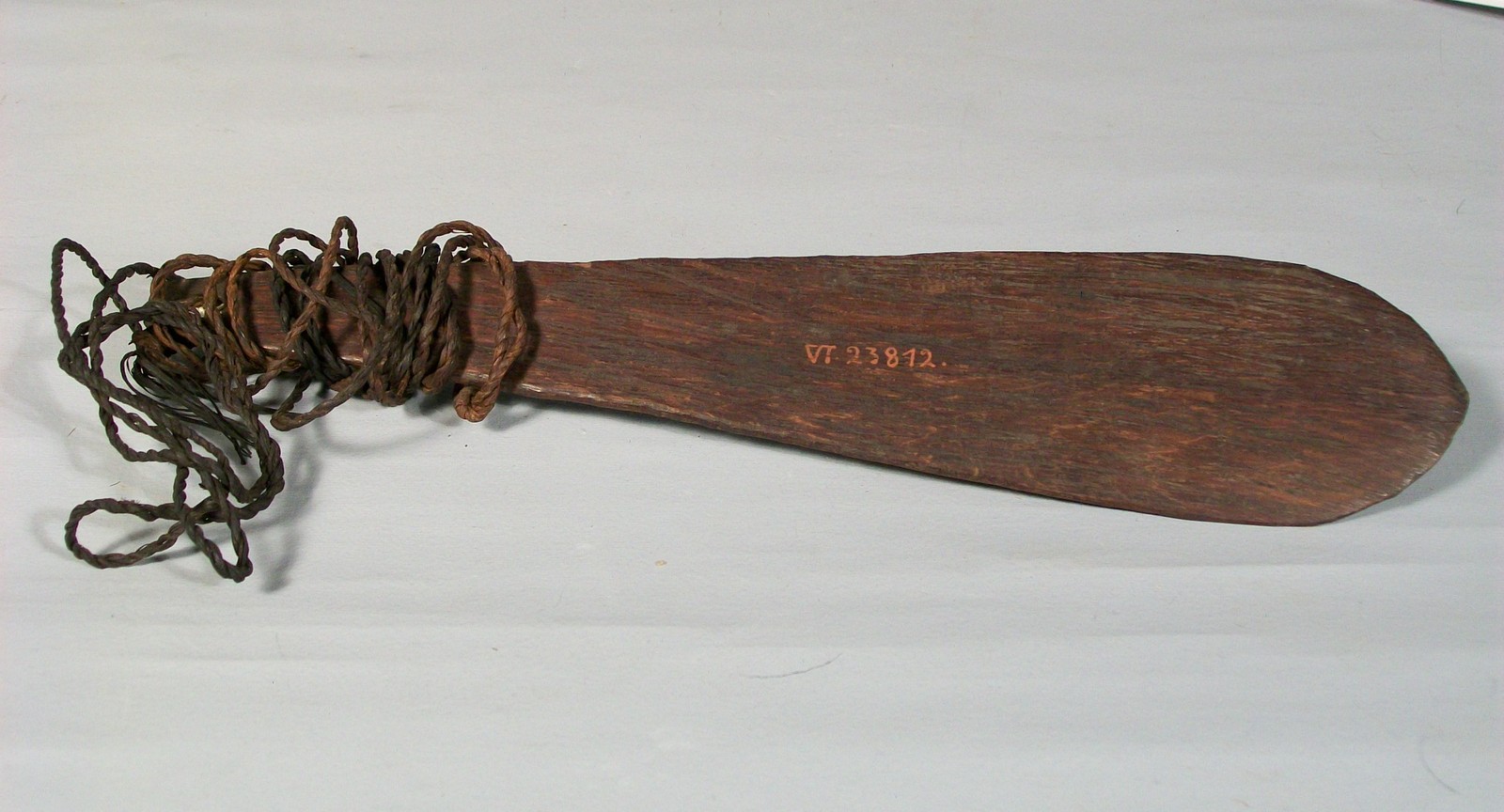
talun; tamanbaránaŭl
Source term: talun; tamanbaránaŭl (Schwirrholz)
talun = the Lak word for the bullroarer (Albert 1987/1991); tamanbaránaŭl = the name Stephan & Graebner record for the Kalil specimen (1907, Abb. 124).
On the southern coast of New Ireland — then the German colony of Neu-Mecklenburg — the survey voyages of the gunboat SMS Möwe in 1904 turned up a bullroarer at the village of Kalil, recorded by Emil Stephan and Fritz Graebner and figured in their 1907 ethnography under its recorded name tamanbaránaŭl — a twenty-four-centimetre blade once used in the Duk-Duk, the masked secret society of the Bismarck Archipelago. King and Kalil were small places; Kalil, the only village on this stretch where an exact count was made, came to thirty-one huts and seventy-eight people, and King had a bachelor house. Gourlay, cataloguing the instrument decades later, was unconvinced that it was native to the island: across New Ireland he found the slit-gong reported by every informant but esoteric secrecy almost nowhere, and he suggested the cult use of the bullroarer in the King and Kalil district was probably borrowed from New Britain, where similar masked dances are found.
Schwirrholz tamanbaránaŭl aus Kalil. Früher angeblich beim Duk-Duk benutzt.
Bullroarer tamanbaránaŭl from Kalil. Formerly reportedly used in the Duk-Duk.
Stephan & Graebner 1907, Neu-Mecklenburg (Bismarck-Archipel), p. 119, Abb. 124.
Source
K. A. Gourlay, Sound-Producing Instruments in Traditional Society (New Guinea Research Bulletin 60; Canberra and Port Moresby, 1975), Table 1, entry 167; Emil Stephan and Fritz Graebner, Neu-Mecklenburg (Bismarck-Archipel): die Küste von Umuddu bis Kap St. Georg (Berlin: Dietrich Reimer, 1907), p. 119, fig. 124 (Ethnologisches Museum Berlin VI 23812)