No. PEUR2026-009
Cuina Turcului decorated antler plaque
Romania · Iron Gates · Danube Gorges; Cuina Turcului rockshelter, Dubova, Mehedinti · Europe
Function not recorded
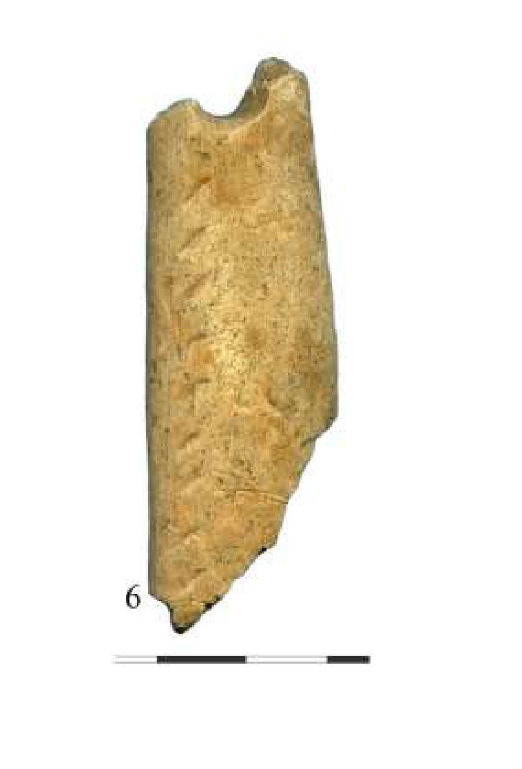
Source term: adornment (perforated antler plaque)
In the last centuries of the Ice Age, someone at Cuina Turcului - a rockshelter camp under the cliffs of the Danube's Iron Gates gorge - scraped a strip of red-deer antler flat, sawed nine deep slanting lines across its face, and bored a hole through one end. The hole did not stay round: it wore open into a smooth-walled notch at the edge, the kind of mark a cord leaves. The broken plaque is at least a finger's length and three times longer than it is wide, proportions in the range of the Magdalenian bramaderas far to the west and nothing like the squat bone pendant that survives beside it in the collection. Whether it ever sounded turns on a single measurement no one has published: how thick it is.
Particulars
- Object
- A flat red-deer antler plaque (inv. 712), broken at the proximal end where four transverse incisions survive; the inferior surface scraped smooth, the superior face carrying nine deep parallel oblique sawn lines of asymmetric V-shaped profile, and a distal perforation made by unifacial rotation. At least 67 x 23 mm (aspect 2.97 or more), derived from the published scale bar; thickness unpublished. Excavated 1969, trench Cas.S at 5.50 m, hearth nearby.
- Function
- Not recorded.
Source
Monica Mărgărit, Adina Boroneanț and Clive Bonsall, 'Prehistoric adornments from Cuina Turcului,' Cercetări Arheologice 27 (2020): 45-71, at p. 57, fig. 7.6-7.10, table 4; Mărgărit, Boroneanț and Bonsall, Open Archaeology 7 (2021), p. 785, fig. 3i-m; Mărgărit, Radu, Boroneanț and Bonsall, Archaeological and Anthropological Sciences 10 (2018)