No. NAAIN-020
Koasati Coushatta Bel Abbey bull roarer
United States · Louisiana · Allen Parish · Bayou Blue near Elton · North America · Southeast
Play / practical
Source term: bull roarer
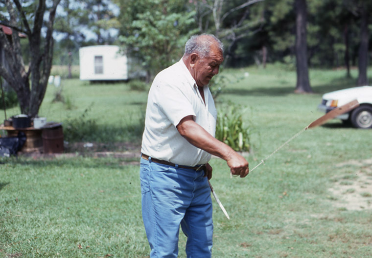
Bel Abbey, a Koasati craft maker and storyteller from a settlement near Elton, Louisiana, was photographed spinning a bull roarer to make a pulsating vibrato sound. Born in 1916 and dead in 1992, Abbey belonged to the last Koasati generation raised in the traditional way, brought up by his grandmother, mother, and maternal uncles, and he grew up speaking Koasati before adding Alabama, Choctaw, Mobilian, Cajun French, and English. He made blowguns, darts, bows, arrows, whistles, and Spanish moss spinners, demonstrating them while he told stories and taught his listeners the Koasati names of his creations.
Neighbor children, in addition to his own family members watched as Bel produced enchanting animal shapes, spinning tops, and puzzles out of mere pieces of wood.
Louisiana Folklife Program, 'Keeping It Alive: Koasati Crafts and Storytelling' (1993)
Particulars
- Object
- A narrow flat slat on a long cord, whirled from the hand.
- Function
- Spun in Bel Abbey's demonstrations of Koasati toys and children's games.
Source
Louisiana Folklife Program, Keeping It Alive: Koasati Crafts and Storytelling (1993), Bel Abbey and Timothy Langley profile