No. KTBULL2026-001
Kings Tableland bullroarer stencils
Australia · New South Wales · Blue Mountains · Kings Tableland
Sacred / spirit
Source term: bullroarers / stencilled bullroarers
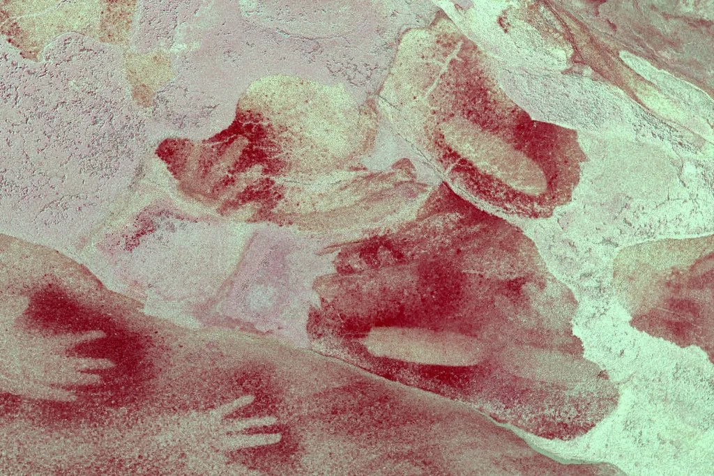
Three red-ochre ovals pressed among hand stencils on a Kings Tableland shelter wall are bullroarers — the swung wooden voices that, in this Gundungurra country of the Blue Mountains, summoned men to the Bunan initiation. R. H. Mathews described that whirring roar drawing boys toward manhood; across south-eastern Australia it was heard as the sky-being Daramulan himself, an instrument no woman or uninitiated man was permitted to see. Here the hidden object was set openly into the rock in plain ochre.
the majority of the region’s art coincides with the recent archaeological evidence in the region - the late Holocene Bondaian periods
Jo McDonald 2008, Dreamtime Superhighway, ch.10, p.229; regional Sydney Basin context, not a direct date for this stencil.
Particulars
- Object
- Red-ochre oval bullroarer stencils among hand stencils and other pigment traces in Shelter 2.
- Function
- Not recorded.
Source
Hiking the World, 'Kings Tableland Bullroarer and Stencils Shelter' (2024), Shelter 2; R. H. Mathews, 'The Bunan Ceremony of New South Wales', American Anthropologist 9 (1896), pp. 327-344; Jo McDonald, Dreamtime Superhighway (2008), ch. 10, p. 229; Taçon, Kelleher, Brennan, Hooper and Pross 2006